Author: Tom Lopez

  • Lost River Range Volcanoes by Rick Baugher

    Lost River Range Volcanoes by Rick Baugher

    Volcanoes and related igneous flows are a staple of the Pacific Northwest landscape, so it is interesting to observe that Idaho’s highest mountain range presents a 60-mile front of sedimentary limestone. How did these Lost River Mountains align the way they did and how did they reach their current height? Much can be explained by the movements of the North American tectonic plate over the last 11 million years, when compression and extension forces initially faulted the surface crust. Also, 2 glaciations over the past 100,000 years left their mark. But a far more powerful source, arising from deep within the earth, are the volcanoes.

    Their presence can be seen along much of the back side of the Lost River Range. The largest igneous flow begins at the mouth of Pass Creek, continues north then northwest, to form a large apron around the range. The keen observer, with a little imagination, can trace the roots of long-gone Mesozoic stratovolcanoes on the order of Rainier and Orizaba. The limestone which piled up against their eruptive flanks gave the birth to our Lost River Mountains. Three stratovolcano locations tentatively identified are: Arco Valley (between King Mountain and Arco Hills), Wet Creek Basin and Upper Pahsimeroi.

    Here’s a look at some remnant Lost River volcanic peaks. Clockwise from top left.

    VULCAN PEAK 10297' The highest volcanic summit in LRR. View S to USGS Peak, 1999. APRON MOUNTAIN 9382' View NE to Hawley Mtn & Lemhi Range, showing Wet Creek stratovolcano caldera, 2007. EAST BURNT PEAK 10149' A prehistoric cairn? View SW to Cleft Peak, 1999. THE CAPE 8387' Iron rich andesite of Eocene Challis Volcanics. View S to Massacre Mtn, 2007. GROUSE PEAK 8464' The northernmost Pahsimeroi/LRR summit overlooks the Round Valley caldera. A TM Bannon 1914 triangulation station, 1994. VICTORIAS SECRET 8860~ Beauty is in the eye of the beholder, 2007.
    VULCAN PEAK (10,297 feet): The highest volcanic summit in the Lost River Range. View S to USGS Peak (1999).
    APRON MOUNTAIN (9,382 feet): View NE to Hawley Mountain and the Lemhi Range, showing the Wet Creek stratovolcano caldera (2007).
    EAST BURNT PEAK (10,149 feet): A prehistoric cairn? View SW to Cleft Peak (1999).
    THE CAPE (8,387 feet): Iron-rich andesite of Eocene Challis Volcanics. View S to Massacre Mountain (2007).
    GROUSE PEAK (8,464 feet): The northernmost Pahsimeroi/Lost River Range summit overlooks the Round Valley caldera. A T. M. Bannon 1914 triangulation station (1994).
    VICTORIAS SECRET (8,860 feet): Beauty is in the eye of the beholder (2007).
    SQUAWTIP 9046' The most prominent topographic feature in the Burnt Creek area. A conical peak of rugged andesite breccia. There is no easy line to the summit. First ascent Lee Morrison, Lester Walker, USGS, 1934-5. SQUAWTIP The easiest way up Squawtit is a zig zag climb on its east face & gully system. The average slope angle is 65 degrees, 2007. CAMPION PEAK 9597' A 2005 cairn and view SW to Borah Peak. Campion is a pink alpine flower. SPRING HILL MOUNTAIN 9449' A 1932 benchmark placed by EM Buckingham. View to Doublespring Pk, 1996. DRABA HILL 9315' Above Horseheaven Pass. Draba is a bright yellow circumpolar flower abundant in this area, 2005. BABY PEAK 9191' Heads Baby Creek in lonely cowboy country, 2005. Any errors of opinion or observation in this article are mine alone.......Rick Baugher, May 2007
    SQUAWTIP (9,046 feet): The most prominent topographic feature in the Burnt Creek area. A conical peak of rugged andesite breccia. There is no easy line to the summit. First ascent by Lee Morrison and Lester Walker, USGS (1934-1935). The easiest way up Squawtip is a zig-zag climb on its East Face and gully system. The average slope angle is 65 degrees (2007).
    CAMPION PEAK (9,597 feet): A 2005 cairn and view SW to Borah Peak. Campion is a pink alpine flower.
    SPRING HILL MOUNTAIN (9,449 feet): A 1932 benchmark placed by E. M. Buckingham. View to Doublespring Peak (1996).
    DRABA HILL (9,315 feet): Above Horseheaven Pass. Draba is a bright yellow circumpolar flower abundant in this area (2005).
    BABY PEAK (9,191 feet): Heads Baby Creek in lonely cowboy country (2005).
    Any errors of opinion or observation in this article are mine alone. Rick Baugher (May 2007)


  • Fire Lookouts By Rick Baugher

    Fire Lookouts By Rick Baugher

    For more on fire lookouts see the following articles: Boise National Forest Fire Lookouts  and An Overview of the Lookouts on the Salmon National Forest


    By the 1930s, the Forest Service had a goal to “put a firewatch on every mountaintop.” Idaho ended up with 989 fire lookout structures, more than any other state in the Pacific Northwest. Of Southern Idaho’s 128 lookouts, 36 were above 9,000 feet. Red Wings (10,910 feet) was the highest. Twin Peaks (10,340 feet) is the highest fire station in America today. By the 1960s, many of the old lookouts were destroyed in the name of progress but, fortunately, a representative sampling remain today at least until the elements ultimately win.

    Everything you’d ever want to know about lookouts is contained in the book “Fire Lookouts of the Northwest” by Ray Kresek. You can reach Ray through his Historic Lookouts Project in Spokane, Washington. In doing his research, Ray has climbed over 1,000 mountains. He knows what he’s talking about. As mountain users, sooner rather than later, we have an encounter with lightning. In his book, Ray describes one of those terrible nights in a shack on a summit, something like this:

    As the lightning approached, the firewatcher would pull the “go to hell rope” to disconnect all appliances. The copper wire grounding system would begin to hum and glow with dancing Saint Elmo Fire. At this time, as your hair began standing on end, you’d hop on a glass-legged insulated stool. For the grand finale, the blinding white light would cause anything metal to sizzle. The cabin reeked of foul ozone. After several minutes your sight and senses return….and leave you something not to forget in a lifetime.

    L to R from top: WILDHORSE PEAK el 9546' White Knob Mtns This fire lookout is preserved as a national historic monument. TWIN PEAKS el 10340' Idaho's highest outhouse provides a contemplative view to 10442' White Mountain, range highpoint of the Salmon River Mtns SLEEPING DEER el 9881' in the heart of the Frank Church Wilderness. Built in 1935. Still active. SAL MOUNTAIN el 9593' Lemhi Range This 10'x10' lookout was built in 1926. The USCGS triangulation signal is from 1945. These are the first Idaho mountains to be seen and described by a white man. Cresting Lemhi Pass on Aug 12, 1805, Meriwether Lewis records: "I discovered immence ranges of high mountains still to the west of us with their tops partially covered with snow". BLUE NOSE el 8677' ID/MT An oddity- this lookout was split down the middle by 2 states, counties, National Forest ranger districts & regions. The lower floor acomodated livestock. The brass benchmark in foreground was set by USGS' TM Bannon in 1912. MOUNT GREYLOCK el 9857' Left to the elements. By Rick Baugher, 4/24/07
    Left to right from top:
    WILDHORSE PEAK (9,546 feet): White Knob Mountains. This fire lookout is preserved as a national historic monument.
    TWIN PEAKS (10,340 feet): Idaho’s highest outhouse provides a contemplative view to 10,442-foot White Mountain, high point of the Salmon River Mountains
    SLEEPING DEER (9,881 feet): In the heart of the Frank Church Wilderness. Built in 1935. Still active.
    SAL MOUNTAIN (9,593 feet): Lemhi Range. This 10’x10′ lookout was built in 1926. The USGS triangulation signal is from 1945. These are the first Idaho mountains to be seen and described by a white man. Cresting Lemhi Pass on August 12, 1805, Meriwether Lewis records: “I discovered immense ranges of high mountains still to the west of us with their tops partially covered with snow.”
    BLUE NOSE (8,677 feet): ID/MT border. An oddity: this lookout was split down the middle by 2 States, Counties, National Forest Ranger Districts and Regions. The lower floor accommodated livestock. The brass benchmark in the foreground was set by USGS’ T. M. Bannon in 1912.
    MOUNT GREYLOCK (9,857 feet): Left to the elements.
    By Rick Baugher (April 24, 2007)
  • Idaho County High Points by Andy Martin

    Idaho County High Points by Andy Martin

    Out-of-staters Ken Jones and Bob Packard were the first to reach all the Idaho county high points. Dan Robbins was the first Idaho resident to reach the summit of all of Idaho’s county high points. Terri Rowe of Boise became the first woman to complete the list on August 6, 2019. As you will see from the table, it takes a lot effort, time, snacks and gas money to finish the list.

    Andy Martin developed the earliest list of Idaho county high points. Since his original work, improved maps became available. We have updated the list below to incorporate the updated elevations found on the newer maps. Revised August 2018

    The list of finishers includes:

    Ken Jones, Bob Packard, Dan Robbins, Dennis Poulin, Adam Helman, Chris Anderson, Tony Wofford and Terri Rowe


    Hiking the U.S. state high points is a popular activity and naturally leads to considering the next level of detail: the 3,140+ county high points. During the 1990s, lists were prepared that locate these points based on the USGS 7.5-minute maps. The book County High Points by Andy Martin, oldadit@iname.com, includes all of these lists.

    Hiking the counties of different Western States—AZ, CA, CO, ID, MT, NM, NV, OR, UT, WA and WY—makes an interesting goal and Idaho proved to be a challenge. The Idaho County High Point List was finally completed on Labor Day of 2001 by Ken Jones and Bob Packard. This leaves Montana as the only uncompleted Western State as of 2018.

    High Points of Idaho’s 44 Counties

    The Idaho high point list was composed by county high point guru Andy Martin. Please note that some of Idaho counties’ highest points are not ranked summits. The average elevation is 8,289 feet (364,705 feet in peaks/44 counties). The high points in the table are shown in order by elevation. I have linked the peaks that are found on this website to the peak’s page.

    County High Point Elev. Location USGS 7.5′ MAP
    Custer Mount Borah 12,662 6-N-23E Borah Peak
    Butte Diamond Peak 12,197 2-9N-28E Diamond Peak
    Blaine Hyndman Peak 12,009 ?-5N-19/20E Hyndman Peak
    Lemhi Bell Mountain 11,612 36-11N-27E Bell Mountain
    Clark Point 11220 east of Webber Peak 11,200+ 33-12N-31E Scott Peak
    Boise Mount Cramer 10,716 19-8N-13E Mount Cramer
    Elmore Snowyside Peak 10,651 ?-7N-13E Snowyside Peak
    Fremont North Targhee Peak 10,420 ?-16N-43E Targhee Peak
    Camas Peak 10337 10,337+ ?-6?N-15E Galena
    Cassia Cache Peak 10,339 21-14S-24E Cache Peak
    Bonneville Mount Baird 10,025 5-1S-46E Mount Baird
    Bear Lake & Caribou Meade Peak 9,957 1-11S-44E Meade Peak
    Valley Big Baldy 9,705 26-17N-10E Big Baldy
    Franklin Peak 9484, locally known as Felt Hat Peak 9,484 29-15S-42E Egan Basin
    Idaho Point 9439 9,439 7-29N-17E Mt. Jerusalem
    Oneida Oxford Peak 9,282 26-13S-37E Oxford
    Bannock Bonneville Peak 9,271 33-7S-37E Bonneville Peak
    Teton Piney Peak 9,020 24-4N-43E Garns Mtn.
    Adams Monument Peak 8,920+ 22-22N-2W Purgatory Saddle
    Power Deep Creek Peak 8,748 13-11S-32E Deep Creek Peak
    Owyhee Hayden Peak 8,403 23-5S-3W Cinnabar Mtn.
    Madison Red Butte

    Note: Two unnamed points over 8,080 feet lie near Red Butte.

    8,108 20-4N-43E Temple Peak
    Clearwater Rhodes Peak 7,930 35-39N-13E Rhoades Peak
    Gem Peak 7971 7,921 1-13N-2E Tripod Peak
    Washington Cuddy Mountain 7,867 35-17N-4W Cuddy Mountain
    Twin Falls Point 7860 7,860 27/34-16S-12E Curtis Draw
    Boundary Peak 7714 7,714 2-63N-2W Pyramid Peak
    Shoshone Illinois Peak 7,690 33-43N-11E Illinois Peak
    Bingham Blue Ridge aka Blackfoot BM 7,550 34-2S-39E Poison Creek
    Bonner Scotchman Peak 7,009 21-56N-3E Scotchman Peak
    Jefferson Point 6664

    This point is part of Kelly Mountain

    6,664 33-4N-41E Heise
    Kootenai Latour Peak 6,408 8-47N-1E Twin Crags
    Gooding This high point is located on the county’s north boundary. It has no rise and it is not a peak in any sense. 6,360+ 4-3S-13E Davis Mountain
    Benewah Peak 6180 6,160+ 20-47N-1E Twin Crags
    Ada Point 6020 6,020+ 22-4N-3E Robie Creek
    Lincoln Peak 5950 5,950 3-3S-16E Thorn Creek Res.
    Nez Perce Craig Mountain 5,360+ 29-32N-4W Frye Point
    Latah Bald Mountain 5,320+ 34-43N-2W Emida
    Minidoka Bear Den Butte 5,104 8-3S-25E Bear Den Butte
    Lewis Peak 4795

    Note: Two points 4,780 feet+ lie about 800 feet NE of spot elevation 4,795 feet.

    4,795 23-32N-3W Hoover Point
    Payette Point 4763

    Note: Two points 4,760 feet+ lie on the east border of Section 4-9N-1W.

    4,763 4-9N-1W Coonrod Gulch
    Jerome This high point is located on the side of Kimama Butte. It has no rise and it is not a peak in any sense. 4,760+- 1-8S-21E Kimama Butte
    Canyon Pickles Butte 3,084 21-2N-3W Givens Hot Sprs.
  • Idaho’s Albion Range, Published in Summit Magazine Vol. 30, No. 2 March-April, 1984

    Idaho’s Albion Range, Published in Summit Magazine Vol. 30, No. 2 March-April, 1984

    Text and Photos by Tom Lopez

    The Albion Range is Idaho’s most important destination for climbers south of the Snake River. It offers opportunities for bouldering, technical rock climbing and scrambling. The range extends north from the Utah border for 25 miles to a point just southeast of Burley, Idaho in the South Central part of the State. Included in its inventory are Cache Peak (10,339 feet)–the highest point in Idaho south of the Snake River–and the City of Rock, a concentration of granite domes and spires which is the premier rock climbing area in the State.The range is typical of the nearby Great Basin ranges, with which it shares many similarities.

    A variety of environments are present to stimulate the senses, ranging from bare and windswept summits to thick stands of Douglas fir to and desert-like lower slopes. It is among these dry lower slopes that the City of Rocks is situated. Water is present throughout the range although its quality cannot be guaranteed. The surrounding country is big and open, with smaller North-South trending mountain ranges interspersed by wide sagebrush-covered flats. An exception is the Raft River Range, located just south of the Idaho border, which runs in an uncommon East-to-West direction. See Summit, November-December 1972.

    Historically, the range gained early notoriety from its association with the Oregon Trail. In fact, the “Silent City of Rock” not only fascinated the early immigrants who traveled west over the Oregon Trail, but also served as a major junction along the route. It was from this point that many pioneers broke off to follow either the Hudspeth Cutoff Trail or the Salt Lake Cutoff Trail. In the early 1860s, over 50,000 immigrants passed through the City in a single year.The geology of the range is highlighted by the granitic Cassia Batholith which pushed up through the Earth’s crust. The range is formed by 2 large, rolling ridges which accumulate into 2 main summits: Mount Harrison (9,265 feet) in the north and Cache Peak in the south.

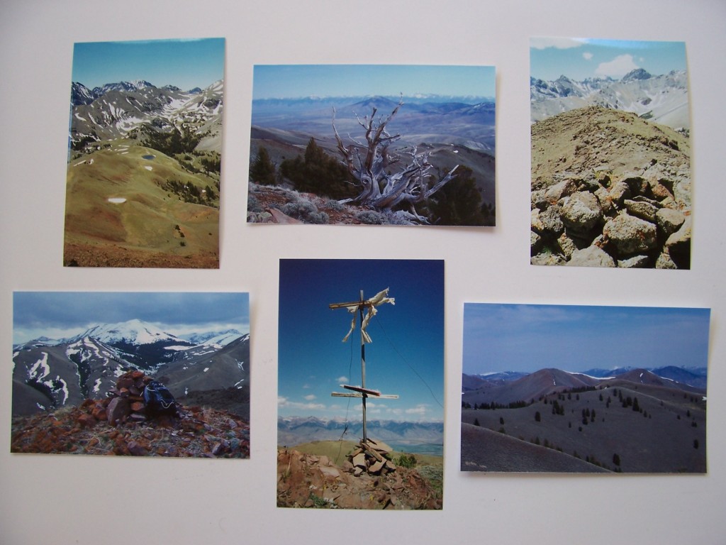
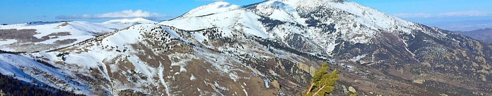
    A glacial cirque is nestled into the East Slopes of Cache Peak. The cirque holds several high lakes which are the only mountain lakes present in Idaho’s 27 mountain ranges located south of the Snake River. While overlying sedimentary rocks are still present throughout the range, it is the batholith’s granite that is of primary interest to climbers. Climbing the major peaks of the Albion Range is generally limited to long tedious scrambles that lead to rewarding views. Cache Peak can be reached from several directions. One route leads up from Independence Lakes to the saddle between Cache Peak and Mount Independence. Both peaks can be reached from the saddle.

    Unlimited technical climbing is available throughout the City of Rocks. These opportunities are situated in 4 main locations: the head of Circle Creek, the main formations in the City of Rocks proper, the Castle Rock area and the Twin Sisters. While climbing in the City of Rocks has never been documented, many of the formations have been informally named and established routes exist on most of them.

    Climbers who have visited this out-of-the-way place feel that it is one of the finest climbing spots in the country. The granite has a rough texture which is perfect for friction climbing. Although most routes are from one to two pitches in length, there are an infinite number of routes available. The large variety of shapes present a wide spectrum of daring problems from cracks to chimneys, large faces, and obelisk-shaped spires.

    Climbing is best in the Spring when the City’s desert-like climate warms up long before surrounding mountains have even begun to melt out. During Memorial Day weekend, many climbers from all over Idaho, Jackson (Wyoming) and Salt Lake City areas congregate at the City of Rocks.

    The heart of the City of Rocks is easily reached by road and contains a number of impressive formations including Window Rock, Bath Rock and Morning Glory Spire. Elephant Rock is one of the most prominent formations. Located at the City’s main entrance, this rock is only 50 yards from the road for those who have absolutely no interest in hiking.

    The upper valley can be reached by trail from Elephant Rock. A trail leaves the parking area and generally follows a fence line for a mile into the upper reaches of Circle Creek. There are no signs. The Box Top and Lost Arrow formations are the most important of the dozens of formations located along Circle Creek. Even on a busy Memorial Day weekend when climbers wait in line to do a crack on Elephant Rock, this area sees relatively little use.

    The Twin Sisters formations are located over one mile south of the main City of Rocks. The BLM has provided an established campground (Smoky Mountain Campground) in addition to over 80 individual campsites scattered along the main road through the City of Rocks. The Twin Sisters tower over 600 feet.

    Additional Information

    State Highways 27 and 77 are on the range’s West and East Sides, respectively. A combination of county and forest service roads penetrate the southern part of the range. To visit the City of Rocks, drive along I-84 to the Sublette/Malta Exit. This exit is located roughly 32 miles north of the Utah border. Drive west from the exit to the village of Almo on a good paved road. Six miles of good dirt road leads from Almo to the City of Rocks.

    Four USGS quadrangles cover the region. From north to south, they are Conner Ridge, Mount Harrison, Cache Peak and Almo. All are 7.5-minute topographical maps. Furthermore, the BLM sells a surface management map that displays the land ownership patterns which is especially helpful for identifying public and private land. The one covering the City of Rock is the BLM Oakley map.

    SUMMIT (March/April 1984)