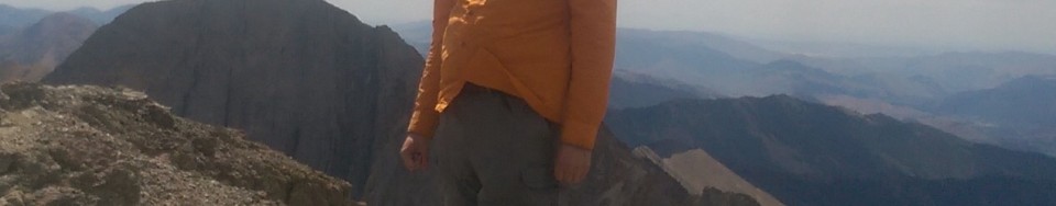
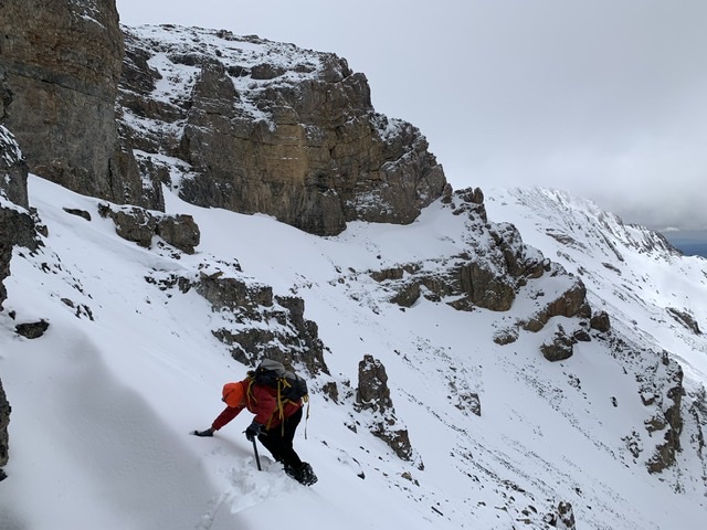
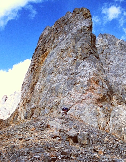
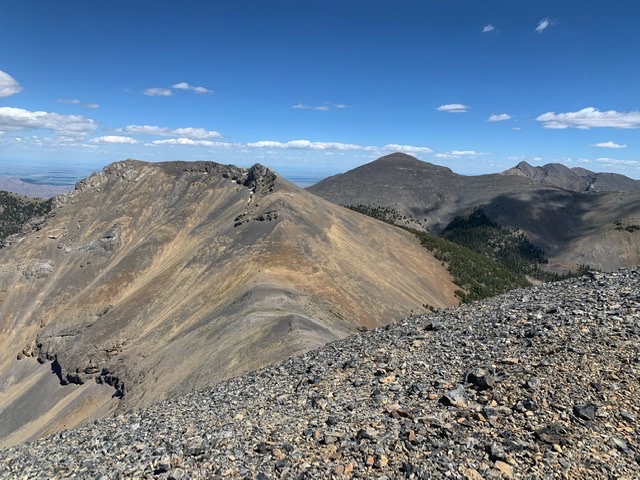
On September 28, 2015, Ken Jones reached the summit of Grave Peak in the Selway Bitterroot Wilderness and became the first person to climb all 100 Idaho peaks with prominence exceeding 2,000 feet. Climbing every peak on this list is an impressive accomplishment which took an incredible amount of determination and support.
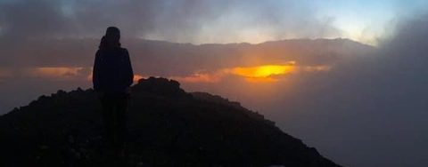
Ken Jones on the summit of Ryan Peak (2015).
Ken notes that: “Although far too many of the hikes were, in fact, done solo, I can honestly say that I never could have done it alone. I’d like to take this opportunity to say thanks to all who hiked with me or provided information that helped me find a decent summit route”
“First off, thanks to my wife Karen for hiking with me on some of them and for encouraging me to pursue the list rather than complaining about the time I spent away from home. Thanks also to my sons Evan and Colin for their company on some of the peaks (before they grew up and moved to graduate programs too far from home to spend their free time hiking in Idaho).
I would especially like to thank Dennis Poulin for joining me for many of these peaks even when they were my priority but not his (especially, I think, a long day last month on Sheep Mountain), and Ryder Irvine who joined me for many (including an off-trail slog through brush, rain, wind, and eventually snow on Moose Creek Buttes on my birthday this year).
Thanks too to others who’ve hiked with me in Idaho. I hope I don’t overlook anyone and apologize if I have: Bob Packard, Dean Molen, Greg Jagielski, Kadee Smith, Victor Zhou, Roger Williams, Dan Robbins, Andy Martin, and John Hamann.
I cannot close without thanking Tom Lopez for his Idaho: A Climbing Guide book, without which I would have been at a loss many times for the best approach to each summit.
I encourage anyone with any possible interest in this list to give it a try. I can recommend a few peaks as particularly delightful, and others as particularly challenging. Just let me know what you’re looking for!”
When he was asked about the difficulties involved in completing the list, Ken wrote: “Andy M asked me about which peak was the most technical on the list. I would say that nothing gets beyond Class 3 and I don’t recall using a rope at any time (and as those who’ve hiked with me know, if I didn’t use a rope not many people would). He also asked about which peak might have the toughest access. If by that he meant getting permission to cross private property then that’s not a discussion I want to have in public. But I will say that I avoided long access hikes to more than one summit by flying in to a back-country air strip to shorten a backpack. I don’t think I’d done that since Denali. Without the flights, someone who hikes at my pace might have taken a week to get a single peak in two or three instances.”
Ken, along with Bob Packard, was the first to complete all of Idaho’s county highpoints.
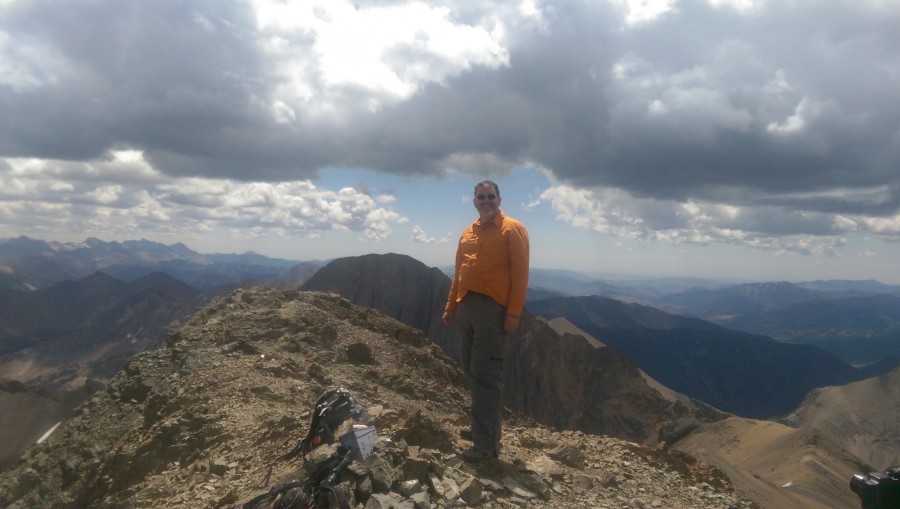
Brett Sergenian, aka exflatlander, climbed Hyndman Peak in mid-July 2015. It was his first peak on the list of Idaho’s highest 200 peaks. On September 5, 2021, he climbed Peak 10780. In between, he climbed another 198 peaks that ranged in elevation between 10,780 feet and 12,662 feet. Thus, in a time period of 2,244 days, he became the first person to climb all of Idaho’s highest 200 peaks. This massive accomplishment encompassed and followed his success in climbing all of the Idaho 11ers which he finished in August 2020. He was the 9th person to complete that list.
Brett related: “I wasn’t really thinking about doing the highest 200 peaks until January 2021 when someone mentioned the list to me and pointed out that I had climbed all but 32 of the highest 200.” As a result of this revelation, he set out to finish the list in 2021. Although, over the years, Brett had accomplices on some of his climbs, he climbed most of the highest 200 peaks solo. While his only technical climb was True Grit, he climbed new routes on many of the peaks and often linked up peaks with daring ridge traverses.
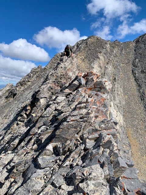
Brett just above the White Rock Traverse on True Grit
Brett’s 10 favorites climbs from the “Highest 200” list as follows in no particular order: Leatherman Peak from Sawmill Gulch, Roaring Peak (north ridge), WCP-10, Bell Mountain, Cobb Peak (the traverse between Cobb and Old Hyndman is one his favorite routes), Brocky Peak, The Fin, Gabriel’s Horn, Boulder Lake Peak and Hourglass Peak (Peak 10718). Additionally, he gives Honorable Mentions accolades to Mount Corruption (from Cleft Peak), Merriam Lake Peak, Castle Peak, Acropolis Peak, Rearview Peak (Peak 10860), May Mountain and Black and White Peak (from Little Diamond Peak).
While Brett is well known for his nonstop motor, endurance and drive, he deserves even more credit for his mental toughness and fearlessness. His more daring routes included the Cobb to Old Hyndman traverse (considered to be one of the hardest Class 4 routes in the Pioneer Mountains) and the USGS Peak to Mount McCaleb traverse which was likely the second time the route was utilized and the first time that route had been completed by a solo climber.
Brett has put in many long days climbing these peaks. He reports that his “biggest or most memorable slog” was his ascents of Mill Mountain and Buffalo Skull Peak. He decided to climb these peaks from Morse Creek on the west side of the Lemhi Range to save driving miles. His route encompassed 24 miles and over 10 thousand feet of elevation gain. It took him 16 hours as the trail on the map between Morse and Patterson Creek did not exist east of Fall Creek but he reports “plenty of deadfall and brush did exist.”
Another long day was a traverse with Haylee Stocking which took them over The Incredible Hulk, Second Peak, Third Peak, and Rust Peak. This day covered 17 miles with over 8,000 feet of elevation gain. At the end of the traverse, a thunderstorm forced Haylee and Brett to descend off Rust Peak quickly through soupy, soft snow on the warm Spring day.
As of September 21, 2021, Brett has climbed 692 Idaho peaks.
Brett leading the way up Breitenbach Pass. The beginning of our Triple to Corruption traverse. July 2021. Haylee Stocking PhotoDown-climbing one of the many towers on the base of the ridge to Mount Corruption. Haylee Stocking PhotoBrett approaching the summit of Mount Corruption. The final peak of our 3-peak traverse that included Triple Peak and Cleft Peak (plus soft-ranked Peak 10980). Haylee Stocking PhotoBrett on the summit of “Third” in the Lemhi Range. Starting from Meadow Creek, this traverse included Incredible Hulk, all the bases at the baseball field (Home, First, Second, Third) and ended with Rust Peak and a thunderstorm. May 2021. Haylee Stocking PhotoNice mellow ridge walk from “Home” to “First.” Haylee Stocking PhotoBrett breaking trail for me somewhere between North Twin and South Twin in the Lost River Range. We also did Red Cone & Peak 10677. May 2020. Haylee Stocking PhotoA little scrambling during the North and South Twin traverse. Haylee Stocking PhotoBrett standing on Down East Peak in the Boulder Mountains. Our first planned 11er outing which included Window Peak. September 2019. We ran into each other on DBW in September 2018. Haylee Stocking Photo
The Idaho Statesman reported this accident in its September 3, 1954 edition.
Lightning Hits Climbers
MACKAY, A lightining bolt struck a mountain climbing party near the top of 12,655 foot Mt. Borah Thursday iatternoon, causing the disappearance of one man and temporarily paralyzing another. A third escaped unhurt. Missing is John Landenberger, 18, son or J. C.Landenberger, superintendent or the Utah division the Kennecott Copper company, Salt Lake City. Robert A. Je‘ster, 20, of Salt Lake‘ City, who later recovered the use of his limbs, was helped to the valley floor by the third member or. the party, GreorgePierce, 28, of Trenton, N.J. Pierce told officials here that the party had reached the top of the peak and was starting down when the storm hit; They attempted to slide down one of the snow fields on, the mountain to escape the storm, when the lightning bolt struck.In the following confusion Jester and Pierce lost track or Landenberger. Pierce told officers that he made a hurried search of the area near him trying to find the lost climber but couldn’t. He then packed the injured Jester to the base or the mountain and to the Fulton ranch 20 miles north or there on U. S. highway 93.Jester’s only injuries were a. few cuts and bruises from the descent and a burned toe.A party of searchers was organized Thursday night and began searching for the‘ missing Landenberger. Friday an additional party will make the ascent, lead by Custer County Sheriff Lee Clark Blaine County Sheriff Les Outz and two experienced Sun Valley climbers. The three victims were employed at Sun Valley.
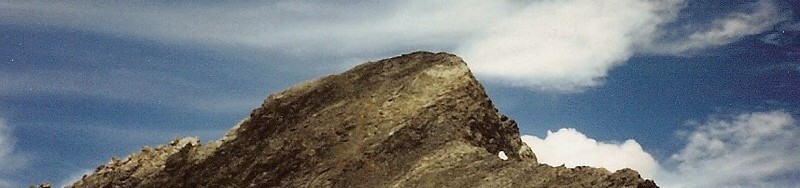
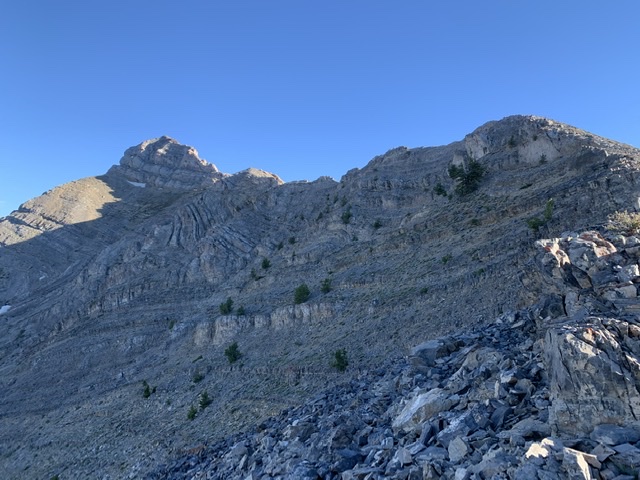
The second edition of the book discussed the then unnamed Triple Peak as follows:
Peak 11280+ 11,280+ feet (Rating unknown)
This complicated tower, the southernmost summit on the Corruption/Breitenbach divide, is probably unclimbed. It is located 1.5 miles northeast of Mount Breitenbach. It is the steepest, most rotten looking summit in the entire range. Access the base of the peak from Breitenbach Pass [(A)(6.1)(a) or (C)(3.2)(a)]. USGS Leatherman Peak
It was the only peak that I put in the book that I was sure had never been climbed. I thought I would give others a chance to make the first ascent but I had every intention of being the first to reach its summit.
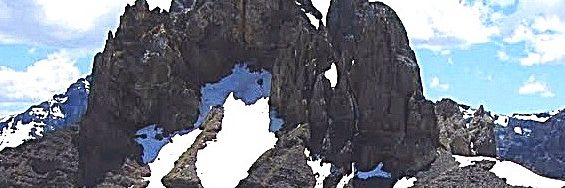
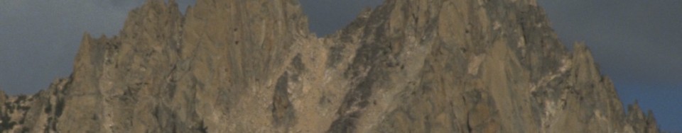
Triple Peak in all its majesty viewed from the north. George a Reinier Photo
The peak first caught my attention when I reached the top of Mount Breitenbach in 1991. The peak’s multiple towers dominated the view to the northeast. It looked like a difficult climbing problem. Triple Peak is a complicated summit located on the treacherous Mount Corruption/Breitenbach Divide. Triple Peak is composed primarily of Challis Volcanic rock which was deposited on top of the Lost River Range’s limestone base. The rock is as rotten you can find in Idaho. It was clear that the peak’s poor rock quality would be the biggest obstacle facing climbers.
I mentally added the peak to my exceedingly long climbing todo list. At this time I was working on the second edition of the guidebook and many other peaks across the state had a higher priority than that rotten towers I observed from Breitenbach’s summit.
Eight years later the second edition of my book was scheduled to hit the books stores in late Summer 2000. I decided I should make an attempt before the book was sent to the printer or someone else got ahold of the new edition and beat me to it. Little did I know that it would take me four tries over four years to discover the secrets of the towers that make up the peak.
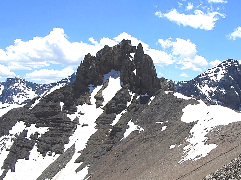
Triple Peak, 11,280, from Brietenbach. Beyond is Bell Mountain.
The first attempt took place in late June of 1996 with Scott Mcleasch. We were surprised to find that unusually high water would keep us from driving across either Dry Creek or the upper Pahsimeroi. We turned to plan B which was to begin from West Fork Burnt Creek, climb Cleft Peak and then traverse the connecting ridge to Triple Peak. This was a long approach and I was not having a great day. When we reached the summit of Cleft Peak, the view of the connecting ridge and Triple Peak’s east tower was not encouraging. We decided to call it a day. Cleft was a nice consolation prize and at least I learned that the traverse, while it might be work, was not an efficient route to make the summit.
The second attempt took place in 2000 with Brian and Karen Wright. This time we were able to ford Dry Creek and reach the trailhead. At one time a good trail climbed up Dry Creek, crossed Breitenbach Pass and descended down the Pahsimeroi River. In 2000 the trail had not been maintained in many years. We hiked up the poorly maintained trail toward Breitenbach Pass. At 8,600 feet we decided to leave the trail and climb the talus directly to the base of the east face of the summit block aiming for its southwest corner. It was a long, loose and tiring trudge. The higher we got, the looser the talus got. We finally reached the summit block and began looking for a line we could climb. The block’s face was mostly vertical. We tried a crack and a gully without finding a suitable route. We then climbed around to the peak’s south ridge and spotted a suitable line. However, it was now late in the day and, as working stiffs, we had to call it a day.
Karen Wright leading us up the peak’s east face across endless scree.Looking for a line up the east face.Exploring a dead end.The rock face had potential difficult lines on hard rock. Since we were not sure if these lines would lead to the true summit we were not enthusiastic about trying them.
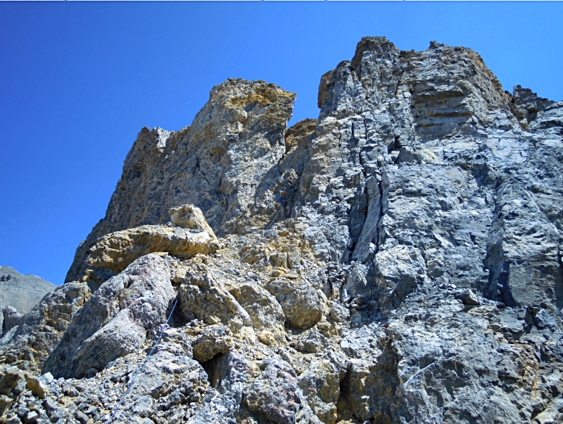
On the third try in 2001 Brian and I backpacked up the Pahsimeroi River and set up a camp at 8,800 feet. The next day we hiked to Breitenbach Pass utilizing the trail where it existed and the mostly open slopes where the trail disappeared. From the pass we had a good view up the peak’s southwest ridge. The tower that loomed above us looked imposing but there was a split in the vertical wall that looked like a potential line to start our ascent. We hiked up to the base of the tower and roped up.
Looking at the summit towers from Breitenbach Pass.Time to harness up at the base of the west tower.
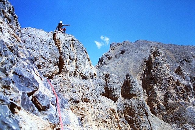
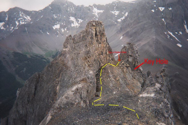
I started up the steep gully that cut the tower’s face cognizant that the rotten rock was not conducive to roped climbing. First, I traversed to the right off the ridge top climbing over boulders and talus for about 150 feet to the base of the steep, slippery, debris-filled gully that split the face. I carefully climbed up the gully crossing loose talus in places and a series of hard ledges covered with loose rock. At the top of the gully, I was in an alcove capped by a 12-foot-high Class 3-4 wall. At the top of the wall I found a narrow hole or keyhole that exited out of the alcove to the northeast. I set an anchor and looked through the keyhole and discovered we had options to continue the ascent. I put Brian on belay and brought him up.
Looking down the dirty gully from the Keyhole. Judi Steciak and Carl Hamke Photo
We climbed through the keyhole and continued to climb up, unroped, across Class 2-3 debris until we found ourselves at the base of the southwestern most tower’s highest point. Above us was a vertical 75-foot wall shaped like an open book. The wall’s was composed of hard or at least harder rock than we had already crossed. It appeared this feature would lead to the top of the tower without too much difficulty. To the left, we could see a ledge system that appeared to traverse the base of tower’s north face. Access to this ledge would involve crossing a steep rotten gully and climbing a 25-foot-high nearly vertical wall of dirt and debris. From our perch any further the view northeast along the summit ridge was blocked.
Looking back at Carl Hamke on a later ascent climbing through the keyhole. Judi Steciak and Carl Hamke PhotoThe view from the keyhole looking toward the base of the open book. Judi Steciak and Carl Hamke Photo
Since we had no confirmation of which of the peak’s three towers was actually the highest (we did suspect the middle tower was the highest) we debated our two options. First, we could climb the tower we were on which would at least help clarify the highest point issue. Second we could descend down the very steep, loose debris filled gully and see if we could locate a route out of the gully at some point which would allow us to traverse northeast toward the notch between the West Tower on and the middle tower. In sum we had to choose between a descent of unknown length into the unknown on loose and unconsolidated crud or a climb to the top of the tower we were on relatively hard rock. It really was not a choice that was hard to make. We did not consider attempting to climb out of the gully via the 25-foot dirt wall.
We set an anchor. I put Brian on belay and he made short work of the climb. We rated this short 75-foot section at 5.7. He belayed me up. As I reached the top I detected disappointment on Brian’s face. He didn’t say anything. He just point to the next tower which was undoubtedly higher. Although it was higher it was obviously a Class 2 scramble from the intervening notch. Between us and the notch was a hundred foot vertical drop, a drop that didn’t look conducive to down climbing. “Okay,” I said, we need to rappel down the 100 foot drop into the notch.
Brian on top of the tower.
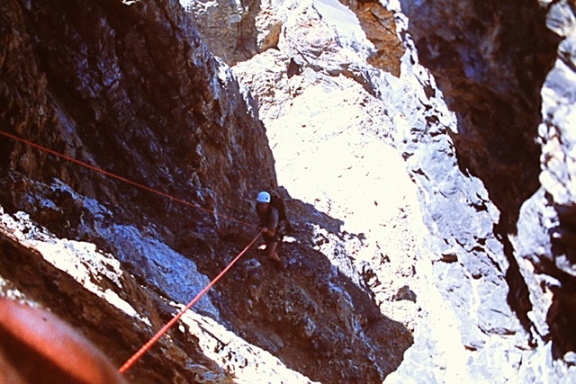
We spent the next thirty minutes trying figure out a safe way to set up a bomb proof rappel anchor cognizant that we would also have to use the anchor to safely protect ourselves when we had to climb back up wall on our return. There was horn we could safely use to rappel down our line of ascent but it’s shape would not work for a rappel down into the notch. The rope would slide off it. Our effort to set an anchor proved futile. It was impossible for us to set an anchor to rappel into the notch between the two towers with the equipment we brought.
While the route from the notch to the summit looked an easy walk, it was late on Sunday afternoon, we still had to backpack out to the truck, make the six hour drive back to Boise and we both had to work the next day. We gave up and vowed to return. The Summer passed by without an opportunity or the desire to return.
Brian rappelling off the tower.
In 2002, I broke my leg sliding into second base in a softball tournament in early June. (I was safe by the way). After surgery, recuperating and physical therapy it was late September and my leg was too weak for serious climbing. I settled for easier climbing until the snow flew.
Finally, on July 19, 2003 Brian and I found ourselves once again at the base of the southwestern most tower. Based on our prior adventures, we decided that the best route was to climb the southwestern tower again, set up some south of Rube Goldberg rappel anchor and rappel into the intervening gap and finish the climb. We took an extra rope, a bolt kit and 100 feet of sling, ascenders in hopes that we could fashion a safe rappel anchor someplace on the tower’s rotten summit.
Once again we packed up the Pahsimeroi River and set up camp. In the morning we hiked up to Breitenbach Pass and then hiked northeast up the ridge to the base of the wowed. This time we climbed the dirty gully to the keyhole without roping up. We climbed through the keyhole and up to the base of the open book.
While Brian was setting up an anchor to begin the climb up the open book, I stared at the ledge to the rotten 25-foot wall blocking the way and the view. After wondering for two years what was on the other side of the wall and whether it connected with the ledge I made up my mind. I decided to take a look. Brian put me on belay and I edged across to the gully to the base of the wall and started up. It was like climbing an overhanging road cut. Dirt and rocks streamed down around me but it was not as bad as I had imagined two years earlier. When I reached the top and looked over the top, I found a rather wide ledge that traversed the remaining section of the Towers north face which lead into the notch. From that point on, the climb was a walk across talus and boulders.
As we reached the summit, the East Tower came into view. We could not say with certainty that we were on the highest point. We had to check with a spirit level to be certain that we had the first ascent.
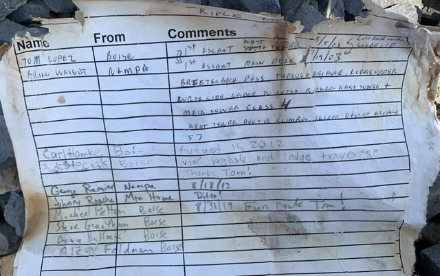
Looking from the summit down the upper route. The West Tower is roughly 25 feet lower than the summit.The register that Brian and I left on the summit. Haylee Stocking PhotoBrian on the summit with East Tower in the background.
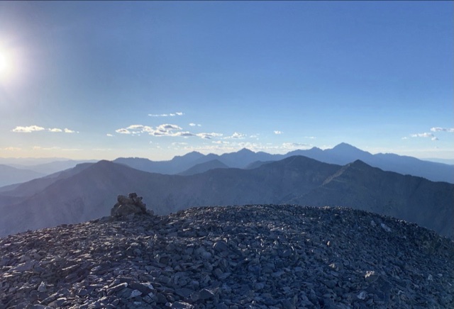
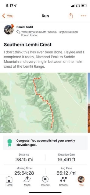
The Lemhi Range’s southern crest between Diamond Peak and Saddle Mountain perfectly frames the northern horizon when viewed from almost anyplace between Idaho Falls and American Falls. This stretch of high mountains with twelve 10ers was constantly on my mind. Sometime in the last few years, I got it in my head that I should traverse the whole thing in a single push.
After some research, it appeared that this traverse had never been attempted or done. I asked Haylee Stocking if she would like to join me on the adventure and she agreed. Josh Smith heard about our plans and volunteered to provide support. His friend, Jenny I believe it is Woolstenhulme, signed on to the support team. With everything in place, we were ready to start Saturday, June 26, 2021.
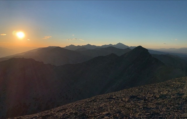
We started the trip with an ascent of Diamond Peak. We reached its summit in 2 hours and 15 minutes, just in time to enjoy the sunrise.
Sunrise on Diamond Peak
The route south from Diamond Peak has no shortage of rugged/exposed terrain to make things entertaining. The traverse from Diamond to The Riddler was my favorite section of the traverse.
Early morning light on The Riddler as we traverse over from Diamond Peak.Haylee scrambling between Diamond Peak and The RiddlerDescending The Riddler was challenging at times.The late Larry Prescott called this section “close shave” as it is a steep slab on one side and an overhanging drop on the other. The picture doesn’t depict the exposure well, but there was plenty.
The route across Big Boy, Shoshone John, and Black and White included numerous sections of knife-edge ridge walking on grippy limestone with a few places having lots of exposure.
Typical terrain on the traverse north of Pass Creek Summit.
Typical terrain on the traverse south of Little Diamond Peak.
Josh met us on Pass Creek Summit and supplied us with water and energy supplies.
South of Pass Creek Summit, the mountains just kept coming and we summited everyone of them before reaching Saddle Mountain. After refueling, our next peak was Marshalls Mount.
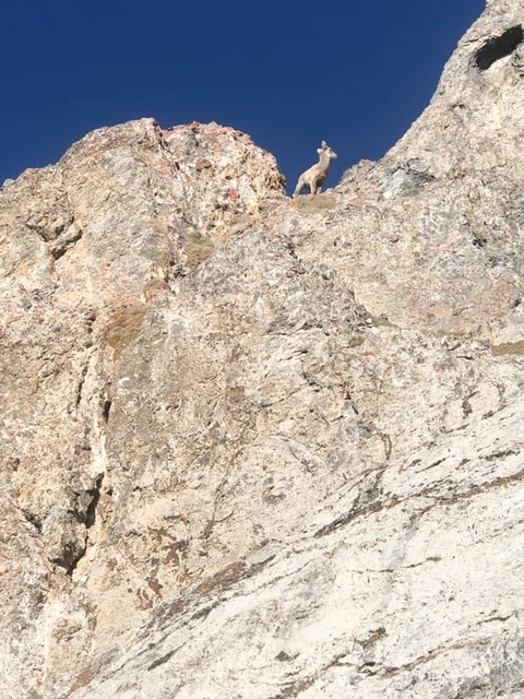
Looking south from the summit of White Bird towards Dome, Shril and Tyler. Haylee Stocking PhotoDaniel approaching summit of Shril Benchmark. Haylee Stocking PhotoGearing up for Striped, Tyler, Hoopes, and Saddle. Haylee Stocking PhotoLooking at the ridge and summit of Tyler Peak. Haylee Stocking PhotoThe day is waning as the shadows spread out from Tyler Peak’s summit. Haylee Stocking PhotoLooking north from the summit of Tyler Peak at everything we’ve climbed. Haylee Stocking PhotoLate in the day from the summit of Hoopes. Haylee Stocking PhotoGoats on Tyler Peak. Haylee Stocking PhotoSomewhere on the crest :). Haylee Stocking Photo
The final test was Saddle Mountain. We knew this would be a test after so many hours above tree line. Our enthusiasm was bolstered because we knew that Josh had climbed Saddle Mountain earlier in the day and left us a cache of food and water. Climbing the north ridge of saddle in the dark was not physically hard with just a few Class 3 sections. However, it was psychologically taxing since we couldn’t see what was above us. Neither of us had climbed Saddle before and I finished my water while climbing Tyler Peak.
Saddle Mountain awaits us. Haylee Stocking Photo
Our effort progressed smoothly with the exception of our descent off of Saddle Mountain in the dark. Finishing off the day with a long tiring slog through the deadfall in Middle Canyon was a chore. Haylee told me “I felt great all day and was loving life until we hit Middle Canyon. That was hell in the dark.”
After 26 hours of climbing, we reached our vehicle and feasted on cold beverages and snacks.
Final Thoughts
Our traverse was 90 percent off-trail and covered a lot of undocumented terrain. As a result, a substantial portion of the traverse involved route finding and scrambling improvised as we traveled. In total, there were three technical cruxes: the traverse between Diamond Peak and The Riddler, the exposure on the south side of Shoshone John, and a short knife-edge between Black and White and Little Diamond. None of this was difficult climbing–just exposed scrambling on sometimes questionable rock. Josh’s logistical support was essential since there was no water or snow along the route.
Haylee told me she really enjoyed her summit time and the “hardest part besides the actual climbing was not being able to stay as long as I wanted on the summits.” In retrospect, the hardest part for Haylee was probably that she constantly had to wait for me. She is a powerhouse in the mountains. Haylee offers the following advice for those thinking about following our route: “Arrange a couple more aid drops so your pack is lighter which will allow you to move a little faster on the easy ‘runnable’ sections.”
Trip Statistics
Distance: 28.15 miles
Elevation Gain: 16,491 feet
Time: 25 hours, 54 minutes, 28 seconds.
Haylee and Daniel during their 26-hour extravaganza looking no worse for the wear.