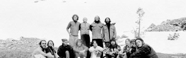
This July 23, 1939 article briefly surveys Idaho Mountaineering at the time. Unfortunately, the climbers shown in the photographs are not identified. Nevertheless, the article demonstrates that Idaho climbers were actively “getting after it” 80 years ago.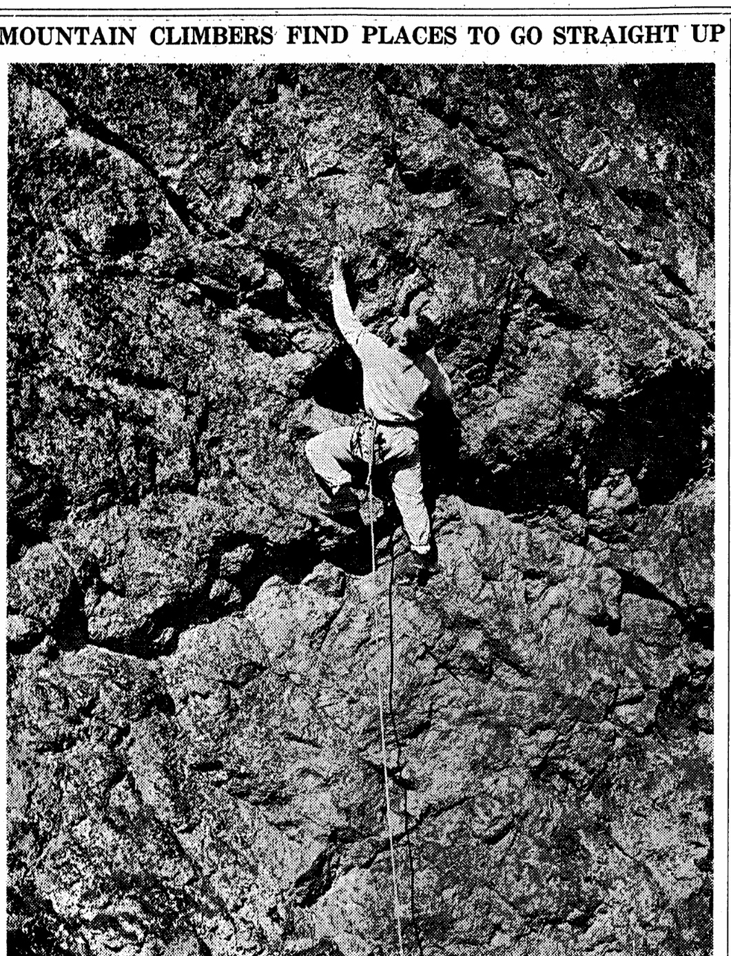


Author: Tom Lopez
-
Idaho Mountaineering 1939
-
The Missing Link: Norman Clyde in Idaho
Idaho is a virtual sea of mountains. While there is no doubt that Native Americans rambled across the state’s mountain summits and that explorers, trappers, miners, ranchers, surveyors and locals were climbing Idaho’s mountains from the time Lewis and Clark first passed through the state, there are few recorded accounts of these early ascents.
When I wrote Idaho: A Climbing Guide, I noted at the time the second edition was published that “The following [Climbing History] is a thumbnail sketch of Idaho’s mountaineering history, filled with unfortunate, but unavoidable gaps.” In the intervening years, I have searched for additional accounts of Idaho climbers to fill in the gaps. I recently came across a couple of 92-year-old Idaho Statesman articles that answered one of my unanswered questions about the Sawtooth Range.
The birth of modern Idaho Sawtooth mountaineering has historically been credited to Robert and Miriam Underhill. Robert, a Harvard philosophy professor and an Appalachian Mountain Club member, was a cutting edge American mountaineer in the 1920s and 1930s. Miriam was the top American female climber of her time. They climbed in the Sawtooths in 1934 and 1935 and then published articles in the Appalachian Mountain Club’s journal, Appalachia, in 1934 and 1935. No doubt, these articles awakened the wider climbing community to the Sawtooth’s impressive granite peaks but who told the Underhills about the Sawtooths?
The Idaho Department of Commerce publicized the scenic beauty of the Sawtooths as early as 1910. However, it is unlikely that the Underhills read about Sawtooth climbing opportunities in an Idaho Department of Commerce brochure or in Idaho Statesman articles, like the the 1927 article “Crown of the Sawtooths” by Bob “Two Gun” Limbert.
It turns out that the link between the Underhills and Idaho was Norman Clyde. Norman Clyde (1885-1972) was unquestionably one of the most prolific Sierra Nevada explorers and climbers. He is credited with more than 130 first ascents in the Sierra, has a peak, a minaret and many routes named after him. Less well known are Clyde’s climbing adventures in Montana, Wyoming and Idaho. Yes, Idaho. Although a very obscure fact, in 1927, Clyde climbed in both the Sawtooth Range and the White Clouds.
Clyde was also a prolific writer. The Bancroft Library at the University of California maintains Clyde’s papers which includes an archive of 1,467 articles. Three of these articles cover Clyde’s visit to Idaho in 1927: An Ascent of Castle Peak; Up and Down Castle Peak; and A Glimpse of the Sawtooth Mountains of Central Idaho. Two of these articles, An Ascent of Castle Peak and A Glimpse of the Sawtooth Mountains of Central Idaho (albeit with a slightly altered form) were published in the Idaho Statesman in 1929.
Clyde’s visit to Idaho was first noted in a September 10, 1927 news clip in the Idaho Statesman:
“CLIMBS SAWTOOTH PEAKS”
HAILEY — Norman Clyde, who makes a specialty of guiding parties on mountain climbs, is in the Sawtooth country looking for new territory and has finished climbing a number of the major Sawtooth peaks, including some of the White Cloud peaks and Castle Peak. He reports that Castle Peak is not so hard to climb as the Grand Teton, where he conducted a party last year, but is a mountain that will appeal to mountain climbers. Mr. Clyde’s home is at Independence, California.”
The first Clyde article published by the Statesman was a shortened version of his longer, unpublished article, A Glimpse of the Sawtooth Mountains of Central Idaho. The Statesman article was entitled A Southerner’s Glimpse of the Sawtooth Mountains. It appeared on June 2, 1929. This article recounted his ascent of Decker Peak and described the rugged crest.
“Arriving at the crest of the ridge, I came upon a trail leading toward the summit of the range. This I followed until it terminated near timber line. To the southwest, beyond rocky cirques, the summit of Mount Decker came into view. Here it was necessary to drop down several hundred feet in order to avoid an impassable crag.”
Despite suffering from a violent toothache, Clyde pressed on. He recounted:
“As I advanced, more and more of the rugged crest of the range came into view. After surmounting several craggy and glaciated pitches, I reached a talus slope just below the summit. Seized with the elan that fills me when nearing the summit of a mountain, I soon traversed this and scrambled up to the crest of a narrow arete which I followed to the highest point of the peak.”
Clyde then described the view in terms that make climbers grab their packs and head for the mountains:
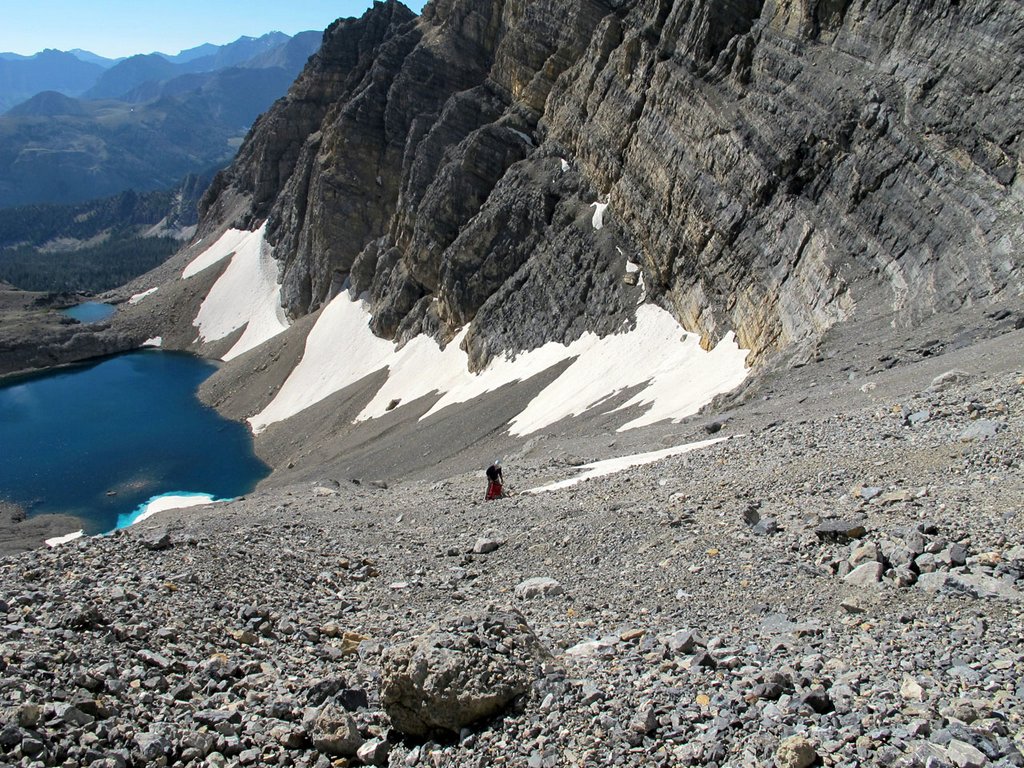
“The panorama that lay outspread around me was thrilling. For a score of miles in either direction extended the crest of the Sawtooths—a maze of craggy peaks, deep cirques, narrow ridges and pinnacled knife-edges. Azure lakes lay ensconced in verdant timbered bowls of the lower basins while others lurked in rocky cirques, tinged with a shade of turquoise; one with an indescribable amethystine hue. Masses of snow clung here and there to precipitous slopes, while several remnants of almost vanished glaciers appeared in sheltered depressions. Fleecy clouds floated slowly past, crossed the Sawtooth Valley and gathered about Castle peak and the White Cloud peaks. In every direction, range after range extended to the horizon. To the north, the broken crest of the Sawtooths continued for a considerable distance. To the southeast, undulating lines varied by several precipitous mountains faded away in the distance. To the east, beyond the Sawtooths were the high masses of the Boulder and Hyndman groups .”
The second of Clyde’s three Idaho articles, An Ascent of Castle Peak, was published in the Idaho Statesman on June 9, 1929. His article doesn’t mention if he found evidence of a previous ascent but does constitute the earliest description of a climb of the White Cloud Peaks giant.
Clyde made his base camp for his Idaho explorations at the F.W Shaw Ranch near Obsidian. He undoubtedly learned about the lay of the land from his hosts. Following, this advice, he approached Castle Peak via Fourth of July Creek. He climbed an unnamed peak along the way, probably the still unnamed Peak 10405, and then made his way of into Chamberlain Basin and the lake below Castle Peak’s South Face. The next day he climbed up the face, writing:
“Leaving camp early on the following morning, I was soon trudging up the steep slope that rises to the east of the lake to an elevation of about 1,500 feet above it. As I surmounted it, I came into full view of Castle Peak, towering above a lake-studded basin a few hundred feet below me. A number of steep chutes seemed to rise almost vertically toward its summit, which appeared to consist of a series of pinnacles of almost equal height. One chimney, just to the left of the summit almost reached it but, as the apparently perpendicular wall above it appeared to possess few holds, I decided to go to the east and ascend its Southwest Shoulder or attempt to find a way up–another.”
His account into the unknown continued:
“. . . Crossing above one of them, I made my way up a a broad stretch of talus and then up a chute, broad and gently sloping at first, but soon narrow and steep. After reaching its head by a somewhat difficult scramble, I crossed one narrow arete to another and went toward what appeared to be the summit, but upon reaching it I found it to be only a point on a jagged knife-edge, with another higher one to the east, beyond a deep gash in the arete. Dropping down several hundred feet, I quickly climbed to the top of it. Probably the highest point on the mountain, but several pinnacles of almost equal or possibly greater height were seen to the east. . . .”
Thus, Clyde was confronted with the same question that still confounds climbers 92 years later: which point on Castle Peak’s ragged summit ridge is the true summit? He continued:
“To make certain of not missing the highest point of the mountain, I proceeded to climb the other pinnacles. As I worked my way along the cliff, surmounting one after another of them, I found interesting but not very hazardous climbing, except possibly in one instance where I carelessly stepped on a loose mass of rock that suddenly gave way. Fortunately I had a good handhold, and after hanging in partial suspension for a few moments I was able to proceed along a narrow shelf. Eventually I came to the last of the higher pinnacles.”
No doubt the Idaho Statesman’s publishing of Clyde’s articles and similar articles gave local climbers further reason to explore the Idaho mountains. How did Clyde inspire the Underhills to travel form their home at Harvard to Idaho?
Clyde was a member of the Sierra Club. In 1931, Sierra Club officer Francis Farquhar invited Robert Underhill to the Sierra Nevada to teach the latest techniques of roped climbing to Sierra Club members. Clyde was part of this group. Given Underhill’s drive to explore mountains world wide, there can be no doubt that he and Clyde exchanged climbing stories over a campfire.
The link between Clyde and the Underhills led to the opening of the Sawtooth Range to a cosmopolitan, out of state, array of climbers including Fred Beckey, Luis Stur, Gordon Webster, Steve Roper, Bill March, Jeff Lowe and the Iowa Mountaineers. Idaho climbers followed these climbers and established themselves in the Pantheon of Sawtooth Climbers. Lyman Dye started the first Sawtooth climbing guide service and he was later followed by Kirk Bachman who established Sawtooth Mountain Guides. Reid Dawdle, Ray Brooks, Dave Bingham, Kevin Swigert, Jeff and Kelly Rhoads and many others redefined and refined the Sawtooth climbing ethic which started with Norman Clyde’s 1927 visit.
Read more about Norman Clyde in Wikipedia and in the Adventure Journal.
-
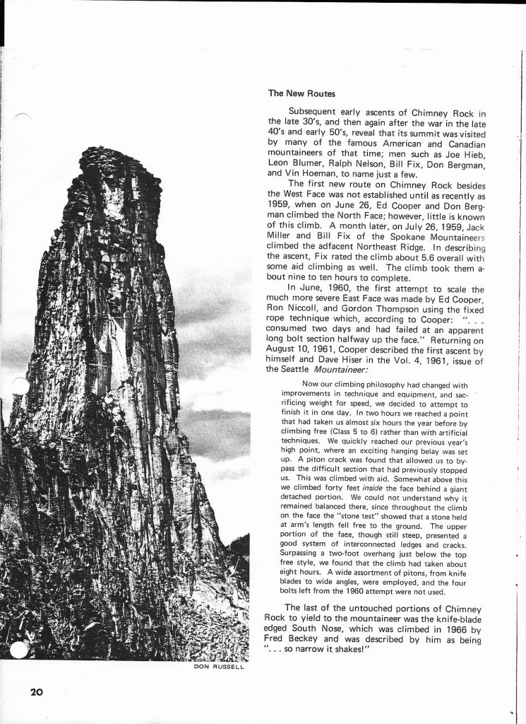
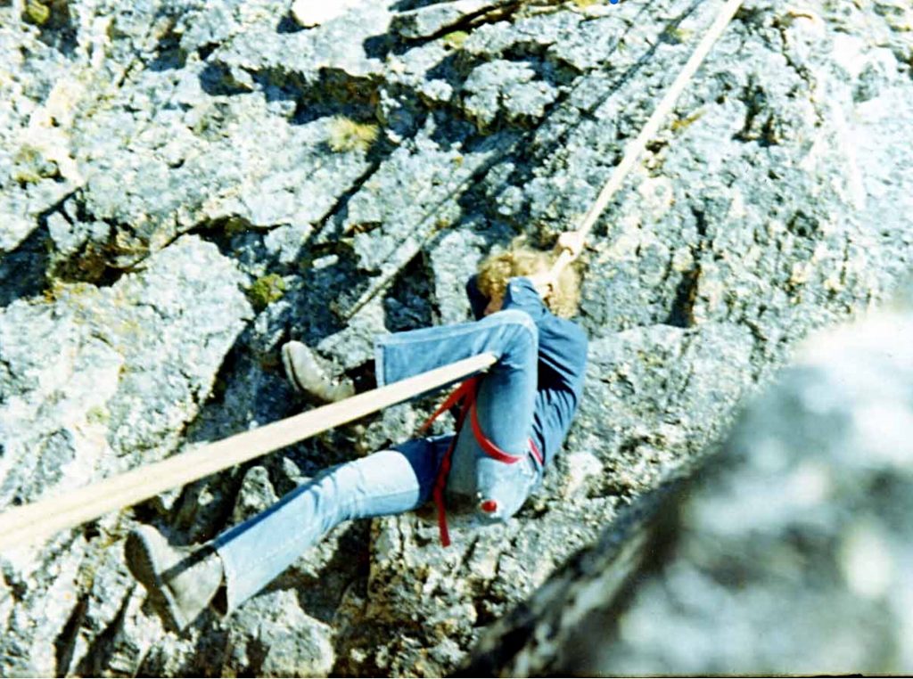
Chimney Rock Off-Belay Magazine 1972
Off Belay Magazine was THE climbing magazine of its day. The following article had an extensive discussion of Chimney Rock [Off-Belay Dec. 1972 Vol. No 6.]. Ron Klimkow (1936-2012), the author, was a professor in the Music Department at the University of Idaho and an accomplished climber.


-
The First Winter Ascent of Mount Heyburn
The first Winter ascent of Mount Heyburn was made by Gordon Williams, Mark Sheehan, Jacques Bordeleau, Chris Puchner and Joe Saviers on December 30, 1974. They climbed the peak from the fifth Bench Lake via the Northwest Ridge. Mark Sheehan recalls: “It was a real slog, breaking trail though waist deep powder on a 45 degree slope. Once we got onto the rock it was one pitch of 5.5 climbing.” [Use this link to see Jacques’ photos from the groups first Winter attempt: Mount Heyburn Attempt]

The ascent crew after the first ascent. Left to right: Mark Sheehan, Joe Saviers, Gordon Williams and Chris Puchner. Photo courtesy of Jacques Bordeleau. John Miller was the sixth member of the expedition but he did not summit. Jacques Bordeleau remembered “All but one guy summitted in 1975. Milner sat in his tent whining about his cold toes all day and I haven’t seen him since. It was 2 degrees on the summit but the sun felt good once we had climbed up into it.”
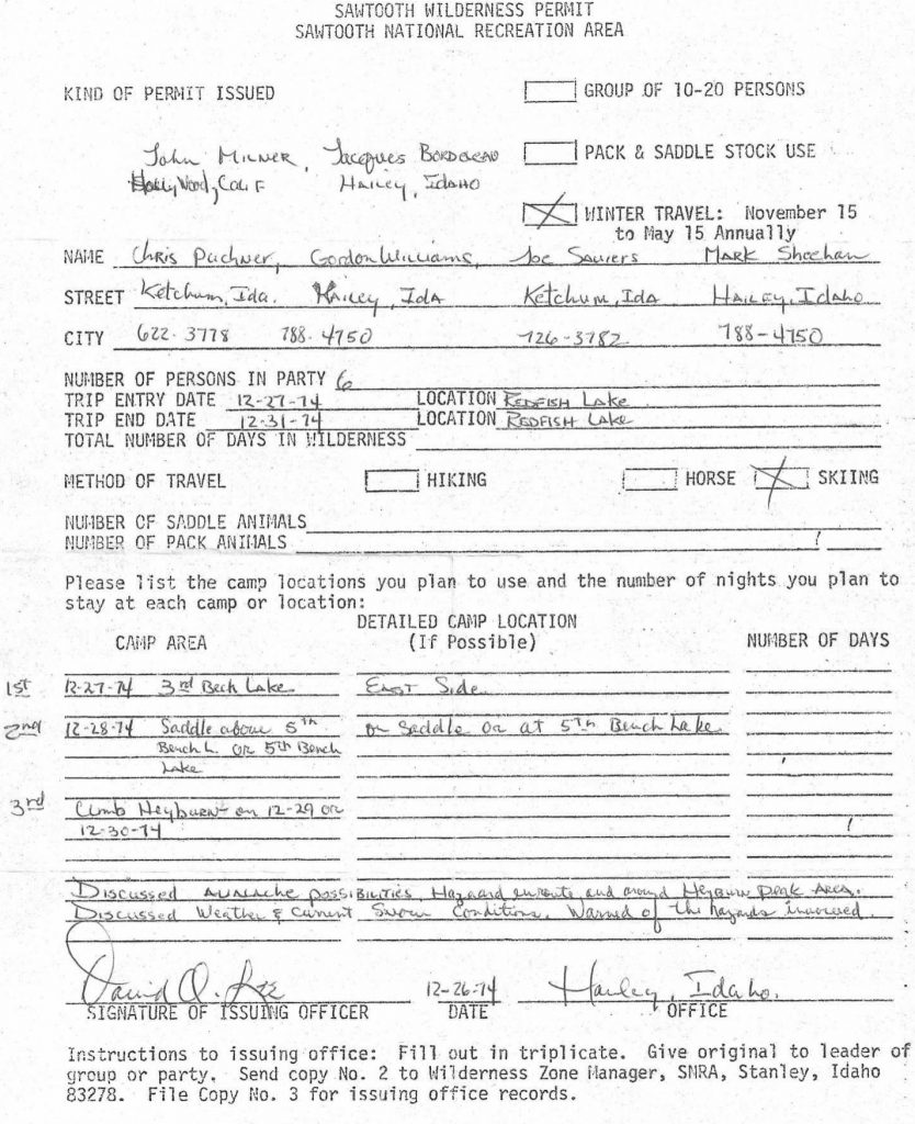
This is the Wilderness Permit issued to the climbers. Note the signature is David O. Lee, the long time backcountry ranger for the Sawtooths. A White Cloud peak is named after him. 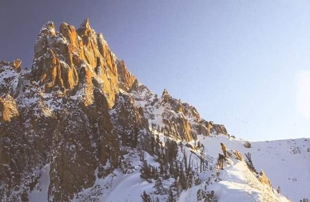
Mount Heyburn covered in deep snow at the time of the climb. Mark Sheehan Photo -
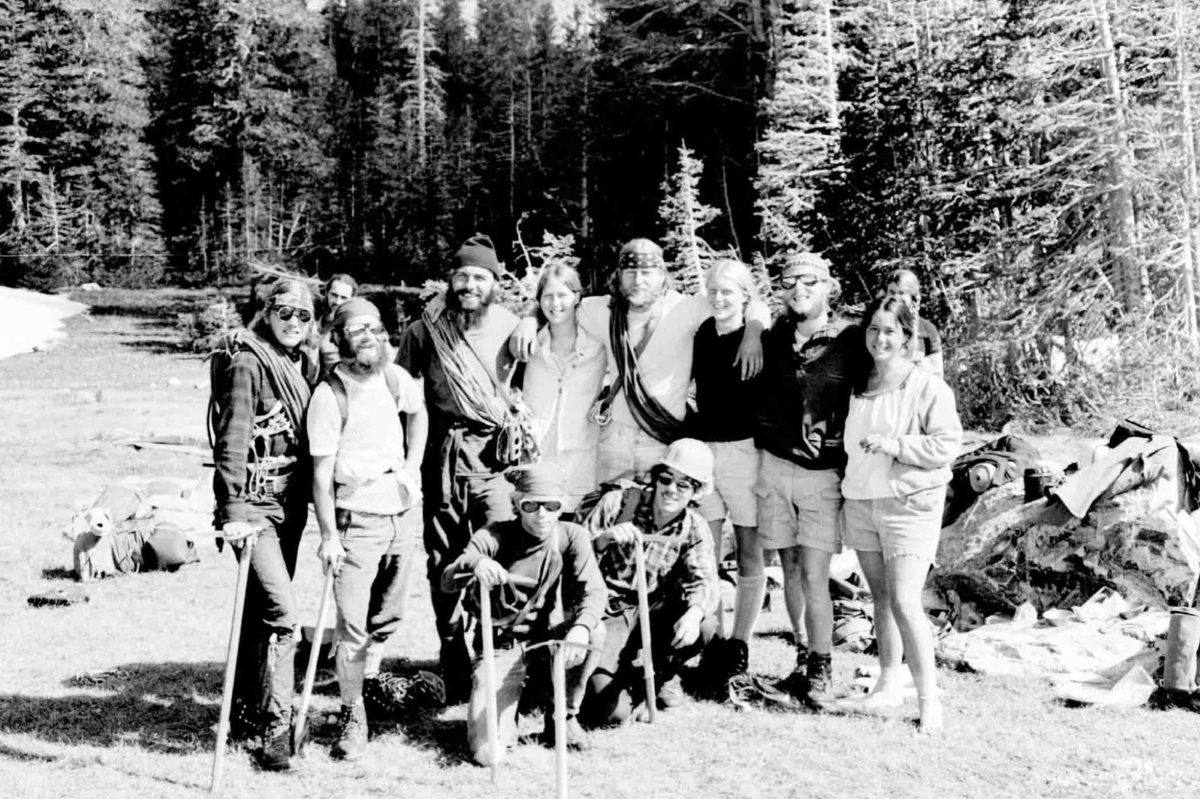
The Decker Flat Climbing & Frisbee Club By Ray Brooks
I guess we were the Decker Flat Climbing & Frisbee Club (DFC&FC) before anyone, including us, knew. The little guy in the back of my mind liked the way the words fit together. Until the name popped into my head we were simply a group of like-minded climbers who lacked an identifying name. However, on a fateful morning in the mountains of Idaho, adversity transformed us from a nameless, ragged band of climbers into an organization that would accomplish endless deeds of climbing derring-do.
The fateful day was a hot one in late July 1970. We were hiking into Mount Regan above Sawtooth Lake. Our packs were heavy, each with 60-70 pounds of climbing and camping gear. In addition to the heat, it was a humid and windless morning. We were sweating hard and were being chased mercilessly by a full-strength squadron of horseflies.
Flies dive-bombed us incessantly, trying to break through the curtain of insect repellent we had drenched ourselves with. They grew in numbers, until it was difficult to see the sun through the voracious fly swarm above our heads. Frenzied buzzing horseflies became noisily trapped in our long hair and select kamikaze flies would creep between our sweaty fingers to inflict amazingly painful bites.
It was starting to look like we might become the first known case of climbers eaten by flies when suddenly all the horseflies dipped their wings, did a double roll and turned tail. They flew off down-canyon–a roaring cloud of instant misery. The reason for their retreat stood by the trail snarling evilly, shovel in hand. Even horseflies don’t mess with SMOKEY THE BEAR!! Of course, a sudden breeze might have helped too.
We had arrived at the Wilderness Boundary! There beside the plywood Smokey was an 8-foot tall, solid redwood sign proclaiming:
ENTERING SAWTOOTH WILDERNESS AREA
CHALLIS NATIONAL FOREST
PLEASE REGISTER FOR YOUR OWN
PROTECTION!We had some fun filling out the overly-detailed registration form, but then none of us wanted to put our name on it as group leader. In a moment of inspiration, I exclaimed “Let’s call ourselves the Decker Flat Climbing & Frisbee Club” and, since I thought of it, I get to be manager.
We had elections on the spot and Gordon chose to be Social Chairman, Harry Bowron, Treasurer, and Joe Fox, Member at Large. The next day we climbed Mount Regan (which was somewhat challenging) and had a great time. Our mountain fun was just starting. We never had scheduled meetings or dues but, in order to become a member, you had to go climbing with another member. Of course Gordon took his duties as Social Chairman seriously. He was soon adding females to our club. I must admit to being jealous of Gordon’s social skills in the 1970s and 1980s. His girlfriends were always attractive, assertive and intelligent. Gordon was a “babe-magnet” of the first magnitude. Thus, he was the perfect Social Chairman.
The rest is history, and we did climb Mount Regan the next day.
Gordon Williams on a Tyrolean Traverse near the summit of Mount Regan. Note the vintage Goldline rope. After our spur of the moment start in July 1970, we never had regularly scheduled meetings, but we enjoyed a 4th of July group outing in the Pioneer Range and another outing in 1971, with about 20 friends attending. For the most part, DFC&FC members climbed together in small groups.

A Gordon Williams photo of most of the 1970 party group. I’m at the left in the front row. In the early 1970s, Idaho mountaineering was a different world than now. It was a world without good USGS maps, climbing guidebooks, cell phones, GPS devices, an internet to access for climbing information and satellite rescue beacons. Thus, we suffered considerable obstacles to safe and sane mountaineering, but let me assure you, rock climbing and mountaineering in Idaho was a helluva lot more adventurous and a lot more fun then than it is now. Amazingly, although some of our climbing students suffered long scary slides on steep snow slopes, there are no serious climbing injuries or deaths in the history of the DFC&FC.
In keeping with the local ethics of Sawtooth climbing which sought to keep the Sawtooth Range unpublicized, club members did not (for the most part) publish their climbing exploits. Still, members made some impressive ascents and all of us were actively invested in exploring the nearby mountains.
In the early 1970s, Gordon Williams was instrumental in leading groups which pushed the limits of Winter climbing in the Sawtooth Range. There were some setbacks, but under Gordon’s leadership, there were successes. The two most notable Winter first ascents were the Finger of Fate and Mount Heyburn.
Harry Bowron and I completed several notable new routes in 1971 and 1972 in the Sawtooth Mountains, including two new routes to the summit block of Big Baron Spire and a new route on the South Side of Warbonnet. Contrary to local ethics, I did publish an account of a new route I achieved with Mike Paine and Jennifer Jones on Elephant’s Perch in 1967. My ethical breach insured that no other climbers would climb the same route and claim the glory of a first ascent on the biggest wall in the Sawtooths.

Here’s a group of us at our 4th of July 1971 gathering. Gordon is at left in the back row. Others pictured include William Michael Bird, Gordon K. Williams, Ray Brooks, Danny Bell, Vicki Smith and Randy Felts. The only tangible achievement of the DFC&FC was to restore Pioneer Cabin, which sits on a high ridge east of Sun Valley adjacent to the high peaks of the Pioneer Range, in 1972 and 1973. I was in Moscow, Idaho at the time and had nothing to do with the project. Credit for the rehabilitation goes to Gordon Williams, Robert Ketchum, Chris Puchner and others who donated materials, helicopter time and labor.
Gordon Williams was insistent on painting our club slogan: “The higher you get, the higher you get” on the roof. Somehow, that painted slogan survives on the roof of Pioneer Cabin to this day. Here’s a link to an Idaho Public TV article on it: Pioneer Cabin
Long-term club member John Platt recalls another club slogan he heard while skiing potential avalanche terrain into the Finger of Fate in 1972. “Stay High & Spaced Out.” A high-end outdoor magazine, Adventure Journal, published an article on Pioneer Cabin and the DFC&FC link in their second issue in 2018.
After a high-point with the Pioneer Cabin restoration, the DFC&FC never managed to hold more scheduled events. Nevertheless, members continued to use the name on wilderness registration forms and an informal competition to achieve the most yearly “back-offs” from major rock climbing routes or mountain peaks, persisted into this century. We of the DFC&FC enjoyed fiascos. In the era before decent USGS maps, climbing guidebooks, cell phones, GPS devices, an internet to access for climbing information and satellite rescue beacons, success on routes was not assured and failures were cherished.
In 2001, Gordon Williams hosted a 30th Anniversary party for a surprising number of DFC&FC members. I recall around 20 attendees, including one who flew in from Alaska for the occasion.
In 2012 Matt Leidecker interviewed Gordon Williams, Jacques Bordeleau and me for historical information on notable climbs DFC&FC members had achieved in the Sawtooth Mountains. Leidecker included several paragraphs recounting the club’s history in his fine hiking guide “Exploring The Sawtooths.”
Matt summed up the DFC&FC club achievements in the Sawtooths with a Gordon Williams quote: “I got to thinking what was the shining achievement of our time in the Sawtooths and I came to the conclusion that it was simply to have a good adventure. Once you learn how to do that, you can keep doing it forever.”

DFC&FC members Chris Puchner, Gordon Williams and Mark Sheehan retreating from their first Winter attempt to climb Mount Heyburn. Jacques Bordeleau Photo -
Mount Borah: Dirty Traverse and Northeast Ridge Variation – East Face by Bob Boyles
Bob Boyles provided the following history and, with Wes Collins, the route descriptions (below) for these two East Face Routes.
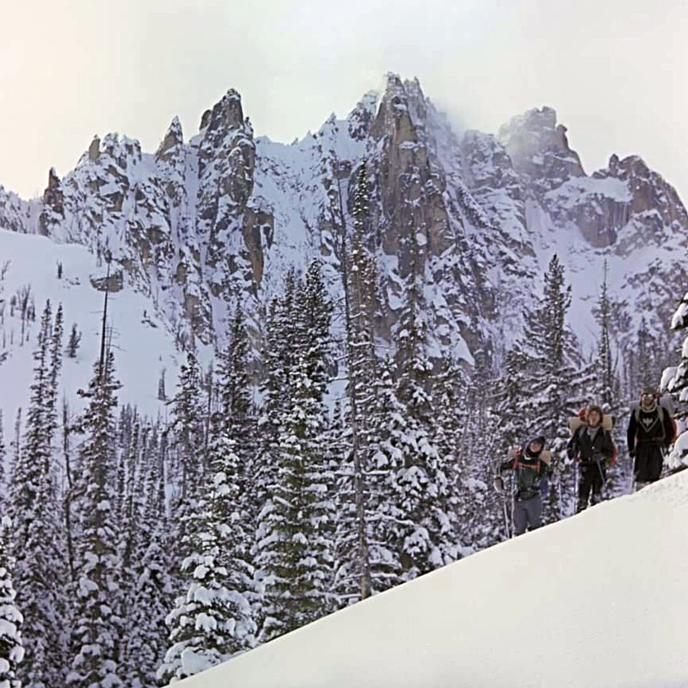
I first visited the East Side of the Lost River Range (The Pahsimeroi Valley) in 1972, while working on a helicopter contract for the Forest Service. Flying through the range provided me a view that few ever get to see. While all of the range is impressive from the eastern side, one face stood out from the others.
When our contract with the USFS finished at the end of Summer, I took a break from the 24/7 aviation life I was accustomed to. During this down time, I happened to notice an ad for an introductory rock climbing class and thought, “Wow. Cool. Ropes and everything, I’m game for this!” I talked a couple of friends into joining me for the class. After completing our class, we were ready to test our newly-learned skills on a real mountain but Winter soon arrived and we put our plans aside until the next Summer.
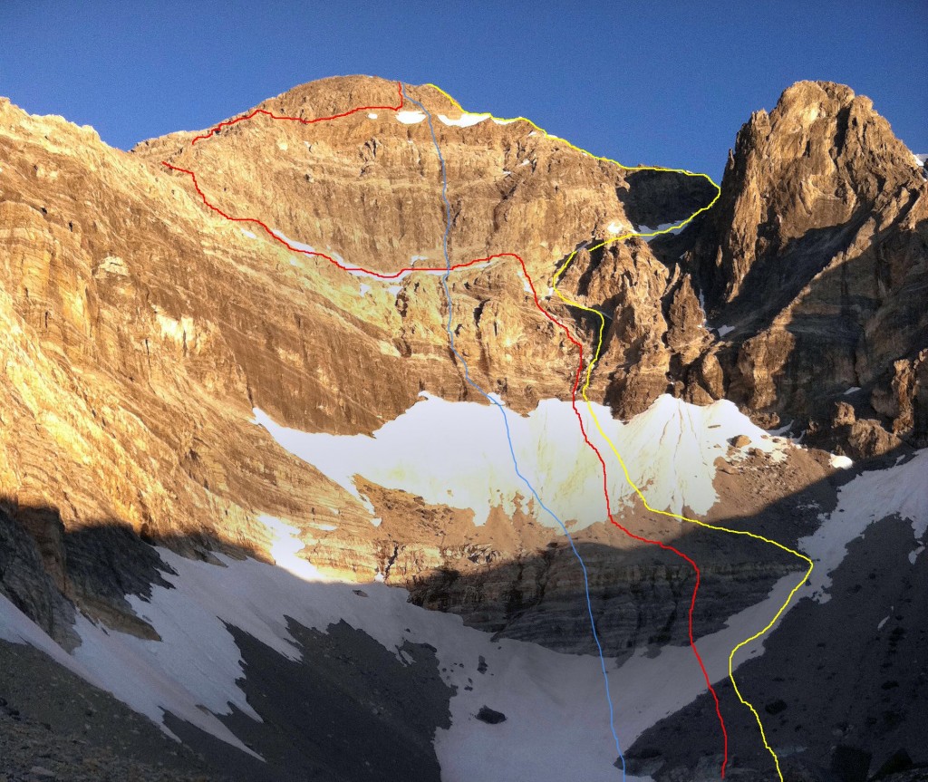
East Face Routes. The Direct East Face (blue line), the Dirty Traverse (red line) and the Northeast Face Variation (yellow). Wes Collins Photo
Summer came late in 1973. It wasn’t until the end of June that we were able to get in for a closer look at the East Face. As the morning sun warmed the snow high in the cirque, we watched slide after slide tear loose and nail virtually every approach to the mountain. Along with the snow slides came a lot of rock fall as well. After sitting and studying the face, it looked to be climbable. There was no doubt, however, that the attempt would have to be made during the dry season. In 1974, we returned for another exploratory trip and picked out a line on the face that followed some water streaks in a nearly straight path to the summit. We decided that this was the route we would attempt on our next visit.
A couple of years passed. In trying to sell potential climbing partners, I described this face as “Idaho’s Eiger” but at the time, the range had no technical rock routes. Idaho has so much fine granite it was hard to justify a trip to the Lost Rivers, where the limestone rock had a reputation for being nothing but choss.
In the Fall of 1975, Mike Weber and I decided to throw caution to the wind and give this face a serious attempt. We loaded up all of the gear we thought we’d need and made the brutal drive to the end of the road up the West Fork of the Pahsimeroi River. Hiking through open sagebrush, we made quick work of the approach and found a nice grass-covered spot for our camp at the lower tarn just above timberline. Curious to see the face up close, we grabbed our crampons and axes and headed up the snow and ice to where the bare rock began.

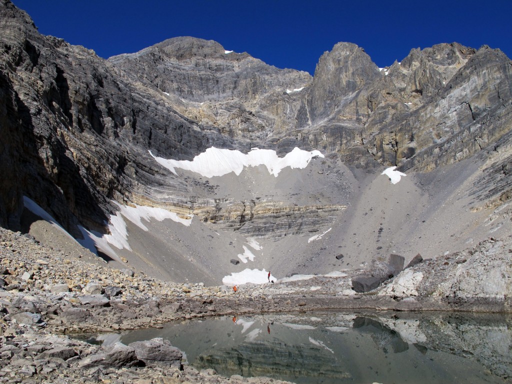
A picture-perfect September day in the Lost River Range (9/24/11). The vertical rise from the lake to the summit is 2,440 feet. Bob Boyles Photo
Just as we were approaching the final section of snow and the start of our proposed route, we heard a rumble from above, freezing us in our tracks. A Volkswagen-sized rock was flip-flopping down the face. Within seconds, it reached terminal velocity bouncing back and forth down the face. We stood motionless in our stances trying to figure out if we should go left, right, or just clasp our hands and pray. Fortunately, the rock deflected about 40 feet to our right. We just stood there watching it tear up snow and bounce to the flats and the tarn at the bottom of the cirque.
We tried to convince each other that the face would be frozen up by morning but neither of us was to be convinced. Around 2:00AM, we were startled awake by a blinding flash of light and, milliseconds later, a rumble of thunder. We both knew our chances to climb were most likely over, so we pretended to go back to sleep. Within minutes, the rain was falling at a rate of an inch or two an hour, and shortly afterward our campsite became a flood zone. We stayed in the tent until it was surrounded by flowing water, our cue to get the hell out of there.
For decades after that ill-fated attempt, my climbing partners and I continued to explore and put up routes in the range. Despite those many visits, we never made it back to the cirque. I pretty much wrote off the East Face as being a very dangerous place and that kind of risk no longer appealed to me. Also, as time progressed, I gained the impression that sport climbing and bolted routes on established climbs were the “new norm” and the pioneering of new alpine routes seemed to have gone by the wayside. It wasn’t until the Spring of 2011, during a discussion of Lost River climbs on the Idaho Summits web forum that a new spark of interest began. When I first described the East Face Cirque, most local climbers did not know what I was talking about. This, despite most of them having climbed Mount Borah multiple times. One did, though.
After reading my description of the face, Wes Collins, a local climber and native of the area, immediately became interested. Soon, a new discussion started about taking a trip to the cirque.
Route Information
The Dirty Traverse
First Ascent – Wes Collins (solo) July 2011
Rating: Grade III 5.4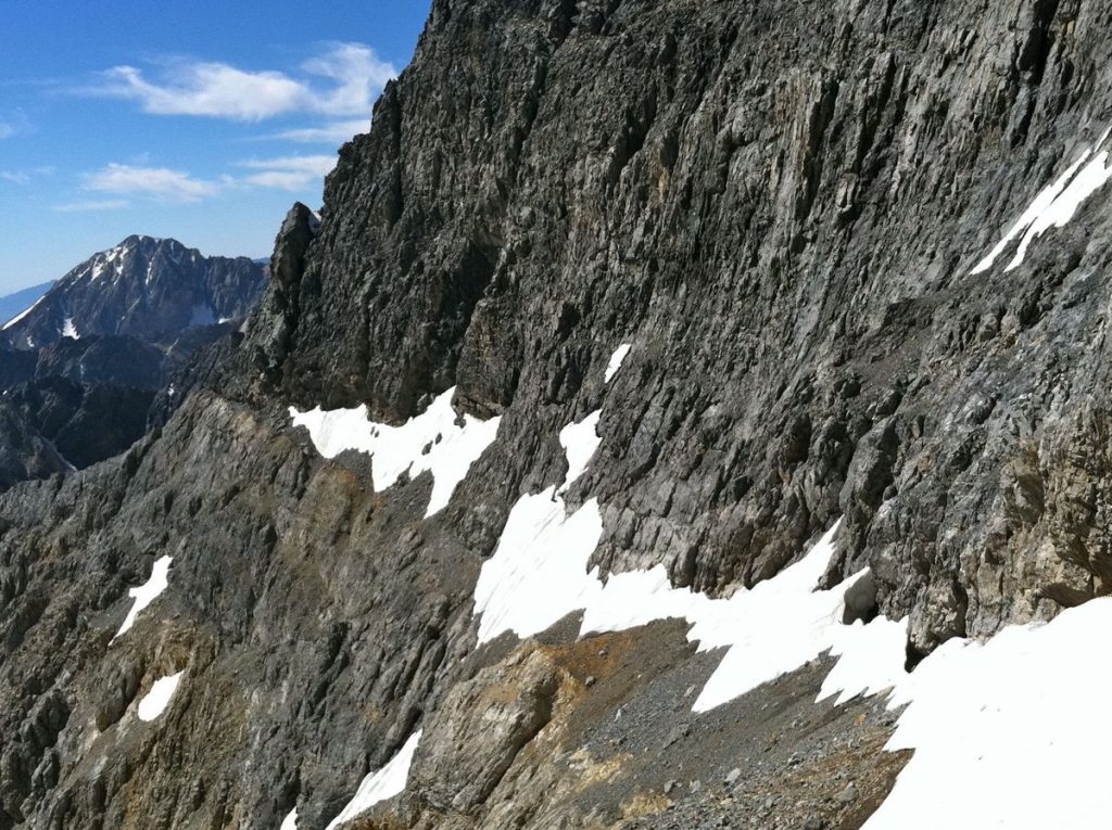
The Dirty Traverse ledge leading out to the East Ridge from the center of the face. Wes Collins Photo
Wes couldn’t wait to see the face up close so he took off on an exploratory trip with his wife and dog. This trip in 2011 started as a recon, but Wes found himself drawn to the face like a magnet. The following is Wes’ account of the first ascent.
Bob got me all fired up to get a look at the East Cirque and what he described as Idaho’s Eiger. I certainly wasn’t disappointed. Susan and I planned the trip as a leisurely backpack into Lake 10204 to take in the views, but I tossed an axe and some light crampons in the truck just in case.
Dirty Traverse-1
Standing on the last of the snow slopes below the first wall. Susan Collins PhotoI spent a lot of time looking at the face before I even thought about a spot for the tent. Stupidly, I’d left my axe and spikes in the truck, but at this point I knew I was going to make a serious try for the summit. It didn’t take long to pick out a couple possibilities, but the most probable line would involve a long traverse across a talus-covered ledge on the lower face. I started thinking of the route as the Dirty Traverse before I even put my boots on it. Morning was an easy laid-back affair. We sipped coffee and we watched the sun line slowly make its way down the mountain. I had to wait until nearly 10:00AM before the snow softened enough for step-kicking. The first, lower snowfield was pretty firm, but the second was much softer.
I’d found a nice, tooth-shaped chunk of limestone that probably wouldn’t have done much more than keep my feet down hill if I took a fall. I was on my own, but it was still embarrassing to have the damn thing in my hand and I had to keep fighting the urge to hide it in my pocket. At the top of the snow, the randkluft was several meters deep and the first tentative moves on rock over the blackness below felt pretty exposed. The rock, however, was surprisingly solid and clean.
Wes Collins about a third of the way across the traverse. Susan Collins Photo
The scramble to the traverse ledge was fairly sustained Class 4, but the rock was good enough to make me forget about the exposure and enjoy the ride. The traverse ledge was quite tedious though and I wasn’t sure it would go all the way to the ridge until I got there. Once on the ridge, I made my way up an easy Class 5, 70-foot buttress but it could have been easily bypassed by scrambling around its West Side. Most of the ridge above the traverse is Class 3 or easier.

The key to the climb. A tiny col where the East Ridge meets the Upper East Face. Cross the snow field “sky ledge” to get to the summit. Wes Collins Photo
As I continued up the ridge, my doubts got bigger. The entire North Side of the East Ridge is very tall and overhung in several places. More and more I suspected it would dead-end into the headwall but, at the last possible minute, a tiny col opened up onto the uppermost ledge (which we named the “sky ledge”) that crosses the East Face. It wasn’t until that moment that I knew the ridge would go all the way. John Platt summed it up nicely in his trip report of JT peak as the almost magical opening of doors as you climb. This was one of the most fun parts of this outing. I couldn’t agree more.
The descent follows the standard route down the mountain to the big saddle at 11,800 feet. From there, I dropped into the cirque that takes in the South Side of Mount Borah and Mount Sacajawea. There are several sections of Class 3-4 scrambling over short but loose cliff bands and several linkable snowfields, but the glissade run-out potential is pretty dangerous on most of the snowfields. At the 10,400-foot contour, the angle eases up. From there I hiked down and around the bottom of the East Ridge and finally back up to camp.
This link will take you to an astounding video of the route by Mediocre Amature: Dirty Traverse Video.
East Face/Northeast Ridge Variation
Rating: Grade III 5.6 WI2
First Ascent – July 25, 2012 Bob Boyles, Frank FlorenceWhile this route is not overly difficult, it does require a willingness to climb with long run-outs and minimal protection both at belays and while leading. Many of our belays were protected with a single piece of gear and most pitches only allowed for a few placements. Rockfall, both self-initiated and trundled from the summit, is an ever-present danger on this route.
Frank on the approach to the East Face of Mount Borah. Bob Boyles Photo
The route starts slightly to the right of Wes Collins’ Dirty Traverse Route and follows the slab like ramps for about 6 pitches of Class 4 and low-to-moderate Class 5 climbing until you reach the ledge system that allows for an exit to the Northeast Ridge.
From there we climbed two pitches of very steep snow and joined the ridge. On the Northeast Ridge, we encountered a short section of water ice (WI2) and several more pitches of moderate Class 5 climbing until just below the summit, where it turns to easy, but very loose, Class 3 and Class 4 climbing.

Frank on the short snow pitch that leads to the Dirty Traverse ledge. Bob Boyles Photo
This route is probably best done when there is some remaining snow to cover loose scree and talus (June/July) and, during some years, it may not be climbable at all due to the large cornice that can form and block the narrow exit to the Northeast Ridge. Parties willing to solo or simu-climb can reduce the overall number of pitches required on this route.

East Face-Northeast Ridge Variation. Bob Boyles Photo
Return to the main Mount Borah page.