Author: Tom Lopez

  • Gordon K. Williams by Ray Brooks

    Gordon K. Williams by Ray Brooks

    Editor’s Note: see additional photos assembled by Jacques Bordeleau at the following link: Gordon K. Williams Photos


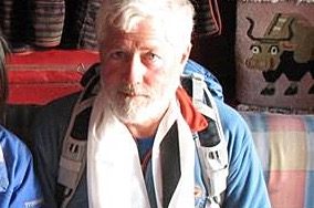
    My friend, high school classmate, climbing and adventure buddy Gordon Williams (aka Stein Sitzmark and, on occasion, “Imstein”) passed away on Tuesday July 23rd at age 69 and 3/4. He leaves a lot of good friends and his loving family behind.

    Gordon was trained to be a registered surveyor but was also an artist by choice and inclination. Many folks enjoyed his keen wit and loquacious manner. He was interested in many, many things, but his photography has been a major achievement since the late 1960s.

    I met Gordon soon after his family moved to Ketchum in the mid-1960s.  Although I was a year ahead of him in high school, we were almost the same age. Like many have since, I found him interesting and likable, but we were not close friends in high school. However, I must confess to being the person who introduced him to roped rock climbing.

    The Early Days

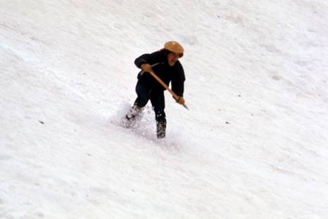
    In the Summer of 1969, Jim Cockey took an afternoon to teach his younger half-brother Art Troutner and me some key elements of roped rock climbing near McCall. We learned how to belay climbers with a rope, hammer in pitons to anchor belays and rappel off a rock cliff, in a few short hours of instruction. I went home to Ketchum and ordered a climbing rope, some soft-iron pitons and aluminum carabiners from REI. I then proceeded to share my inadequate and dangerous knowledge of the rudiments of roped technical climbing with Gordon and his high school classmate, Chris Hecht. They were instant converts and soon Chris thereafter ordered better climbing gear. That Winter, we read up on climbing techniques and practiced climbing knots until we could tie them while stoned.  

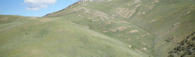
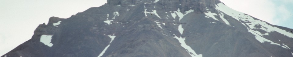
    By the Summer of 1970, we were ready for real mountains. Gordon, Chris and I started with a bang by climbing 10,981-foot Boulder Peak near Ketchum in early June. Next, we convinced a number of friends to hike into Wildhorse Canyon in the Pioneers for the 4th of July weekend. But during that weekend, Chris, Gordon and I encountered steep and difficult rock on the North Face of 11,771-foot Old Hyndman Peak and an oncoming thunderstorm convinced us to retreat.

    The Decker Flat Climbing & Frisbee Club

    For our next trip into the Pioneers, we were mentored by my “somewhat” experienced climber-friend Harry Bowron, who summered in Stanley. Harry had been exposed to roped climbing on various Sierra Club trips and had recently survived a long National Outdoor Leadership School (NOLS) outdoor skills course in the Wind River Range. His knowledge and abilities helped our climbing skills considerably.

    It was a hot day in late July 1970, during our hike into Mount Regan above Sawtooth Lake. Pursued by evil, we hurried up the dusty trail. Our packs were heavy, each with 60-70 pounds of climbing and camping gear. It was a hot, humid and windless morning. We were sweating hard and were being chased mercilessly by a full-strength squadron of horseflies.  

    Flies dive-bombed us incessantly, trying to break through the curtain of insect repellent we had drenched ourselves with. They grew in numbers until it was difficult to see the sun through the voracious fly swarm above our heads. Frenzied buzzing horseflies became noisily trapped in our long hair and select kamikaze flies would creep between our sweaty fingers to inflict amazingly painful bites.

    It was starting to look like we might become the first known case of climbers eaten by flies when suddenly all the horseflies dipped their wings, did a double roll and turned tail. They flew off down-canyon–a roaring cloud of instant misery. The reason for their retreat stood by the trail: snarling evilly, shovel in hand. Even horseflies don’t mess with SMOKEY THE BEAR!!  Of course, a sudden breeze might have helped too.

    We had arrived at the Wilderness Boundary!! There beside the plywood Smokey was an 8-foot tall, solid redwood sign proclaiming:

    ENTERING SAWTOOTH WILDERNESS AREA
    CHALLIS NATIONAL FOREST
    PLEASE REGISTER FOR YOUR OWN
    PROTECTION!

    We had some fun filling out the overly-detailed registration form, but then none of us wanted to put our name on it as group leader. In a moment of inspiration, I exclaimed “Let’s call ourselves the Decker Flat Climbing & Frisbee Club” and, since I thought of it, I get to be manager.

    We had elections on the spot and Gordon chose to be Social Chairman, Harry Bowron, Treasurer and Joe Fox, Member at Large. The next day we climbed Mount Regan (which was somewhat challenging) and had a great time. Our mountain fun was just starting. We never had scheduled meetings or dues but, in order to become a member, you had to go climbing with another member. Of course, Gordon took his duties as Social Chairman seriously. He was soon adding females to our club. I must admit to being jealous of Gordon’s social skills in the 1970s and 1980s. His girlfriends were always attractive, assertive and intelligent. Gordon was a “babe-magnet” of the first magnitude. Thus he was the perfect Social Chairman.

    In the early 1970s, Idaho mountaineering was a different world than now. It was a world without good USGS maps, climbing guidebooks, cell phones, GPS devices, an internet to access for climbing information and satellite rescue beacons. Thus, we suffered considerable obstacles to safe and sane mountaineering but, let me assure you, rock climbing and mountaineering in Idaho was a helluva lot more adventurous and a lot more fun then than it is now. Amazingly, although some of our climbing students suffered long scary slides on steep snow slopes, there are no serious climbing injuries or deaths in the history of the Decker Flat Climbing & Frisbee Club.

    June 1971, my photo of Gordon glissading “way too fast” on our way down from climbing the highest peak in the Sawtooths.
    Gordon glissading “way too fast” on our way down from climbing the highest peak in the Sawtooths (June 1971).

    Gordon As A Climbing Pioneer 

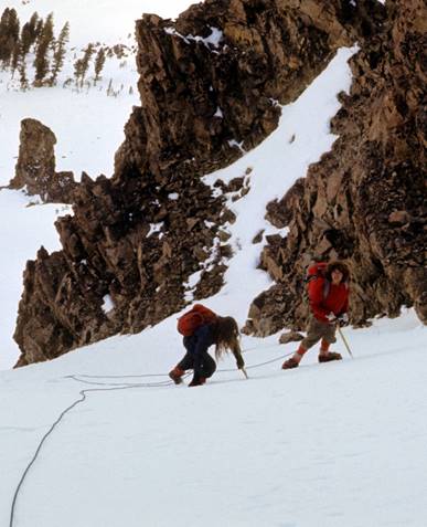
    In the early 1970s, Gordon was active in attempting the first Winter ascents of some Sawtooth Range peaks which even difficult to climb in Summer. There were some setbacks, but he was integral in the first Winter ascent of the difficult pinnacle, The Finger of Fate, and a large peak with no easy way to the summit, Mount Heyburn.

    In mid-March 1971, Gordon, his Seattle friend Roxanna Trott and I enjoyed a somewhat unconventional moonlight Winter ascent of Boulder Peak. We knew the snow was very firm with near zero avalanche danger (despite our lack of avalanche awareness training). Gordon and I departed Whiskey Jacques at 1:00AM with a drink, picked up Roxanna at her place, drove to Boulder Flat and skied into the Southwest Side of Boulder Peak on Styrofoam-hard snow under a full moon. We arrived on the summit at dawn and were back in Ketchum for a late lunch.

    Here’s my photo of Gordon & a friend Roxanna Trot, on a winter moonlight ascent of 10,891’ Boulder Peak near Sun Valley.
    Here’s my photo of Gordon & a friend Roxanna Trot, on a winter moonlight ascent of 10,891’ Boulder Peak near Sun Valley.

    Pioneer Cabin

    In 1972-1973, Gordon, Chris Puchner, Robert Ketchum and others worked on the now locally-famous restoration of Pioneer Cabin above Sun Valley. Pioneer Cabin (a 1937 Sun Valley Company high mountain ski hut) sits on a scenic ridge at the edge of the Pioneer Mountains. Here’s a link to an Idaho Public TV article on the cabin which mentions the history: Outdoor Idaho. Gordon’s hard work on Pioneer Cabin and his insistence on painting the DFC&FC slogan “The Higher You Get, The Higher You Get” on the newly-repaired roof of Pioneer Cabin made both him and our club famous in western mountain lore. The story has appeared in several outdoor magazines.

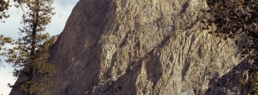
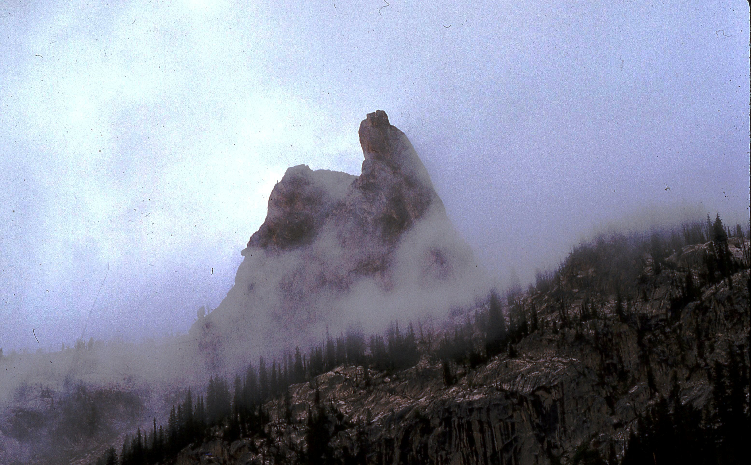
    Gordon and the Finger of Fate

    Gordon was active at rock-climbing and mountaineering through the 1970s. Gordon really enjoyed climbing the challenging Open Book Route on the Finger of Fate in the Sawtooths. By 1978, it was a routine climb for him and Mark Sheehan. On one of these outings in 1978, they were hit by a severe thunderstorm just below the top of the Finger. Suddenly lightning was hitting nearby peaks and it was raining hard. They could not climb the final difficult summit pitch in the rain and with their single rope, descending the Open Book Route was unthinkable. Getting off the rock was essential and they started to down climb on what seemed to be a safer alternative. As Gordon rappelled, the rope slipped . . . but I will let Gordon tell the story.

    Gordon’s Close Call by Gordon K. Williams

    In late July 1978, I hiked into Idaho’s Sawtooth Mountains with my friends Mark and Gail Sheehan. We were off to do our favorite rock climb, the Open Book Route on The Finger of Fate. By 1978, I had climbed the classic Class 5.8 route a number of times and it had become normal for us to hike in, climb the route and return back to Ketchum on the same day.

    The Finger of Fate from the Southeast.
    The Finger of Fate as viewed from the Southeast.

    Perhaps we made a bad choice. The weather was deteriorating and we put on the climb anyway. That is how we first met Brent Bernard. When Brent and several of his friends had arrived at the base of the Open Book, we hadn’t yet finished the first pitch. They sat down to wait for us. While waiting, they looked at the sky. The sky told them to back off. They walked away. That was a good choice.

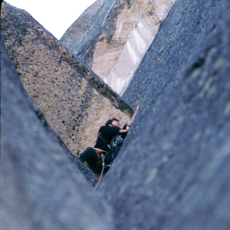
    Twenty feet of steep snow guards the bottom of the climb. In early July, it is cold on the North Side. First thing in the morning, that snow is hard. We chopped steps, kicked the snow off and gingerly stepped onto the rock. You must immediately swarm up a blank section with wet boots. This may be the crux. There is no warm up. There is not much to work with. Go up or go home.

    From the belay ledge, I watched Mark Sheehan levitate up the first pitch. It is the only place big enough for two and a welcome refuge after working around the foreboding overhang. Looming at the top of a perpetually cold jam crack, the clean overhang extinguishes hope. There appears to be no way around it. One must push up under that overhang then exchange heel for toe in the crack. Turning around to face out puts your head where the next move becomes visible. Exit right onto the face for a “Thank God” handhold that is nearly beyond your reach. Swinging across on one hand brings you to where it is possible to work up the face and mantel on the ledge. Some consider this the crux problem. On arrival, Mark expressed pleasure. We were having fun.

    Gordon at the top of the jam-crack lead on the second pitch of the Open Book. The crack ends under the overhang and climbers are forced out right onto thin holds. Mark Sheehan Photo
    Gordon at the top of the jam-crack lead on the second pitch of the Open Book. The crack ends under the overhang and climbers are forced out right onto thin holds. Mark Sheehan Photo

    Our plan had been to travel light and fast. One rope, three slings and about a dozen chocks would be enough. We had everything necessary and nothing more. Heavier clouds were beginning to build. They told us to pick up the pace. Two more pitches would bring us to the top of the Book. Then send a short pitch up the ski tracks, crawl under the summit block, jump the gap and bag the summit. We would rappel from an old bolt and down climb to another short rap above the saddle. Our plans began to change half way through the third pitch.  

    Lichens cover most of the rock on the Finger. Lichens are composite organisms consisting of a symbiotic relationship between an alga and a fungus. The fungus surrounds the algal cells, enclosing them with complex fungal tissues unique to lichen. Lichens are capable of surviving extremely low levels of water content. When fully hydrated, the complex fungal tissues become slippery. Rehydration requires several minutes. We were still adapting to light rain and slippery rock when thunder started echoing off nearby mountains.

    Suddenly our location near the top of a prominent pinnacle seemed imprudent. We were climbing a lightning rod. Mark and I are both afraid of lightening. We wanted to get down fast. From the ridge above the Book we had two choices. Knowing the South Side to be much shorter, we decided to rappel that way. Mark split the coil while I threw a sling over a horn on the ridge. No time to tie knots at the ends – throw the rope. More thunder and louder now we were in a panic to get off. Assemble four carabiners as a brake, clip into the line and ease gingerly to the edge. Wind was whipping rain from every direction. I would be careful not to slip on the wet rock or rap off the end of the rope.

    Starting down with feet spread wide I was leaning back perpendicular to the wall so my boots wouldn’t slip. Descending slowly and looking down for more foot placements, I felt the line above release. Turning my head to look up, I saw the rope and anchor sling whipping against the sky above. My rappel anchor had slipped off the rock horn and I was accelerating in free-fall with hundreds of feet to the floor… a dead man falling.

    Instantly I understood this to be the end. There was no hope of surviving such a fall. Anxiety and fear disappeared. Perhaps I stopped thinking. Time did not compress or elongate. There was certainly no flipping through old photos or videos of past events no life flashing by. This was the end of the film, the part where the screen goes blank.

    I have no recollection of hitting the wall. It knocked the wind out of me. I came to my senses gasping for air, unable to get the first bite. It was a raw shock, being jerked from some quiet place back into my body. Everything was confusing. I was hanging upside down pressing lightly against the rock wall. Nothing made sense. How could Mark have caught me? My hands found the rope and I struggled to get back upright. Stepping onto a toehold produced sharp flashes of pain in my left ankle. It was broken.

    Mark was peering down from the ridge. Raindrops were hitting my face. The situation was coming into focus. He hadn’t caught the rope. Instead, it had snagged on the rock face. My rappel brake was jammed. This had prevented my sliding off the end of the rope after slamming into the wall. I used one hand to loosen the brake while holding onto the wall. Easing weight onto the rope again, I rappelled to a ledge fifteen feet below. Off rappel, a flick on the rope set it free from the snag… first try.

    Mark was stranded on the ridge and the threat of lightening was not yet past. He had to get down. We were too far apart to throw the rope back up so Mark rummaged into his pack for cord. He lowered it… too short. Next he pulls out his boot laces and tied them onto the cord. Altogether it reached and I sent the rope up. Mark set a new anchor and rappelled to my level. We followed the ledge system around the East Side back onto the North Face trying to find the top of the PT Boat Chock Stone. We had enough gear to set two more rappel anchors and it would take five to get off the pinnacle. Several years earlier, we had left slings retreating down the Chock Stone route. In spite of their age, we hoped they might still hold our weight. They did.

    Gail Sheehan was waiting at the bottom, wet and worried by our extended absence. We were greatly relieved to be off the rock. Climbing with a broken ankle was difficult, but hiking was out of the question. We had several miles of rough terrain to negotiate before getting to the lower end of Hell Roaring Lake. From there, another two miles of easy trail ran back to the car. Again Mark rummaged into his pack pulling out a Swiss army knife with a saw. He cut free some planks about an inch thick from the shell of a rotting hollow log. He then fashioned a splint that allowed me to walk by transferring some of my weight past the ankle and onto my left hand. It worked pretty well. Gail had taken all of the weight out of my pack and we three set off down the mountain. It was torture. By the time we reached the lake, I was exhausted and ready to confess. Mark offered to carry me. I said yes.

    We rearranged the rope into a long mountaineer’s coil, split the coil into halves from the knot and draped it over Mark’s shoulders with the knot behind his neck. My legs ran through the coils transferring my weight onto his shoulders in a piggyback carry. Mark didn’t have to hold my weight with his arms. Gail carried our three packs. We set off down the trail. It was torture. After a few hours, Mark was exhausted and ready to confess. Gail was pretty much used up too. It was raining and the three of us were sitting on a log in the dark. We were too tired to start again. It was a low point. That is when Brent arrived.

    They had waited at the cars. They knew something was wrong and were just about ready to drive out to call for help. Brent decided to walk up the trail a short way and see if he might find us. That is what he did… barefoot in the dark. We put my shoes on Brent and he carried me the rest of the way out to the road. Our self rescue had come to an end.

    Life After Climbing

    Around the time of the accident, he and Mark Sheehan bought an old hotel/boarding house at the onetime mining town of Triumph a few miles southeast of Sun Valley. In the early 1980s, they remodeled it into two separate two-story homes, with lots of room for possessions and the range of woodworking machinery he had acquired. Gordon’s half of that project provided him the comfortable home he had lived in since then.

    Gordon knew he was lucky to have survived the accident and as a result he climbed less after that near disaster. I think flashbacks of his near death fall continued to bother him. By the 1990s he was hardly climbing at all, but Kim Jacobs talked him into climbing the Open Book on the Finger again in 2003, although she led all the pitches. 

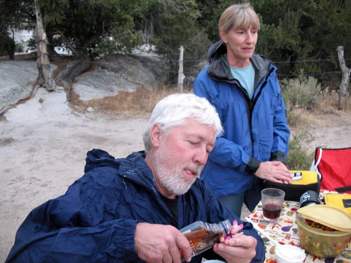
    Somewhere along the way, Gordon and I adopted a toast that amused us both. We had both suffered close calls in our climbing and whitewater rafting careers and we both knew we were somewhat lucky to still be alive and healthy. Thus was born our, “Here’s to cheating death” toast at the end of every day of outdoor adventure. As some of us may have noted, “Life is so uncertain” and Gordon and I, and our friends appreciated that we had lived, for the most part, lucky and blessed lives.  

    In the late 1990s, Gordon started going to Nepal with small groups that were guided by his old friend Pete Patterson and Kim Jacobs. Gordon fell in love with Nepal, its people, and especially its mountains. He made 7 trips to Nepal between 1998-2008. I was lucky enough to accompany him and a small group of friends on two 16-day treks through some of the most spectacular mountains in the world.

    Gordon was not doing what we considered mountain climbing but, in 2005, we did steep hiking up to a 17,500-foot summit for a spectacular view of nearby Mount Everest.

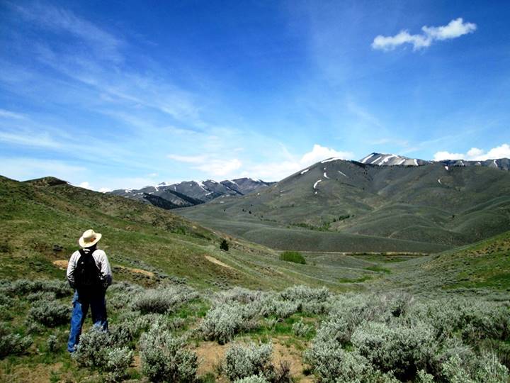
    In 2010, my wife Dorita and I started doing regular multi-day climbing trips to the spectacular City of Rocks. Gordon was invited and soon joined in enthusiastically, but didn’t climb much. With the urging of our “old” friend, noted climber Jim Donini, we started sponsoring yearly camp-outs for mostly older climbers. Although Gordon seldom climbed at these meetings, he enjoyed being around other climbers and the scenic crags of the area.  

    At our gatherings, climbers from all over the U.S. enjoyed Gordon, his good temper, his stories, his wit, and his wisdom, as did we all. This year, including 4 nights at the City of Rock outing, my wife Dorita and I got to enjoy Gordon’s fine company on some, or all, of 10 precious days.

    Here’s my 2008 photo of Gordon & a merchant of Lo Manthang in remote Mustang, Nepal.
    Here’s my 2008 photo of Gordon and a merchant of Lo Manthang in remote Mustang, Nepal.

    Gordon also became involved in white-water rafting in the 1980s and survived many challenging river trips, including two Grand Canyon adventures. In 2016, we finally enjoyed a multi-day river trip with him, thanks to our mutual friend Chris Puchner. We loaned Gordon our “sportscar” raft and he navigated it down the large and sometimes scary rapids of Idaho’s Main Salmon River without mishap.

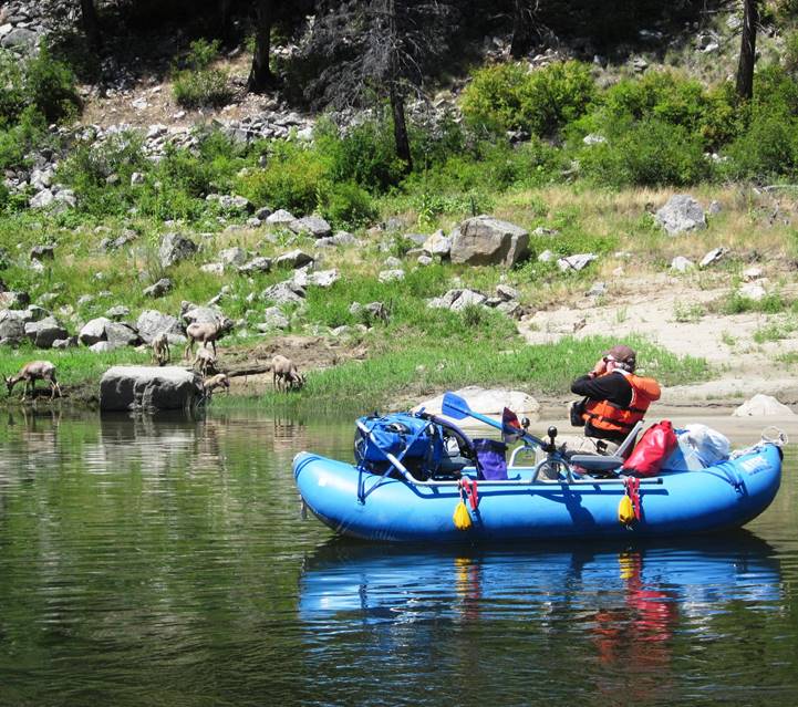
    Part of the fun of being around Gordon was his rich imagination. His little plastic friend Piglet traveled many places with him and proved fascinating to Gordon’s many female friends.

    Here’s Gordon at the City of Rocks sharing a drink with Piglet while my wife Dorita politely averts her gaze.
    Here’s Gordon at the City of Rocks sharing a drink with Piglet while my wife Dorita politely averts her gaze.

    Although Gordon continued to work part-time, he was usually willing to go explore old mines or Native American rock art with us.

    This photo of Gordon was taken this spring as we were hiking back from a 1880’s mine we explored west of Hailey.
    This photo of Gordon was taken this Spring as we were hiking back from a 1880s mine we explored west of Hailey.

    Final Thoughts 

    I deeply appreciate that except for a miraculous catch of Gordon’s falling rappel rope by a rock flake, during a thunderstorm on the Finger of Fate back in 1978, we almost certainly would have lost Gordon 41 years ago. So we have been in the bonus Gordon round for many, many years, which I know we are all grateful for.  

    So we have been blessed that Gordon survived not only that 1978 storm and rappel failure, but he also graced us with his lively presence until now.

    I miss him.

  • Appendicitis Hill and T.M. Bannon

    Appendicitis Hill and T.M. Bannon

    On February 26th, 1926, the Sunday Idaho Statesman published the following report by E.S. Crawford describing the origin of the name Appendicitis Mountain, now Appendicitis Hill. Bannon’s extensive surveying contributions to Idaho Surveying are discussed on Pages 14 and 15 of the book.


    Appendicitis Case – Responsible for Mountain’s Name

    Answering a query of The Statesman several weeks ago as to how “Appendicitis Mountain” acquired its name, E.S. Crawford of Antelope Valley sends the Arco Advertiser the following story which adds a bit to Idaho history:

    “What is now known as Appendicitis Mountain forms part of the East Canyon Wall of Antelope Valley, and is one or Antelope’s beauty spots. It is steep and rugged and rises almost from the creek bed. From the top of this mountain looking eastward, Moore and Arco can be seen.”

    “In the Spring of 1915, the Hanson brothers (from Lewiston, Idaho) came through this section of the country, building monuments on the highest peaks of the mountain ranges. Among these peaks are Old Smiley, Mount Shelley, what is now known as Appendicitis Mountain and Mount McCaleb.

    “During the Summer and Fall of the same year, T. M. Bannon (a geographic surveyor from Washington, D.C.) and his helper, Mr. Tucker (from New Jersey), George Adams (of Challis, Idaho) and another man from Colorado (who acted as cook for the party), came through, making maps and prints of the airline distances between these mountains.

    “In the early part of September 1915, they camped at the foot of this mountain, in the grove of trees which is on the Crawford Ranch. On the second day of their stay, a trip was made to the mountain top. But as the fog and haze were so thick, they were unable to make the survey and planned on making another trip the following day. This trip, though they did not know it at the time, was never to be made by Mr. Bannon, for that very night he became suddenly ill and passed a night in pain from which morning brought no relief.

    Stricken With Appendicitis

    “About 8:00AM the next morning, they asked for the best doctor in Mackay and Dr. N. H. Farrell was called. Doctor Farrell pronounced the trouble as appendicitis and advised the removal of Mr. Bannon to the Mackay Hospital. As cars were few in the Antelope Valley, a bed was made in the back of a white-topped buggy and a trip of 20 miles, over not any too smooth roads, was made. This was Doctor Farrell’s first operation case after coming to Mackay, which proved to be a serious as well as a successful operation and Mr. Bannon (in writing to Mr. Crawford after he had recovered returned to his home in Washington, D.C.) wrote very highly of Doctor Farrell and the nurse, Miss  Hendickerson.”   

    “Although lung trouble set in after the operation and Mr. Bannon had to spend a great deal of time in Ashville, North Carolina, he finally recovered from that and died from some minor ailment in either 1918 or 1919. In one of his letters to Mr. Crawford, he told of naming this mountain and having it put on record in Washington, D.C. as Appendicitis Mountain.”

  • 1975 Fatality on El Capitan

    1975 Fatality on El Capitan

    [Editor’s note: This August 6, 1975 article by UPI was published in the Idaho Statesman. No other details are known.]


    Climber, 24, Dies After 70-Foot Fall

    United Press International

    -A mountain climber from North Carolina died in a Boise hospital Tuesday from injuries he suffered in a fall Sunday on El Capitan in the Sawtooth Wilderness.

    A hospital spokesman said Tom Brothers, 24, of Morganton, North Carolina died at 7:40AM from massive injuries. Brothers fell 70 feet while climbing El Capitan. He was about three quarters of the way to the summit when he grabbed rocks that broke loose. His partner, Neil Harrison of Atlanta, Georgia was not injured.

    Brothers was taken to the Sun Valley Hospital for emergency treatment and was transferred by ambulance to Boise. He was the son of Mr. and Mrs. Grayson Brothers of Morganton. Arrangements for cremation were handled by Alden-Waggoner Funeral Chapel in Boise. The family planned an interment on the slopes of El Capitan.

    UPI article 8/6/1975
    UPI article 8/6/1975
  • An 1884 Ascent of Mount McCaleb by J.D. Martin

    An 1884 Ascent of Mount McCaleb by J.D. Martin

    [Editor’s note: J.D. Martin was an early settler of the Lost River Valley. As he was nearing his 90th year, he wrote a memoir covering the early history of the Lost River area which was published in installments in the Arco Advertiser. This portion covers his ascent of Mount McCaleb in 1884. It also references other ascents of mountains in the Lemhi Range near Badger Creek but does not supply names. Badger Creek is located just below Diamond Peak. Martin’s obituary is set out below his trip report.]

    . . . From there we went on to Badger Creek where a number of mining locations had already been made. We climbed several mountains around there but could find nothing which incited us to remain very long. We took another trail, over what was also then called Pass Creek and came onto Birch Creek, a few miles below where the old-time ghost town of Nicholia was at that time quite a bustling and busy little mining town.

    A smelter was in operation and a population of perhaps two hundred people were living there. We then went on over the divide to another old time “ghost town” called Junction which was located on the east site of the Lemhi River about a mile from where the town of Leadore now is. This was also quite a bustling and active little town for that time and place. From there, we went on over the [Beaverhead] Range on the East Side of the Lemhis and prospected along the dividing line of the two territories of Idaho and Montana.

    We found nothing which we deemed worth locating and returned soon to Junction. We then concluded to go up the stream, then and now called Timber Creek, which comes into the Lemhis about a mile or so below Leadore. We endeavored to simply “course our way” without trails or guidance of any kind, relying solely upon our sense of direction. Wild game was so plentiful that we could in a few minutes after pitching camp, easily kill all the wild birds we wanted to eat. An abundance of the three camp essentials (wood, water and grass) were everywhere and we were well inured to outdoor and camp life.

    In passing around the divide between the headwaters of the Little Lost River and the Pahsimeroi, we somehow got onto a blind Indian trail which led us to a point and in a direction somewhat too far north. We came to a place where the higher mountains in front of us seemed to offer an impassible barrier to our further progress in the direction we were going. We found a good camping place for the night and were considering plans for retracing our steps next day. Next morning, Mr. Soloman was not feeling well and proposed that we lay over a day. Williams had seen bear tracks and, taking his gun, started out to add to his hunting laurels by killing a bear. I took a prospector’s pole, pick and started to climb the rough and rugged mountain which stood directly in front of our camp.

    After some hours of arduous and laborious climbing over fallen timber, rocky gorges and deep precipices, I arrived at the top. And behold I stood at the summit of Mount McCaleb. Well, lest this screed should exceed the limits of permissible space, I will here close with the promise that the next installment of this narrative will begin at the summit of Mount McCaleb. (ARCO, June 15, 1941)

    From the summit of Mount McCaleb and the date of about the last of August 1884. I do not deem it necessary to attempt  any kind of a detailed description of the view from the top of Mount McCaleb. I will say that, at that time, nothing contributed by human agency was visible from there. A long, winding fringe of deep green, reflected from the dense growth of trees which marked the course of Lost River (at that time far more abundant and extensive in every way than it is now) was quite visible and marked the course of the valley from the extreme northwest to the southeast. Upon the whole, it was really a sight never to be forgotten and it has always been something of a wonder to me to find so many people who have never been to the top of Mount McCaleb. I returned to the camp and was able to inform my companions—Solomon and Williams—exactly where we were. . . .

    J.D. Martin 1852 to 1942

    “GRAND OLD MAN” OF BIG LOST RIVER VALLEY SUMMONED

    Honorable James D. Martin Closes Career Tuesday Morning After Nearly 90 Years of Active and Honorable Life. [The Arco Advertiser April 17, 1942]

    Judge James D. Martin, known as the “Grand Old Man” of the Lost River Valleys, came to the end of the long, long trail Tuesday morning. His nearly 90 active and honorable years–more than half of them spent in this valley–closed Tuesday morning, and with his death closes the career of a man who was very much a part of the life of our community.

    He had been ill with a cold for several days, but he seemed somewhat improved when he retired Monday night. When he did not appear at his usual hour Tuesday morning, Mr. Daniels (hotel owner) went to the room where the lifeless body was found in bed. Only a short time before, Dr. Egbert said, had his spirit taken flight. Although he was known to be failing in health, the news of his demise spread to the remotest sections of our county and was a shock to all. There was a hushed silence as the death was announced because “Judge” Martin was known intimately by every man, woman and child in the Lost River country and to them he was both friend and counselor.

    Judge Martin wasn’t just an ordinary individual. Although he left his native state of North Carolina when he was a lad of 17 and, as a consequence of which, his education was sadly neglected, he was a man of brilliant intellect–a self-educated man. He continued the quiet dignified bearing of his early youth to the very last. He wrote many interesting pioneer articles for The Advertiser in recent years and always took a leading part in community affairs.

    Martin was born in North Wilkesboro, North Carolina in October 1852. At the age of 17, he and a boyhood chum left to cast their lot in the West. He followed the life of a nomad from then on for 15 years, spending time on the frontier in Colorado, Arizona, and California. In 1883, Martin was attracted to the Wood River country where a mining boom was underway and, naturally, he turned toward the Lost River Valley in 1884 as this valley was then attracting a great deal of attention.

    He filed on a homestead in what is now the Lost River precinct in 1884. He lived there during the required length of time and, between times, worked in the mines on the Wood River. After proving up on his claim, he settled down and became a gentleman farmer in this valley. His education had been improved during his spare time, as he studied hard to increase his many abilities. He taught the second school of record in this valley, and spent a year or more in similar work in Little Lost River Valley. Many of our “old timers” gained the fundamentals of their schooling–their three “R’s”–in the little schools he taught.

    Soon after the Lost River Valley began taking on airs as a “homeland,” he was elected Justice of the Peace. in this position, he served many  years. He became a confident and legal assistant to many of our first families. He performed marriages, spoke at funerals, settled estates and, in scores of ways, endeared himself to the people of the valley.

    He served in other official capacities also. he was County Commissioner during 1919 and for several years thereafter. The first highway construction work in this county—the road to Howe—was built and gravel surfaced during his administration. He was County Commissioner when the Irrigation District was formed. Later he retired as County Commissioner and served several terms as Probate Judge. He was always active in civic and fraternal affairs. He served as Treasurer of the Arco Lions Club during its existence. He “went through the chairs” in the Odd Fellows’ Lodge and for many years continued an active interest in that great fraternal organization. He made frequent trips to his old home in Wikesboro, North Carolina. He also visited a brother in Texas, who served many years as a district judge.

    For quite a number of years, Judge Martin made his home at the Dee Hotel at Arco and, during most of this time, he served as chairman of the Butte County Red Cross, an organization of which he held the highest regard. The successful membership campaigns and other activities engaged in by this humanitarian organization were always a great delight to Judge Martin. He was generous and kind-hearted. He gave generously to charity. He was far from wealthy but, by frugal management and simple wants, he garnered enough of the world’s goods to maintain himself during the years in the sunset of his life.

    Judge Martin seemed to feel that his days were numbered that when he was stricken with a cold about two weeks ago. He confided to friends that in all of his other illnesses he seemed to been able to overcome them, but on this occasion he told one intimate friend: “I feel that it is only a matter of time now, until I shall be called. I do not seem to be able to overcome this cough, but I am ready.” That was like him.

    He united with the Unitarian church in his youth and, although he did not affiliate with any other, he was quite a regular attendant at  services in this community dividing his time between the Baptist and the L.D.S. churches. Funeral services will be conducted this afternoon from the L.D.S. church officiating. Funeral arrangements are in charge of the Marvel Funeral Home and interment will be at Hillcrest. Services will begin at 2:00PM and several of his intimate friends are taking part in these rites. A nephew is expected to arrive from Texas. Thus a highly honored and respected citizen will remain with us in life.

  • Boise National Forest Fire Lookouts

    Boise National Forest Fire Lookouts

    Fire Lookouts are a great way to experience the mountain world. I just discovered a Boise National Forest brochure (linked below) that covers most of the existing fire lookouts on the forest and provides brief access information for each. All of these mountains have pages on this website. Fire lookout sites were chosen because of their commanding views. You will find on a visit to any of these lookouts that the Forest Service chose well. The views are uniformly impressive.

    Use the link below to read the entire brochure. Courtesy of USFS.

    Boise National Forest brochure link: Sentries at the Skyline

    I would note that I believe the Forest Service has underestimated the difficulties of most of the access roads. I recommend a 4WD or at least a high-clearance vehicle with good all-terrain tires if you are going to visit any of these lookouts.

    In addition to the manned lookouts, the brochure also lists 5 unmanned lookouts: Bear Valley Mountain, Thorn Creek Butte, Meadow CreekRice Peak and Swanholm Peak. Photos and links are found below. The lookout structures are still present on these mountains but they are no longer used. Many other mountains in the Boise National Forest were used as fire lookouts in the past. You can research these and many others at firelookouts.com or Idaho Lookouts.

    The brochure also mentions the Deadwood Lookout but gives no directions. Deadwood Lookout is available to rent through recreation.gov. Be forewarned this rental is extremely popular. You will need to reserve many months in advance. Finally, the brochure does not include Shafer Butte (at the center of the Bogus Basin Ski Resort), Hawley Mountain (near Horseshoe Bend) and Pilot Peak (near Idaho City). These lookouts offer great views and are also worth visiting.

    Trinity Mountain from Peak 8554.

    Trinity Mountain as viewed from Peak 8554.

    Trinity Mountain link.

    The Sunset lookout on January 17th, 2015.

    The Sunset Mountain Lookout (1/17/15).

    Sunset Mountain link.

    The Scott Mountain lookout has a commanding view. The view of the Sawtooths is outstanding.

    The Scott Mountain Lookout has a commanding view. The view of the Sawtooths is outstanding.

    Scott Mountain link.

    A closer view of the Thunderbolt Mountain lookout from the trail.

    A closer view of the Thunderbolt Mountain Lookout from the trail.

    Thunderbolt Mountain link.

    In addition to the large lookout, there is a large garage like structure on the summit. The lookout was staffed in 2016.

    In addition to the large Jackson Peak Lookout, there is a large garage-like structure on the summit. The lookout was staffed in 2016.

    Jackson Peak link.

    The Silver Creek Lookout sits in the middle of steep county studded with granite outcropping.

    The Silver Creek Lookout sits in the middle of steep county studded with granite outcroppings.

    Silver Creek link.

    The Deadwood Lookout is located due south of the Bog Benchmark. Make sure after you tag the summit to continue on to the lookout for a great view. The lookout is availabile for overnight rentals.

    The Deadwood Lookout is located due south of the Bog Benchmark. Make sure after you tag the summit to continue on to the lookout for a great view. The lookout is available for overnight rentals.

    Deadwood Lookout link.

    The Meadow Creek Lookout in 2012. National Historic Lookout Registry Photo

    The Meadow Creek Lookout in 2012. National Historic Lookout Registry Photo

    Meadow Creek Lookout link.

    Rice Peak in happier days. USFS Photo

    Rice Peak in happier days. USFS Photo

    Rice Peak link.

    Bear Valley Mountain summit contains one of the scariest fire lookouts I have visited.

    The Bear Valley Mountain summit has one of the scariest fire lookouts I have visited.

    Bear Valley Mountain link.

    The Thorn Creek Butte lookout has seen better days but the view is still spectacular.

    The Thorn Creek Butte Lookout has seen better days but the view is still spectacular.

    Thorn Creek Butte link.

    The Whitehawk Lookout has ot all.

    The Whitehawk Lookout has it all.

    Whitehawk link.

    The old Shafer Butte fire lookout sits just north of the high point.

    The old Shafer Butte Fire Lookout sits just north of the high point.

    Shafer Butte link.

    The summit of Hawley Mountain. Dan Robbins Photo

    The summit of Hawley Mountain. Dan Robbins Photo

    Hawley Mountain link.

  • An Overview of the Lookouts in the Salmon National Forest by Bing Young (1982)

    An Overview of the Lookouts in the Salmon National Forest by Bing Young (1982)

    According to A History of the Salmon National Forest, by 1916 there were two lookouts in the Salmon National Forest, at Blue Nose and Salmon City Peak (later given the name “Baldy“). It was assumed that most of the forest could be seen from these two points. Cathedral Rock, in the Bighorn Crags, was also used at times to see the Middle Fork area, and there was  apparently even a telephone line at one time to Cathedral Rock. [Footnote 7: Personal conversation with Mr. Howard Castle who remembers being told about this phone line. The author seriously doubts, however, that the line was ever extended to the top of the mountain, though it may well have existed at the base of Cathedral Rock. Cathedral Rock is an extremely sheer crag-type mountain not to be climbed except by professionals, which no doubt affords a great view of the Middle Fork area and which would have been left blind by just the use of Baldy and Blue Nose.]

    But the effect of the Weeks Act was to change that situation. The 1918 Forest map lists Taylor Mountain, Lake Mountain, Haystack Mountain, Blackbird, Sagebrush Mountain , and Ulysses as lookouts. Apparently Blue Nose was also still used.

    The Blue Nose lookout is unlocked and in need of some serious repair work.
    The Blue Nose Lookout is unlocked and is in need of some serious repair work.

    At this point, there were few lookout buildings as we know them today. As late as 1924, lookout structures had been built only on Long Tom, Baldy, Taylor, Stein, and Blackbird Mountain. Most of the lookout “houses” built at that time were extremely small—most 9‘ x 9’—and in 1924, only Blackbird Mountain had the more typical 14′ x 14′ structure of  today’s lookouts.

    Rather than live in lookout buildings, most lookouts were camped near mountain peaks during the critical fire period. Many of those lookouts were also “smokechasers,” that is after finding a fire, the lookouts would take off to put it out. This was particularly the use before telephone lines were installed. Lookouts were thus placed in many locations in the forest, often varying from year to year. Since no visibility maps (those indicating the area seen from a lookout) were then available, lookout stationing was not planned in a very organized manner.

    It was decided about this time that some lookouts should be considered “primary” and manned for the entire fire season at all times; “secondary”, which would be manned only for a month in the worst part of the fire season ; and “tertiary” or third line lookouts, manned only in bad fire years. In 1923, the Salmon National Forest’s primary lookouts were Taylor Mountain, Blackbird, Blue Nose, and Long Tom. Secondary lookouts were Middle Fork Peak, Two Point, and Granite Peak. Additional smokechasers were stationed at various paces in the forest, including Lake Mountain, Sagebrush, Haystack, and Sheepeater Point. Lookout selection was not made with a lot of information and choices varied from year to year.

    In 1926, the first visibility maps were made of many peaks of the forest. Henry Shank, in an effort to better select the primary and secondary lookouts, tried to plot the area visible from each lookout station. The 1926 map indicates Lake Mountain, Stein, Haystack, Sheepeater, Two Point Peak, and Sagebrush as primary lookouts. I assume that Taylor Mountain and Blue Nose were also still in use, as they appear on later maps.

    By 1929, 19 points in the forest had either a lookout or a dual/smokechaser. The year 1929 was one of  the worst fire years in the recorded history of the Salmon National  Forest, particularly with the Wilson Creek Fire. In order to avoid large conflagrations of the size of the Wilson Creek Fire, the early detection system needed additional improvement. This determination to improve detection, coupled with the surfeit of workers made available by the Great Depression, enabled the Forest to initiate a massive lookout construction program. By 1932, 23 lookout points were in operation in the Salmon National Forest, with selection and construction contemplated for 7 more. Smokechasers were also stationed at the Indianola, Hughes Creek, and Yellowjacket Guard Stations.

    1935 appears to have marked the time when lookouts reached their peak. Thirty-four lookouts then stood as sentinels over the forest. Buildings had been set up on nearly all of the sites, even though many weren’t primary lookouts. All seemed to be hooked up to telephones.

    Just when the lookouts began their decline is not clear, but it is known that by the early 1940s some were being abandoned—particularly early ones like Duck Creek Point and Taylor Mountain. Perhaps this was partly due to the war—there weren’t enough men around to staff all of the lookouts. This is when women began to serve as lookouts. Money was short and it was recognized that there was much visibility duplication in the lookouts.

    The remains of the Taylor Mountain lookout.
    The remains of the Taylor Mountain Lookout.

    Even without the war, the decline of the lookout system was inevitable. As early as the 1920s, Region I (Missoula, Montana) had been experimenting with the airplane as a fire detection tool. If anything, the war probably delayed the demise of the lookout system, as airplanes, pilots, and the like were needed more in the war that they were in experimenting with forest fire detection.

    After World War II and the Korean conflict, aerial detection began to change the scene. Smokechasers became smokejumpers—at least in the more remote areas—and airplane “watchdogs” replaced many lookouts. Most lookouts faded out gradually one or two at a time until in 1982 there were only 6 of the original number remaining: Long Tom, Stormy Peak, Sagebrush, Stein Mountain, Middle Fork Peak and Sheephorn. Butts Point was not manned in the 1982 season, but the North Fork Ranger District has not given it up, as it is still considered to be of primary importance. Fire management personnel have indicated that it is unlikely that any of the others will be used again.

    Middle Fork Peak viewed from Peak 9101.
    Middle Fork Peak as viewed from Peak 9101.

    An interesting trend in the site selection of lookouts was the preference to use the highest peaks in the Forest. Pre-1930 lookouts included Taylor Mountain, Blackbird, Lake Mountain, Cottonwood Butte, Duck Creek Point, Two Point Peak and Middle Fork Peak—all over 9,000 feet. Post-1930 lookouts included Granite Mountain, Jureano, Sheephorn, Hot Springs and Butts Point. Nearly all of the post-1930 lookouts are under 8,500 feet and most are less than 8,000 feet.

    This change in trend was probably because the high lookouts may cover great distances, yet they are often too high for visibility of the high-hazard country of lower elevations right under them. Indeed, most of the high lookouts have no view of large or important drainage bottoms. The Forest is hampered by the problem of its extreme verticality. Canyons are generally narrow, steep and very deep. This has made it difficult to use the “highest peaks” as lookouts as is done by many other Forests.

    In the early 1930s, forests were required to have 80 percent lookout coverage of the Forest’s high fire-hazard acreage. The only way to see much in the rugged Salmon River country was to “come down” in elevation. Thus, later lookouts like Granite Mountain and Sheephorn don’t have the horizontal viewing distance that some of the older lookouts do, like Blue Nose and Taylor Mountain. They do, though, afford  excellent views of specialized high-hazard drainages.

    Other problems encountered by the high peaks were: the great distances to water which lookouts had to hike to daily; great distances to “climb down” to a fire; the problem that high lookouts were often “fogged in” in the morning (one of the best times to find fires); and rugged and costly to packers supplying the high lookouts.

    Today’s lookouts have been selected by the Forest Service through a long process of elimination. They have excellent views of high-hazard drainages and nearly all report fires every year.