Corner Shot Peak

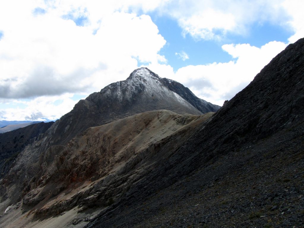
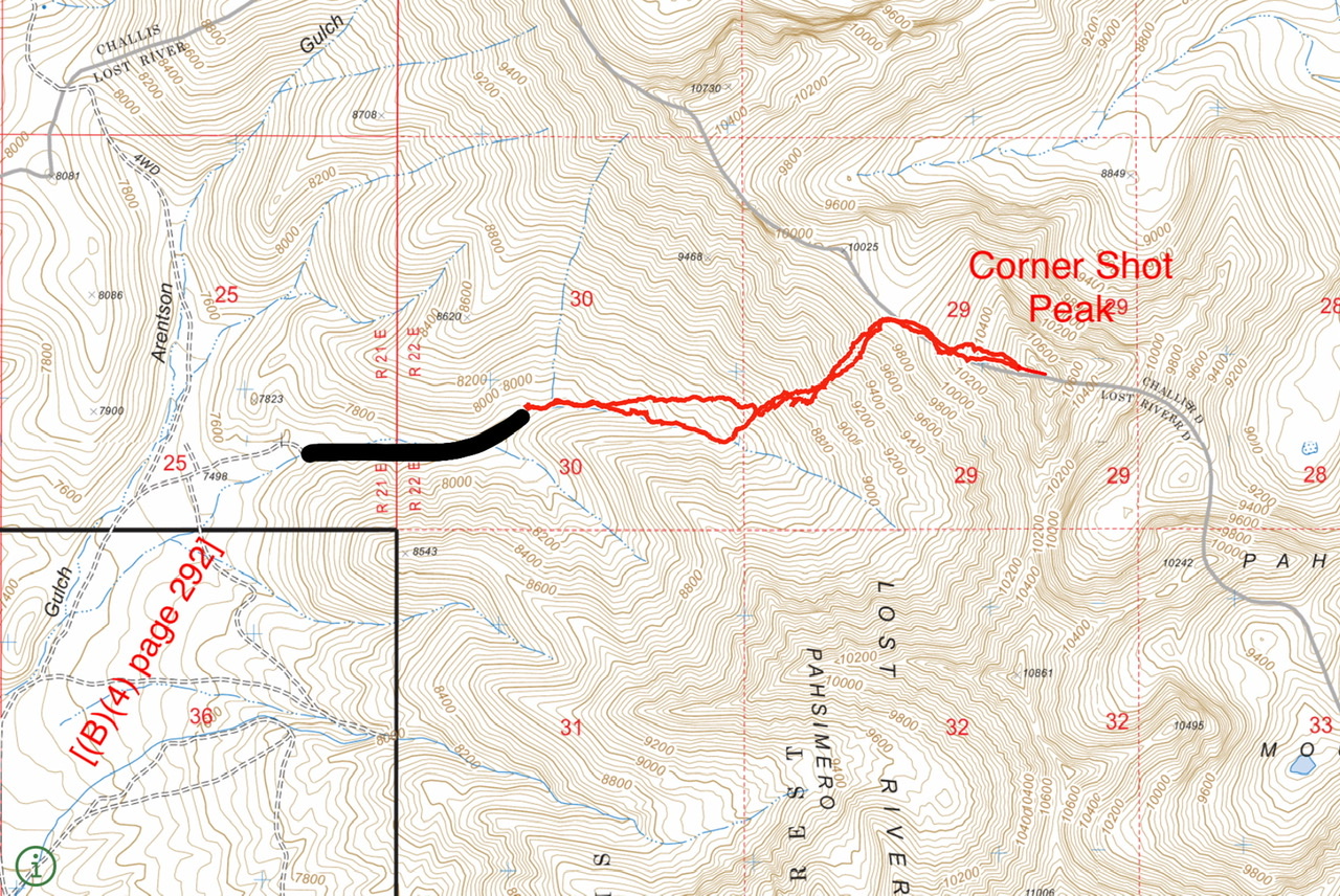
Climbing and access information for this peak is on Page 268 of the book. The book lists the elevation at 10,925 feet. Newer estimates put the elevation at 10,940 feet. I added Brett Sergenian’s photo of the upper route and his GPS track which starts from the Arentson Gulch and which shows the East Headwall Route set out in the book. Brett’s trip report is linked below. Updated November 2021


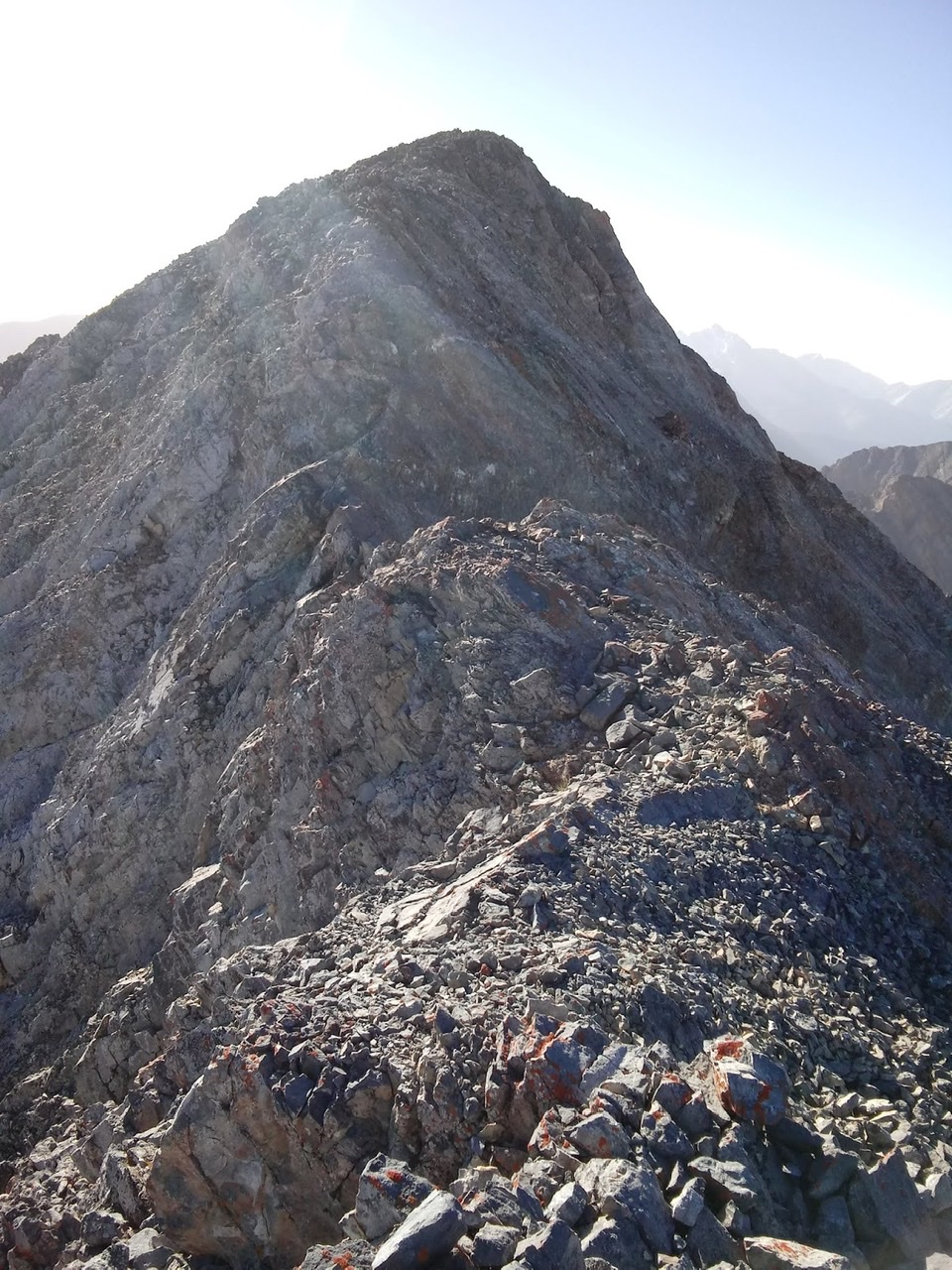
Rick Baugher named this peak based on how it looks when viewed from US-93: tucked into the corner of the Pahsimeroi Range. Rick climbed the peak in 1994 and found no evidence of previous ascent after encountering a short, exposed Class 3 section near the top. USGS Grouse Creek Mountain

Corner Shot Peak from the southeast. Rick Baugher Photo.
Corner Shot Peak as viewed from the southeast. Rick Baugher Photo
Corner Shot from saddle to Straight Shot. George Reinier Photo
Corner Shot Peak as viewed from the saddle to Straight Shot. George Reinier Photo
Brett Sergenian’s GPS track. The black line identifies the upper extension of the road which is not shown on the map. Brett recorded a round trip milage of 3.4 miles with 2,800 feet of gain.
Brett Sergenian’s GPS track. The black line identifies the upper extension of the road which is not shown on the map. Roundtrip stats: 3.4 miles with 2,800 feet of elevation gain.
Above the East Headwall this is the final, Class 3, section of the route to the summit. Brett Sergenian Photo
Above the east headwall. This is the final (Class 3) section of the route to the summit. Brett Sergenian Photo
Straight Shot Peak (right) and Corner Shot Peak (left) as viewed from the east. Livingston Douglas Photo