Climbing and access information for this peak is on Page 308 of the book. This update includes a lot of photos as well as information on climbing the peak from the west. Dan Paulson provided a photo essay showing the entire East Ridge Route. Use the link below to read Rick Baugher’s discussion of the peak’s early history.
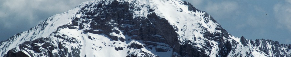
Diamond Peak is the highest peak in the Lemhi Range. It is located in the Caribou-Targhee National Forest, except for a portion of its West Side, which lies in the Challis National Forest. Diamond Peak is the 4th-highest peak in the State of Idaho and is the only 12er in the Lemhi Range. Diamond Peak is one of 3 peaks in Idaho (the others being Borah Peak and He Devil) that have over 5,000 feet of prominence. Diamond Peak ranks #43 of 57 summits in the Lower 48 States in this category. USGS Diamond Peak

Back in 1981, when I climbed the peak, no one was talking about climbing all of the 12,000-foot Idaho peaks. Consequently, Diamond Peak was seldom climbed. Since that time, the peak has gained in popularity, especially among the 12ers, because of its straightforward eastern approach, its proximity to cities on in Eastern Idaho (Idaho Falls, Rexburg, and Pocatello), and growth of outdoor recreation programs at BYU-Idaho and Idaho State University.
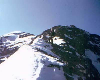
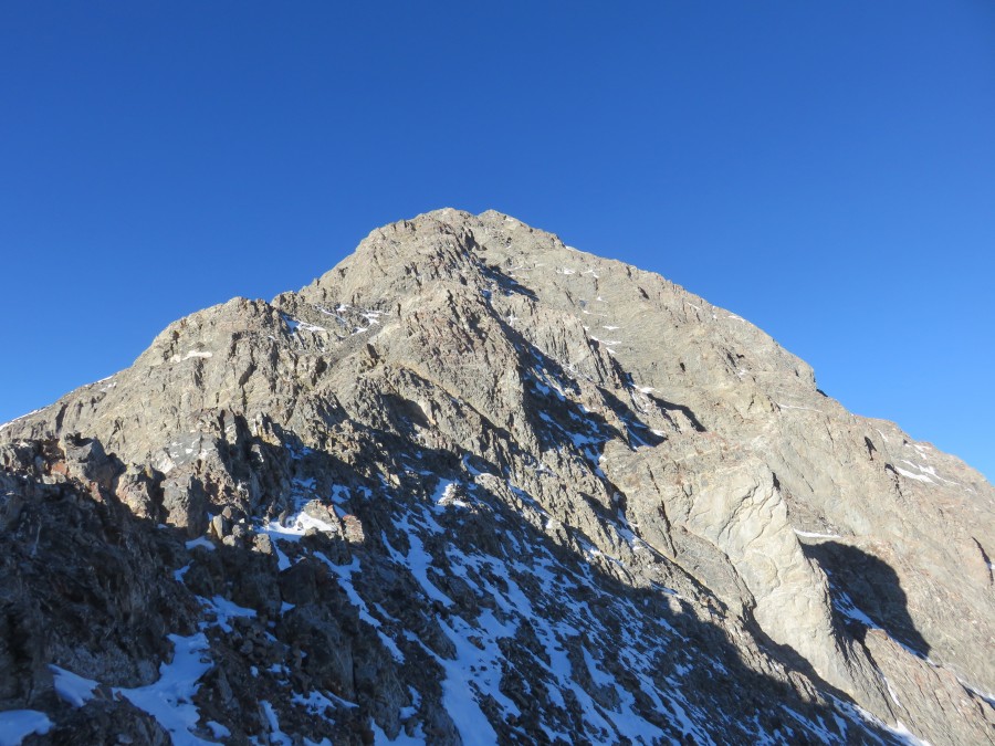
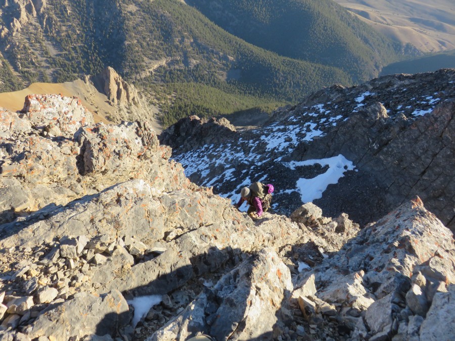
The peak’s East Ridge is the standard route. It is a classic line that should not be overlooked. I have included a few photos from my 1981 climb of that route below. Farther down, you will find the entire route documented in a photo essay by Dan Paulson. Please also see Larry Prescott’s excellent photo essay on the East Ridge Route.
East Ridge Access by Ken Jones
From Idaho SR 28, take the signed Pass Creek Road (north of Blue Dome site) westward. At 1.8 miles, a fork to the right immediately fords Pass Creek and climbs above the creek, then turns north. Follow the main track keeping right at 3.4 miles and passing through a gate. Stay on the main track as it winds northerly and westerly, and enters Targhee National Forest (gate and sign) at about 6 miles. Half a mile further, you are in Section 29 (see the 1987 Diamond Peak 7-1/2″ quad) at the 4WD junction from the road.
From here, the high clearance road becomes rough jeep tracks. The routes have numbered signs, which I did not write down. You want to head south, keep left at the first junction, cross the North Fork Pass Creek (dry when we were there, and the mapped 4WD tracks up and down the creek were obscure) and climb up to the south. Turn right in the lower middle of Section 32. We followed this track to the closed 8000′ contour and parked there; there is a sign in the immediately adjacent saddle indicating “RTE CLOSED” beyond this point. This drive was definitely 4WD only, and a passenger sedan might not have got beyond the 1.8 mile mark.
East Ridge Route, Class 3
This is the Standard Route. The top half of the route is a sustained Class 3 climb. Stay as close as possible to the ridge crest—as the terrain on both sides of the crest quickly becomes Class 5 difficulty. BE CAREFUL


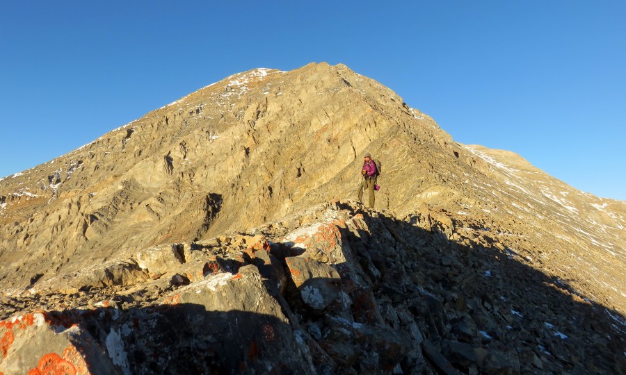
East Ridge Route Photo Essay
by Climber and Photographer, Dan Paulson


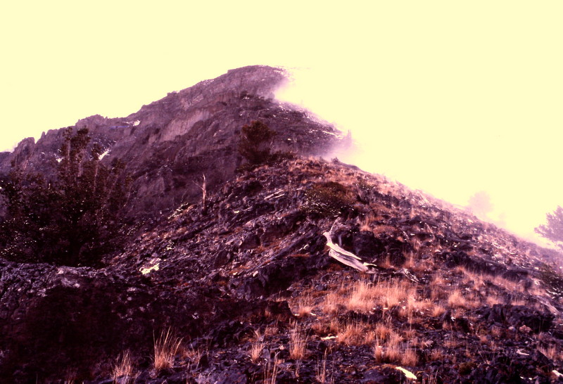
West Side Route, Class 3
Not many people climb the peak from the west because it involves a steep scree climb. Here is a West Side Route photo courtesy of Zach Vickery.

More Views of Diamond Peak


Return to the Idaho 12ers page.
Comments
4 responses to “Diamond Peak”
[…] Diamond Peak […]
[…] Idaho’s tallest peak, Mount Borah, followed by Leatheman Peak, 12,228; Mount Church, 12,200; Diamond Peak, 12,197; Mount Breitenbach, 12,140; Lost River Mountain, 12,078; Mount Idaho, 12,065; and Hyndman […]
[…] Download Image More @ http://www.idahoaclimbingguide.com […]
[…] Lemhi Range’s southern crest between Diamond Peak and Saddle Mountain frames perfectly in southern Idaho as it stretches south to the Snake River […]