This peak is not in the book. Access is now apparently closed to the public. In April 2017, there were no “Private Property-No Trespassing” signs or orange paint markings notifying you that the property is private and thus cutting off access. Margo Mandella reports that on April 23rd, 2021 that “The second gate at the public/private boundary (slightly higher than 6400 ft elevation at 43.260559, -116.887817) is now flagged in orange and fence posts next to the gate are also painted orange. Thus, sorry to report, there is no longer any public access to this 1k prominence peak.” Updated April 2021

One of eleven Idaho peaks using the name “squaw,” this Squaw Butte is 6,740 feet tall and sits east of US-95. Although it is impossible to tell when you traverse the route to the summit, part of this mountain is located on private property.
It is unknown how long the landowner will allow public access, but we all owe a “Thank You” to the owner for allowing access to this mountain and its massive views of Idaho, Oregon, and Nevada! Remember to respect all private property. If the property is posted, keep out. If public access is allowed, treat the land with respect. USGS Piute Butte
Access
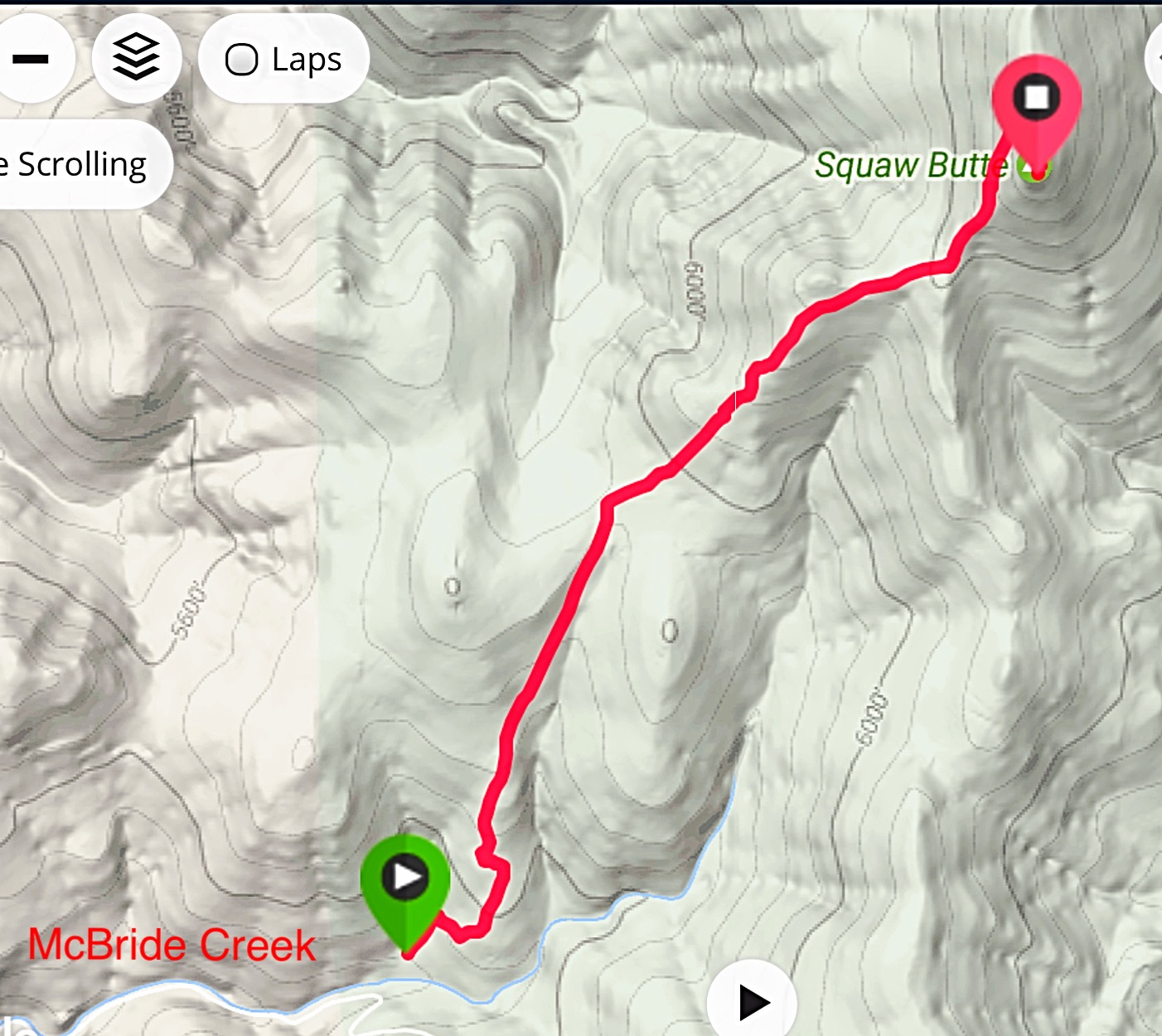
Squaw Butte is accessed from US-95. Access begins at Milepost 7 on a good gravel road, which runs southeast from the highway toward the mountains. The road is unsigned. Follow the road southeast past a reservoir fed by Little McBride Creek and then into the McBride Creek drainage below Flattop Butte. The road enters the McBride Creek Canyon at this point. Follow the road up the canyon roughly 2 miles to an unsigned road fork. Take the left fork, which quickly crosses the creek. The right fork leaves the creek bottom at this point, so if you start climbing you should know you missed the turn. There is a nice flat parking area about 100 yards after the creek crossing.
The Climb (Class 1-2)
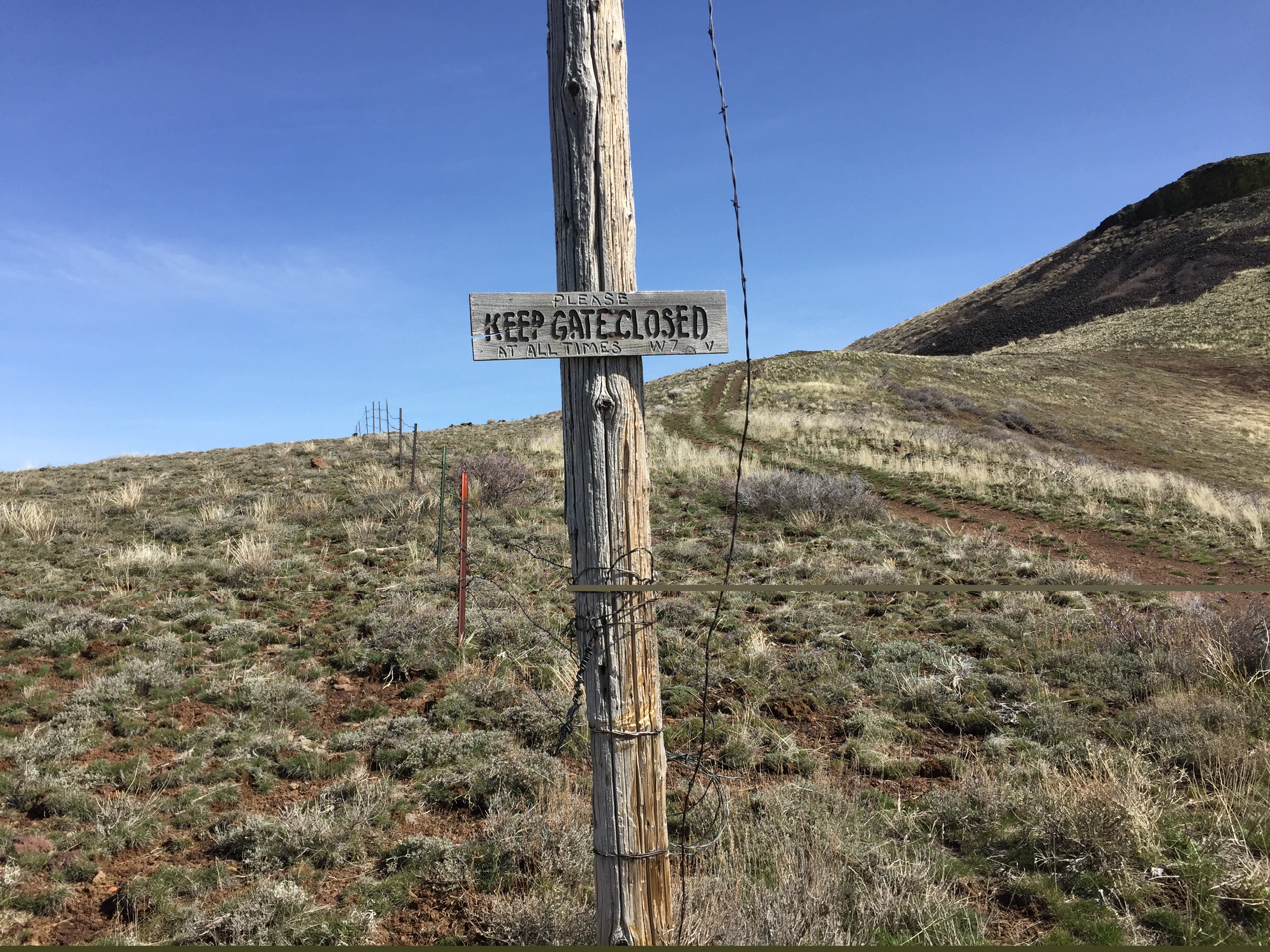
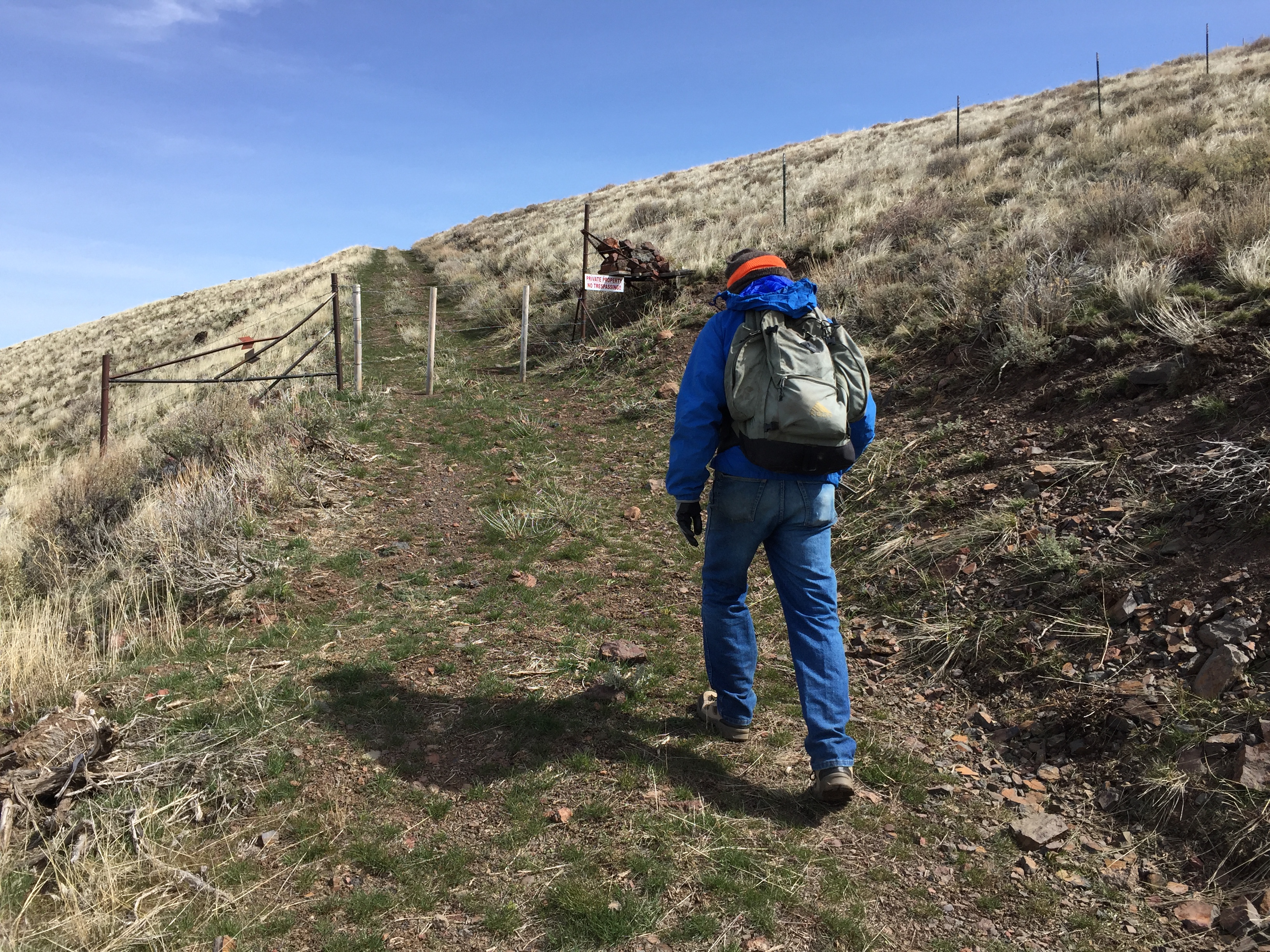
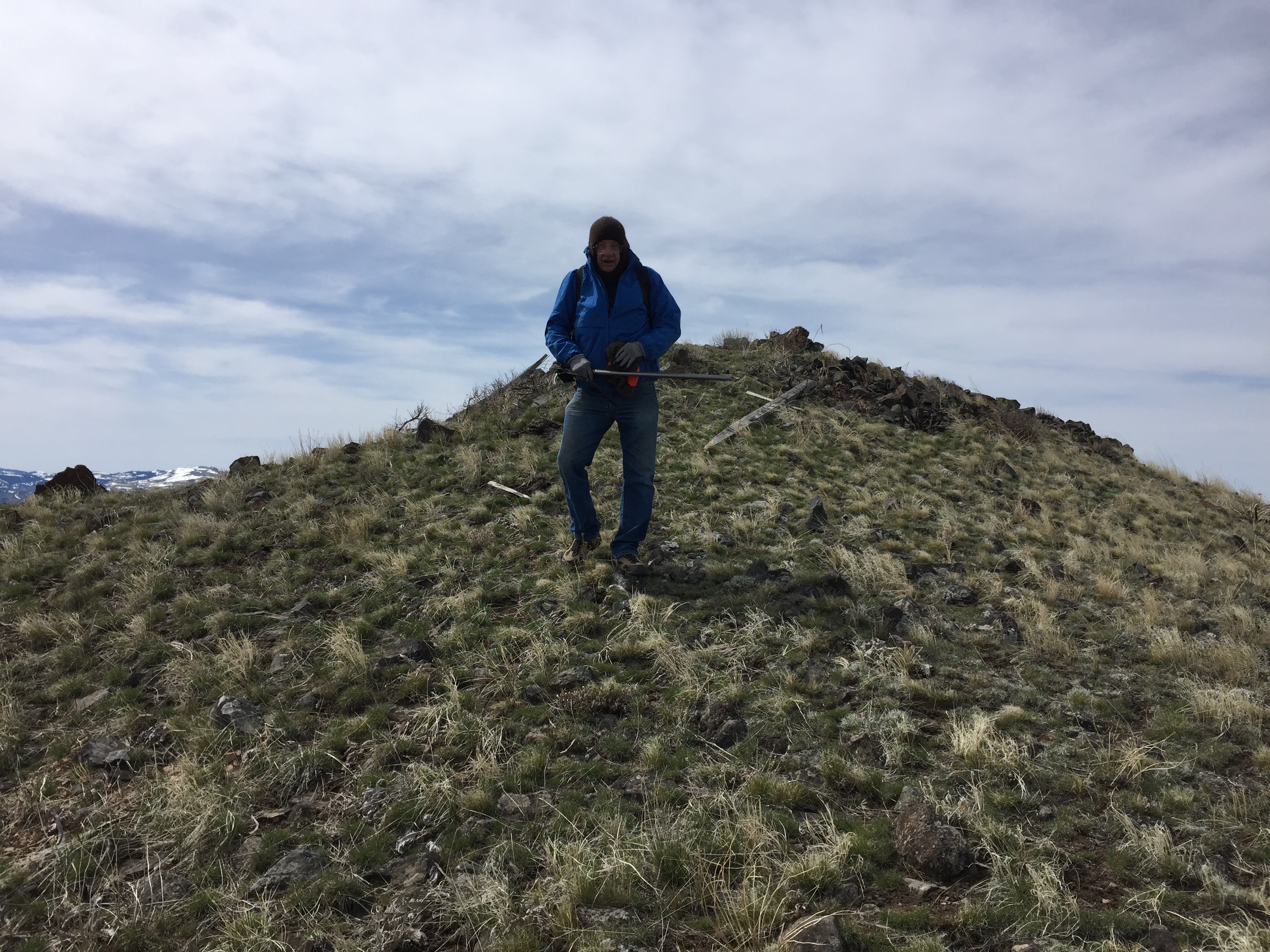
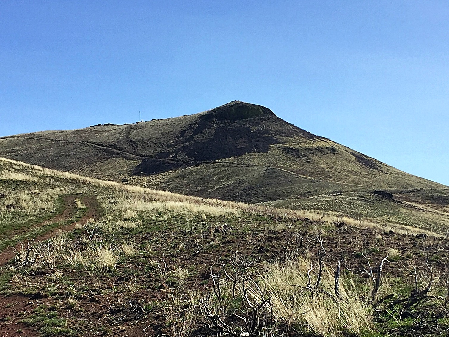
From the fork, a 4WD road leads upward and nearly to the summit. The road runs north to a gate in a fence line in about a mile. Pass through the gate and follow the road east up to a second gate in 0.8 miles. Then, the road turns northeast and continues upward, cutting across the peak’s West Face to another fence line in 0.4 miles. This fence line is clearly marked “Private Property–No Trespassing.” Stay on the south side of this fence and climb up to the summit ridge toward the visible solar panels. Turn south and follow the easy summit ridge to the high point.
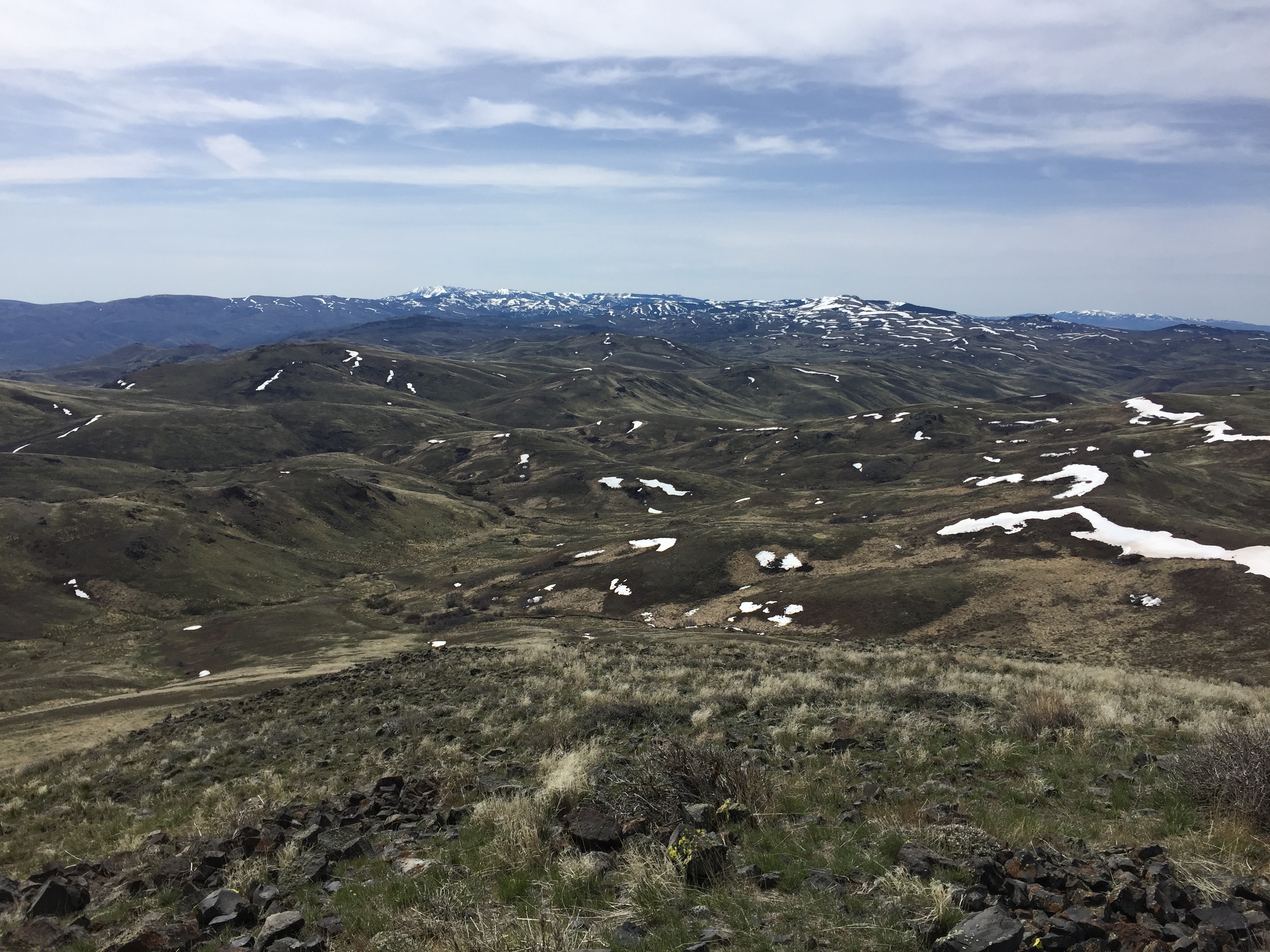
In addition to the Owyhee Mountains, the summit view takes in the Boise Mountains and West Mountains in Idaho, as well as the Wallowas, Elkhorns, Steens and Pueblos in Oregon in addition to several Nevada mountain ranges. My GPS reported 2.4 miles with 1,434 feet of elevation gain.