Category: Baugher

  • Chuck Ferguson by Rick Baugher

    Chuck Ferguson by Rick Baugher

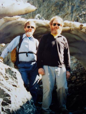
    The late Chuck Ferguson (1940-1998) is not as well known as one would expect, considering his accomplishments as an Idaho climber with a peak (at least unofficially) named after him. I met Chuck in the early 1980s during my working at the Idaho Falls YMCA. I was organizing community fun runs in Idaho Falls and Chuck ran in all of them. As a public school math teacher, Ferguson was a stickler for accuracy and I was told more than once that my 10K courses were not measured accurately. I did not realize he was a climber until 1993.

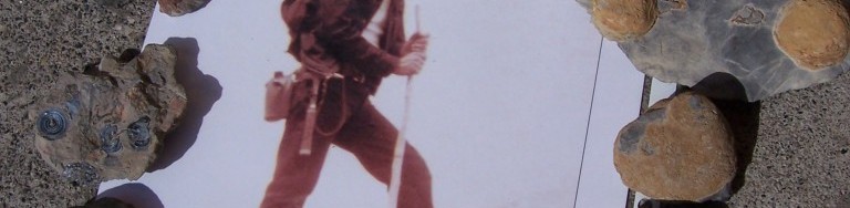
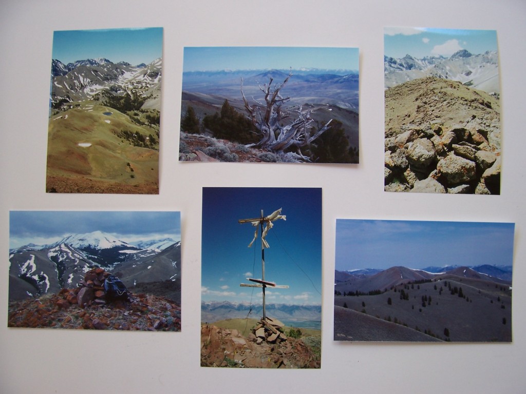
    I discovered that he was more than a runner when I climbed Peak 11509, now named after Chuck. Perhaps a good starting point for my discovery was August 15, 1993 when I finally climbed the peak. The 11,509-foot, cliff-rimmed mountain that divides Dry Creek and Long Lost Creek on the back side of the Lost River Range is a daunting challenge. The day before (from Far and Away Peak) I had spotted a gully on the Southwest Side of the peak that looked climbable. It was and when I reached the top, it looked untouched. But then I found a little meat snack tin tucked into the rocks. Inside the tin was the name Chuck Ferguson along with the date June 29, 1978.

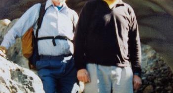
    Anyway, after my adventure I felt compelled to call Chuck and compare notes. Turns out he climbed the dicey East Side line from Swauger Lakes to reach the summit. His route involved crossing a catwalk snow bridge on the peak’s narrow South Ridge. Apparently we had something in common, as we climbed together over the next several years on a dozen peaks or more peaks.

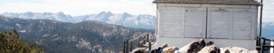
    During his life, he climbed Borah Peak 25 times and climbed hundreds of other Idaho peaks and undoubtedly recorded several first ascents including a difficult route on Brocky Peak in the Pioneer Mountains. Looking over Chuck’s peak list, I see Warbonnet was the second peak he did after Borah. Talk about diving in head first. In addition to Brocky, his other first ascents are Pegasus (July 29, 1994) and Straight Shot (October 21, 1995). He shared his climbs with relatives, colleagues, students, and friends and left an enduring legacy in Idaho’s climbing history. Climbing was something that he was good at, but Chuck’s passion was running.

    He completed 100 of the 26.2-mile marathons and several ultra-marathons, almost winning the Lake Tahoe 72-miler. He began climbing mountains in 1976 as a training tool. All together, Chuck climbed over 200 peaks, including 54 Colorado Fourteeners. Warbonnet was the second peak he did after Borah on July 16, 1977. In fact, he and David were first known Idahoans to complete the 54 Colorado Fourteeners on August 21, 1998.

    Chuck Ferguson (L) and David Ferguson (R) in Jones Creek, Lost River Range, after climbing No Regret Peak July of 1994. Rick Baugher Photo
    Chuck Ferguson (left) and David Ferguson (right) in Jones Creek after climbing No Regret Peak (July 1994). Rick Baugher Photo
  • One Person’s Junk Is Another’s Treasure by Rick Baugher

    One Person’s Junk Is Another’s Treasure by Rick Baugher

    They say that one person’s junk is another’s treasure. Archeologists of future millennia should have a field day sifting through the midden of our modern society. Humans seem to leave calling cards wherever they go. Here are some Idaho mountain summit artifacts left by those of two or three generations back.

    Left to Right (pictured):

    WHISKEY PEAK (11,154 feet, Boulder Mountains). This pre-Prohibition whiskey bottle was left by some reveler high on this mountain. The summit view is north to Castle Peak (September 1993).

    LEATHERMAN PEAK (12,228 feet, Lost River Range). The coffee can worked well to house a summit register until it rusted out. This one may have been placed by William McIntyre of Twin Falls in the mid 1950s….and look at that wooden ice axe! View north to Borah Peak (September 1984).

    HOODOO PEAK/WCP-3 (10,588 feet, White Cloud Peaks). This summit sardine can dates from the early 1960s (October 2004).

    Since the beer can’s introduction in 1935, mountains have provided an
    artistic theme. The draw seemed to be recreation and pure water. Here
    are some brands from the 1930s to the 1950s featuring Western U.S.
    mountains.

    Cone tops (shown on the top row) are sought-after items by collectors. Bohemian Club, brewed in Boise, was a favorite of WWII era beer drinkers. Tons of these could once be found in the Mount McCaleb dump (Mackay). The Sun Valley can (brewed in Pocatello) is rare. But keep exploring. You never know what’s over the next hill.

    All material courtesy of Rick Baugher (April 23, 2007).

    100_0762100_0754

  • Fossils of Idaho’s High Peaks by Rick Baugher

    Fossils of Idaho’s High Peaks by Rick Baugher

    Some of the best examples of Idaho’s marine Paleozoic fossils are found near the summits of mountain peaks (10,000 feet of elevation and higher). Although they appear in carbonate formations throughout East Central and Southeast Idaho, the core zone is in the Southern Lemhi and Lost River Ranges. Specifically, the best preserved fossils are found in the Scott Peak Formation of Mississippian Age. 330 million years ago, this part of Idaho was a shallow subtropical sea far to the southeast, part of the super continent Gondwanaland.

    It was not an easy journey to the present for these coral reef relics. Only those that were quickly buried in lime muds and survived being eaten, baked, burned, squashed or torn asunder have survived. No soft body parts remain, and what we see is not the original shell-y part. This has been chemically replaced by silicates and iron oxides. Fossils allow us to see and touch the incredibly distant past. This visualization can also be enhanced by the sense of smell. Crack open a piece of black fossiliferous limestone. The sulfur dioxide (rotten egg) smell is another remnant of the decayed organism. The following 3 photos each depict a pioneer Idaho geologist and a suite of fossils he likely found in the course of his fieldwork.

    JOSEPH B. UMPLEBY (1883-1967). Dressed in his “survey tans,” US Geologist J. B. Umpleby is ready to leave camp on his mount for another day in the field, somewhere in Lemhi or Custer County (circa 1912). Colony coral is found on the summit of Umpleby Peak (10,713 feet). Fossils clockwise from lower left: Foraminifer; Bryozoan mass; next 5- colony coral (Tabulata); next 3- Crinoid (sea lilly) showing head, stem length and star-shaped axial cross section of stem; spicule.

    CLYDE P. ROSS (1891-1965). A prolific writer of Idaho geology, 1947 was a banner year for US Geologist C. P. Ross with his publication of “Geology of the Borah Peak Quadrangle” and “Geologic Map of Idaho.” Here he is pictured in Sawmill Canyon (Lost River Range) with White Cap Peak in the background (early 1930s). The bony fish was found en route to Clyde Ross Peak (11,724 feet). Fossils clockwise from bottom center: Streptelasma; Gastropod; 2 Trilobites; bony fish; 2 Archemedes-fan and stem mass, Coquina (limestone biomass).

    OSCAR K. HUH (1935- ). O. K. Huh did his Penn State doctoral field work in the Lemhi Range, shown here in the Diamond Peak area (1959). Huh specialized in the Mississippian limestones and defined 4 new geologic formations, including the Scott Peak. You guessed it, Horn Coral fossils are found around Huhs Horn (11,292 feet). Fossils clockwise from lower left: 2 Productids, Orbiculoidia (with original blue sheen?); Spirifera-these are all Brachiopods; 6 Horn Corals (Rugosa) of various sizes, 2 show in tact septa. Horn Coral disappeared with the Permian Extinction, but as members of the Coelenterate family they are survived today by the jellyfish. Pelecepods (clams).

    All material is from the Rick Baugher collection (April 21, 2007).

    100_0747

    100_0749

    100_0751
    Fossil collection. Rick Baugher Photo
  • Lost River Range Volcanoes by Rick Baugher

    Lost River Range Volcanoes by Rick Baugher

    Volcanoes and related igneous flows are a staple of the Pacific Northwest landscape, so it is interesting to observe that Idaho’s highest mountain range presents a 60-mile front of sedimentary limestone. How did these Lost River Mountains align the way they did and how did they reach their current height? Much can be explained by the movements of the North American tectonic plate over the last 11 million years, when compression and extension forces initially faulted the surface crust. Also, 2 glaciations over the past 100,000 years left their mark. But a far more powerful source, arising from deep within the earth, are the volcanoes.

    Their presence can be seen along much of the back side of the Lost River Range. The largest igneous flow begins at the mouth of Pass Creek, continues north then northwest, to form a large apron around the range. The keen observer, with a little imagination, can trace the roots of long-gone Mesozoic stratovolcanoes on the order of Rainier and Orizaba. The limestone which piled up against their eruptive flanks gave the birth to our Lost River Mountains. Three stratovolcano locations tentatively identified are: Arco Valley (between King Mountain and Arco Hills), Wet Creek Basin and Upper Pahsimeroi.

    Here’s a look at some remnant Lost River volcanic peaks. Clockwise from top left.

    VULCAN PEAK 10297' The highest volcanic summit in LRR. View S to USGS Peak, 1999. APRON MOUNTAIN 9382' View NE to Hawley Mtn & Lemhi Range, showing Wet Creek stratovolcano caldera, 2007. EAST BURNT PEAK 10149' A prehistoric cairn? View SW to Cleft Peak, 1999. THE CAPE 8387' Iron rich andesite of Eocene Challis Volcanics. View S to Massacre Mtn, 2007. GROUSE PEAK 8464' The northernmost Pahsimeroi/LRR summit overlooks the Round Valley caldera. A TM Bannon 1914 triangulation station, 1994. VICTORIAS SECRET 8860~ Beauty is in the eye of the beholder, 2007.
    VULCAN PEAK (10,297 feet): The highest volcanic summit in the Lost River Range. View S to USGS Peak (1999).
    APRON MOUNTAIN (9,382 feet): View NE to Hawley Mountain and the Lemhi Range, showing the Wet Creek stratovolcano caldera (2007).
    EAST BURNT PEAK (10,149 feet): A prehistoric cairn? View SW to Cleft Peak (1999).
    THE CAPE (8,387 feet): Iron-rich andesite of Eocene Challis Volcanics. View S to Massacre Mountain (2007).
    GROUSE PEAK (8,464 feet): The northernmost Pahsimeroi/Lost River Range summit overlooks the Round Valley caldera. A T. M. Bannon 1914 triangulation station (1994).
    VICTORIAS SECRET (8,860 feet): Beauty is in the eye of the beholder (2007).
    SQUAWTIP 9046' The most prominent topographic feature in the Burnt Creek area. A conical peak of rugged andesite breccia. There is no easy line to the summit. First ascent Lee Morrison, Lester Walker, USGS, 1934-5. SQUAWTIP The easiest way up Squawtit is a zig zag climb on its east face & gully system. The average slope angle is 65 degrees, 2007. CAMPION PEAK 9597' A 2005 cairn and view SW to Borah Peak. Campion is a pink alpine flower. SPRING HILL MOUNTAIN 9449' A 1932 benchmark placed by EM Buckingham. View to Doublespring Pk, 1996. DRABA HILL 9315' Above Horseheaven Pass. Draba is a bright yellow circumpolar flower abundant in this area, 2005. BABY PEAK 9191' Heads Baby Creek in lonely cowboy country, 2005. Any errors of opinion or observation in this article are mine alone.......Rick Baugher, May 2007
    SQUAWTIP (9,046 feet): The most prominent topographic feature in the Burnt Creek area. A conical peak of rugged andesite breccia. There is no easy line to the summit. First ascent by Lee Morrison and Lester Walker, USGS (1934-1935). The easiest way up Squawtip is a zig-zag climb on its East Face and gully system. The average slope angle is 65 degrees (2007).
    CAMPION PEAK (9,597 feet): A 2005 cairn and view SW to Borah Peak. Campion is a pink alpine flower.
    SPRING HILL MOUNTAIN (9,449 feet): A 1932 benchmark placed by E. M. Buckingham. View to Doublespring Peak (1996).
    DRABA HILL (9,315 feet): Above Horseheaven Pass. Draba is a bright yellow circumpolar flower abundant in this area (2005).
    BABY PEAK (9,191 feet): Heads Baby Creek in lonely cowboy country (2005).
    Any errors of opinion or observation in this article are mine alone. Rick Baugher (May 2007)


  • Fire Lookouts By Rick Baugher

    Fire Lookouts By Rick Baugher

    For more on fire lookouts see the following articles: Boise National Forest Fire Lookouts  and An Overview of the Lookouts on the Salmon National Forest


    By the 1930s, the Forest Service had a goal to “put a firewatch on every mountaintop.” Idaho ended up with 989 fire lookout structures, more than any other state in the Pacific Northwest. Of Southern Idaho’s 128 lookouts, 36 were above 9,000 feet. Red Wings (10,910 feet) was the highest. Twin Peaks (10,340 feet) is the highest fire station in America today. By the 1960s, many of the old lookouts were destroyed in the name of progress but, fortunately, a representative sampling remain today at least until the elements ultimately win.

    Everything you’d ever want to know about lookouts is contained in the book “Fire Lookouts of the Northwest” by Ray Kresek. You can reach Ray through his Historic Lookouts Project in Spokane, Washington. In doing his research, Ray has climbed over 1,000 mountains. He knows what he’s talking about. As mountain users, sooner rather than later, we have an encounter with lightning. In his book, Ray describes one of those terrible nights in a shack on a summit, something like this:

    As the lightning approached, the firewatcher would pull the “go to hell rope” to disconnect all appliances. The copper wire grounding system would begin to hum and glow with dancing Saint Elmo Fire. At this time, as your hair began standing on end, you’d hop on a glass-legged insulated stool. For the grand finale, the blinding white light would cause anything metal to sizzle. The cabin reeked of foul ozone. After several minutes your sight and senses return….and leave you something not to forget in a lifetime.

    L to R from top: WILDHORSE PEAK el 9546' White Knob Mtns This fire lookout is preserved as a national historic monument. TWIN PEAKS el 10340' Idaho's highest outhouse provides a contemplative view to 10442' White Mountain, range highpoint of the Salmon River Mtns SLEEPING DEER el 9881' in the heart of the Frank Church Wilderness. Built in 1935. Still active. SAL MOUNTAIN el 9593' Lemhi Range This 10'x10' lookout was built in 1926. The USCGS triangulation signal is from 1945. These are the first Idaho mountains to be seen and described by a white man. Cresting Lemhi Pass on Aug 12, 1805, Meriwether Lewis records: "I discovered immence ranges of high mountains still to the west of us with their tops partially covered with snow". BLUE NOSE el 8677' ID/MT An oddity- this lookout was split down the middle by 2 states, counties, National Forest ranger districts & regions. The lower floor acomodated livestock. The brass benchmark in foreground was set by USGS' TM Bannon in 1912. MOUNT GREYLOCK el 9857' Left to the elements. By Rick Baugher, 4/24/07
    Left to right from top:
    WILDHORSE PEAK (9,546 feet): White Knob Mountains. This fire lookout is preserved as a national historic monument.
    TWIN PEAKS (10,340 feet): Idaho’s highest outhouse provides a contemplative view to 10,442-foot White Mountain, high point of the Salmon River Mountains
    SLEEPING DEER (9,881 feet): In the heart of the Frank Church Wilderness. Built in 1935. Still active.
    SAL MOUNTAIN (9,593 feet): Lemhi Range. This 10’x10′ lookout was built in 1926. The USGS triangulation signal is from 1945. These are the first Idaho mountains to be seen and described by a white man. Cresting Lemhi Pass on August 12, 1805, Meriwether Lewis records: “I discovered immense ranges of high mountains still to the west of us with their tops partially covered with snow.”
    BLUE NOSE (8,677 feet): ID/MT border. An oddity: this lookout was split down the middle by 2 States, Counties, National Forest Ranger Districts and Regions. The lower floor accommodated livestock. The brass benchmark in the foreground was set by USGS’ T. M. Bannon in 1912.
    MOUNT GREYLOCK (9,857 feet): Left to the elements.
    By Rick Baugher (April 24, 2007)