Out-of-staters Ken Jones and Bob Packard were the first to reach all the Idaho county high points. Dan Robbins was the first Idaho resident to reach the summit of all of Idaho’s county high points. Terri Rowe of Boise became the first woman to complete the list on August 6, 2019. As you will see from the table, it takes a lot effort, time, snacks and gas money to finish the list.
Andy Martin developed the earliest list of Idaho county high points. Since his original work, improved maps became available. We have updated the list below to incorporate the updated elevations found on the newer maps. Revised August 2018
The list of finishers includes:
Ken Jones, Bob Packard, Dan Robbins, Dennis Poulin, Adam Helman, Chris Anderson, Tony Wofford and Terri Rowe
Hiking the U.S. state high points is a popular activity and naturally leads to considering the next level of detail: the 3,140+ county high points. During the 1990s, lists were prepared that locate these points based on the USGS 7.5-minute maps. The book County High Points by Andy Martin, oldadit@iname.com, includes all of these lists.
Hiking the counties of different Western States—AZ, CA, CO, ID, MT, NM, NV, OR, UT, WA and WY—makes an interesting goal and Idaho proved to be a challenge. The Idaho County High Point List was finally completed on Labor Day of 2001 by Ken Jones and Bob Packard. This leaves Montana as the only uncompleted Western State as of 2018.
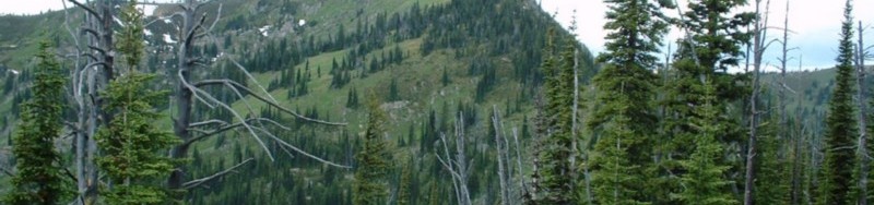
High Points of Idaho’s 44 Counties
The Idaho high point list was composed by county high point guru Andy Martin. Please note that some of Idaho counties’ highest points are not ranked summits. The average elevation is 8,289 feet (364,705 feet in peaks/44 counties). The high points in the table are shown in order by elevation. I have linked the peaks that are found on this website to the peak’s page.
| County |
High Point |
Elev. |
Location |
USGS 7.5′ MAP |
| Custer |
Mount Borah |
12,662 |
6-N-23E |
Borah Peak |
| Butte |
Diamond Peak |
12,197 |
2-9N-28E |
Diamond Peak |
| Blaine |
Hyndman Peak |
12,009 |
?-5N-19/20E |
Hyndman Peak |
| Lemhi |
Bell Mountain |
11,612 |
36-11N-27E |
Bell Mountain |
| Clark |
Point 11220 east of Webber Peak |
11,200+ |
33-12N-31E |
Scott Peak |
| Boise |
Mount Cramer |
10,716 |
19-8N-13E |
Mount Cramer |
| Elmore |
Snowyside Peak |
10,651 |
?-7N-13E |
Snowyside Peak |
| Fremont |
North Targhee Peak |
10,420 |
?-16N-43E |
Targhee Peak |
| Camas |
Peak 10337 |
10,337+ |
?-6?N-15E |
Galena |
| Cassia |
Cache Peak |
10,339 |
21-14S-24E |
Cache Peak |
| Bonneville |
Mount Baird |
10,025 |
5-1S-46E |
Mount Baird |
| Bear Lake & Caribou |
Meade Peak |
9,957 |
1-11S-44E |
Meade Peak |
| Valley |
Big Baldy |
9,705 |
26-17N-10E |
Big Baldy |
| Franklin |
Peak 9484, locally known as Felt Hat Peak |
9,484 |
29-15S-42E |
Egan Basin |
| Idaho |
Point 9439 |
9,439 |
7-29N-17E |
Mt. Jerusalem |
| Oneida |
Oxford Peak |
9,282 |
26-13S-37E |
Oxford |
| Bannock |
Bonneville Peak |
9,271 |
33-7S-37E |
Bonneville Peak |
| Teton |
Piney Peak |
9,020 |
24-4N-43E |
Garns Mtn. |
| Adams |
Monument Peak |
8,920+ |
22-22N-2W |
Purgatory Saddle |
| Power |
Deep Creek Peak |
8,748 |
13-11S-32E |
Deep Creek Peak |
| Owyhee |
Hayden Peak |
8,403 |
23-5S-3W |
Cinnabar Mtn. |
| Madison |
Red Butte
Note: Two unnamed points over 8,080 feet lie near Red Butte. |
8,108 |
20-4N-43E |
Temple Peak |
| Clearwater |
Rhodes Peak |
7,930 |
35-39N-13E |
Rhoades Peak |
| Gem |
Peak 7971 |
7,921 |
1-13N-2E |
Tripod Peak |
| Washington |
Cuddy Mountain |
7,867 |
35-17N-4W |
Cuddy Mountain |
| Twin Falls |
Point 7860 |
7,860 |
27/34-16S-12E |
Curtis Draw |
| Boundary |
Peak 7714 |
7,714 |
2-63N-2W |
Pyramid Peak |
| Shoshone |
Illinois Peak |
7,690 |
33-43N-11E |
Illinois Peak |
| Bingham |
Blue Ridge aka Blackfoot BM |
7,550 |
34-2S-39E |
Poison Creek |
| Bonner |
Scotchman Peak |
7,009 |
21-56N-3E |
Scotchman Peak |
| Jefferson |
Point 6664
This point is part of Kelly Mountain |
6,664 |
33-4N-41E |
Heise |
| Kootenai |
Latour Peak |
6,408 |
8-47N-1E |
Twin Crags |
| Gooding |
This high point is located on the county’s north boundary. It has no rise and it is not a peak in any sense. |
6,360+ |
4-3S-13E |
Davis Mountain |
| Benewah |
Peak 6180 |
6,160+ |
20-47N-1E |
Twin Crags |
| Ada |
Point 6020 |
6,020+ |
22-4N-3E |
Robie Creek |
| Lincoln |
Peak 5950 |
5,950 |
3-3S-16E |
Thorn Creek Res. |
| Nez Perce |
Craig Mountain |
5,360+ |
29-32N-4W |
Frye Point |
| Latah |
Bald Mountain |
5,320+ |
34-43N-2W |
Emida |
| Minidoka |
Bear Den Butte |
5,104 |
8-3S-25E |
Bear Den Butte |
| Lewis |
Peak 4795
Note: Two points 4,780 feet+ lie about 800 feet NE of spot elevation 4,795 feet. |
4,795 |
23-32N-3W |
Hoover Point |
| Payette |
Point 4763
Note: Two points 4,760 feet+ lie on the east border of Section 4-9N-1W. |
4,763 |
4-9N-1W |
Coonrod Gulch |
| Jerome |
This high point is located on the side of Kimama Butte. It has no rise and it is not a peak in any sense. |
4,760+- |
1-8S-21E |
Kimama Butte |
| Canyon |
Pickles Butte |
3,084 |
21-2N-3W |
Givens Hot Sprs. |