Category: First Ascents

  • Mount Borah: Dirty Traverse and Northeast Ridge Variation – East Face by Bob Boyles

    Mount Borah: Dirty Traverse and Northeast Ridge Variation – East Face by Bob Boyles

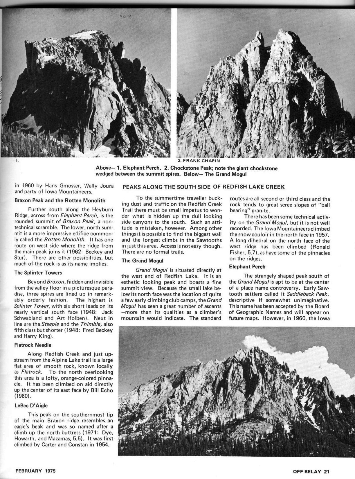
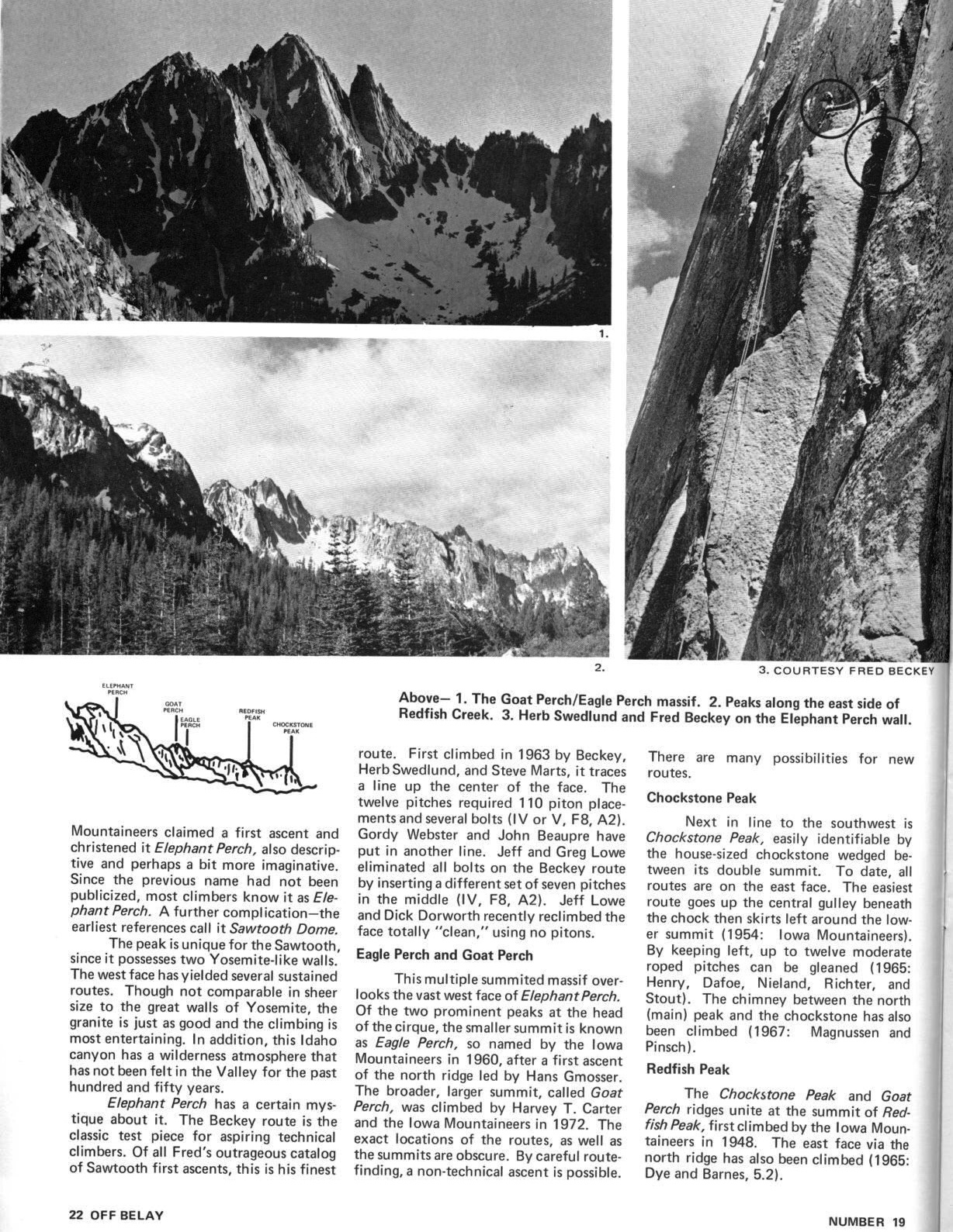
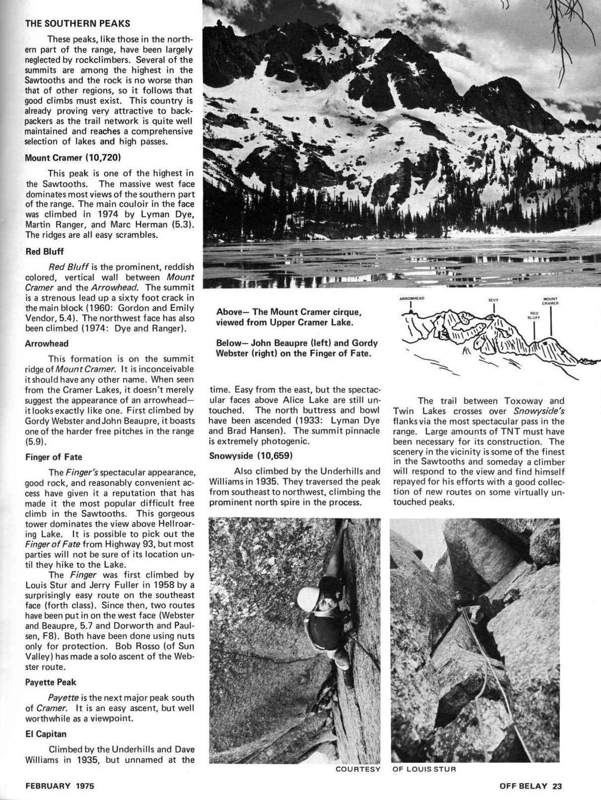
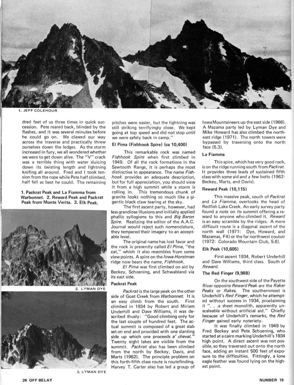
    Bob Boyles provided the following history and, with Wes Collins, the route descriptions (below) for these two East Face Routes.

    I first visited the East Side of the Lost River Range (The Pahsimeroi Valley) in 1972, while working on a helicopter contract for the Forest Service. Flying through the range provided me a view that few ever get to see. While all of the range is impressive from the eastern side, one face stood out from the others.

    When our contract with the USFS finished at the end of Summer, I took a break from the 24/7 aviation life I was accustomed to. During this down time, I happened to notice an ad for an introductory rock climbing class and thought, “Wow. Cool. Ropes and everything, I’m game for this!” I talked a couple of friends into joining me for the class. After completing our class, we were ready to test our newly-learned skills on a real mountain but Winter soon arrived and we put our plans aside until the next Summer.

    East Face Routes. The blue line is the Direct, red the Dirty Traverse and yellow the East Face variation. Photo - Wes Collins

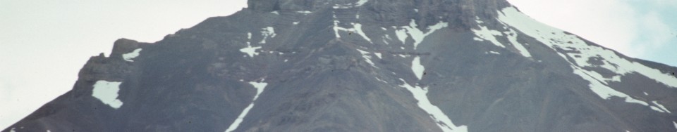
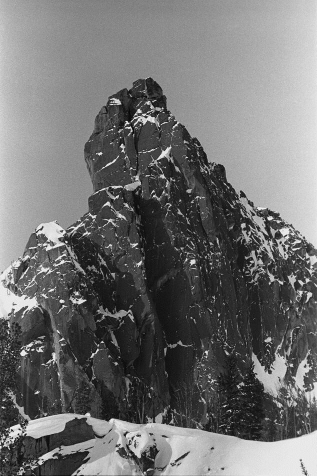
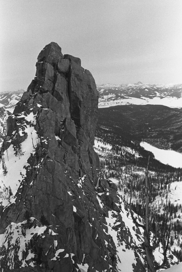
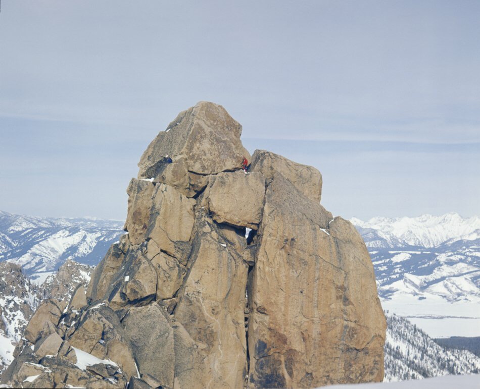
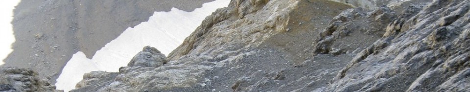
    East Face Routes. The Direct East Face (blue line), the Dirty Traverse (red line) and the Northeast Face Variation (yellow). Wes Collins Photo

    Summer came late in 1973. It wasn’t until the end of June that we were able to get in for a closer look at the East Face. As the morning sun warmed the snow high in the cirque, we watched slide after slide tear loose and nail virtually every approach to the mountain. Along with the snow slides came a lot of rock fall as well. After sitting and studying the face, it looked to be climbable. There was no doubt, however, that the attempt would have to be made during the dry season. In 1974, we returned for another exploratory trip and picked out a line on the face that followed some water streaks in a nearly straight path to the summit. We decided that this was the route we would attempt on our next visit.

    A couple of years passed. In trying to sell potential climbing partners, I described this face as “Idaho’s Eiger” but at the time, the range had no technical rock routes. Idaho has so much fine granite it was hard to justify a trip to the Lost Rivers, where the limestone rock had a reputation for being nothing but choss.

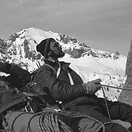
    In the Fall of 1975, Mike Weber and I decided to throw caution to the wind and give this face a serious attempt. We loaded up all of the gear we thought we’d need and made the brutal drive to the end of the road up the West Fork of the Pahsimeroi River. Hiking through open sagebrush, we made quick work of the approach and found a nice grass-covered spot for our camp at the lower tarn just above timberline. Curious to see the face up close, we grabbed our crampons and axes and headed up the snow and ice to where the bare rock began.

    A picture perfect September day in the Lost River range. Wes is deep in contemplation over the route that he and Kevin will use for their intended climb. The vertical rise from the lake to the summit is 2440′.” Lost River Range – Mt Borah, Idaho Sept 24, 2011 (photo by Bob Boyles)

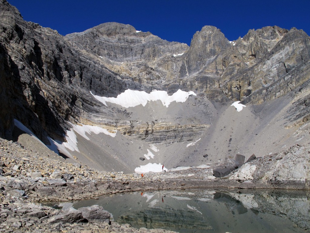
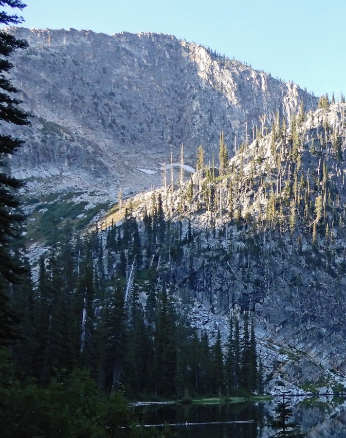
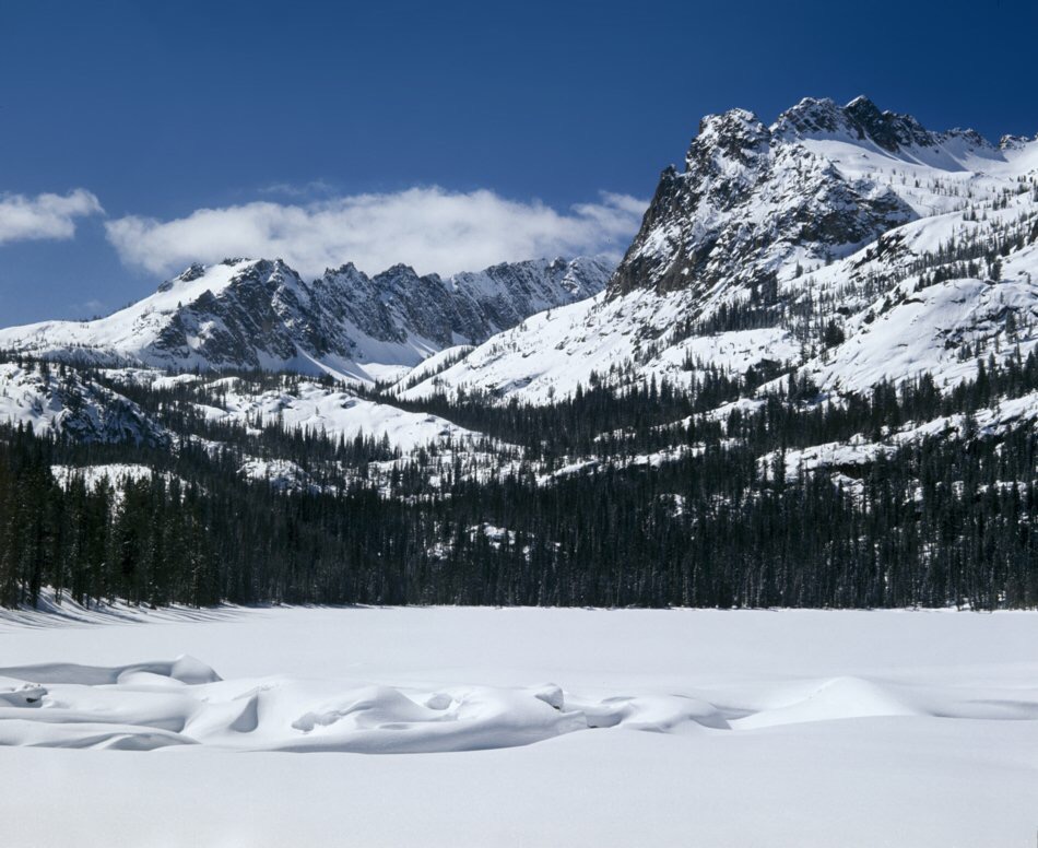
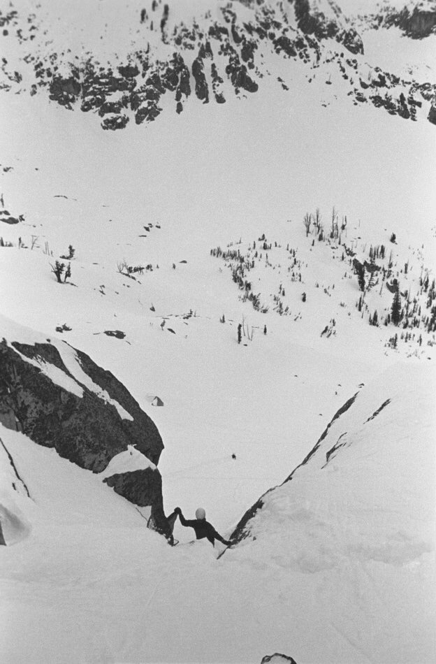
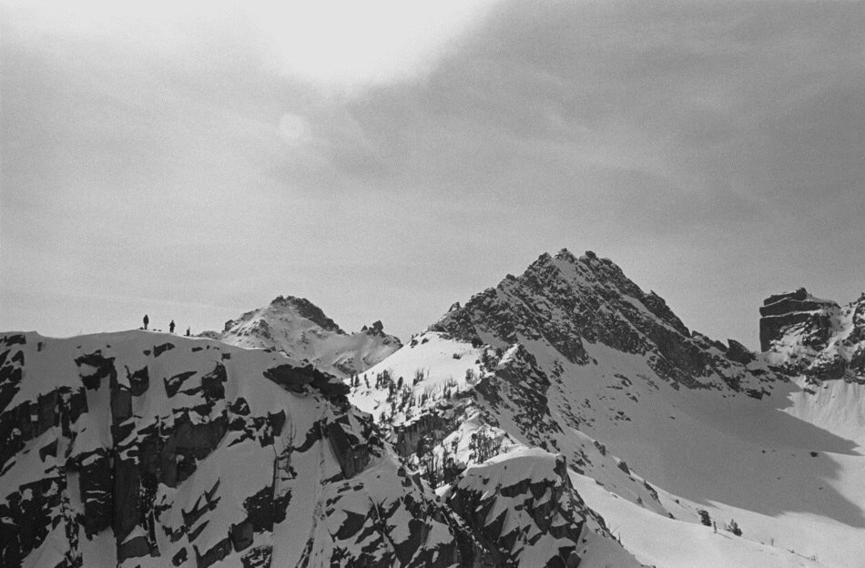
    A picture-perfect September day in the Lost River Range (9/24/11). The vertical rise from the lake to the summit is 2,440 feet. Bob Boyles Photo

    Just as we were approaching the final section of snow and the start of our proposed route, we heard a rumble from above, freezing us in our tracks. A Volkswagen-sized rock was flip-flopping down the face. Within seconds, it reached terminal velocity bouncing back and forth down the face. We stood motionless in our stances trying to figure out if we should go left, right, or just clasp our hands and pray. Fortunately, the rock deflected about 40 feet to our right. We just stood there watching it tear up snow and bounce to the flats and the tarn at the bottom of the cirque.

    We tried to convince each other that the face would be frozen up by morning but neither of us was to be convinced. Around 2:00AM, we were startled awake by a blinding flash of light and, milliseconds later, a rumble of thunder. We both knew our chances to climb were most likely over, so we pretended to go back to sleep. Within minutes, the rain was falling at a rate of an inch or two an hour, and shortly afterward our campsite became a flood zone. We stayed in the tent until it was surrounded by flowing water, our cue to get the hell out of there.

    For decades after that ill-fated attempt, my climbing partners and I continued to explore and put up routes in the range. Despite those many visits, we never made it back to the cirque. I pretty much wrote off the East Face as being a very dangerous place and that kind of risk no longer appealed to me. Also, as time progressed, I gained the impression that sport climbing and bolted routes on established climbs were the “new norm” and the pioneering of new alpine routes seemed to have gone by the wayside. It wasn’t until the Spring of 2011, during a discussion of Lost River climbs on the Idaho Summits web forum that a new spark of interest began. When I first described the East Face Cirque, most local climbers did not know what I was talking about. This, despite most of them having climbed Mount Borah multiple times. One did, though.

    After reading my description of the face, Wes Collins, a local climber and native of the area, immediately became interested. Soon, a new discussion started about taking a trip to the cirque.


    Route Information

    The Dirty Traverse

    First Ascent –  Wes Collins (solo) July 2011
    Rating: Grade III 5.4

    The Dirty Traverse ledge leading out to the East Ridge from the center of the face. Photo - Wes Collins

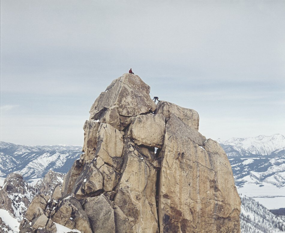
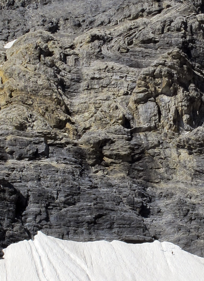
    The Dirty Traverse ledge leading out to the East Ridge from the center of the face. Wes Collins Photo

    Wes couldn’t wait to see the face up close so he took off on an exploratory trip with his wife and dog. This trip in 2011 started as a recon, but Wes found himself drawn to the face like a magnet. The following is Wes’ account of the first ascent.

    Bob got me all fired up to get a look at the East Cirque and what he described as Idaho’s Eiger. I certainly wasn’t disappointed. Susan and I planned the trip as a leisurely backpack into Lake 10204 to take in the views, but I tossed an axe and some light crampons in the truck just in case.

    Dirty Traverse-1 Standing on the last of the snow slopes below the first wall. Photo - Susan Collins

    Dirty Traverse-1
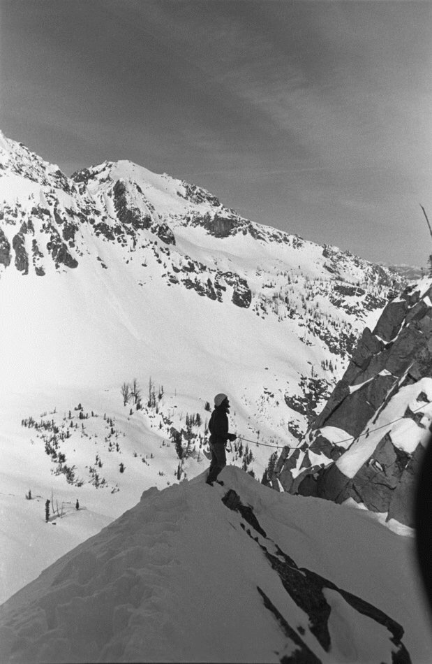
    Standing on the last of the snow slopes below the first wall. Susan Collins Photo


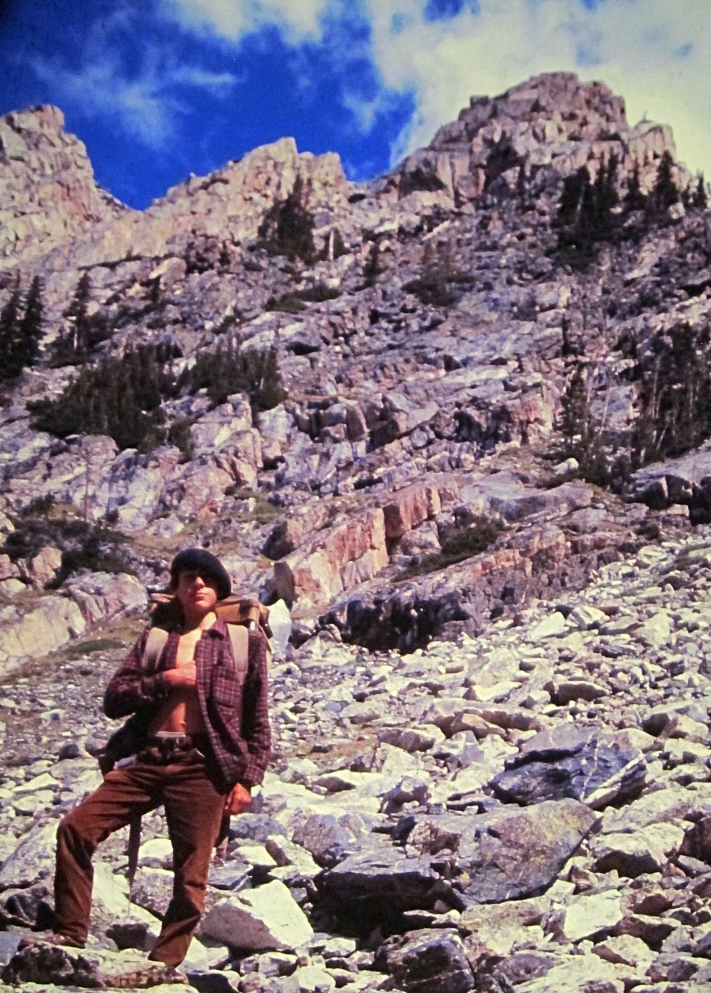
    I spent a lot of time looking at the face before I even thought about a spot for the tent. Stupidly, I’d left my axe and spikes in the truck, but at this point I knew I was going to make a serious try for the summit. It didn’t take long to pick out a couple possibilities, but the most probable line would involve a long traverse across a talus-covered ledge on the lower face. I started thinking of the route as the Dirty Traverse before I even put my boots on it. Morning was an easy laid-back affair. We sipped coffee and we watched the sun line slowly make its way down the mountain. I had to wait until nearly 10:00AM before the snow softened enough for step-kicking. The first, lower snowfield was pretty firm, but the second was much softer.

    I’d found a nice, tooth-shaped chunk of limestone that probably wouldn’t have done much more than keep my feet down hill if I took a fall. I was on my own, but it was still embarrassing to have the damn thing in my hand and I had to keep fighting the urge to hide it in my pocket. At the top of the snow, the randkluft was several meters deep and the first tentative moves on rock over the blackness below felt pretty exposed. The rock, however, was surprisingly solid and clean.

    Wes Collins about a third of the way across the traverse. Photo - Susan Collins

    Wes Collins about a third of the way across the traverse. Susan Collins Photo


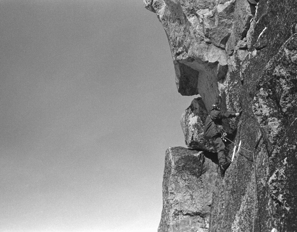
    The scramble to the traverse ledge was fairly sustained Class 4, but the rock was good enough to make me forget about the exposure and enjoy the ride. The traverse ledge was quite tedious though and I wasn’t sure it would go all the way to the ridge until I got there. Once on the ridge, I made my way up an easy Class 5, 70-foot buttress but it could have been easily bypassed by scrambling around its West Side. Most of the ridge above the traverse is Class 3 or easier.

    The key to the climb. A tiny col where the East Ridge meets the upper East face. Cross the snow field "sky ledge" to get to the summit. Photo - Wes Collins

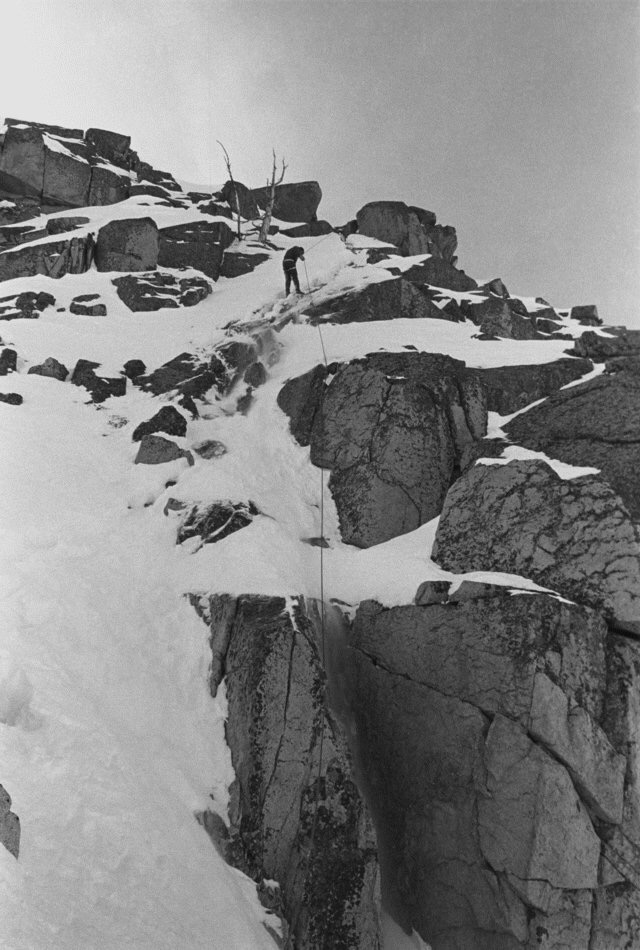
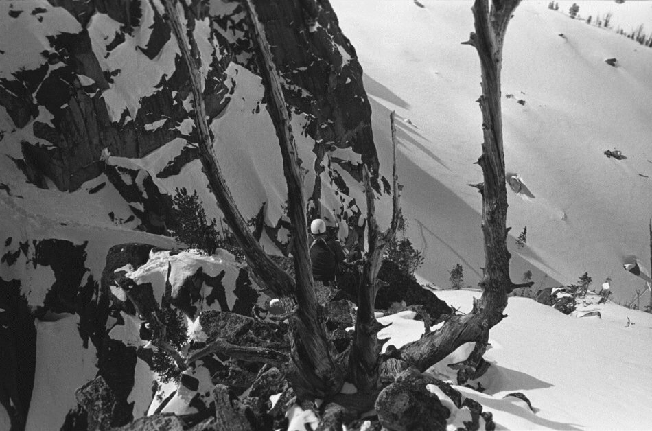
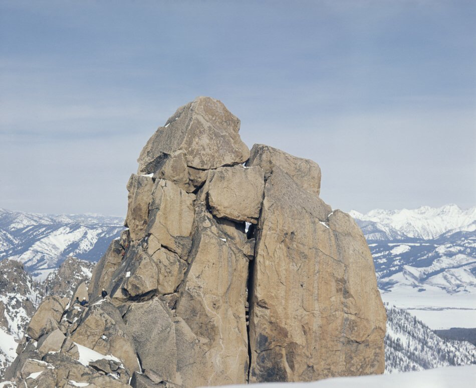
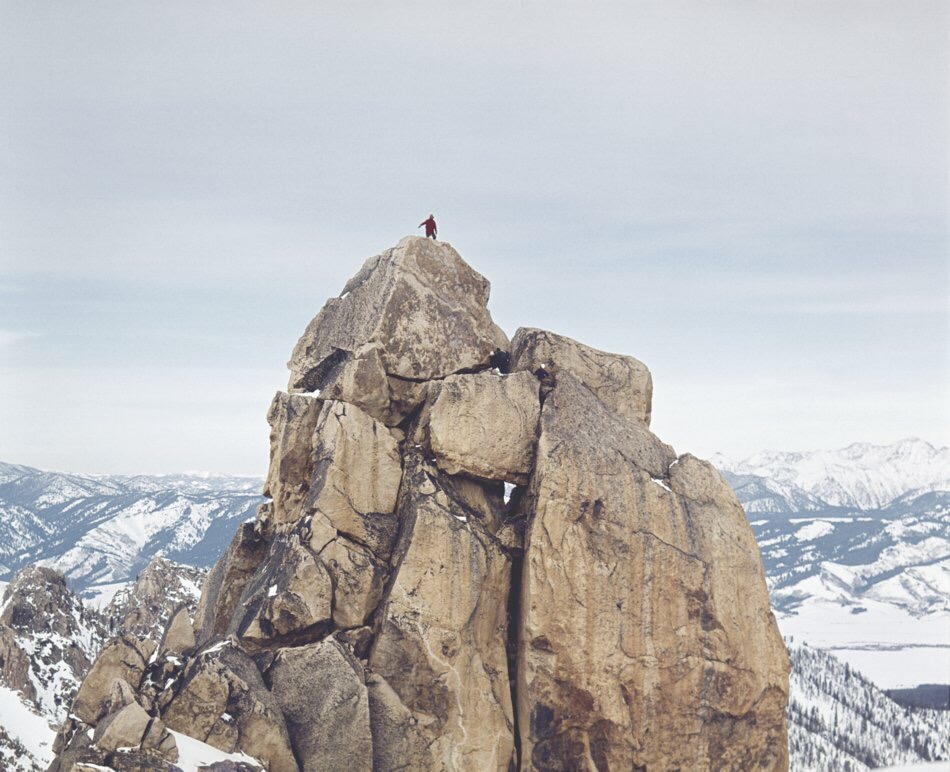
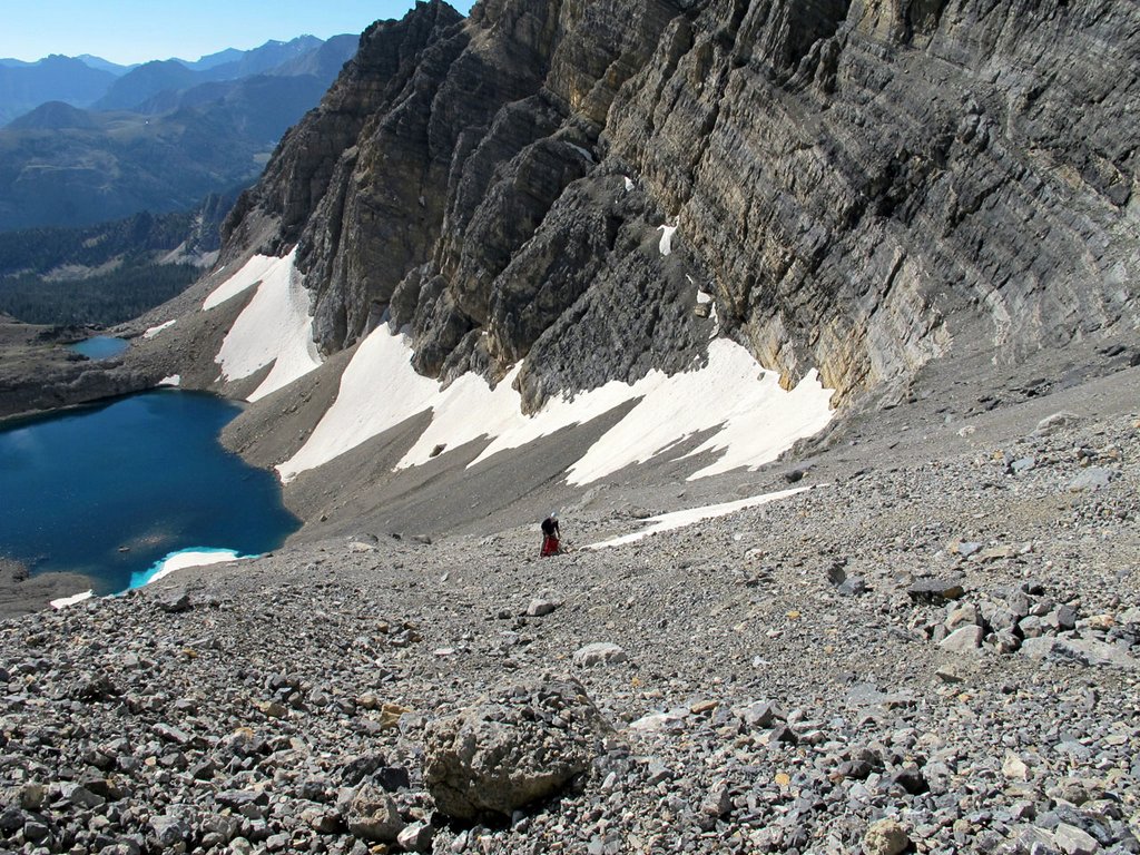
    The key to the climb. A tiny col where the East Ridge meets the Upper East Face. Cross the snow field “sky ledge” to get to the summit. Wes Collins Photo


    As I continued up the ridge, my doubts got bigger. The entire North Side of the East Ridge is very tall and overhung in several places. More and more I suspected it would dead-end into the headwall but, at the last possible minute, a tiny col opened up onto the uppermost ledge (which we named the “sky ledge”) that crosses the East Face. It wasn’t until that moment that I knew the ridge would go all the way. John Platt summed it up nicely in his trip report of JT peak as the almost magical opening of doors as you climb. This was one of the most fun parts of this outing. I couldn’t agree more.

    The descent follows the standard route down the mountain to the big saddle at 11,800 feet. From there, I dropped into the cirque that takes in the South Side of Mount Borah and Mount Sacajawea. There are several sections of Class 3-4 scrambling over short but loose cliff bands and several linkable snowfields, but the glissade run-out potential is pretty dangerous on most of the snowfields. At the 10,400-foot contour, the angle eases up. From there I hiked down and around the bottom of the East Ridge and finally back up to camp.

    This link will take you to an astounding video of the route by Mediocre Amature: Dirty Traverse Video.


    East Face/Northeast Ridge Variation

    Rating: Grade III 5.6 WI2
    First Ascent – July 25, 2012 Bob Boyles, Frank Florence

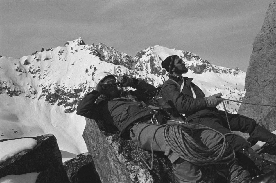
    While this route is not overly difficult, it does require a willingness to climb with long run-outs and minimal protection both at belays and while leading. Many of our belays were protected with a single piece of gear and most pitches only allowed for a few placements. Rockfall, both self-initiated and trundled from the summit, is an ever-present danger on this route.

    Frank on the approach to the East Face of Mt Borah.

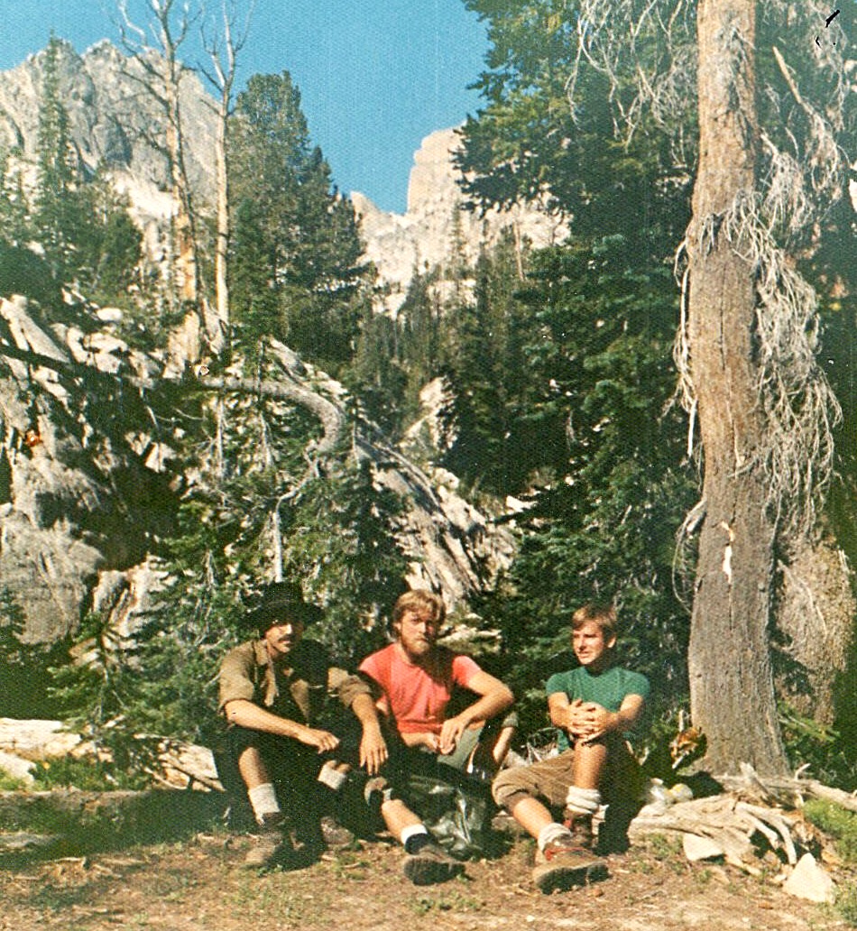
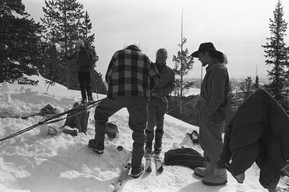
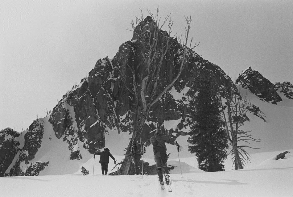
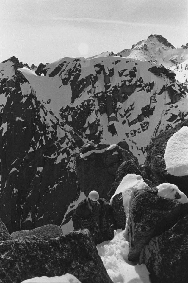
    Frank on the approach to the East Face of Mount Borah. Bob Boyles Photo

    The route starts slightly to the right of Wes Collins’ Dirty Traverse Route and follows the slab like ramps for about 6 pitches of Class 4 and low-to-moderate Class 5 climbing until you reach the ledge system that allows for an exit to the Northeast Ridge.

    From there we climbed two pitches of very steep snow and joined the ridge. On the Northeast Ridge, we encountered a short section of water ice (WI2) and several more pitches of moderate Class 5 climbing until just below the summit, where it turns to easy, but very loose, Class 3 and Class 4 climbing.

    Frank on the short snow pitch that leads to the Dirty Traverse ledge.

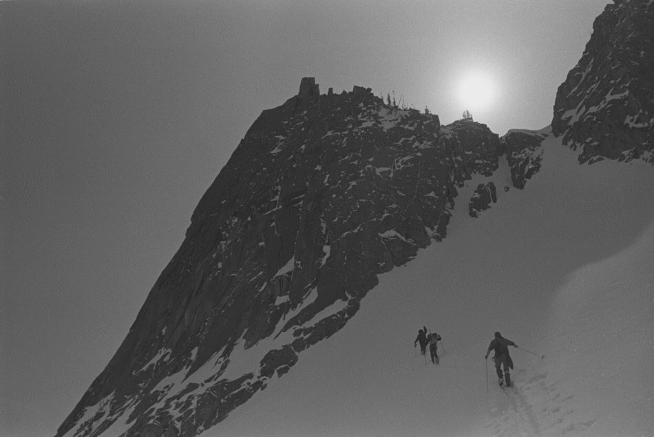
    Frank on the short snow pitch that leads to the Dirty Traverse ledge. Bob Boyles Photo

    This route is probably best done when there is some remaining snow to cover loose scree and talus (June/July) and, during some years, it may not be climbable at all due to the large cornice that can form and block the narrow exit to the Northeast Ridge. Parties willing to solo or simu-climb can reduce the overall number of pitches required on this route.

    East Face-Northeast Ridge Variation. Bob Boyles Photo

    East Face-Northeast Ridge Variation. Bob Boyles Photo

    Return to the main Mount Borah page. 

  • An 1884 Ascent of Mount McCaleb by J.D. Martin

    An 1884 Ascent of Mount McCaleb by J.D. Martin

    [Editor’s note: J.D. Martin was an early settler of the Lost River Valley. As he was nearing his 90th year, he wrote a memoir covering the early history of the Lost River area which was published in installments in the Arco Advertiser. This portion covers his ascent of Mount McCaleb in 1884. It also references other ascents of mountains in the Lemhi Range near Badger Creek but does not supply names. Badger Creek is located just below Diamond Peak. Martin’s obituary is set out below his trip report.]

    . . . From there we went on to Badger Creek where a number of mining locations had already been made. We climbed several mountains around there but could find nothing which incited us to remain very long. We took another trail, over what was also then called Pass Creek and came onto Birch Creek, a few miles below where the old-time ghost town of Nicholia was at that time quite a bustling and busy little mining town.

    A smelter was in operation and a population of perhaps two hundred people were living there. We then went on over the divide to another old time “ghost town” called Junction which was located on the east site of the Lemhi River about a mile from where the town of Leadore now is. This was also quite a bustling and active little town for that time and place. From there, we went on over the [Beaverhead] Range on the East Side of the Lemhis and prospected along the dividing line of the two territories of Idaho and Montana.

    We found nothing which we deemed worth locating and returned soon to Junction. We then concluded to go up the stream, then and now called Timber Creek, which comes into the Lemhis about a mile or so below Leadore. We endeavored to simply “course our way” without trails or guidance of any kind, relying solely upon our sense of direction. Wild game was so plentiful that we could in a few minutes after pitching camp, easily kill all the wild birds we wanted to eat. An abundance of the three camp essentials (wood, water and grass) were everywhere and we were well inured to outdoor and camp life.

    In passing around the divide between the headwaters of the Little Lost River and the Pahsimeroi, we somehow got onto a blind Indian trail which led us to a point and in a direction somewhat too far north. We came to a place where the higher mountains in front of us seemed to offer an impassible barrier to our further progress in the direction we were going. We found a good camping place for the night and were considering plans for retracing our steps next day. Next morning, Mr. Soloman was not feeling well and proposed that we lay over a day. Williams had seen bear tracks and, taking his gun, started out to add to his hunting laurels by killing a bear. I took a prospector’s pole, pick and started to climb the rough and rugged mountain which stood directly in front of our camp.

    After some hours of arduous and laborious climbing over fallen timber, rocky gorges and deep precipices, I arrived at the top. And behold I stood at the summit of Mount McCaleb. Well, lest this screed should exceed the limits of permissible space, I will here close with the promise that the next installment of this narrative will begin at the summit of Mount McCaleb. (ARCO, June 15, 1941)

    From the summit of Mount McCaleb and the date of about the last of August 1884. I do not deem it necessary to attempt  any kind of a detailed description of the view from the top of Mount McCaleb. I will say that, at that time, nothing contributed by human agency was visible from there. A long, winding fringe of deep green, reflected from the dense growth of trees which marked the course of Lost River (at that time far more abundant and extensive in every way than it is now) was quite visible and marked the course of the valley from the extreme northwest to the southeast. Upon the whole, it was really a sight never to be forgotten and it has always been something of a wonder to me to find so many people who have never been to the top of Mount McCaleb. I returned to the camp and was able to inform my companions—Solomon and Williams—exactly where we were. . . .

    J.D. Martin 1852 to 1942

    “GRAND OLD MAN” OF BIG LOST RIVER VALLEY SUMMONED

    Honorable James D. Martin Closes Career Tuesday Morning After Nearly 90 Years of Active and Honorable Life. [The Arco Advertiser April 17, 1942]

    Judge James D. Martin, known as the “Grand Old Man” of the Lost River Valleys, came to the end of the long, long trail Tuesday morning. His nearly 90 active and honorable years–more than half of them spent in this valley–closed Tuesday morning, and with his death closes the career of a man who was very much a part of the life of our community.

    He had been ill with a cold for several days, but he seemed somewhat improved when he retired Monday night. When he did not appear at his usual hour Tuesday morning, Mr. Daniels (hotel owner) went to the room where the lifeless body was found in bed. Only a short time before, Dr. Egbert said, had his spirit taken flight. Although he was known to be failing in health, the news of his demise spread to the remotest sections of our county and was a shock to all. There was a hushed silence as the death was announced because “Judge” Martin was known intimately by every man, woman and child in the Lost River country and to them he was both friend and counselor.

    Judge Martin wasn’t just an ordinary individual. Although he left his native state of North Carolina when he was a lad of 17 and, as a consequence of which, his education was sadly neglected, he was a man of brilliant intellect–a self-educated man. He continued the quiet dignified bearing of his early youth to the very last. He wrote many interesting pioneer articles for The Advertiser in recent years and always took a leading part in community affairs.

    Martin was born in North Wilkesboro, North Carolina in October 1852. At the age of 17, he and a boyhood chum left to cast their lot in the West. He followed the life of a nomad from then on for 15 years, spending time on the frontier in Colorado, Arizona, and California. In 1883, Martin was attracted to the Wood River country where a mining boom was underway and, naturally, he turned toward the Lost River Valley in 1884 as this valley was then attracting a great deal of attention.

    He filed on a homestead in what is now the Lost River precinct in 1884. He lived there during the required length of time and, between times, worked in the mines on the Wood River. After proving up on his claim, he settled down and became a gentleman farmer in this valley. His education had been improved during his spare time, as he studied hard to increase his many abilities. He taught the second school of record in this valley, and spent a year or more in similar work in Little Lost River Valley. Many of our “old timers” gained the fundamentals of their schooling–their three “R’s”–in the little schools he taught.

    Soon after the Lost River Valley began taking on airs as a “homeland,” he was elected Justice of the Peace. in this position, he served many  years. He became a confident and legal assistant to many of our first families. He performed marriages, spoke at funerals, settled estates and, in scores of ways, endeared himself to the people of the valley.

    He served in other official capacities also. he was County Commissioner during 1919 and for several years thereafter. The first highway construction work in this county—the road to Howe—was built and gravel surfaced during his administration. He was County Commissioner when the Irrigation District was formed. Later he retired as County Commissioner and served several terms as Probate Judge. He was always active in civic and fraternal affairs. He served as Treasurer of the Arco Lions Club during its existence. He “went through the chairs” in the Odd Fellows’ Lodge and for many years continued an active interest in that great fraternal organization. He made frequent trips to his old home in Wikesboro, North Carolina. He also visited a brother in Texas, who served many years as a district judge.

    For quite a number of years, Judge Martin made his home at the Dee Hotel at Arco and, during most of this time, he served as chairman of the Butte County Red Cross, an organization of which he held the highest regard. The successful membership campaigns and other activities engaged in by this humanitarian organization were always a great delight to Judge Martin. He was generous and kind-hearted. He gave generously to charity. He was far from wealthy but, by frugal management and simple wants, he garnered enough of the world’s goods to maintain himself during the years in the sunset of his life.

    Judge Martin seemed to feel that his days were numbered that when he was stricken with a cold about two weeks ago. He confided to friends that in all of his other illnesses he seemed to been able to overcome them, but on this occasion he told one intimate friend: “I feel that it is only a matter of time now, until I shall be called. I do not seem to be able to overcome this cough, but I am ready.” That was like him.

    He united with the Unitarian church in his youth and, although he did not affiliate with any other, he was quite a regular attendant at  services in this community dividing his time between the Baptist and the L.D.S. churches. Funeral services will be conducted this afternoon from the L.D.S. church officiating. Funeral arrangements are in charge of the Marvel Funeral Home and interment will be at Hillcrest. Services will begin at 2:00PM and several of his intimate friends are taking part in these rites. A nephew is expected to arrive from Texas. Thus a highly honored and respected citizen will remain with us in life.

  • The First Ascent of the North Face of Snowslide Peak by Art Troutner

    The First Ascent of the North Face of Snowslide Peak by Art Troutner

    [Editor’s Note: Art Troutner is a pioneering Idaho mountaineer who was involved in many firsts in the 1970s including the first Winter ascent of Mount Borah. In this article, he writes about a difficult first ascent of the Lick Creek Range’s most compelling North Face.]

    On July 4th, 1973, Bill Whitman (19 years old) and I (18 years old) made the first ascent of the North Face of Snowslide Peak. We took my brother Jim Cockey’s rack of Lost Arrow pitons and around ten Bongs and my diminutive rack of nuts and chocks along with one 90-foot length of Goldline nylon rope and an assortment of white slings, also on loan from my brother.

    When my brother had gone off to college, he loaned his climbing equipment to Bill who was forever borrowing it to climb Slick Rock. We suspected Bill’s infatuation with Slick Rock was more often than not used as a ploy to introduce some young lovely to the wonders of rock climbing. We hoped the best for Bill in his endeavors but never found out the results as he was not a braggart. All the same, due to his frequent infatuations, he racked up quite a lot of rock time on Slick Rock. So Jim figured Bill was a worthy recipient of the gear. Lord knows I had considerably less of the gumption that Bill showed for getting out on the rock.

    The north face of Snowlide Peak. The V-climbed by Troutner and Whitman is just right of center. John Platt Photo
    The North Face of Snowlide Peak. The V-climbed by Troutner and Whitman is just right of center. John Platt Photo

    All the same, I was intrigued by Snowslide’s imposing North Face and thought it was something I’d like to work up to. The fact that none of us knew anyone who had climbed it was an incentive that was hard to ignore. When I was 16, I was working on a house my dad and uncle were working on in Stanley, I used my free time to started gaining some climbing experience in the Sawtooths. 

    Art and Jerry on the way to start the Open Book. Art Troutner Photo
    Art and Jerry on the way to start the Open Book. Kathy Troutner Photo

    Now comes some jostling of my memory as to the sequence of events, but I believe the house construction was the same Summer that Jerry Osborn and I attempted the Finger of Fate, climbed the Stur Chimney Route on Heyburn, and climbed the back side of Finger of Fate.

    From left to rigjt, Art Troutner, the photographer and Jerry Osborne. Art Troutner Photo
    From left to right: Art Troutner, the photographer and Jerry Osborne. Art Troutner Photo

    Jerry lead the first pitch which, though not very exposed, is the most technical pitch. From there we traded leads. We used 2 ropes and 3 climbers. Jerry brought along a photographer acquaintance who we roped up between us.

    The attempt on the Finger of Fate involved a nasty slog in overripe Spring snow. I feel that we, in our utter ignorance, were smiled upon by the gods as I now know that the snow should have slid and ended my little story right there. At some point in the day, we realized our predicament and shifted over to the south a bit to some thin snow and navigable rock where we “felt” safer in our retreat to our sodden camp. We avoided a possible disaster and learned a lot from the experience.

    So working up to the Snowslide climb included a couple trips up the Open Book on the Finger and a trip up Warbonnet with Pierre Saviers. One of the Open Book excursions was in September 1972. This was a 2-team effort that met at the top for a group photo which included one of our party (Tom McLeod) posed while intensely studying his Physics book. Tom’s photo won the honor of gracing the Wall behind our physics teacher’s desk.

    Anyway, by the time July 1973 rolled around, I must have felt enough seasons had taken place to attempt the dark and vertical North Face of Snowslide Peak. The day of the climb we were up at dawn, drove my Mom’s Citroen at speed to the trailhead and were hiking by 7:30AM. About 45 minutes later, we arrived at the lake and made our way around to the base. Here we encountered the permanent snow field (not anymore) that wedged up against the start of the climb. This was a favorite boot glissading spot on previous trips to the lake.

    Bill Whitman on a winter climb of the Finger of Fate.
    Bill Whitman on a Winter climb of the Finger of Fate.

    The “route” from here was pretty simple. The face is concave but trending to a V shape on its right side. As long as we stayed in the V we knew it would lead us to the high point of the face. As the face is very fractured for its entire length we just ascended what looked easiest and didn’t stray too far left or right. There were plenty of holds but many of them were loose. We had to be very careful to not drop any rocks down the face as we belayed. All in all, it was not pleasant rock to deal with. We never felt very confident in the protection or the belay anchors we set. 

    The overall face is very steep with several small, reach-over type, overhanging ledges. Fortunately, there were places where we could gather our wits a bit and rest. I remember them as pockets where 2 could sit. The rock was consistently loose until a couple of rope lengths from the top where things improved. 

    As it is a north facing, very steep face, the temperatures for the 4th of July were quite cool. While climbing, we watched folks at the lake bathing. It seemed quite incongruous but also somehow reassuring or even comforting to see some normality as we felt quite cut off from that. 

    We realized early on in the climb that retreating off this thing did not present a pretty picture. The realization was that the best way down was up. So, we got lucky. The face was consistent: loose holds and steep, but doable. Just had to pay attention to the holds and not drop anything on the belay man.

    We got to the top around 3:30PM to the sounds of bleating sheep who were grazing unconcernedly right up to the 800+ foot drop. We were elated to have arrived! The sheep not so much. Our reward? Beer and Brass Lamp pizza by 6:00PM.

    Art Troutner “back in the day.”
    Art Troutner at 15.
  • The First Winter Ascent of the Finger of Fate by Jacques Bordeleau

    The First Winter Ascent of the Finger of Fate by Jacques Bordeleau

    The first winter ascent of the Finger of Fate was made on March 19, 1973 by James Christopher Hecht, Harry Bowron, Gordon K. Williams and Joe Fox. I was part of the support team which also included Art Troutner and John Platt. I took the color photos. I developed the black and white photos that were shot by the ascent team.

    1. Our first day was spent skiing up Hell Roaring road down in the forest, the end of the road being Camp I. Semi-unplanned as it was we hooked up with a Boise contingent of the DFC&FC* on the ski in, boosting our group to seven adventuresome lads. The second morning we were greeted with scenery. The fickle "Finger of Fate" is seen pointing skyward in this view from the outlet at Hell Roaring lake, flanked by the Arrowhead and the Birthday Cake on the skyline. * Decker Flats Climbing & Frisbee Club
    Our first day was spent skiing up Hell Roaring Road down in the forest, the end of the road being Camp I. Semi-unplanned as it was we hooked up with a Boise contingent of the DFC&FC* on the ski in, boosting our group to seven adventuresome lads. The second morning we were greeted with scenery. The fickle “Finger of Fate” is seen pointing skyward in this view from the outlet at Hell Roaring Lake, flanked by the Arrowhead and the Birthday Cake on the skyline. *Decker Flats Climbing & Frisbee Club
    2. Looking SW from the Hell Roaring Lake outlet, toward Imogene lake, which is up and around the spectacular canyon beyond. This was my first winter expedition and at this point I remember being extremely impressed with the snow forms on the mountains. Everything about the Sawtooths was magnified by being there in winter. I was 22 years old in 1973 and it may as well have been the Himalayas to me.
    Looking southwest from the Hell Roaring Lake outlet toward Imogene lake, which is up and around the spectacular canyon beyond. This was my first Winter expedition and, at this point, I remember being extremely impressed with the snow forms on the mountains. Everything about the Sawtooths was magnified by being there in winter. I was 22 years old in 1973 and it may as well have been the Himalayas to me.
    3. The second day we humped from the road end to Hell Roaring lake, where the climbing began. Carrying heavy packs up to high Camp II was tough. The 3rd morning dawned a little funky but cleared up after a while.
    The 2nd day we humped from the road end to Hell Roaring Lake, where the climbing began. Carrying heavy packs up to High Camp II was tough. The 3rd morning dawned a little funky but cleared up after a while.
    4. The North Face of the Finger, showing the "Open Book" route in deep shadows, not a nice climb in winter. It was attempted repeatedly before selecting an alternate plan.
    The North Face of the Finger, showing the “Open Book” route in deep shadows, not a nice climb in Winter. It was attempted repeatedly before selecting an alternate plan.
    5. Gearing up in the morning. Nice equipment, huh? I believe those are my hickory 215 cm Sundins Mountain Skis from REI, with screwed in metal edges, and my surplus canvas + aluminum frame pack. I fondly remember treating the ski bases with Pine Tar so wax would adhere properly. I don't miss doing it anymore though. The Silveretta cable bindings were versatile and enabled amazing winter travel, though stylish turns were difficult. Also my classic aluminum cup.
    Gearing up in the morning. Nice equipment, huh? I believe those are my Hickory 215CM Sundins Mountain Skis from REI, with screwed in metal edges and my surplus canvas + aluminum frame pack. I fondly remember treating the ski bases with Pine Tar so wax would adhere properly. I don’t miss doing it anymore though. The Silveretta cable bindings were versatile and enabled amazing Winter travel, though stylish turns were difficult. Also my classic aluminum cup.
    5. Gearing up in the morning. Nice equipment, huh? I believe those are my hickory 215 cm Sundins Mountain Skis from REI, with screwed in metal edges, and my surplus canvas + aluminum frame pack. I fondly remember treating the ski bases with Pine Tar so wax would adhere properly. I don't miss doing it anymore though. The Silveretta cable bindings were versatile and enabled amazing winter travel, though stylish turns were difficult. Also my classic aluminum cup.
    Gearing up in the morning. Nice equipment, huh? I believe those are my hickory 215 cm Sundins Mountain Skis from REI, with screwed in metal edges, and my surplus canvas + aluminum frame pack. I fondly remember treating the ski bases with Pine Tar so wax would adhere properly. I don’t miss doing it anymore though. The Silveretta cable bindings were versatile and enabled amazing winter travel, though stylish turns were difficult. Also my classic aluminum cup.
    7. Soft morning light kisses the powder snow 'Good Morning', as Gordon leads off toward the climb on Day 3.
    Soft morning light kisses the powder snow ‘Good Morning’ as Gordon leads off toward the climb on Day 3.
    Skiing up from Camp II the morning of March 19, 1973. A cloudy dawn turned into a fine day.
    Skiing up from Camp II the morning of March 19, 1973. A cloudy dawn turned into a fine day.
    9. A closer look at the Open Book route.
    A closer look at the Open Book Route.
    Ascending the colouir to the West Ridge saddle.
    Ascending the colouir to the West Ridge saddle.
    11. Looking back down the col toward Camp II, with someone working their way up the track way below.
    Looking back down the col toward Camp II, with someone working their way up the track way below.
    12. Sitting atop the buttress west of the Finger, making a plan, before the climbers go scramble back down to the saddle and head up the West Ridge route.
    Sitting atop the buttress west of the Finger and making a plan before the climbers scramble back down to the saddle and head up the West Ridge Route.
    16. Rappelling down the Buttress back to the saddle.
    Rappelling down the buttress back to the saddle.
    The Finger of Fate viewed from the buttress, with Hell Roaring Lake snowed over down below, looking east toward the Sawtooth Valley. Our cars are waaaay out there. Big bad Castle Peak on the horizon.
    The Finger of Fate as viewed from the buttress, with Hell Roaring Lake snowed over down below, looking east toward the Sawtooth Valley. Our cars are waaaay out there. Big bad Castle Peak is on the horizon.
    15. If you see the rope, follow it upward and you'll notice Gordons' head (center) peering out from a belay position above a pitch.
    If you see the rope, follow it upward and you’ll notice Gordon’s head (center) peering out from a belay position above a pitch.
    A casual belay.
    A casual belay.
    Looking down at the saddle.
    Looking down at the saddle.
    The Buttress west of the Finger, as seen from the Finger. I took up a position on top of the buttress with my Graflex to shoot pics back toward the Finger, while the rock climbers worked on their goal. You see the route up and down the buttress in the disturbed snow.
    The Buttress west of the Finger as seen from the Finger. I took up a position on top of the buttress with my Graflex to shoot pics back toward the Finger while the rock climbers worked on their goal. You see the route up and down the buttress in the disturbed snow.
    Looking toward the Arrowhead, Sevy Peak and the Birthday Cake displayed prominently on the skyline.
    Looking toward the Arrowhead, Sevy Peak and the Birthday Cake displayed prominently on the skyline.
    West view from the Finger of Fate, Chris coming up.
    The view west from the Finger of Fate. Chris is coming up.
    Belay on! View is to the NNW, with Decker Peak the more distant summit on the right.
    Belay on! View is to the NNW with Decker Peak the more distant summit on the right.
    Harry leads a nice pitch.
    Harry leads a nice pitch.
    The lads are now seen lower left if you look closely, watching as Harry leads a line. These are the pics I shot from over on the buttress.
    The lads are now seen (lower left if you look closely) watching as Harry leads a line. These are the pics I shot from over on the buttress.
    Looks like Gordon belaying the next climber up, while Harry pokes around.
    Looks like Gordon is belaying the next climber up while Harry pokes around.
    Making a leap of faith. There is a large gap from one boulder to the next, which takes a measured leap to do properly. Don't come up short, but really don't overshoot the landing.
    Making a leap of faith. There is a large gap from one boulder to the next, which takes a measured leap to do properly. Don’t come up short, but don’t overshoot the landing either.
    Harry on the summit block.
    Harry on the summit block.
    Detail summit photo, First Winter Ascent, March 19, 1973. L to R > James Christopher Hecht, Harry Bowren, Gordon K. Williams, Joe Fox.
    Detail summit photo of the first Winter ascent (March 19, 1973). Left to right: James Christopher Hecht, Harry Bowren, Gordon K. Williams and Joe Fox.
  • Off Belay Magazine —The Sawtooth Issue 1975

    Off Belay Magazine —The Sawtooth Issue 1975

    Off Belay Magazine was THE climbing magazine of its day. The following articles contained the most extensive discussion of the Sawtooth Range yet published in 1975. Special thanks to Ray Brooks for providing the scans. (Click on the scans to enlarge)


  • The First Winter Ascent of Mount Regan

    The First Winter Ascent of Mount Regan

    The following newspaper article covers the first Winter ascent of Mount Regan. Joe Leonard has written an extensive account of this climb. See The Lost and Wandering to read Joe’s account which is an excerpt from his  2016 memoir The Son of Madam of the Mustang Ranch. Read more about Joe in the Contributors Section of this website.

    Click on the article for a larger version