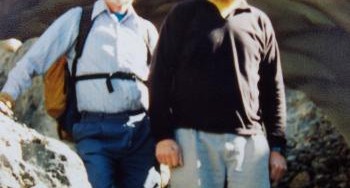
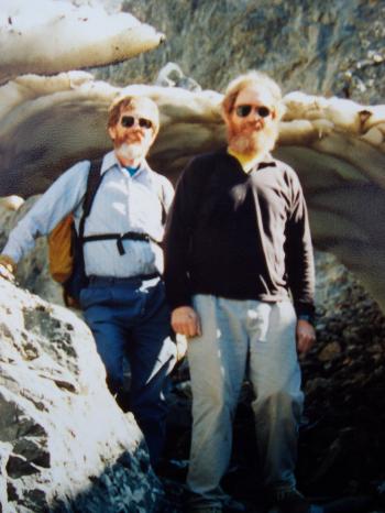
Bill March was a British mountaineer and ice climber who, along with Rick Albano, is credited with the first Winter ascents of Leatherman Peak and White Cap Peak in 1975. He came to Idaho at the request of his friend Harrison “H” Hilbert and was associated with the Idaho State University Outdoor Program in the 1970s. The American Alpine Club has a brief biography which is worth a read. Click on the following link: Bill March
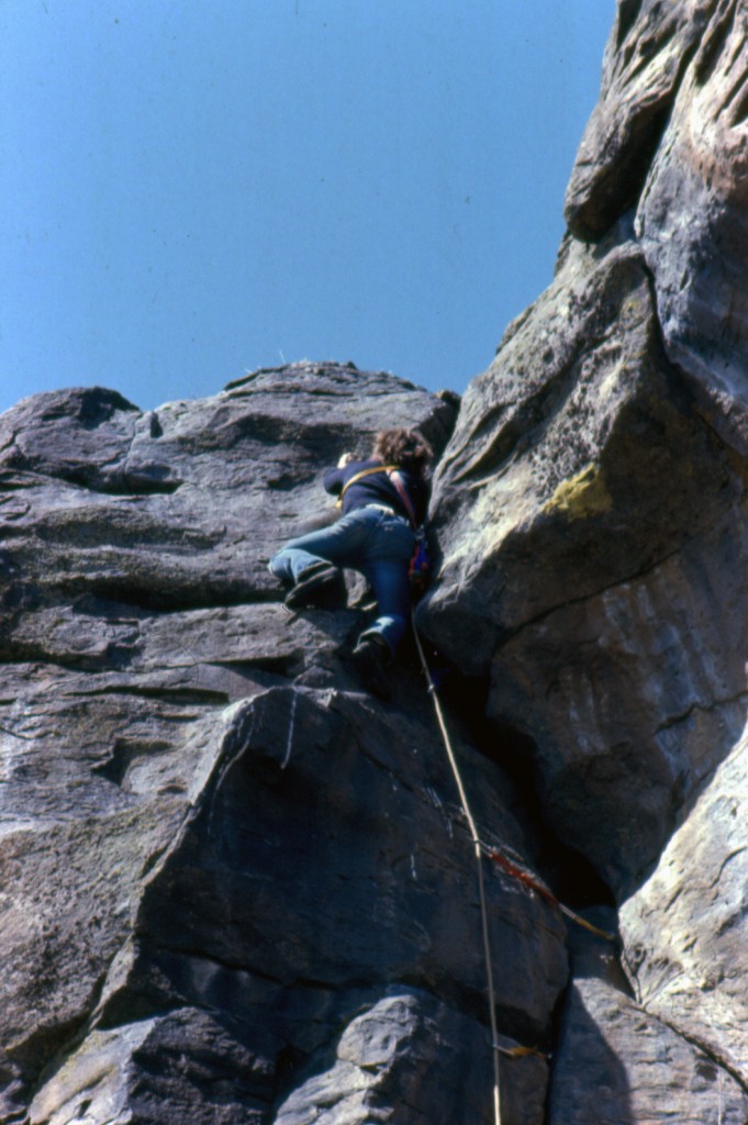
During the Summer of 1972, three of my friends and I took a basic rock climbing class at Table Rock from Frank Florence, a rock climbing instructor who had just opened a shop (Sawtooth Mountaineering) on Fairview Avenue. Frank and his father Lou moved to Boise from New York City in pursuit of a new life out West where the mountains were taller than the buildings on Wall Street. After that initial class, the 4 of us (Carl, Mike, Guy and I) were totally hooked on this new sport and we started to buy climbing gear so that we could continue with our newfound pursuit. We managed to get one trip to Slick Rock near McCall before Fall came and the rain and snow pretty much shut down the high country.
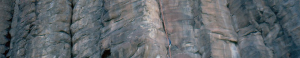
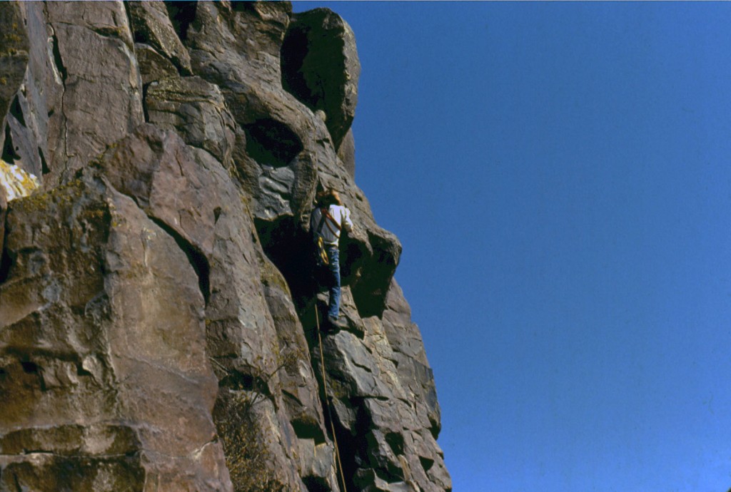
The unimproved dirt road to Table Rock was notorious for holes when it was wet and walking up wasn’t much better so, on a whim, we ventured out ID-21 to check out what we called the “Black Cliffs.” The area had a reputation for being dangerous and we were warned that some of the basalt columns might collapse if we tried to climb them. We never had a problem with the columns being unstable but we did learn to set our belays way off to one side to protect the belayer from the rocks that had to be cleaned while working on a new route.
On earlier Boy Scout hikes in the area, we had stumbled upon a large den of rattlesnakes on what is now called “The Dark Side” so we were pretty cautious about sticking our hands into cracks without taking a close first look. As it turned out, we never found a single rattlesnake on the highway side of the cliffs and later we were told that someone had used dynamite to blow up the den that was found in the main canyon (Car Body as it was later named). We scouted around the cliffs on the left side of the canyon and soon found a line that looked feasible so we roped up and climbed it. I think I took the first lead but as soon as we were done we roped up and did it again. After that first climb, we used the route as a warm-up on future trips and coined the name, The Standard. We soon realized that the black basalt was a magnet for heat even with the low angled sun of Winter and continued to climb and put up new routes throughout the Winter.
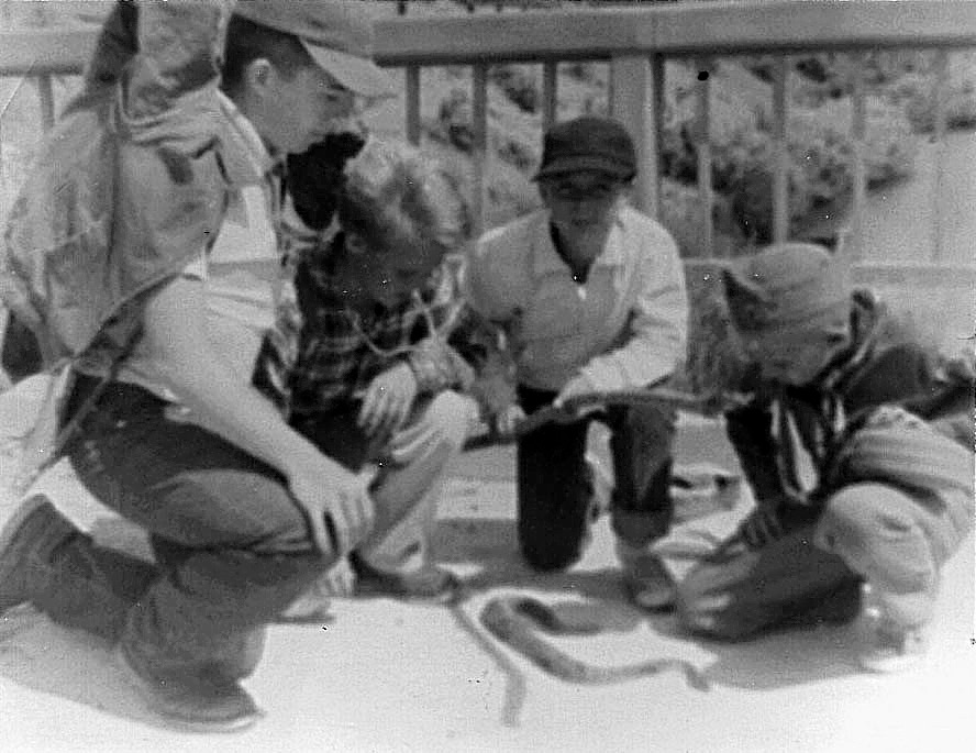
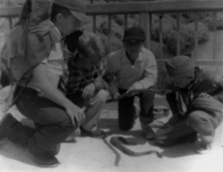
Boy Scout Troop 77 at the black cliffs in 1963 and a big rattlesnake. Ed Boyles Photo
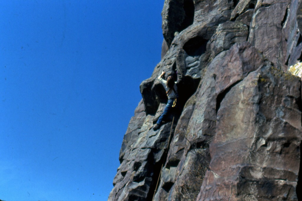
It didn’t take long for word of our discovery to spread in the small climbing community that had formed at Sawtooth Mountaineering, but the stigma of being a dangerous place to climb took a little longer to go away. When the Spring of 1973 came, we pretty much switched our main focus of climbing to the Cliffs and the only other people we saw during the Spring was Tom McLeod and his climbing partners. Tom, one of the hottest climbers at Table Rock and never one to want to just repeat someone else’s climb, started working on new hard routes on the right side of Car Body Canyon. Because we had a friendly rivalry, we never told each other what we were working on until it had been completed.
Bottom-up, on-sight leads were the standard and grabbing a piece of gear or resting on it was considered aid climbing even if no one saw you do it. To us, it was simple. Free climbing was all free and any use of gear to make progress was aid. If a new route was top-roped, it was only because there was no way to protect it with the gear we had and it was noted as being a “top-roped climb”. We figured if we couldn’t do a route with the gear we had, we just weren’t good enough and we would have to get better. Pitons were almost never used due to the fact that they didn’t work well in the flared cracks and the use of them could cause the rock to expand and break.
Yvonne Chouinard had just introduced hexes and stoppers to the climbing world and they turned out to be the best and safest gear we could get to use in the natural features of the basalt. The use of bolts would come later after clean climbing ethics of the 1970s were not adopted by the next generations of climbers. The use of bolts opened up climbing on a large number of new, hard routes that could not be climbed safely without their use. The rock climbing standards in the valley rose higher as a result. I can’t recommend that any modern sport climber should use what was a common anchor back then on the top of the cliff–an improvised V-thread anchored to sagebrush.
By the Summer of 1974, the Black Cliffs had become quite popular. Most of Boise’s small community of climbers were visiting and climbing there. Our exploring took us all the way down towards the end of the cliffs near the Lucky Peak Dam and Tom ventured across the dam to start putting up some very hard routes on what is known as the “Dark Side.” At some point, Tom hooked up with Bob Jahn, a Gunks climber who had moved to Boise from back east. Tom, who had set the standard for the hardest routes at the Cliffs (5.9), soon pushed the standard higher (5.10) when he and Bob started climbing together. This was at a time when the hardest routes in the country were rated 5.10 so, with little doubt, those two were at the cutting edge of free climbing standards in the country at that time.
Later, in the 1970s, Doug Scott, the renowned Himalayan climber from England visited Boise on an invite from Lou Florence and put up a route that bears his name in Car Body Canyon. Lou also invited the renowned solo climber, Henry Barber for a visit to Boise and he spent an afternoon climbing at the Black Cliffs. During this outing, he free-soloed a new route to the amazement of all those who were lucky enough to be there and watch. During the 1980s, Tony Yaniro (the prolific Joshua Tree climber) spent most of the Summer in Boise and out up new routes at the Cliffs. Later, the young Pete Takada was climbing and perfecting his technical rock climbing skill at the Cliffs.
As for any climbing that occurred before the 1970s, the only traces we ever found were some old iron ring pins that looked to have been used for rappel practice. I had heard that the Hari Clark (who worked at Bob Greenwoods Ski Shop) had trained the National Guard out there but I can’t confirm that. Bob Greenwoods was the first shop in Boise to carry modern climbing gear and offer professional rock climbing instruction from Hari and Tom Naylor before they got out of the rock climbing business.
All photos by Bob Boyles except where noted.
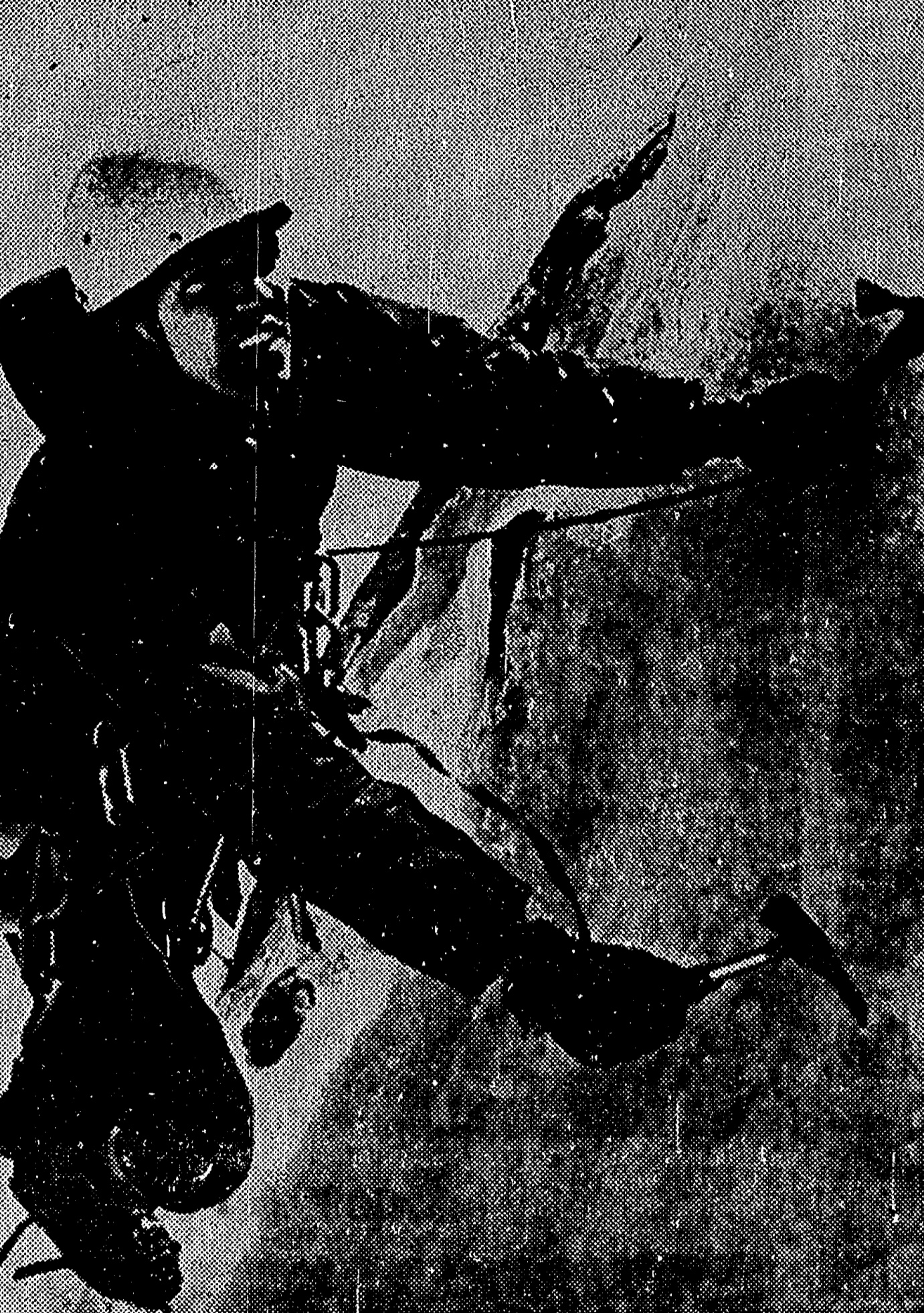
Guy Carson, Carl Sheets and Mike Weber posing for the camera in Car Body Canyon (Fall 1973).Mike Weber leading the “Roof,” now known as “Bloody Crack.”Rick Rosell leading a new route at the Tall Cliff section of the Black Rocks.Frank Florence working the crux at the Black Cliffs.Bob Boyles stretching for a move on the left side of Berry-Berry in Car Body Canyon. Mike Weber PhotoBob Boyles taking a break for the camera near the top of the cliff. Mike Weber PhotoGuy Carson near the top of Barry-Barry in Car Body Canyon.Bob Boyles leading the “Roof” (“Bloody Crack”). Mike Weber PhotoIn 1975, Doug Scott, fresh from his ascent of the Southwest Face of Everest, came to Boise to give a talk at the shop about his recent ascent of the Southwest Face of Everest. He wanted to get in some climbing while in town and a posse quickly assembled. We went out to the Black Cliffs for what turned out to be a toasty day. Scott asked what had been done and what hadn’t and then led through a couple of each. Lou Florence took the photo. Left to right: Bob Boyles, Bob Henry, Doug Scott and Frank Florence..Bob Boyles checking out Wounded Knee at the Black Cliffs for the first time in February 1974. “Soon after, I bought some tube chocks from Sawtooth Mountaineering and went out and completed it with Frank Florence.” Mike Weber Photo
And now for some recollections of John Platt:
I remember trying to climb out there with pitons. They would ring like a mother as you pounded them in, then rotate 30° when you put weight on them. This because the cracks flared as they went in. Not confidence inspiring. So we didn’t do much out there until clean climbing and hexes/stoppers. Of course for me, “we” almost always meant me and McLeod.
Back then, there weren’t any chains. So we climbed to the top, sometimes making the final move in dirt, then tied off to sagebrush for a belay. Kick some spots for your heels (in rock shoes) in the dirt. I think we were still employing this tactic in the late 1980s.
In the late 1980s, McLeod was doing some very hard stuff. I recall going to Car Body Canyon and climbing overhung routes. Tom would lead them, but I couldn’t follow. We called these “thrash and dangle” because the overhangs were always near the top, and I would get past the last piece, then fall off (after thrashing), hanging in space (dangle). Tom didn’t want to lower me 60 feet off a sagebrush, so I would clip jumars and ascend to the top.
1963 Boy Scouts Snake Hunters
Bob Boyles provided the following photos from 1963. Future Idaho explorers start early in Idaho. Bob relates “I was 10 and didn’t get to go on the Boy Scout hike because I wasn’t old enough to join for another year. I was standing there when the “troops” of Troop 77 came back with the rattlesnake that almost bit one of them.”
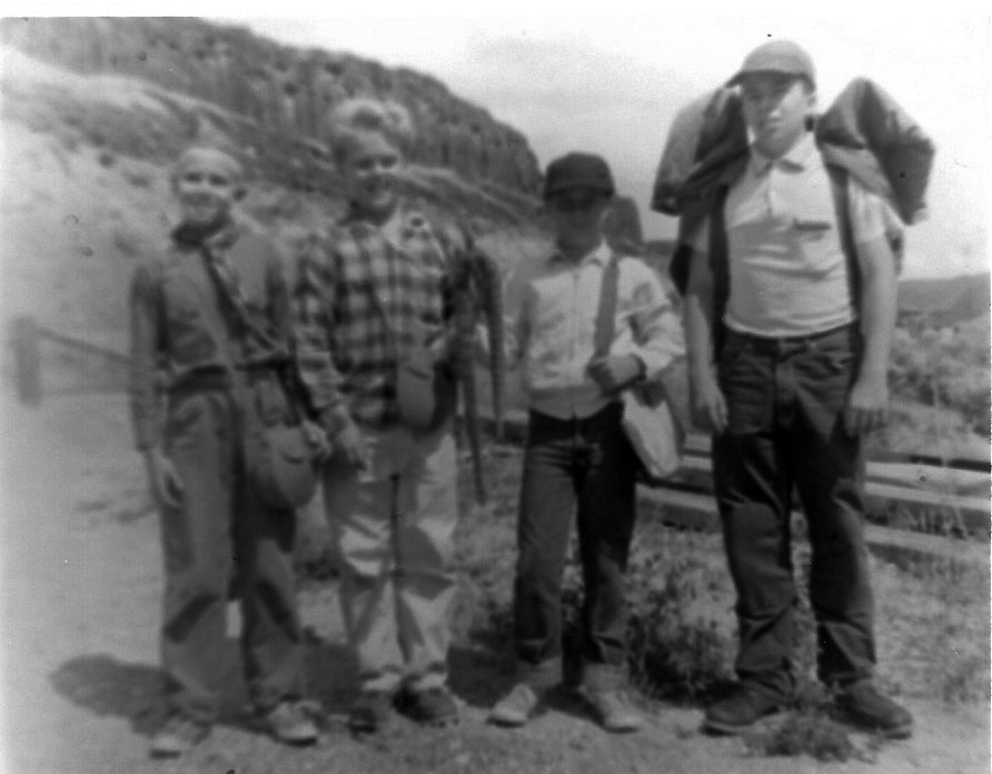
Boy Scout Troop 77. Ed Boyles PhotoThe kid in the scout uniform is my late brother George. He’s the one who did the handstand on top of the big rock at Table Rock. Boy Scout Troop 77. Ed Boyles PhotoGeorge Boyles is first on the left. Boy Scout Troop 77. Ed Boyles Photo
The late Chuck Ferguson (1940-1998) is not as well known as one would expect, considering his accomplishments as an Idaho climber with a peak (at least unofficially) named after him. I met Chuck in the early 1980s during my working at the Idaho Falls YMCA. I was organizing community fun runs in Idaho Falls and Chuck ran in all of them. As a public school math teacher, Ferguson was a stickler for accuracy and I was told more than once that my 10K courses were not measured accurately. I did not realize he was a climber until 1993.
I discovered that he was more than a runner when I climbed Peak 11509, now named after Chuck. Perhaps a good starting point for my discovery was August 15, 1993 when I finally climbed the peak. The 11,509-foot, cliff-rimmed mountain that divides Dry Creek and Long Lost Creek on the back side of the Lost River Range is a daunting challenge. The day before (from Far and Away Peak) I had spotted a gully on the Southwest Side of the peak that looked climbable. It was and when I reached the top, it looked untouched. But then I found a little meat snack tin tucked into the rocks. Inside the tin was the name Chuck Ferguson along with the date June 29, 1978.
Anyway, after my adventure I felt compelled to call Chuck and compare notes. Turns out he climbed the dicey East Side line from Swauger Lakes to reach the summit. His route involved crossing a catwalk snow bridge on the peak’s narrow South Ridge. Apparently we had something in common, as we climbed together over the next several years on a dozen peaks or more peaks.
During his life, he climbed Borah Peak 25 times and climbed hundreds of other Idaho peaks and undoubtedly recorded several first ascents including a difficult route on Brocky Peak in the Pioneer Mountains. Looking over Chuck’s peak list, I see Warbonnet was the second peak he did after Borah. Talk about diving in head first. In addition to Brocky, his other first ascents are Pegasus (July 29, 1994) and Straight Shot (October 21, 1995). He shared his climbs with relatives, colleagues, students, and friends and left an enduring legacy in Idaho’s climbing history. Climbing was something that he was good at, but Chuck’s passion was running.
He completed 100 of the 26.2-mile marathons and several ultra-marathons, almost winning the Lake Tahoe 72-miler. He began climbing mountains in 1976 as a training tool. All together, Chuck climbed over 200 peaks, including 54 Colorado Fourteeners. Warbonnet was the second peak he did after Borah on July 16, 1977. In fact, he and David were first known Idahoans to complete the 54 Colorado Fourteeners on August 21, 1998.
Chuck Ferguson (left) and David Ferguson (right) in Jones Creek after climbing No Regret Peak (July 1994). Rick Baugher Photo
I wrote this article about the first ascent of the North Face of USGS Peak for the Idaho State Bar magazine, The Advocate. They wanted me to write an article to demonstrate that attorneys could have a life apart from their legal practice. This article recounts the first ascent of the North Face. It was originally published in The Advocate, published by the Idaho State Bar in the July 1997 issue, Volume 40, No. 7. The peak’s page is found at this link: The climb took place in August 1995. USGS Peak
I climb with my wife. For us, spare time means weekends and vacations. The typical climbing weekend begins as the prior weekend ends. As our truck reaches the pavement. Dana, my wife asks “What shall we climb next weekend?”
“I’m not sure I can go. I have a hearing the following Monday.”
“Can’t you get ready before the weekend?”
“I’ve got to write three briefs this week. I’ll have to work all night.”
“The weather can’t last forever. We should take advantage of it.”
“I know, I’ll work late.”
“Me too. What shall we climb?”
“What shall we climb?” is a loaded question for us. Its kind of like “to be or not to be?” for poor old Hamlet. There are too many options, too many summits. We talk about the options and then agonize about the decision because time is so limited.
Monday and Tuesday. Work, work, work. At home, it’s chores. At lunch, its running. In between, we pick a peak: The North Face of USGS Peak in the Lost River Range. To our knowledge, the face has never been climbed. Its one of those peaks that has haunted us for a long time. Three earlier attempts on the peak over the last 15 years came up short. One brief is finished.
Wednesday. Wednesday evening is usually the drop-dead date for packing and planning. We must collect the maps, pick the route, pack the packs and buy the food because we will be too tired on Thursday. Brief number two is done by 4:30PM.
Thursday. Its time to finish the third brief and draft an outline for the Monday morning hearing. A new case comes in and I find an answer is due by today. Between witnesses and opposing counsel, too much time is spent on the phone. I run at lunch time. A case settles, gotta draft a release, oops, time to go home. At home, the garden needs water and the equipment needs checking. We look at the maps and go to bed.
Friday. The drive to the East Side of the Lost River Range will take at least 5 hours, so we plan our escape for the early afternoon. The third brief is done. At 3:15PM, we are in the truck and heading for the freeway. From Boise, we drive east to Bliss, Shoshone and Arco. Lava fields and small towns pass by and the mountains to the north and east grow closer. At Arco, we buy gas and drive east to Howe. Its 6:00PM and we are pointed north on Little Lost River Highway.
The good roads end at Clyde. We follow the Wet Creek Road west to the Dry Creek cut-off road which runs northwest. At about 6:45PM, we arrive at the shattered Dry Creek Dam which was, according to one story, blown up as a result of a water rights dispute in the 1920s. We stop for a break. The most difficult 4 miles and hour of the drive are ahead. The sun is dipping down behind the Lost River Range Crest. The shadows bring coolness.
The road down from the top of the dam is reminiscent of a roller coaster ride. One turn and the road is nothing more than a talus slope which pitches out and sharply down at a wicked angle. The Jeep bounces and stammers, the wheels throw gravel and its over. I release my death grip on the steering wheel.
It’s now time to ford Long Lost Creek for the first time. The creek is wider than I remember, but we plunge in anyway, making waves with our bumper. The gravel stream bed supports us and we cross without incident. Its starting to get dark. In another mile, we cross the creek again. A quarter mile farther and we reach a grassy, water-logged meadow. The stream has divided into numerous rivulets which liquefy the earth. No cell phone will reach a tow truck from this remote spot. We have visions of the truck sinking into the meadow and, tired of driving, consider setting up camp without crossing the meadow.
We realize that if we do not continue, we will have a much longer climb the next day. So we go on. Mud oozes and water sloshes around the truck. We creep from one mud hole to the next, finally reaching the mother of all mud holes. “What do you think?” Dana asks. “Someone drove through here,” I say without much confidence. We explore the mud hole on foot, it has a bottom, and we drive on. Suddenly, it’s over. There is dry ground under us. The road is now surprisingly good and the last bit goes quickly. We have made it to the proverbial end of the road.
The Long Lost Valley is a difficult place to reach but is well worth the effort.
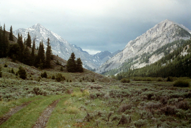
Time to make camp in the twilight. The tent goes up, the sleeping bags are unpacked, the headlamps and novels are thrown in the tent, water is located, a late-night snack is gobbled up and suddenly it’s quiet. Massacre Mountain, a long hulking ridge, towers above one side of the valley while the canyon walls on the other side of the creek climb to the summits of several unnamed peaks. A deer crosses the meadow. The wind shifts slightly and the sound of the creek rolling down the canyon reaches our ears. It’s cool now. The trees sway with the breeze and I fall asleep while my untouched novel lays at my side.
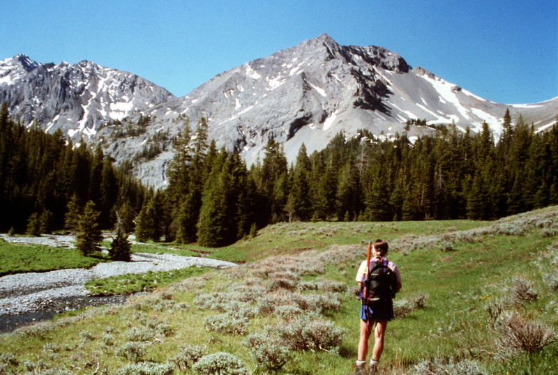
Saturday. Well, OK, not the crack of dawn but a respectable 7:30AM. Time for a quick breakfast, then we load the packs. At 8:10AM, we’re on the trail, an old trail that has seen little use in the last 25 years. We hike through stretches of fir and pine separated by sagebrush-covered flats toward the headwall at the end of the canyon. The trail has disappeared. As the route climbs up a steep slope through an avalanche run, my legs remind me that it’s going to be a long day.
After the road ends, there is a sketchy trail that can be followed in places. It is, for the most part, missing in the meadows but appears in the trees.
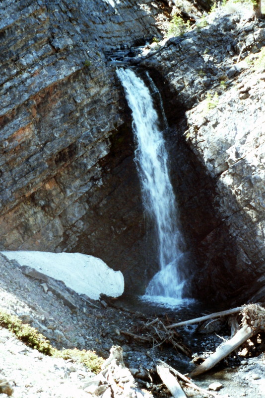
A short distance ahead, we encounter a 100-foot waterfall dropping over vertical rock walls. Following the stream is out of the question. We located a route and start up the side of the canyon. The detour involves climbing 200 feet up a steep, dusty slope. From this point, a 75-foot loss in elevation brings us back down to the stream above the waterfall. The next obstacles (two smaller waterfalls) are not as time consuming to bypass. An hour has gone by.
The highest waterfall along the approach route.
A detour around a 4th waterfall brings us to a spot where the valley opens up into a hanging valley. A small tributary stream flows down from a side canyon, tumbling out of a long snow slope. Our route climbs up this slope to the cirque above. Do we get out our ice axes and crampons to climb the snow or do we climb the rocks to the left? Decisions, decisions. We opt for the rocks to save time. The slope is at least 300 feet high (100 feet higher than the Capital’s dome in Boise) and it takes us nearly 30 minutes to navigate our way to the top.
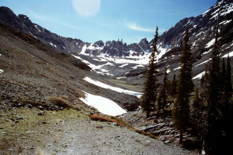
Above the waterfalls, the valley opens up into a spectacular high valley.
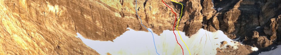
One hundred yards farther and we reach a small pond fed by melting snow. A thin glaze of ice covers its surface, a sure sign that the elevation is well over 10,000 feet. From the pond, we catch our first glimpse of the North Face of USGS Peak. The face is steep (as we knew it would be) but wow, it really looks steep. Slender snow ramps climb up the shadow-covered face. We snap a couple of photos and look at the wall through a monocular. Dana suggests a possible route. We discuss it. I give it my benediction, “Yes, it will go,” meaning that there are no obvious obstacles and what we see ahead of us doesn’t scare me.
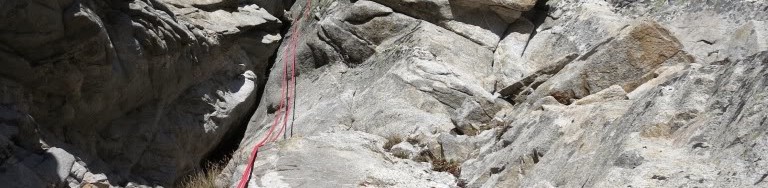
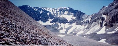
The North Face of USGS Peak.
The intervening terrain is strewn with boulders and patches of snow. Although we picked the easiest route across the broken surface, it still takes 20 minutes to arrive at the face. It’s now time to unpack the ice axes and crampons and to decide whether a rope is necessary. The 1,500-foot slope above us rises at about 45 degrees. We opt for speed and leave the rope. Our ice tools are our only protection. The first pitch is 200 feet high, steep and the snow covering is still rock-hard in the morning shadows. At times, we hit water ice and neither the points of our crampons or the pick on our ice axes will make a dent. We use our ice axes to cut several steps across the ice and soon reach a rock buttress. Rather than remove our crampons, we climb up with our crampons clinking and scraping on the rocks. The footing is good and we scramble up the rock to the base of a snow chute that climbs to the summit ridge, another 1,000 feet above. Another hour has passed.
“It looks good.” We are now 500 feet up the slope and the base of the cirque is spread out below us like the view from an airplane. The tops of the ridges that enclose the cirque are nearly level with us but the summit ridge seems no closer than it was 30 minutes earlier. We use our axes to cut a small platform and sit down to rest. The snow has varied in quality as we climbed, from “Styrofoam like,” to water ice, to unconsolidated, rotten snow where we have fallen through the crust to our waists. Anything that gets loose on the slope will end up in the rocks 500 feet below in no time at all.
We continue cutting steps across water ice. Our quadriceps ache and our calves cramp, but we go on. We reach a rock band which constricts the snow chute and climb onto it for a change of pace. The rock quickly becomes too steep and we move back onto the snow. I’m counting my steps now to take my mind off my weariness. I set a goal. I’ll try to go 200 steps before I rest. I make it to 247. Time to cut more steps. Dana takes the lead. Each blow from the ice ax sends a cascade of ice down the slope. The air is completely still except for our labored breathing. Above the water ice, the slope moderates and the summit ridge cuts the sky. Another 15 minutes and we are on the summit ridge. The summit ridge is narrow but easy walking and we soon reach the top.
A small register in a can records only the name of Rick Bauger of Idaho Falls who climbed the peak from the south one year earlier. We snack, enjoy the view, discuss other possible routes on the peak and drift into our own little worlds. The wind picks up, reminding us that it’s time to go down. We both know the descent is probably more dangerous than the climb up. We say nothing. We’ve climbed together for nearly 20 years and safety concerns are communicated non-verbally. Two hours later, we are back in camp.
Sunday. Sunday we follow a trail to a nearby lake and hike to the top of the high point above it. It’s a nice change from the icy North Face but its anticlimactic. We still have the return hike, the swampy meadow, 2 river crossings, a talus slope and a 5-hour drive ahead of us. We decide to start for home. The next trip must be planned and, somehow, we have to get our heads back into our work.

 —Idaho Statesman June 30, 1973