Category: Geology

  • A Sawtooth Range Glacier

    A Sawtooth Range Glacier

    This article from the Idaho Statesman was published on August 1, 1926. In 2018, we know that there are no active glaciers in Idaho. Pettit Lake is the only landmark mentioned in the article, so it is safe to assume that the glacier was located west of the lake. Based on the distance and size measurements set forth in the article as well as the name Snowyside Peak, I think that the North Slopes of Snowyside Peak is a possible location. I added a photo of the North Side of the peak at the bottom of the page. See also The End of the Last Idaho Ice Age by Bob Boyles.


    Along with its balmy climate, industrial opportunities, scenery and potatoes, Idaho can also boast of those phenomenal masses of ice, the awe inspiring beauty of which each year entices thousands of tourists to Switzerland. One of the few glaciers in the State of Idaho can be found far into the upper reaches of Idaho’s Alps (the Sawtooths) 20 miles up from Pettit Lake at an elevation of approximately 10,000 feet. Extremely difficult to access and far from the paths of men, this mass of ice is today practically unknown (even to native sons) and has not been named.  

    The glacier lies in an upland valley. It is oblong in shape and is estimated to be a mile in length and half-mile wide. Due to the probable irregularities of the valley floor, there is no accurate way of determining its supposedly great depth. The surface is rugged, very irregular and slanting. 

    The claim of this body or ice to the name “glacier” cannot be doubted. It is neither an overgrown snowbank nor the frozen surface of a mountain lake and possesses all glacial properties to the least details. Its interior formation is essentially that or the glacier, being made up of layers of solid lice, which is really frozen snow and seepage water under terrific pressure. At its crest is found the firn, a mass of granular snow which forms the upper part of glaciers. In its surface are crevices, so large and forbidding that as yet no man has dared venture near enough to determine their depth. And, as more substantial proof, it is slowly but inexorably moving, descending between the confining precipices of granite, pushing a moraine (a mass of accumulated debris) ahead of it and leaving a scarred trail on the bedrock in its wake.  

    The ascent from Pettit Lake to the glacier is so rugged and difficult that only a few more hardy nature-lovers have made the trip. The trail (only a dim outline) is so steep and dangerous that it is necessary to travel practically the entire distance on foot. But, dangerous and exhausting as the trail is, those who follow it to the journey’s end will find themselves amply repaid. To the brave belong the spoils.

    Was the glacier located below Snowyside Peak’s northern face?
    Was the glacier located below Snowyside Peak’s North Face?


  • Lyman Marden

    Lyman Marden

    Lyman Marden was a member of the USGS team that surveyed the Borah Peak quadrangle. He wrote an article entitled Climbing the Slopes of Mount Borah—the Dean of Idaho Peaks about the survey. This article appeared in the Idaho Statesman in 1935. In 1950, he wrote the following report for the Boise Public Library.


    —An account given to the Boise Public Library on April 15, 1950 by Colonel Lyman Marden, a member of the party that surveyed the Borah Peak quadrangle and placed the benchmark on the top (September 13, 1934).

    Located halfway between Mackay and Challis, Idaho. Elevation 12,665 feet above sea level. Highest in the State. Approached via Highway 93 to Challis and Highway 93 toward Mackay or via Highway 20 to Arco, thence to Mackay and toward Challis.  

    The Challis approach is enriched by the Salmon River country through which Highway 93 runs. 

    The Arco-Mackay approach is one of great contrast. The Lost River Range, which culminates in Borah Peak, begins as low hills near Arco on the edge of the Snake River Plain. From there, the Range rises to a long series of peaks over 11,300 feet and several over 12,000 feet. See United States Geological Survey, Topographic Map, Borah Peak Quadrangle 1934-35.  

    A road crosses the mountains just a few miles from Borah Peak through Doublespring Pass and gives access to beautiful country at the headwaters of the Pahsimeroi River, one fork of which rises from the North and East Faces of Borah Peak. These headwaters are scenic with long, grassy slopes called Horse Heaven and at a higher elevation Goat Heaven, and a backdrop of perpendicular mountain faces carved out by glacier action. Small caves may be found at surprising places in the high ridge between the forks of the Pahsimeroi. Good but limited camp spots are available. Obtain Forest Service advice at Challis or Mackay and local ranchers’ advice on springs, streams, wooded areas, etc. 

    Rivers and creeks in the near vicinity of Borah Peak are of the Lost River type and are apt to lose themselves in the gravel of the valleys for many miles only to reappear. Big Lost River and Little Lost River lose themselves in the Snake River Plain.

    The Pahsimeroi River reappears just before emptying into the Salmon River. Fishermen say it is a peculiar shock to run out of water while fishing downstream. There are many interesting phenomena in the general area. Almost certainly some of the peaks have never been climbed. There are castle rocks and pinnacles, hanging lakes, big springs, and distorted and twisted strata. Just north of Borah Peak on the edge of the Pahsimeroi Valley and east of Doublespring is an old volcanic crater containing a crater lake, part of the volcanic action represented by the Craters of the Moon National Monument many miles to the south. It is believed that a large meteor left a wide pockmark in the Pahsimeroi Valley near the upper edge of a distinctive alluvial fan close to the North Face of the Pahsimeroi Mountains. Those who desire to climb Idaho’s highest peak are advised to seek a road to the base of the mountain that leaves the Challis-Mackay Highway 93 quite close to the Dickey Ranch and Post Office. The view of Borah Peak from Dickey will reveal a long, curved ridge ascending to the top. The base of the ridge nearest Dickey is divided by a shallow draw slightly darkened by scrub timber. Ascend the shallow draw and continue along the converged, sharpened ridge to the top.

    The Lost River Range viewed from the summit of Mount Borah by Lyman Marden, USGS 1934.
    The Lost River Range as viewed from the summit of Mount Borah by Lyman Marden (USGS 1934).


  • Climbing the Slopes of Mount Borah—the Dean of Idaho Peaks

    Climbing the Slopes of Mount Borah—the Dean of Idaho Peaks

    Editor’s note: This article from The Idaho Statesman (February 10, 1935) was written by Lyman Marden, one of the participants in the 1934 USGS mapping of the 15-minute Mount Borah quadrangle. 


    The Idaho Statesman (February 10, 1935).

    By Lyman Marden 

    During the season of 1934, the United States Geological Survey began the mapping of the Borah Peak quadrangle that includes about 900 square miles of territory around Mount Borah. In charge of the work as chief of party was Lee Morrison, topographic engineer, who first announced in 1929 that his calculations had identified an unnamed peak in the Pahsimeroi Mountains of the Lost River Range as being much higher than Mount Hyndman. It was officially named for Idaho’s famous senator, William E. Borah, about a year later. 

    This veteran Idaho topographer returns each year to the state to advance the mapping of many sections, and each year a great fund of information becomes accessible to parties interested in the terrain covered. This is a part of the plan to eventually map the entire United States on a practical, useful scale. The map of this quadrangle will be of great use to the Forest Service in the Lemhi National Forest and to ranchers and agencies in the area. 

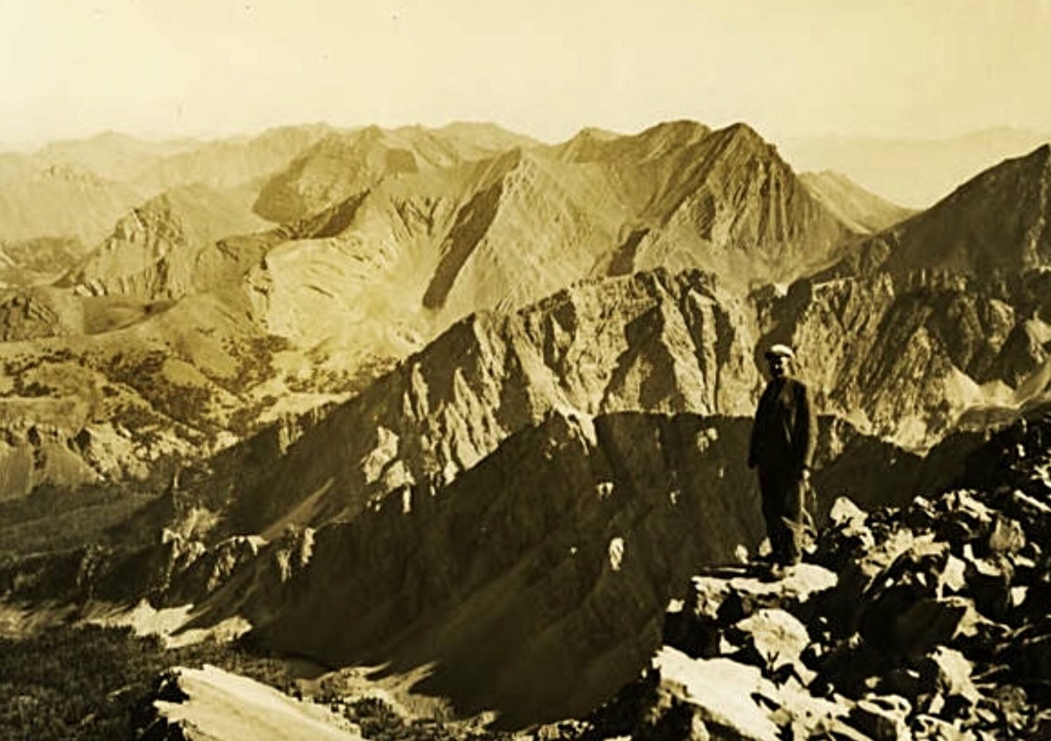
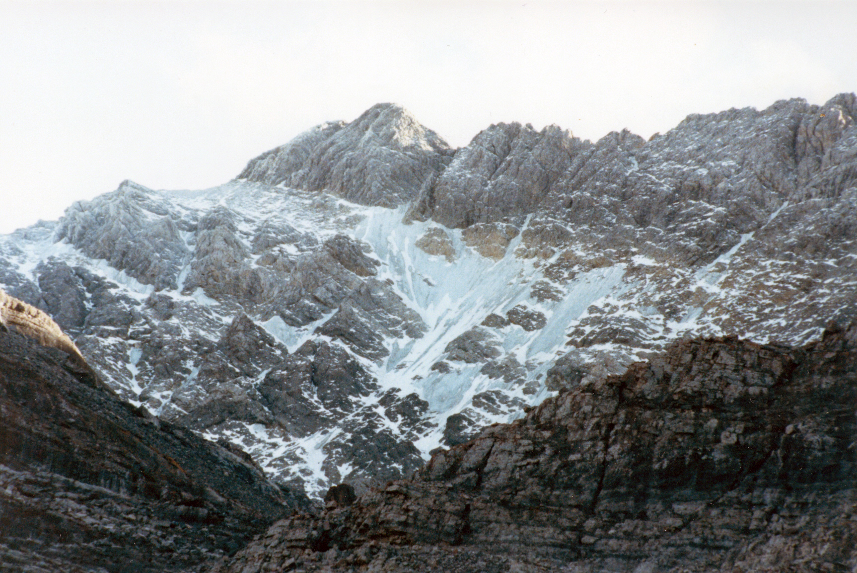
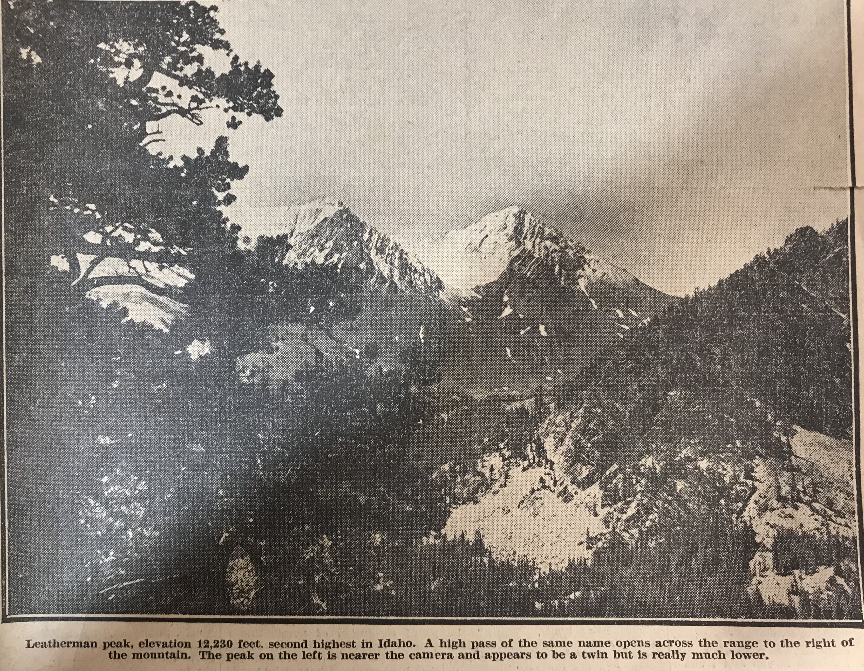
    For general information, it now becomes known that Idaho has several peaks that are higher than Mount Hyndman. From memory these are as follows: Mount Borah (12,655 feet); Leatherman Peak (12,230 feet); Diamond Peak (12,200 feet). Diamond Peak is in the Little Lost River Mountains [Lemhi Range] and, out of curiosity, we calculated its elevation. Since this was done from a distance of 20 miles, it may be slightly in error but hardly enough, we think, to change its allocation among the high points. Then comes Mystery Peak [Mount Idaho] at 12,120 feet and after that, so far as we now know, comes Mount Hyndman at 12,078 feet. Mystery Peak is our name for a mountain peak next to Mount Borah and we so named it because of its elusive-appearing summit.  From no two views does it look the same and at first we thought it must have a double summit, but later learned that its shape gives it a different skyline from the varied views. 

    Among the states’ highest points in the United States, Mount Borah is ninth in elevation, eight states having as high points a peak of greater elevation than Idaho. All these high points are in the west. As a graphic example, there is no elevation east of the Rockies that quite comes up to the altitude of Shafer Peak, just north of Boise, at 7,591 feet. 

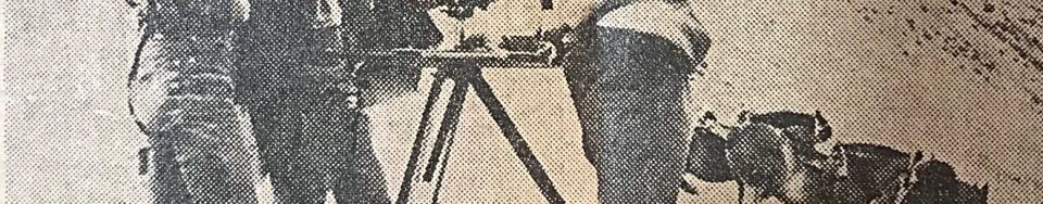
    To make up the engineering party that would begin the accumulation of these facts, men were assembled from various points in the state by orders from H. H. Hodges, division engineer in Sacramento, California (his initials distinctive in repetition), arranged quickly a party of absolute strangers whose only common bond was engineering and orders from H. H. H.

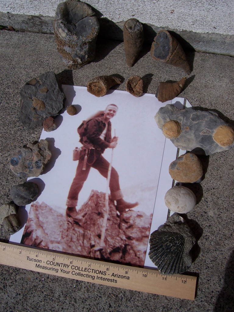
    L.C. Walker of Twin Falls and the author unknowingly rode the same train into Salt Lake to meet the chief and Mrs. Morrison. From there, we took two trucks and supplies back into Idaho and on to Mackay where we met F.F. Hayford of Boise, who had been ordered to meet us there. Additional supplies came from the survey stores in Idaho Falls and a reserve warehouse in Challis. L.V. Carothers from the East Fork of the Salmon met us in the first camp with horses and packs. Accompanying him came Jim Bruce of Challis and the party had come together as smoothly as synchronized cogwheels.  

    From this first camp at the foot of Mount Borah, the work began in earnest. We had already begun the mapping and some of the Lost River Range was taking form in contours on the paper. For persons familiar with the country the south edge of the quadrangle runs just behind Mount McCaleb and north of Mackay and crosses the Lost River Valley cornering south of Chilly. From memory again, Mount McCaleb is 11,595 feet high. From this baseline, the map is a square (30 miles on a side) running northward and taking in most of the Pahsimeroi Valley and part of the Little Lost drainage. [Note: these surveyors were working on a 15-minute quadrangle.]

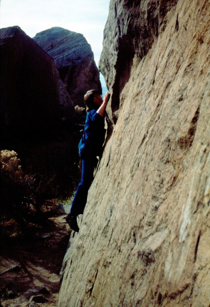
    The interest of the entire party in the climbing of Mount Borah became evident as soon as camp was settled. The pros and cons of possible routes of ascent were argued on many occasions, but we were delayed many times in our plans due to inclement weather. The season was peculiar and good weather was imperative so that we might take the instruments, set the benchmark on top and take pictures. 

    In the meantime, the work gathered momentum through practice and we were soon up to top speed. Moves of the camp and numerous side camps brought all the many the distinct features to light while the map grew like a living thing. Thus, we studied the ascending mountains as they gradually gain altitude to culminate in the state’s highest  point. After reaching Mount Borah they drop off about 1,500 feet and descend toward the Salmon River.  

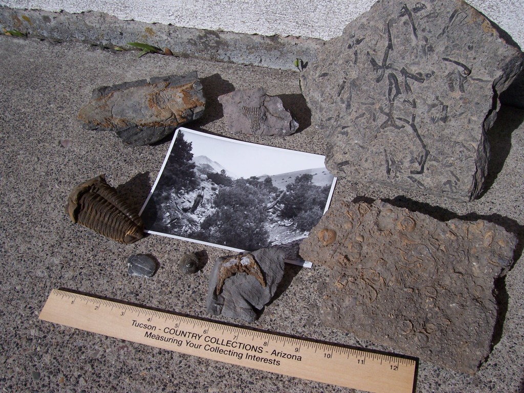
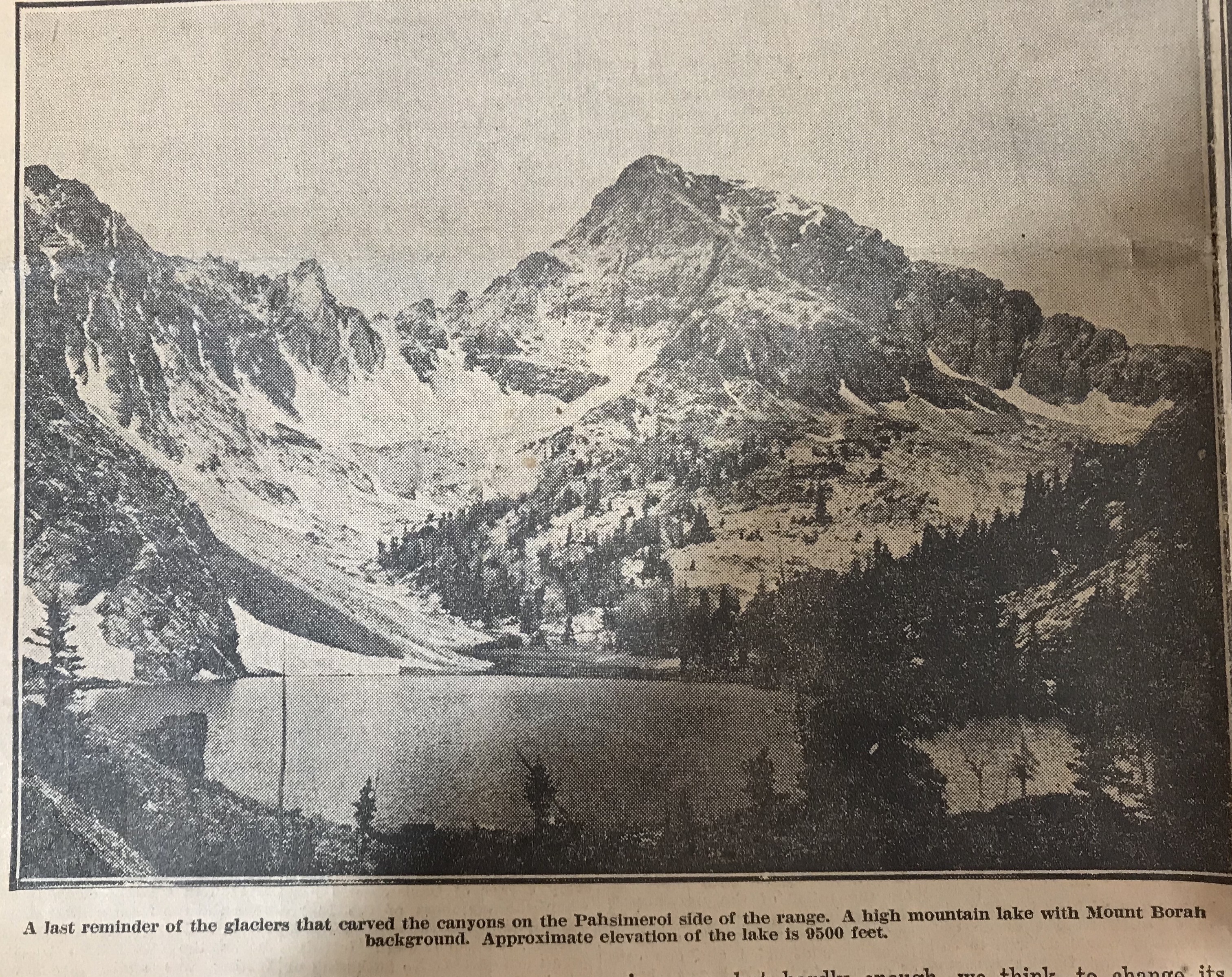
    In the glacial canyons on the Pahsimeroi side, we read the reason why a limestone peak tops Idaho’s basic granite. A very ancient lake bottom of water deposit limestone has been blown upward by a mighty volcanic upheaval that left markings of its power on the faces of sheer mountain walls. Glaciers and violent storms gouged and tore at the mountains until now we may see a range marked differently on all sides and interesting things appear in secluded parts. Several high mountain lakes occupy glacial basins under the sides of Mount Borah and their outlets plunge down hundreds of feet of swift cataracts to the Pahsimeroi River. Much rough and picturesque country may be found under Leatherman Peak and that mountain itself should be a very interesting climb for those so inclined.  

    Of course only a few miles away, Mount Borah rises more than 400 feet higher and takes primary interest. For those who might like to stand some day on the top of Idaho, the peak stands in full view about four miles east of the Al West Ranch at Dickey. It would be a good idea to get directions there before attempting the ascent. Dickey is situated about halfway between Challis and Mackay on the highway and from there one may drive to the foot of the peak.

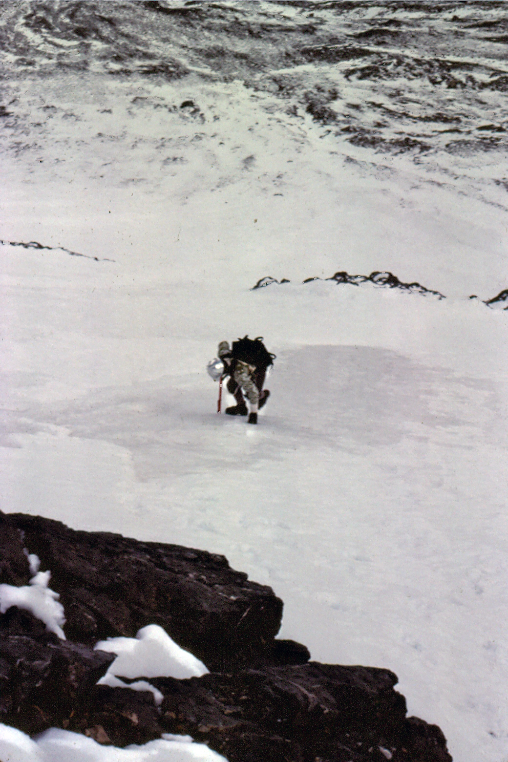
    Our camp was placed at the Birch Springs at the mouth of an open draw on September 12 and we began the climb the next day. Contrary to the reputation of the number, the 13th was a perfect day. It would have been quite impossible to have picked a better. 

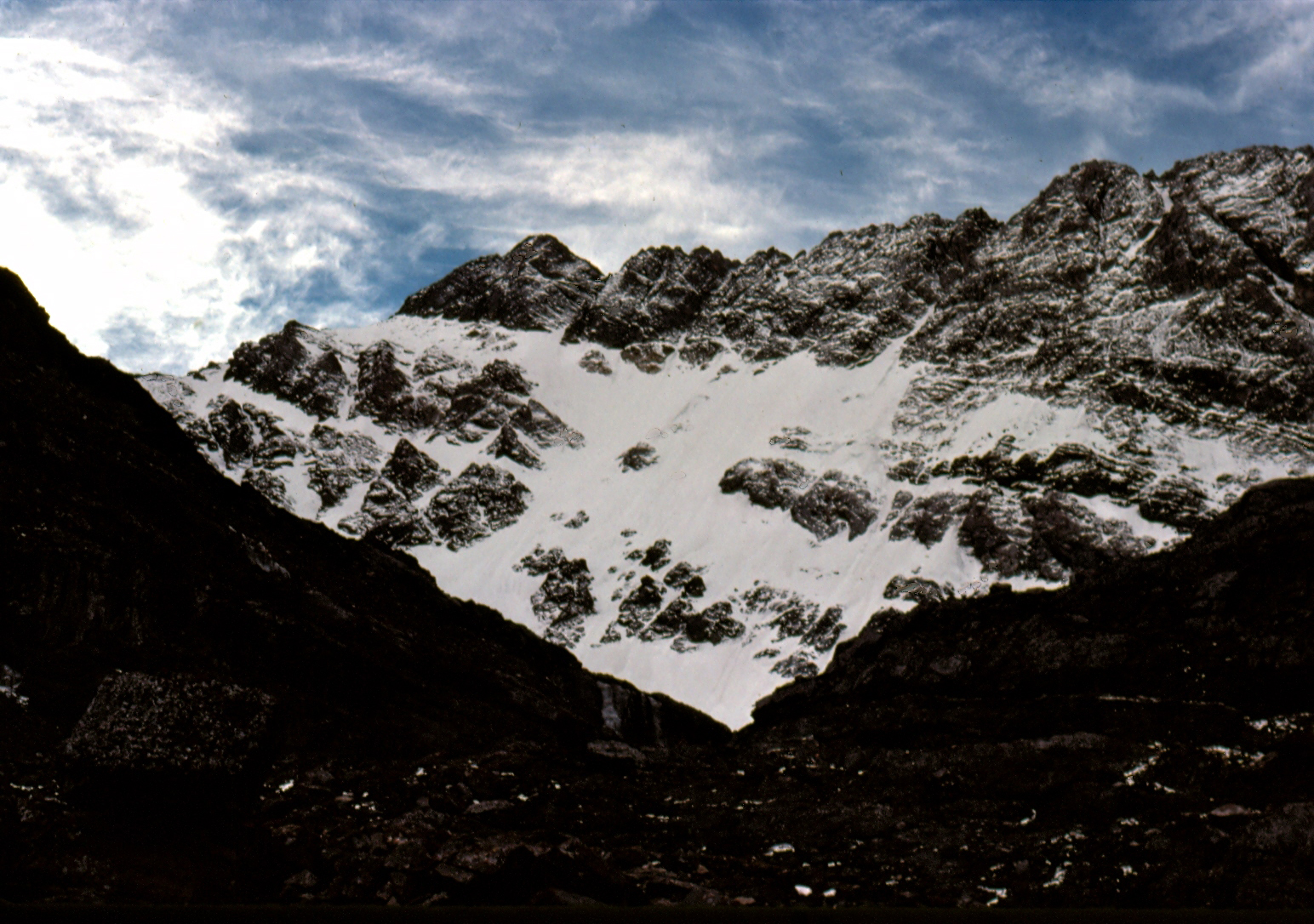
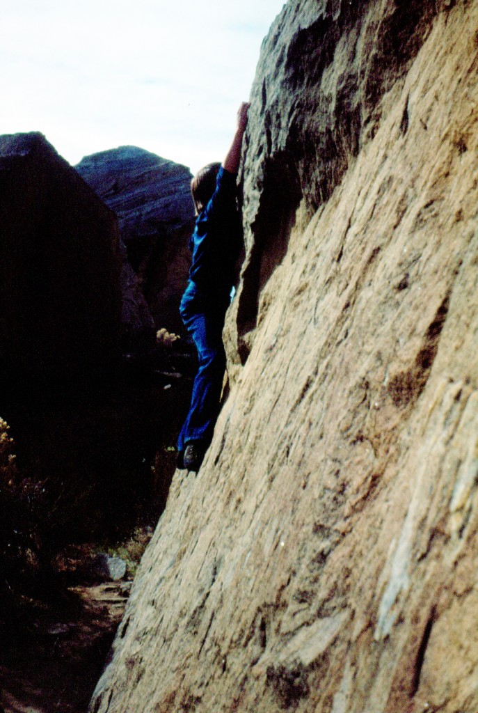
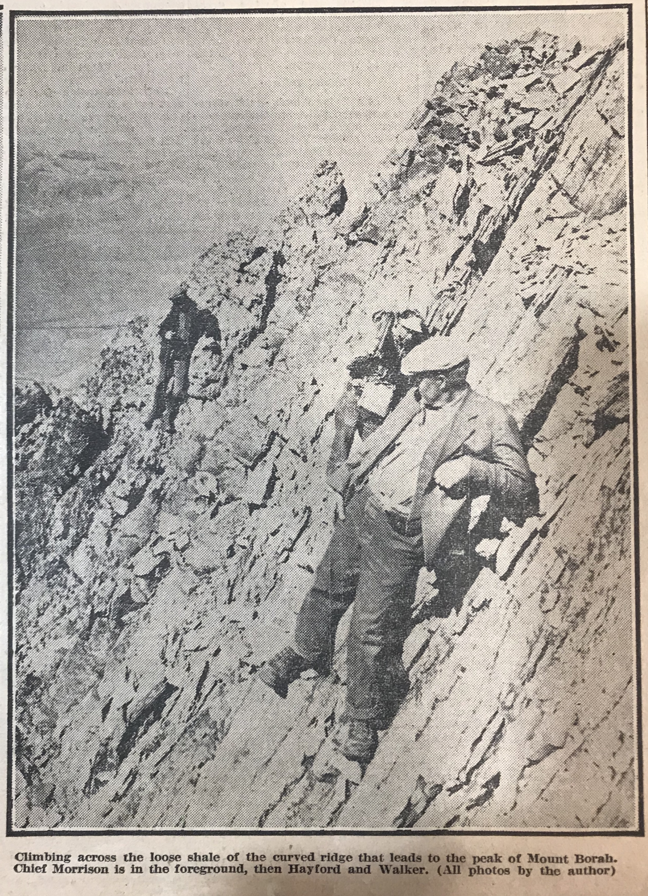
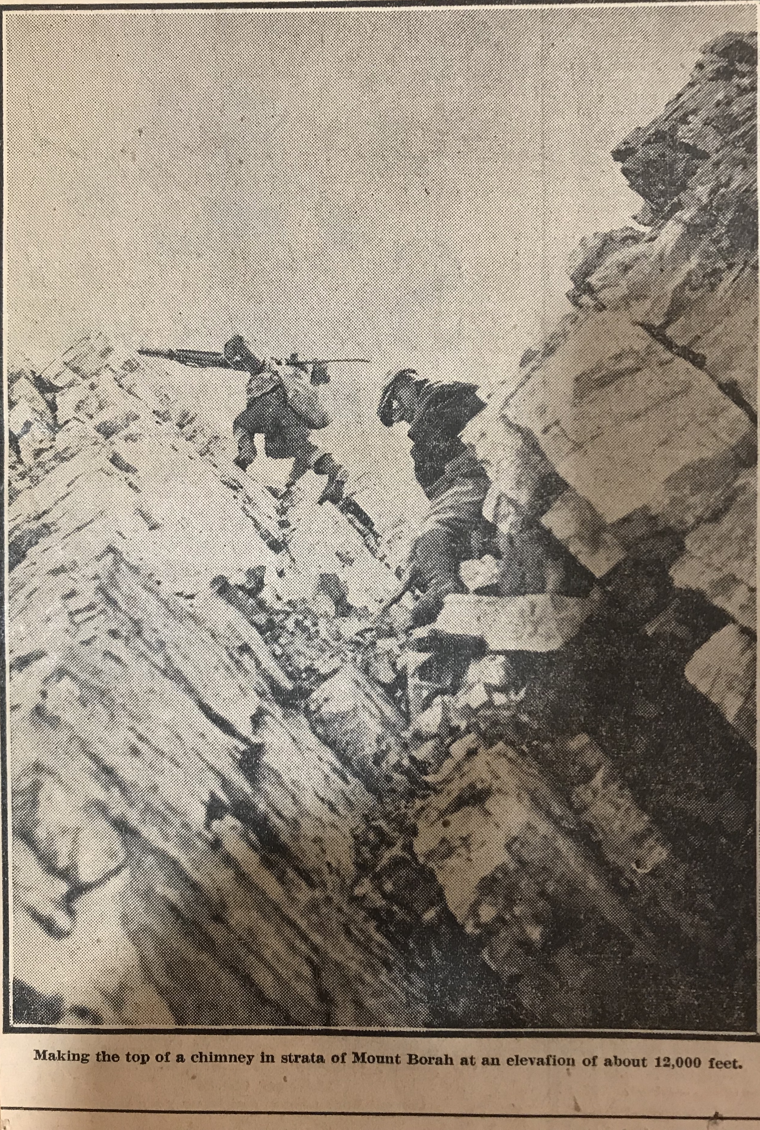
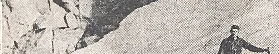
    Straight back of camp the four of us making the climb took our course up the draw to ascend the headwall. On its top, we made our first instrument set-up and checked our elevation at 9,000 feet. From there we approached the edge of a great basin gouged back into the mass of the peak and, after observing it carefully, swung eastward around its edge. Over pinnacles in this edge, as we came close under 12,000 feet, we had our first real climbing. Below, the talus slopes had been fairly uniform though sometimes hard walking presented no other difficulties. Now, however, we were on a ridge that projected shale down steep sides as fast as it loosened weathered limestone is sharp as to edge and treacherous footholds for it loosens easily. 

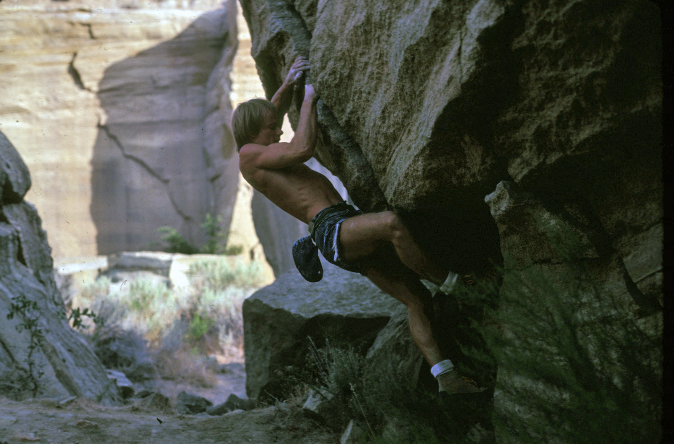
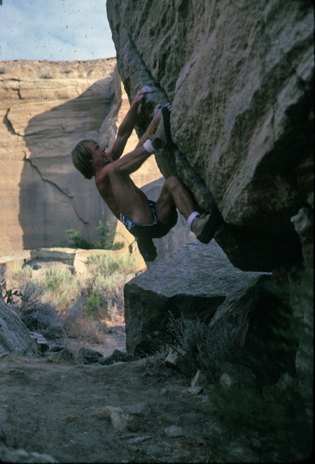
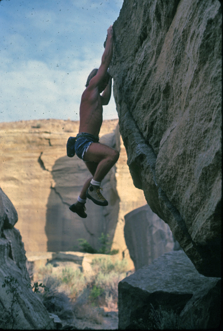
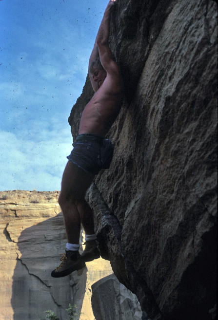
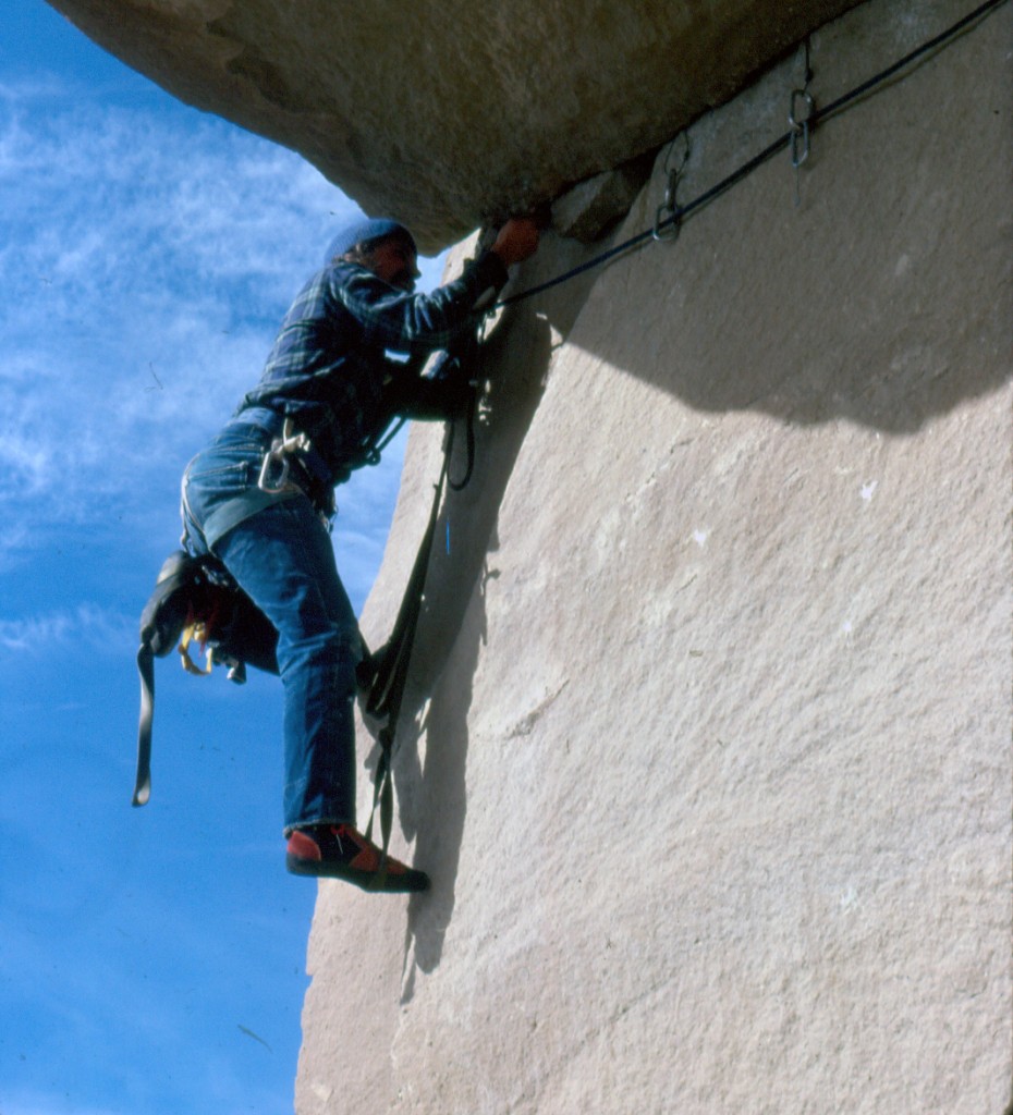
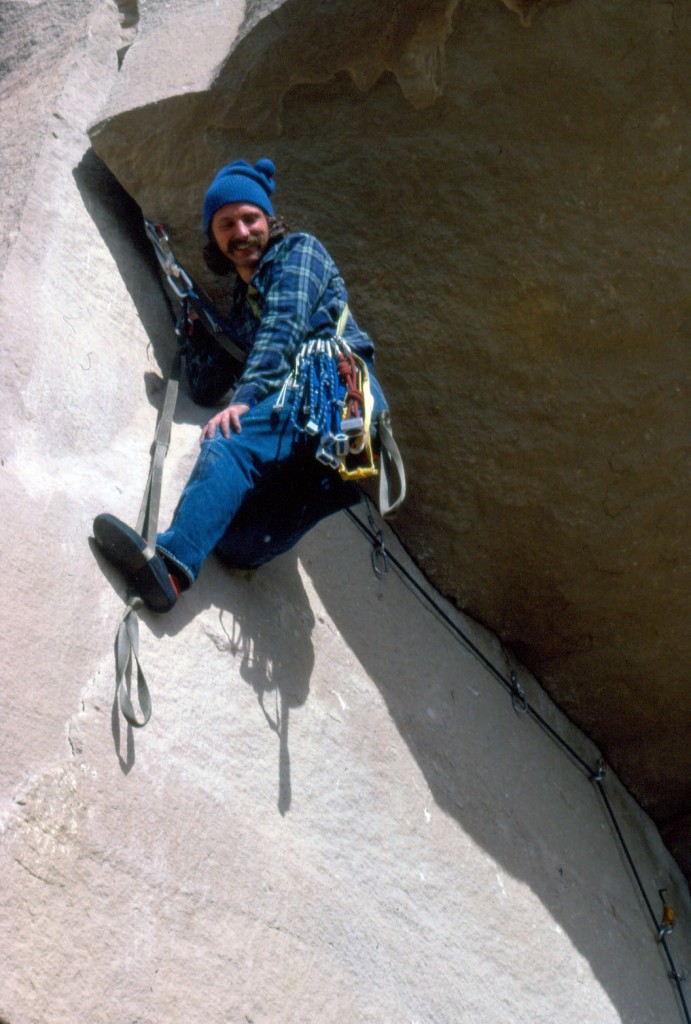
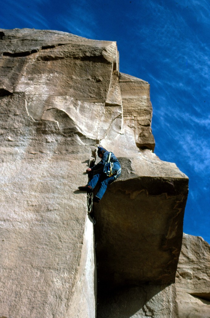
    It is not our intention to brand the climb as very dangerous or difficult. No special equipment is necessary but ordinary precautions must be taken. The average man should make the top in about six hours or less. Two famous mountain climbers made it in four hours under adverse conditions. Their names are Miriam Underhill and Robert Underhill of Boston, Massachusetts and they are registered at the top.

    Past the knife edge of the ridge, the footing seemed easier and we climbed in a slight curve to come upon the top from a little in back. Close under the rock cairn that marks the exact high point, the footing was again insecure and many large rocks that we trusted with our weight suddenly fell away and bounded into space to shatter far below. We gained the top with no mishap, however, and with excellent weather were able to enjoy the view that is unequalled in the state. Idaho’s mountains stretch out in range on range until the earth meets the sky, while under the peak, the valleys appear small and insignificant. All the territory we had worked was but a drop in the bucket compared to the miles to be seen.

    But our time on top was short. We hurriedly set the benchmarks tablet, that may be found from now on at the base of the rock cairn. While the camera registered every angle of the view. Just an hour and 45 minutes we spent at this spot that we had looked forward to gaining all season and then took up our packs for the descent. We were finishing a record season. When ready for distribution, the Borah Peak quadrangle gives Idaho an other important survey of interesting country.
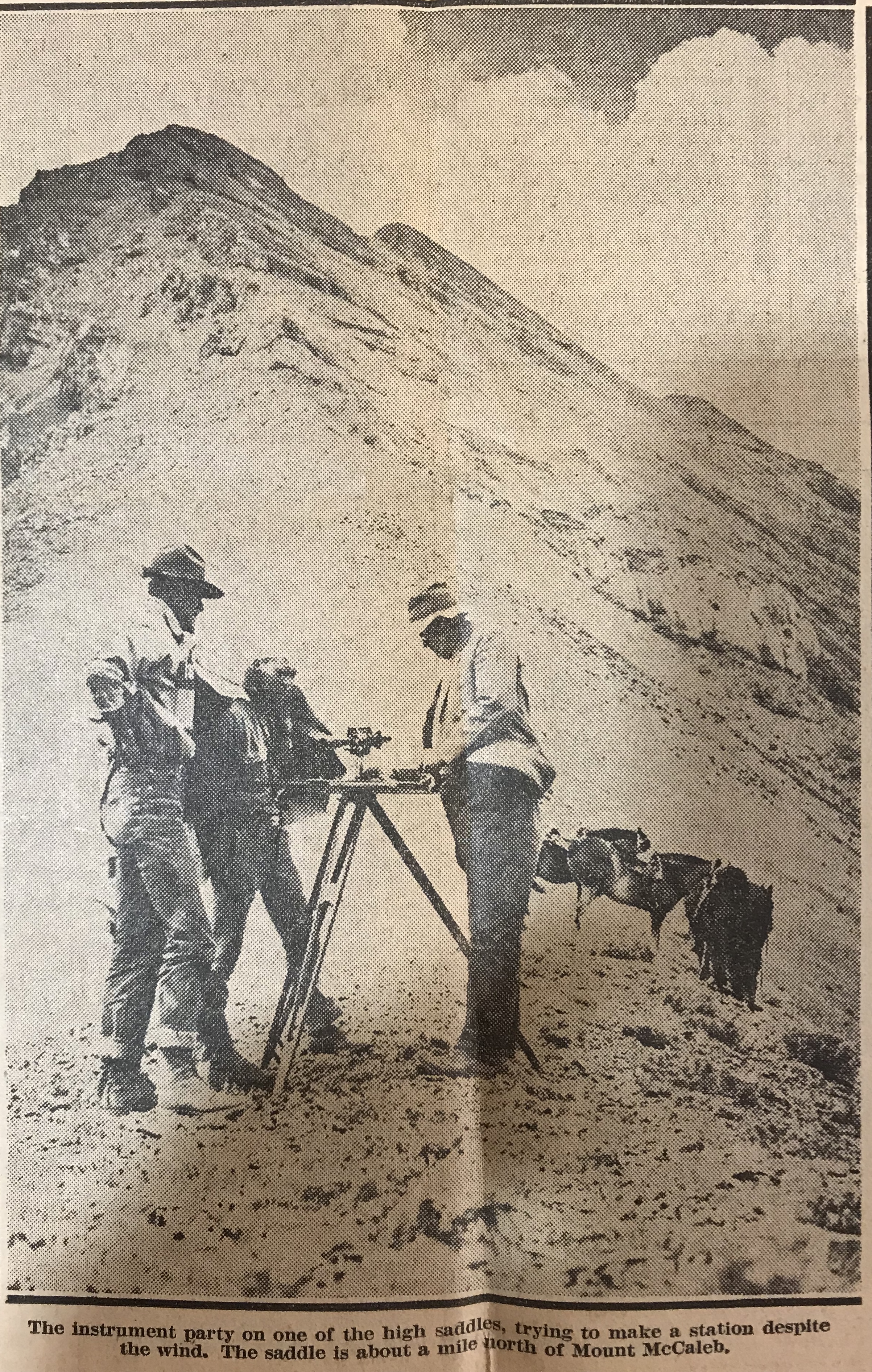
  • The End of the Last Idaho Ice Age By Bob Boyles

    The End of the Last Idaho Ice Age By Bob Boyles

    I first saw the North Face of Mount Borah in the Summer of 1972 while working under contract with the U.S. Forest Service. We were flying helicopters near Horseheaven Pass in the Upper Pahsimeroi Valley, where our daily flights offered unrivaled views of the north and east sides of the Lost River Range. But one face in particular stood out from all the others, and that was the North Face of Mount Borah. Lacking any snow, the face was a dark, steely gray color unlike anything I’d seen in Idaho before. I wasn’t a climber at the time but that was soon to change. I never forgot what I had seen that Summer.

    Two years later (1974), we made a reconnaissance hike into the cirque below the East Face of Mount Borah with the intent to find a climbing route that would lead to the summit. The lower part of the face held what looked like a large snowfield, but upon closer inspection, we found that it was more than just frozen snow. Underneath the snow was hard ice, the kind that only forms from years of accumulation, where the constant pressure slowly squeezes all of the air out of the ice, leaving it vivid blue in color. To a climber, this find was important because ice climbing generally requires specialized gear that one may not carry if expecting to only climb on snow. To the best of my knowledge, no study was ever made of this ice field before it disappeared.

    A year or two later, while attending Boise State University, I heard about Bruce Otto’s discovery of Idaho’s only known glacier on the North Side of Mount Borah. Bruce was a climber and Boise State University geology student who was familiar with Mount Borah and its perennial snowfields. In 1974, while doing research for a class project, he hiked into Borah’s North Face Cirque to study the snowfield and see how much it resembled an actual glacier. What he found in ice was much more than he expected. So the next year he returned with Monte Wilson, his professor and a specialist in the study of glaciers. They would return many times over the next ten years to study the glacier and its annual changes. Bruce’s description of the glacier talks about how it was over 200-feet thick, 1,000-feet wide and 1,200-feet long. He also describes how they determined the glacier was estimated to be 500 or even a few thousand years old. For a relatively short period of time, the glacier was known as the “Otto Glacier.”

    Beginning in 1973, my climbing partners and I embarked on an ice climbing binge, seeking ice wherever we could find it. We found a fair amount of seasonal, winter ice in the canyons of Southern Idaho, but rarely found the hard alpine ice we were craving. The Sawtooths were too low in elevation, and while the nearby Tetons were the most likely place to find alpine ice, we found the range’s ice seasonal and unreliable. While volcanos like Mounts Hood and Rainier had glacial ice, climbing into open-ended crevasses, just to practice, didn’t seem worth the effort for the risk. The Canadian Rockies did have what we were looking for, but were just too far away for poor students to consider. So based on my 1972 aerial observations, and with the knowledge of Bruce and Monte’s discovery, we turned to Mount Borah.

    In September 1976, Frank Florence and I made plans to climb Borah’s North Face, but a torrential thunderstorm turned us back before we reached the moraine below the face. Cloud cover obscured the mountain and all we saw was the lower snowfields, leading us to believe that was all we were going to find on this mountain. In late October, Mike Weber and I returned to give it another go. The weather was perfect this time and after climbing the lower cliff band, we finally got a good look at the North Face. The face was covered with a light dusting of snow from the first snowfall of the season. So until we reached the top of the moraine, we were expecting nothing more than a snow climb. At the top of the moraine, Mike and I geared up, and from the very first swing of our ice tools we knew we had finally found what we had been looking for. The ice was thick and rock hard, not brittle like so much of the Winter ice we had climbed before. We half expected the ice would turn to snow the higher we went but it did not. The ice continued all the way to just below the summit. Like Bruce and his discovery of the glacier, we found more than we ever expected.

    If you look closely, you can see the old blue ice showing in places. Under the snow, the ice appeared to be over 50-feet thick. The East Face of Mount Borah – June 1974. Photo by Bob Boyles
    The East Face of Mount Borah (June 1974). If you look closely, you can see the old blue ice showing in places. Under the snow, the ice appeared to be over 50 feet thick. Bob Boyles Photo
    North Face of Mt Borah - Oct, 1976. Photo by Bob Boyles
    The North Face of Mount Borah (October 1976). Bob Boyles Photo
    Mike Weber showing off his French technique on the lower ice fields of Mt Borah. If you look closely, you can see the old blue ice showing in places.  Bob BoylesBob Boyles photo
    Mike Weber showing off his French technique on the lower ice fields of Mount Borah. If you look closely, you can see the old blue ice showing in places.  Bob Boyles Photo

    My partners and I continued to climb the North Face of Mount Borah throughout the 1980s and we just assumed the ice and glacier would always be there. During most of the year, the face was covered with snow but, by the Fall you could count on the underlying ice showing through. On one of our trips in the mid-1980s, we discovered that a massive avalanche had occurred, taking most of the previous Winter’s snowfall with it. Bruce’s snow measuring equipment was wiped out and was carried almost a mile down to where it now sits. Little did we know at the time that we would be part of a small group of climbers who actually got to see, stand, and climb on Idaho’s last, and perhaps only, remaining glacier.

    In September 1990, Mike Weber, Curt Olson, and I returned to the North Face expecting to find conditions similar to what we had found for the previous 14 years. We were quickly disappointed when we got close to the base of the North Face. The lower ice fields and the glacier were, for the most part, gone. There was still some remaining old blue ice left on the upper part of the North Face, but the bottom was mostly bare rock.

    The remains of Bruce and Monte’s snow measuring gauge Sept, 2010 Photo by John Platt
    The remains of Bruce and Monte’s snow-measuring gauge (September 2010). John Platt Photo
    The North Face of Mt Borah Sept, 1990 – Photo by Curt Olson We were in shock when we saw this. The glacier and lower ice fields were almost gone. This was the last photo we got of the old blue ice that was estimated to be over 500 years old or more.
    The North Face of Mount Borah (September 1990). Curt Olson Photo

    We were in shock. The glacier and lower ice fields were almost gone. This was the last photo we took of the old blue ice that was estimated to be over 500 years old. In 2009, I was contacted by geologists who were doing a study of the Glaciers of the American West, which included Idaho. As a result of that study, Idaho was found to have no remaining glaciers with the exception of perennial snow fields and a few rock glaciers where all of the ice is underground.

    In 2017, I was disappointed to read a trip report that highlighted the demise of snow and ice on the North Face. This news was especially troubling as the 2016-2017 winter resulted in a solid snowpack existing above 8,000 feet in the central mountains in June. Many high-elevation basins had more than twice the normal snowpack. I don’t know what it would take for the ice to come back short of another ice age.

  • The Early Climbing History at Table Rock by Bob Boyles

    The Early Climbing History at Table Rock by Bob Boyles

    For those who live in the vicinity of Boise, Table Rock is an unmistakable landmark rising up on the Northeast Side of town. The climbing history of its rock walls, which are graced by seemingly random bolt placements and the occasional chalk mark, is slowly disappearing as time passes and excavators mine the Northeast Corner for building materials. Table Rock, like the Black Cliffs, was a training ground for Boise climbers who took what they learned to the mountains where they established impressive routes like the North Face of Mount Breitenbach. Though the active rock quarry on the Northeast Side of the rock has changed the landscape considerably since the 1970s, climbing opportunities still exist on Table Rock.

    The silica-infused brown sandstone found in the foothills of the Boise Front is relatively rare in Southern Idaho. Formed by sediment from a large lake (Lake Idaho) and fused with silica from the hot springs that are found outside of Boise, the resulting cement hard rock made it a perfect place for Boise rock climbers to gather during the 1960s and 1970s. Bouldering short but difficult rock moves had become a legitimate form of rock climbing in the country during the 1960s when the legendary John Gill introduced gymnastic training to rock climbing moves.

    During that era, Table Rock quickly developed into what could best be described as Boise’s first outdoor climbing gym and meeting place. The low elevation of Table Rock offered year around opportunities and it was not uncommon to find climbers practicing there throughout the Winter. The climbing was not limited to the quarried rock found on the South Side of Tablerock. In less than a decade, all 4 sides of Tablerock were climbed extensively explored and climbed, including the large roofs that are found near the cross.

    Carol Boyles and Bob's beloved dog, Brit, at the quarry. Bob relates that "in 1963 he watched his brother do the first climb I ever witnessed at Tablerock on the big rock that stands behind us. He took off his shoes, climbed it barefoot, did a handstand on top, and then climbed back down." Bob Boyles Photo
    Carol Boyles and Bob’s beloved dog, Brit, at the quarry. Bob relates that “In 1963 he watched his brother do the first climb I ever witnessed at Table Rock on the big rock that stands behind us. He took off his shoes, climbed it barefoot, did a handstand on top and then climbed back down.” Bob Boyles Photo

    The South Side of Table Rock (the Quarry) offers clean, cleaved-off slabs of hard sandstone, left exposed from decades of quarrying. During the 1970s, this area became the hub of local climbing activity. Unroped bouldering was the main activity but it was not uncommon to see some climbers practicing aid climbing or rappelling. Crash pads were unknown at that time with the exception of a small patch of carpet that might have been left behind for wiping sand from your soles on a wet day. Spotting a partner was a given and it helped to know there was a “mosh” landing on some risky moves. Where it was safe, cat-like jumps were perfected if one fell off a boulder but they didn’t always work. I know that a few of us went home early with sore knees or a sprained ankle. This “climb or fall” technique also provided great motivation for one to perfect the moves on the taller, riskier boulders. Like modern day sport and gym climbing, the Quarry provided us a place to practice extremely hard climbing moves without the distraction of high exposure or the risk of a big fall.

    Frank Florence, co-founder of Sawtooth Mountaineering describes it like this:
    “I think that the spirit of the Boise climbing community of the 1970s was special. It was a fairly small group of people, a tight enough circle that we all knew one another to some degree. And there was real talent there. Local climbers who pretty much started from scratch, like Tom McLeod and Charlie Crist, as well as young Turks, like yourself [Bob Boyles] and Mike [Weber]. Then there were the “externals,” guys who had some experience climbing elsewhere that they could bring to their efforts around Boise. Dan McHale, the Rozells and Bob Jahn are good examples. I might have taught you a few things about ropes and knots but they were the exemplars when it came to pushing abilities and standards. We all learned from them and that sharing of experience, talent, and knowledge was critical for every one of us and led us to wonder if we couldn’t take it a little further. I don’t want to over-romanticize the times, but it’s fair to say that our climbing scene had elements in common with the camaraderie and positive competition found in British pubs and Camp 4 in the same decade.”

    Interviewed in 1975 by the Idaho Statesman, Florence who, at the time, conducted Boise‘s only regularly scheduled climbing classes noted: “The 30-40 foot walls at Table Rock serve as a “sort of nursery” for beginning climbers. The convenient old quarry contains plenty of sandstone for bouldering difficult but close-to-the-ground maneuvering.”

    During the 1980s, a new generation of younger climbers including Ted Thompson and Pete Takeda were climbing at Table Rock. For 4 years, Curt Olson (the founder of High Country Sports in downtown Boise) sponsored what was the first semi-pro bouldering competition in the United States at Table Rock. The competition attracted a young Todd Skinner who is considered one of first proponents of modern sport climbing and top climbers of his generation.

    The Quarry stayed an active place for climbing through the early 1990s when the mid-section of the quarry was sold to a local company and opened to rock mining after sitting idle since 1940. The Table Rock sandstone had always been prized as a building material and no doubt, the extraction of rock generated economic benefit to those who owned the mineral rights.

    The sandstone can now be found in some of the valley’s most expensive homes and at the entrance to upscale developments where it’s used as billboards to announce the name of the subdivision. Local climbers, a loose knit group at best, rallied for a while to save the old quarry, but lacking any kind of formal organization, their voices weren’t loud enough to raise any local activism. Economics won out and rock climbing at the Quarry has never been the same.

    Tablerock
    This climb is now half-buried in dirt. But back then, it was a challenging problem. Here Tom McLeod is starting at ground level (these days, subterranean). John Platt Photo
    Tablerock
    Moving around the overhang. John Platt Photo
    He better be wearing underwear. John Platt Photo
    He better be wearing underwear. John Platt Photo
    Tablerock
    He’s got the top and the mantel is easy. John Platt Photo
    Tablerock
    But no, he’s not done yet. There followed several more pirouettes past the camera before dropping to the ground. John Platt Photo


    Bob working a classic mid-cliff slab in blue jeans and Fabiano Directisma “blue boots” as we called them. They were totally rigid from heel to toe making them terrible for walking, but they worked perfectly on the tiny nicks and chips in the quarried rock. Mike Weber Photo
    Bob Boyles working a classic mid-cliff slab in blue jeans and Fabiano Directisma “blue boots” as we called them. They were totally rigid from heel to toe making them terrible for walking, but they worked perfectly on the tiny nicks and chips in the quarried rock. Mike Weber Photo
    Bob stretching through the crux moves. Mike Weber Photo
    Bob stretching through the crux moves. Mike Weber Photo
    A young John Platt working the sharp edge of a classic mid-cliff Tablerock boulder. Tom Lopez
    A young John Platt working the sharp edge of a classic mid-cliff Table Rock boulder. John Platt Photo
    John at work on the “Layback Crack”.
    John at work on the “Layback Crack.” John Platt Photo
    Mike Weber doing a “clean” aid ascent of the “Roof” using only hexes and stoppers.
    Mike Weber doing a “clean” aid ascent of the “Roof” using only hexes and stoppers. Bob Boyles Photo
    Tablerock
    Mike resting before rounding the edge of the big roof. Bob Boyles Photo
    Tablerock
    Mike stepping out of his etrier and going free. Bob Boyles Photo

    Also see John Platt’s page.

  • Fossils of Idaho’s High Peaks by Rick Baugher

    Fossils of Idaho’s High Peaks by Rick Baugher

    Some of the best examples of Idaho’s marine Paleozoic fossils are found near the summits of mountain peaks (10,000 feet of elevation and higher). Although they appear in carbonate formations throughout East Central and Southeast Idaho, the core zone is in the Southern Lemhi and Lost River Ranges. Specifically, the best preserved fossils are found in the Scott Peak Formation of Mississippian Age. 330 million years ago, this part of Idaho was a shallow subtropical sea far to the southeast, part of the super continent Gondwanaland.

    It was not an easy journey to the present for these coral reef relics. Only those that were quickly buried in lime muds and survived being eaten, baked, burned, squashed or torn asunder have survived. No soft body parts remain, and what we see is not the original shell-y part. This has been chemically replaced by silicates and iron oxides. Fossils allow us to see and touch the incredibly distant past. This visualization can also be enhanced by the sense of smell. Crack open a piece of black fossiliferous limestone. The sulfur dioxide (rotten egg) smell is another remnant of the decayed organism. The following 3 photos each depict a pioneer Idaho geologist and a suite of fossils he likely found in the course of his fieldwork.

    JOSEPH B. UMPLEBY (1883-1967). Dressed in his “survey tans,” US Geologist J. B. Umpleby is ready to leave camp on his mount for another day in the field, somewhere in Lemhi or Custer County (circa 1912). Colony coral is found on the summit of Umpleby Peak (10,713 feet). Fossils clockwise from lower left: Foraminifer; Bryozoan mass; next 5- colony coral (Tabulata); next 3- Crinoid (sea lilly) showing head, stem length and star-shaped axial cross section of stem; spicule.

    CLYDE P. ROSS (1891-1965). A prolific writer of Idaho geology, 1947 was a banner year for US Geologist C. P. Ross with his publication of “Geology of the Borah Peak Quadrangle” and “Geologic Map of Idaho.” Here he is pictured in Sawmill Canyon (Lost River Range) with White Cap Peak in the background (early 1930s). The bony fish was found en route to Clyde Ross Peak (11,724 feet). Fossils clockwise from bottom center: Streptelasma; Gastropod; 2 Trilobites; bony fish; 2 Archemedes-fan and stem mass, Coquina (limestone biomass).

    OSCAR K. HUH (1935- ). O. K. Huh did his Penn State doctoral field work in the Lemhi Range, shown here in the Diamond Peak area (1959). Huh specialized in the Mississippian limestones and defined 4 new geologic formations, including the Scott Peak. You guessed it, Horn Coral fossils are found around Huhs Horn (11,292 feet). Fossils clockwise from lower left: 2 Productids, Orbiculoidia (with original blue sheen?); Spirifera-these are all Brachiopods; 6 Horn Corals (Rugosa) of various sizes, 2 show in tact septa. Horn Coral disappeared with the Permian Extinction, but as members of the Coelenterate family they are survived today by the jellyfish. Pelecepods (clams).

    All material is from the Rick Baugher collection (April 21, 2007).

    100_0747

    100_0749

    100_0751
    Fossil collection. Rick Baugher Photo