Category: Harry Bowron

  • The Underhill Sawtooth Story by Ray Brooks

    The Underhill Sawtooth Story by Ray Brooks

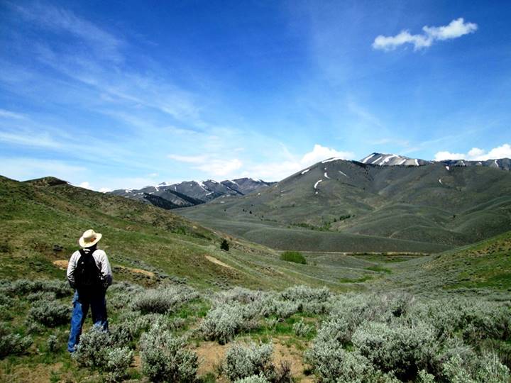
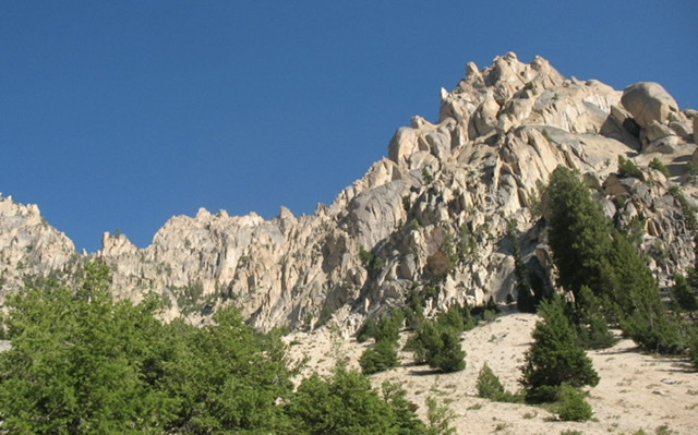
    “Rugged country. Awful rugged country. Miles and miles of sharp jagged pinnacles of firm granite.” A painter-friend of Bob Underhill told him that about Idaho’s Sawtooth Mountains in the early 1930s, when Bob was in the Tetons for a few weeks pioneering big new routes on the Grand Teton and other nearby peaks. Although the painter isn’t named, it almost certainly was Idaho native Archie Teater, who had hiked the Sawtooth mountains for weeks with a pack burro, painting and prospecting for gold. Archie started spending summers at Jenny Lake at the base of the Tetons in 1929, painting pictures of the mountains and selling his paintings to tourists.  Archie Teater’s campmates at Jenny Lake included early Teton climbers Glenn Exum and Paul Petzoldt.

    Bob Underhill and his climber-wife Miriam were interested. What they discovered, by researching climbing club journals, was that the Sawtooth Mountains were unknown to the climbing world. Their subsequent adventures in the Sawtooths captivated me, as a climber who has summited many of the peaks that the Underhills were the first to conquer in the 1930s. I found the couple’s writings on their Sawtooth adventures captivating.

    Miriam Underhill’s article on their 1934 trip, titled “Leading a Cat by Its Tail,” was in the December 1934 edition of Appalachia magazine. Robert Underhill wrote a summary of both their trips into the Sawtooths, aptly title “The Sawtooth Mountains of Idaho,” for the December 1937 issue of Appalachia Magazine and Miriam writes about both their Sawtooth adventures in Chapter 9 of her 1956 climbing autobiography “Give Me The Hills.”

    They were each uniquely qualified to climb difficult, unexplored, and unclimbed peaks. Both were from upper middle-class families and both had much experience climbing difficult peaks in the Alps. They had met during Appalachian Mountain Club trips to mountains in New Hampshire but, for the most part, climbed separately in the Alps. Miriam’s access to wide areas of the Alps, in France, Switzerland, and Italy’s Dolomite Mountains was enhanced by a Buick touring car her parents shipped over to France for her use. By the late 1920s, both Miriam and Bob Underhill had established reputations as some of the best climbers in the world and they had started occasionally climbing together in the Alps by 1928.

    Courtesy of the Adventure Journal.
    Courtesy of the Adventure Journal

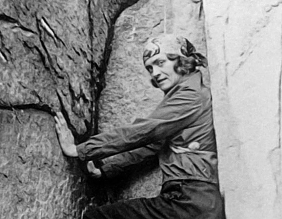
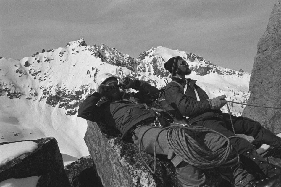
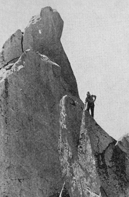
    As Miriam gained climbing experience, she suffered, first with alpine guides who would never let a woman lead, then after she started leading more difficult climbs with more tolerant guides, by the attitudes of the time, that women were too “frail” to be trusted as an equal climbing partner. She started climbing with like-minded women and did some very difficult climbs. In the 1920s, climbers tied themselves together with hemp ropes, but leaders led without driving pitons into cracks to “protect” themselves if they fell. The rule was “the leader must not fall” and Miriam led some very hard climbs without falling including a “test-piece” that only a few Chamonix guides would lead, the famed Mummery Crack (currently rated as a French 5b, or 5.8 – 5.9 by U.S. difficulty ratings) on the Grepon. A photo essay and her article about what she and her friends termed “Manless Climbing” was published in the August 1934 issue of National Geographic Magazine, two years after she married Bob Underhill, and suddenly they were not only the best, but the best-known climbers in America. Bob Underhill was not as famous, but in addition to his new routes in the Tetons, he wrote a 22-page article “On the Use and Management of the Rope in Rock Work,” which was published in the Sierra Club Bulletin in 1931. He then taught modern rope techniques to Sierra Club members in California and did two big first ascents in the Sierra with his best students. The Robert and Miriam Underhill Award is given annually by the American Alpine Club “to a person who, in the opinion of the selection committee, has demonstrated the highest level of skill in the mountaineering arts and who, through the application of this skill, courage, and perseverance, has achieved outstanding success in the various fields of mountaineering endeavor.”

    Acknowledgment: from Wikipedia which secured the photo from Glen Dawson. Who kindly agreed to make those photos from his private collection publicly available. If you use or copy any of the pictures, please quote the source as "From Glen Dawson Collection".
    Acknowledgment: from Wikipedia which secured the photo from Glen Dawson. Who kindly agreed to make those photos from his private collection publicly available. If you use or copy any of the pictures, please quote the source as “From Glen Dawson Collection.”

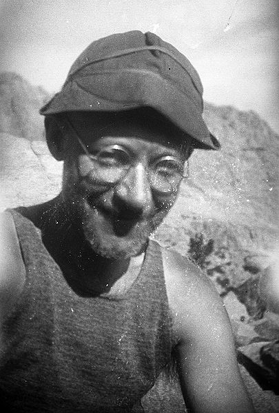
    In June of 1934, the Underhills made the long drive from Boston to Idaho and first stopped in Hailey at the Sawtooth National Forest headquarters to inquire about available horse packers for their Sawtooth adventures (Hailey does not now have an active ranger station). They were referred to a prosperous Sawtooth Valley rancher named Dave Williams and after explaining their needs to him, Dave jumped at the opportunity to share in their adventure. In fact, they could start the following afternoon. Miriam explained: “In the morning he’d have to round up and shoe us some horses, of which he owned large numbers; he wasn’t sure how many, since he hadn’t caught them all that Spring.” Dave had gone to the “school of hard knocks” and had first worked in the area carrying mail twice a week over 8,750-foot Galena Summit from Ketchum to Stanley. The road was closed by snow for six months a year and then Dave rode a horse, or drove a dog team, or wore skis, to make the 61-mile journey. The Sawtooth Valley was mostly ranched by folks on small “starvation-ranches,” but Dave had managed to prosper, supplementing his income from cattle ranching with income from leading pack trips into nearby mountains for fishing or hunting.

    The next afternoon at 4:00 P.M., the three started for the mountains with three riding horses, two pack horses, and one of the pack horses an unweaned colt. Dave led the better-trained pack horse, but “Diamond, the other and a most ornery beast, was left to run loose and it was up to Bob to see that she came along.” After Dave warned Miriam that her horse would buck if brush or clothing touched its rear, she also got to avoid the colt, who would dash in front of the other horses and practice bucking. Miriam wrote, “I felt sure that when he grew up to be a big horse, he too would be a splendid bucker.”

    Somehow, they made it up the barely discernable Hell Roaring Creek Trail to Imogene Lake by dusk and camped for the night. Dave led the belled horses to a pasture at a small lake above camp and warned the Underhills to be alert for the horses trying to sneak past them in the night, to return to his ranch. Nothing bad happened in the night and the next morning Dave and the Underhills hiked up to round up the horses. “Searching for the horses, we hiked up a turbulent little stream, Bob on its right bank and Dave and I on its left. The horses appeared on Bob’s side. Dave shouted across the stream that Diamond would be the only one likely to let Bob get up on her. Bob was to mount Diamond and drive the others across the stream. No one would have guessed that as Bob swung up on that big, round, slippery horse, unsaddled and unbridled, that he was doing this for the first time. But from then on, things went less well. ‘Just go after them like you was roundin’ up some cattle, Dave instructed.’“

    “Bob’s primary difficulty lay in steering Diamond, but even when he managed that, and charged up to the other horses, they continued their placid grazing in complete indifference. An expression of increasing amazement grew on Dave’s face as he watched the ineptness of this eastern dude. ‘It’s a funny thing, he observed to me, but I guess there’s something to learn about most anything.’ In the end, Dave had to wade the stream and do the job himself.“

    Later that day, they went over a high pass just south of Imogene Lake and in a thunderstorm, worked through scenic, but trail-less, steep and rough country to Toxaway Lake, where they camped for three nights. Miriam mentions one of the more exciting parts of their descent. “We all walked most of the most of the way, sloshing along in oilskins. At one point, Diamond, who always knew better than the other horses, or even Dave himself, what route to take, started down a sloping slab of rock which the rest of us had skirted. She fell at once and slid – a sitting glissade. Noticing that my horse was then in line at the bottom of the slab and that I was slightly below it, I expected momentarily to be covered up by two horses. But although Diamond did slide into him, he stood his ground.”

    At the bottom of the mountain, they found a trail that came up from Yellowbelly Lake and followed it to Toxaway. Three lads from Salt Lake City were fishing there and during the ensuing conversation they expressed wonderment that anyone would come into the Sawtooths just to climb. Subsequently, the Underhills learned that Dave had often carried containers with live trout up to fishless Sawtooth Lakes so he could later make money hauling people up to those lakes to catch trout.

    Toxaway Lake (1971). Ray Brooks Photo

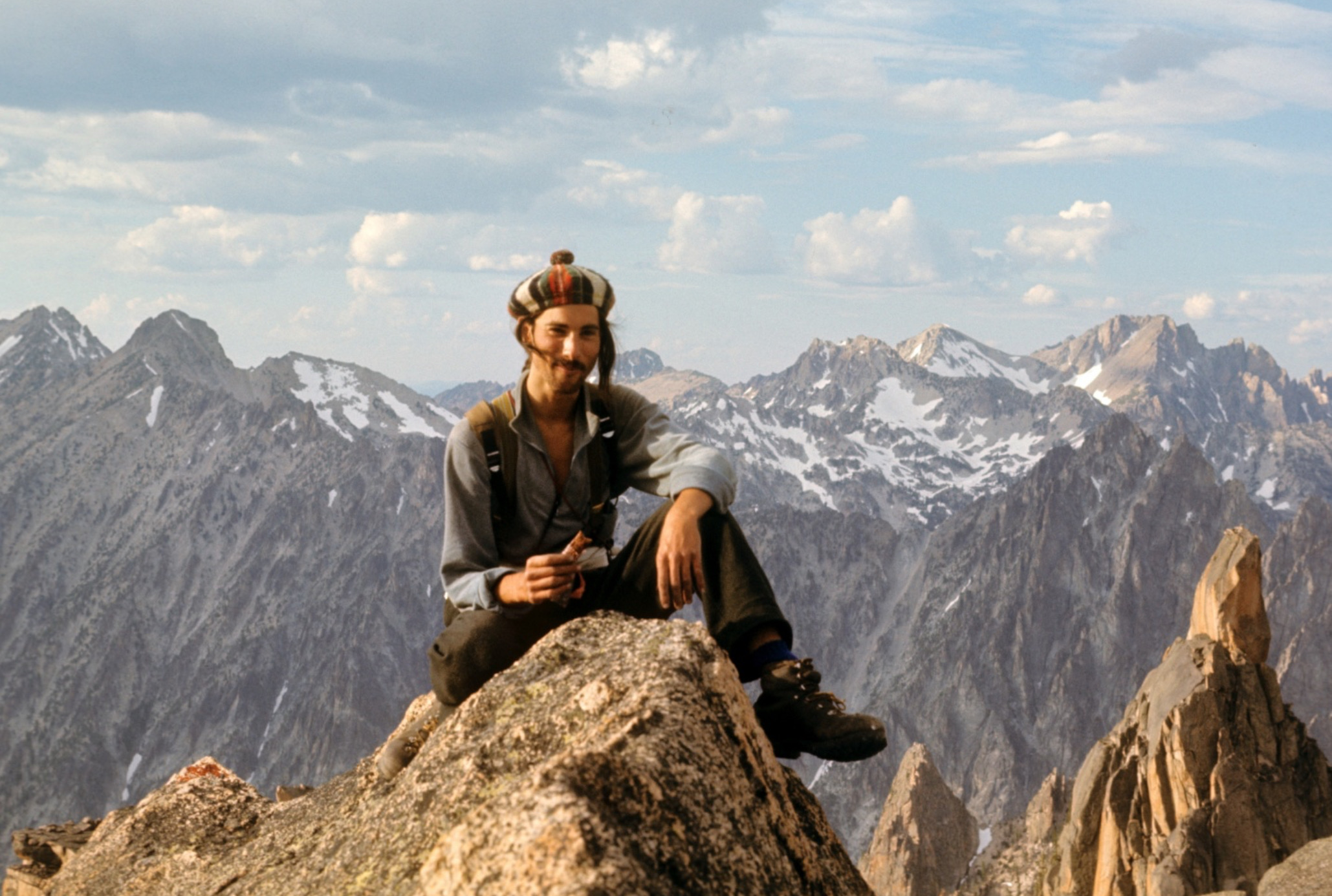
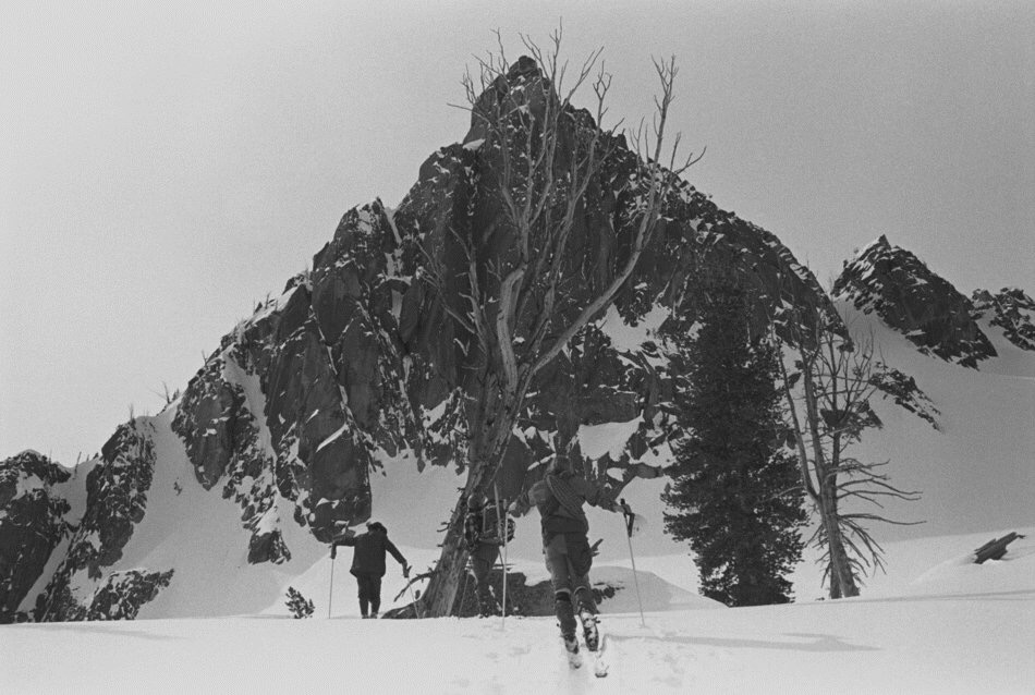
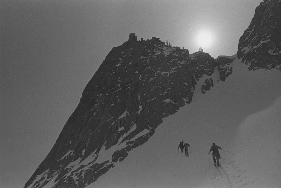
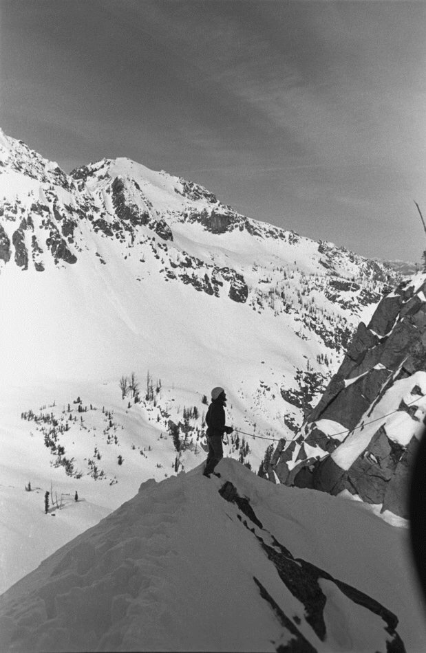
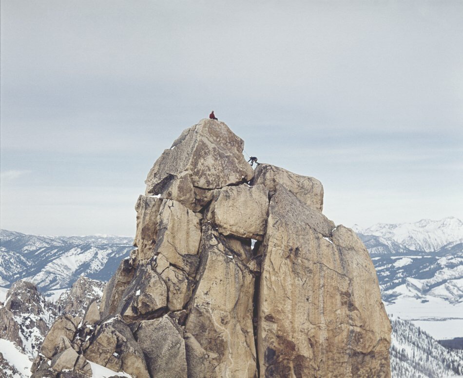
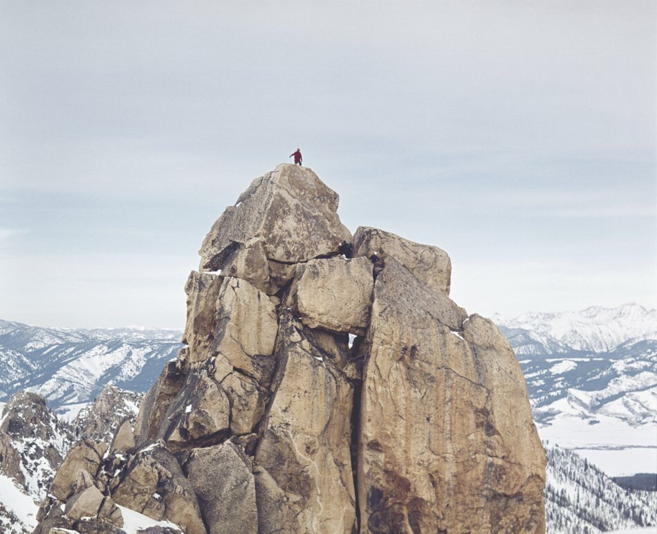
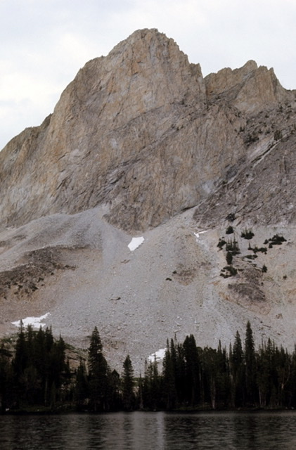
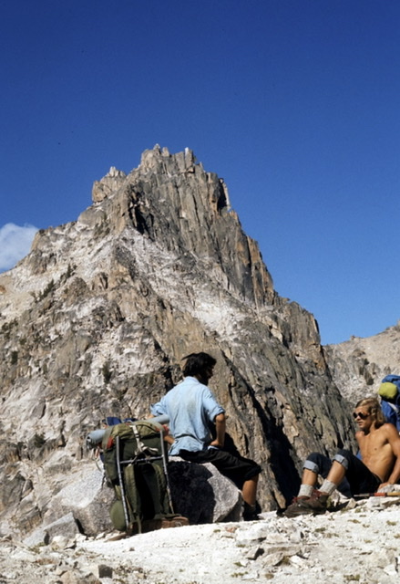
    The next day, they climbed Snowyside Peak (10,651 feet), one of the tallest Sawtooth Peaks. It had been climbed previously by USGS map-makers on a survey of the Sawtooths and was the only peak the Underhills and Dave ascended that Summer that was not a first ascent. I climbed Snowyside’s east ridge in 1971, which is likely the route the Underhills and Dave Williams took up the peak.

    East Ridge Snowyside Peak (1971). Ray Brooks Photo

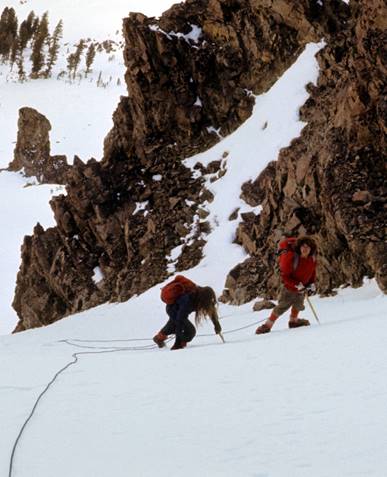
    Dave was athletic and had spent a lot of time in the mountains hunting goats. He wanted to climb with the vastly more-experienced Underhills and did a great job, although he did not trust their ropes. On their descent from a ridge extending north from Snowyside, they needed to do several rappels to descend a steep part about 200 feet high. Miriam writes: “How uneasy Dave felt! Those thin little ropes did not look like they could hold him. To reassure himself, before starting, he peered over the edge to the valley below and observed if worse came to worst, he could make it in about two jumps.”

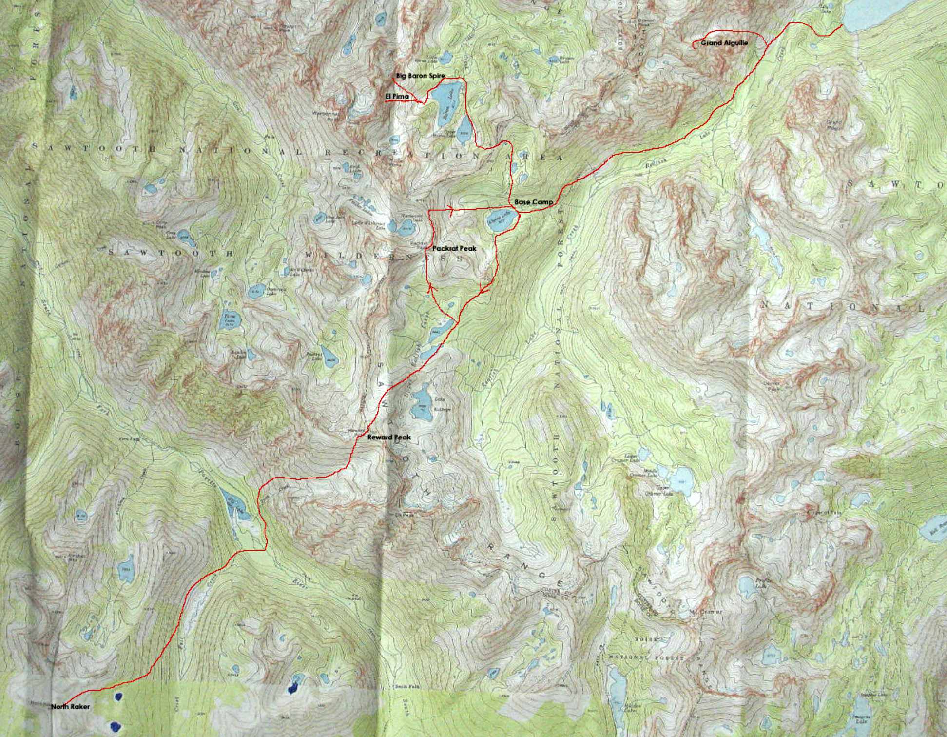
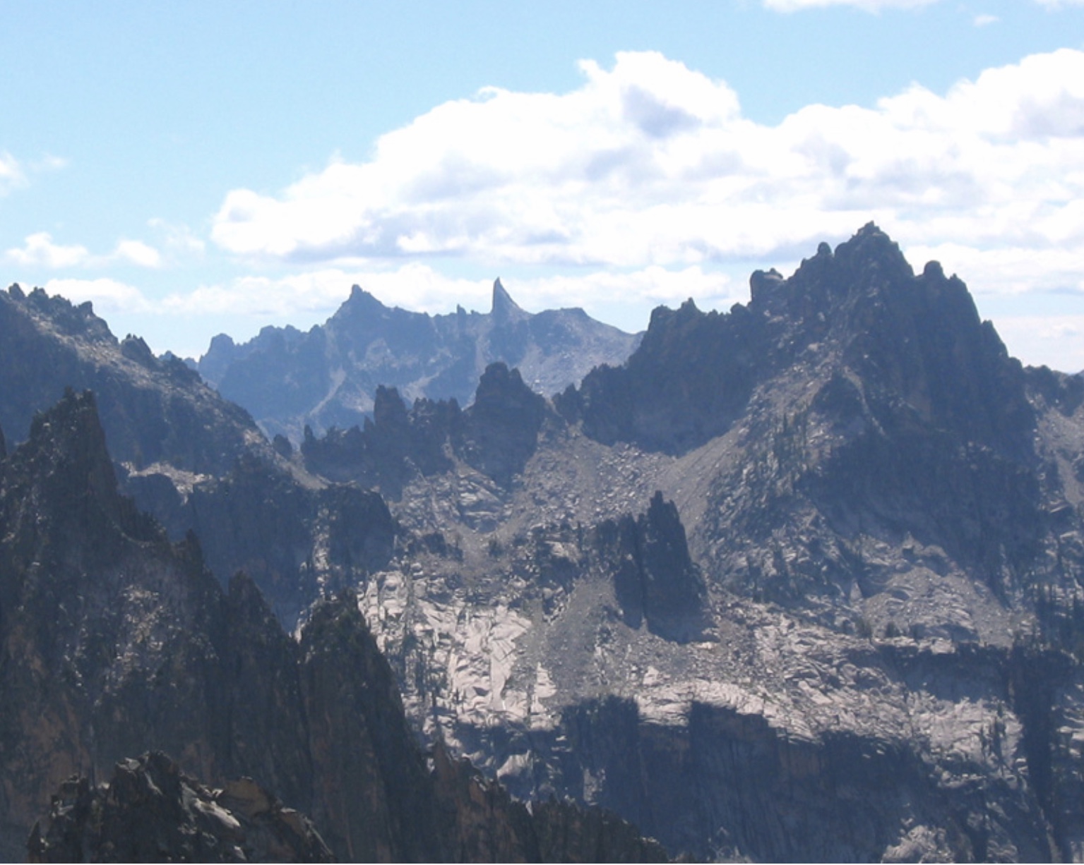
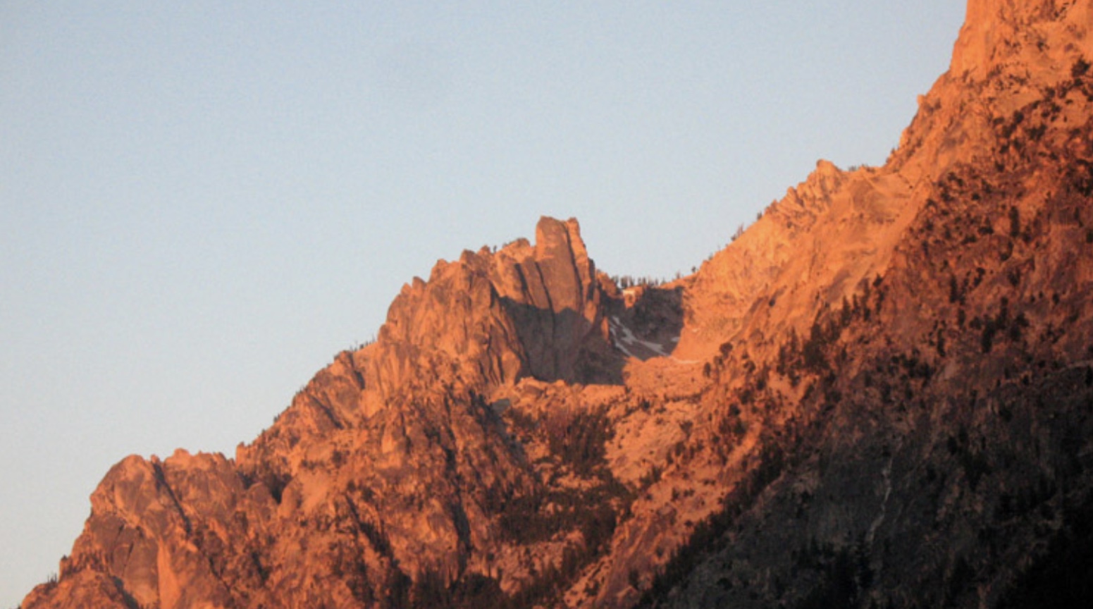
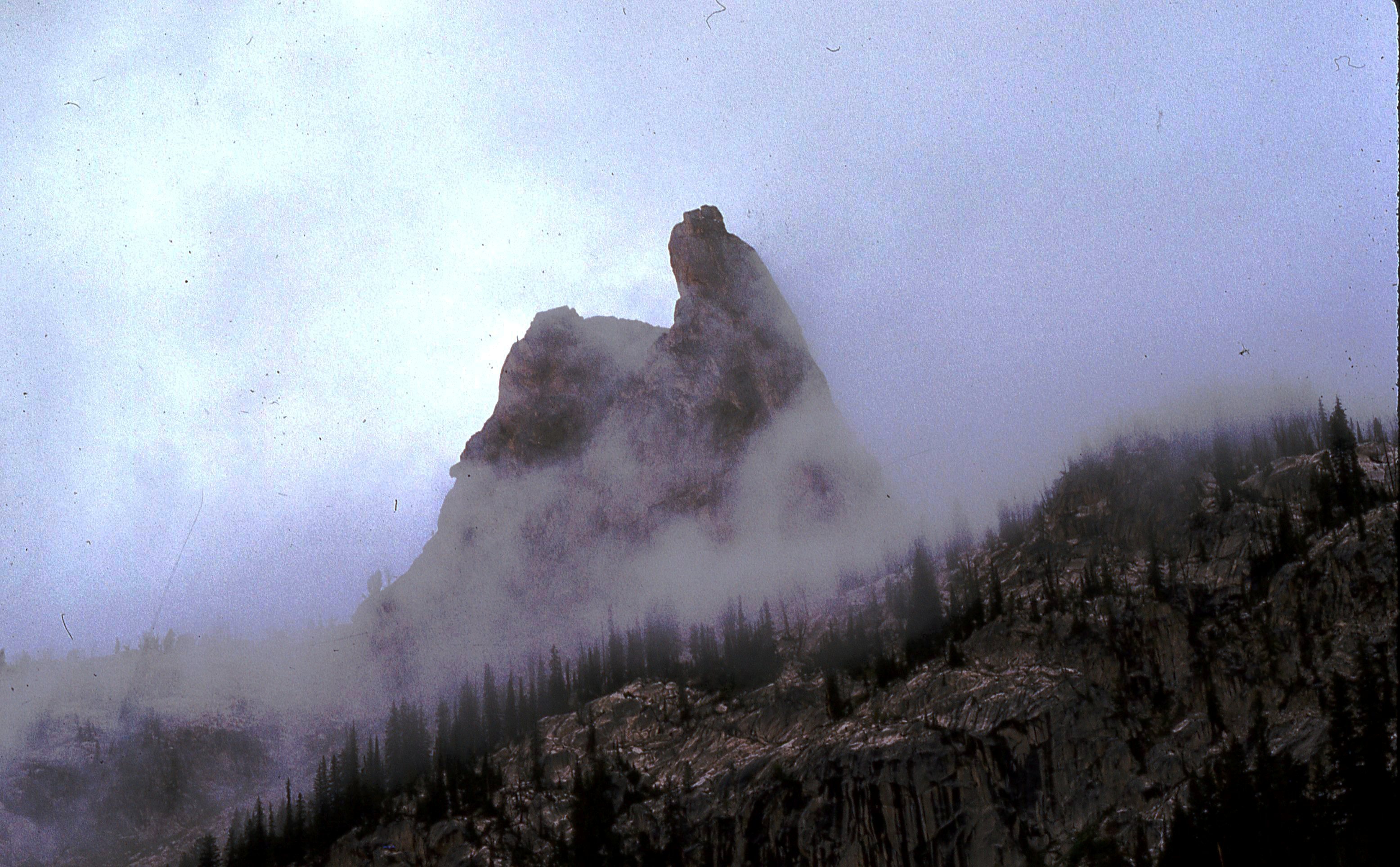
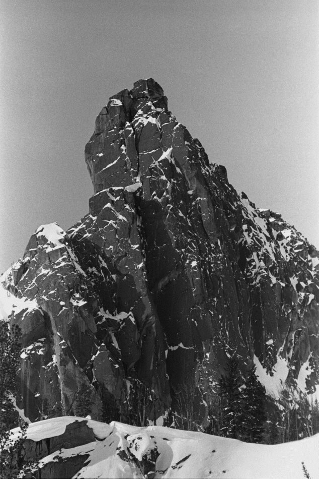
    From the top of Snowyside, they noted, far to the northwest, what they called “The Red Finger,” now named The North Raker. They found it so striking that they wanted to go there, even though Dave thought the South Fork Payette River Valley between them and it did not have a trail. However, he knew a pass he could get his horses over and he was willing to try to get them to the North Raker.

    The next day, they went south and climbed an imposing peak above Alice Lake, later named El Capitan, finding a route up its east side that was not entirely satisfactory, due to much loose rock. The peak was unclimbed and Dave, with his usual enthusiasm, built a huge summit cairn.

    Alice Lake and the north face of El Capitan (1971). Ray Brooks Photo

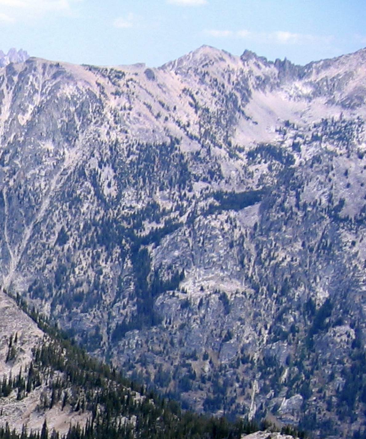
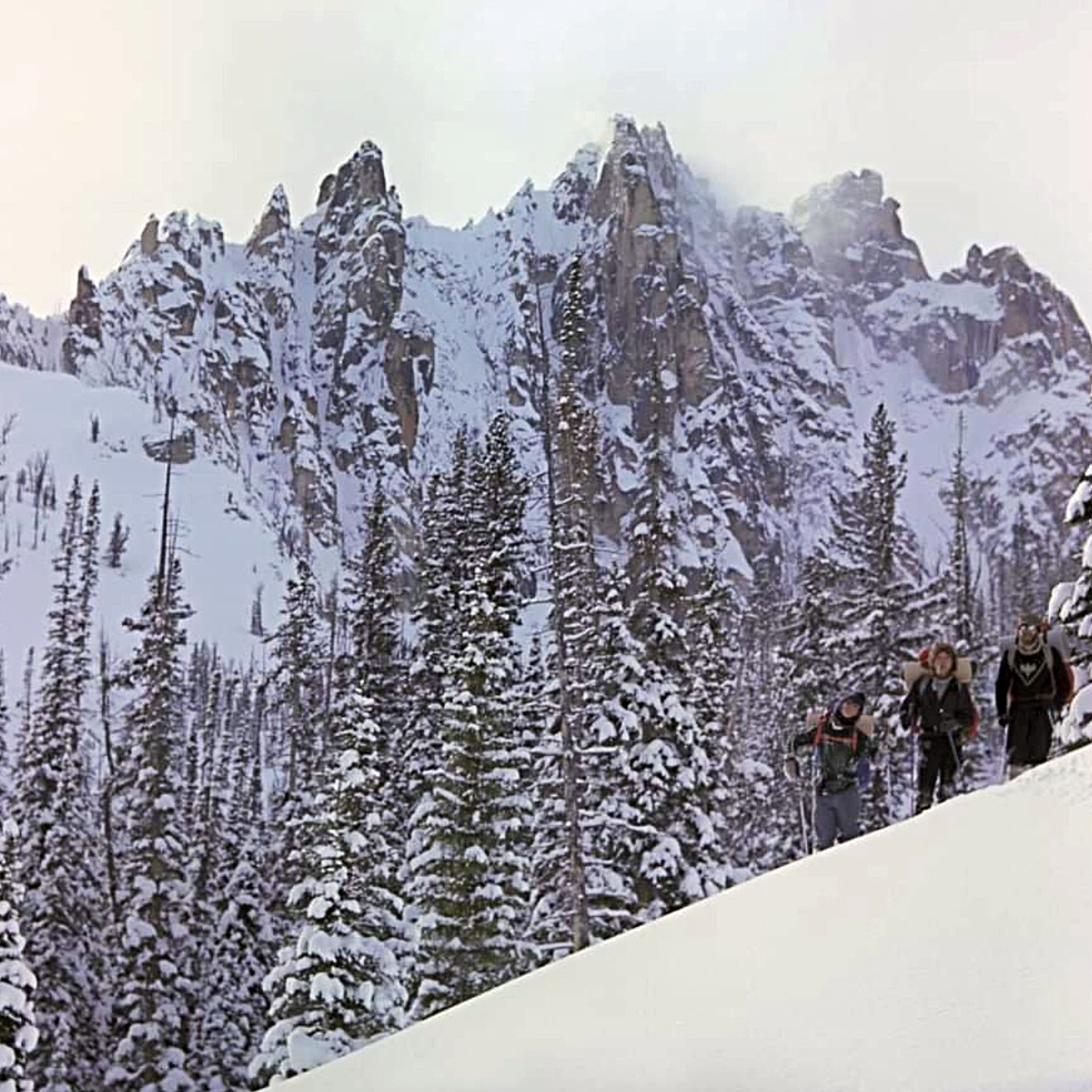
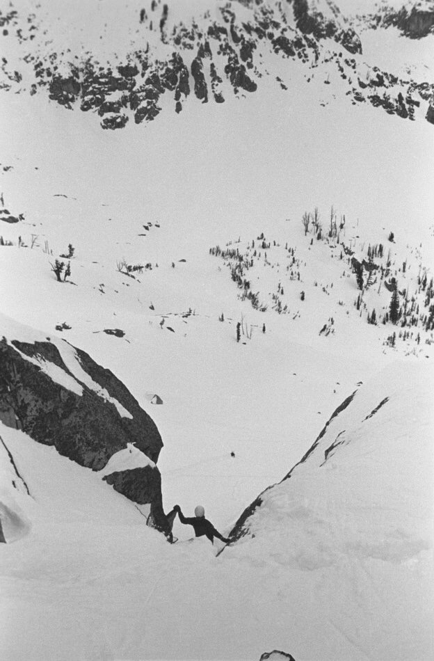
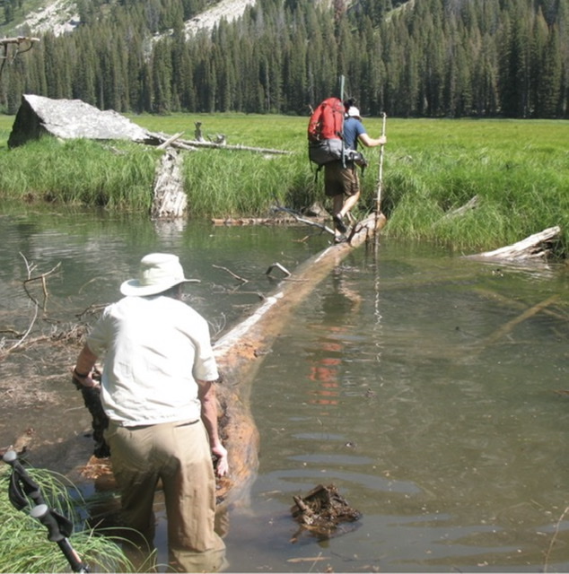
    The following day, they bushwhacked over Dave’s pass into the upper South Fork Payette Basin. They went over a trail-less low pass west of Toxaway Lake to Vernon Lake. Then they had to follow twisty elk trails at a slow pace for miles down the South Fork Payette Valley until they were almost to where they would need to cross the river to go up to the Rakers. At that point, they intersected a beautiful, newly-cleared Forest Service trail which they had likely been next to for several miles. One-half mile above Elk Lake, they camped in a meadow and the next day Bob and Dave hiked about 3,700 vertical feet up steep slopes to the east and made a first ascent of another big mountain, Elk Peak (10,582 feet). I had an easier time of it in 1971 when Harry Bowron and I camped in the Upper Redfish Lakes basin at about 8,700 feet, northeast of Elk Peak, and the next day chased a mountain goat up the north ridge of Elk Peak. Although Bob and Dave are credited with having climbed the east ridge, we all most likely hiked the north ridge which is an obvious route and the first one they would have come to.

    Elk Peak at top center-right and Upper Redfish Lakes from Packrat Peak (1972). Ray Brooks Photo

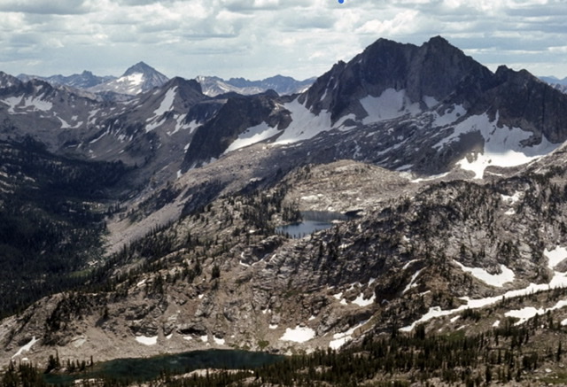
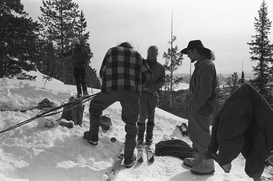
    From the top of Elk Peak, Bob and Dave were able to clearly see the least difficult way to access the Rakers, which was up aptly named Fall Creek, just above their camp. Dave did not believe he could take his horses up there so they first planned to go up with minimal overnight gear, bivouac just below the Rakers, and climb the next day. During a rest day, they ended up deciding to do the trip in one day with an early-morning start. The first obstacle the next morning, was the deep and fast-flowing South Fork Payette. Dave solved the problem by cutting down a tree for a bridge with an axe he just happened to be carrying. It took them about 3-1/2 hours to make the hike up to the north side of the Rakers. I went up the same way in 2009 with my wife Dorita and our fit friends Jerry and Angie Richardson, but we backpacked all our camping gear up the trail-less, steep, and brushy lower part of Fall Creek. From there, we followed game trails up more open terrain to the Rakers.

    North Raker at right and South Raker at left. Ray Brooks Photo

    The Underhills and Dave were able to scramble nearly to the top of the North Raker, but were defeated by a steep, holdless, and rotten tower that was its southern high point. However, they were able to do a first ascent on the smaller South Raker as well as some much smaller summits between them.

    Bob Underhill at their 1934 high point on the North Raker. Miriam Underhill Photo

    Dave and the Underhills were able to go up to the Rakers, have their climbing adventure, and make it back to their camp on the South Fork Payette in one long day. In 2009, we hiked around the Rakers and spent another day exploring peaks on the east side of Fall Creek. Unfortunately, when we went back down to the South Fork Payette, we ended up descending steep terrain a little ways down-river from where we had gone up. We discovered a bottomless side-channel, but we were able to cross by breaking a floating Spruce log loose from our side, which Jerry pulled and I pushed to make a floating bridge.

    Ray Brooks and Jerry Richardson. Dorita Hoff Photo (2009)

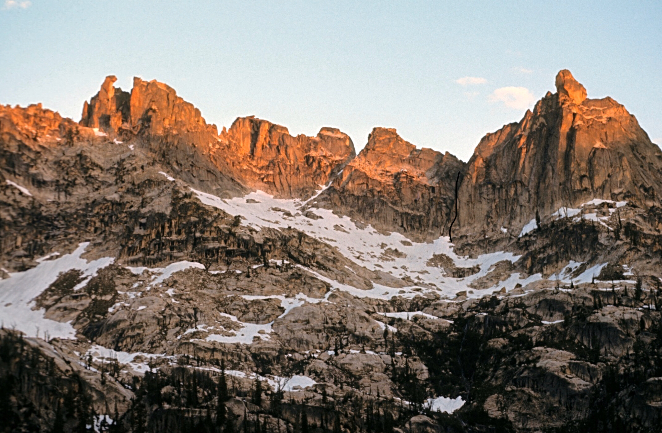
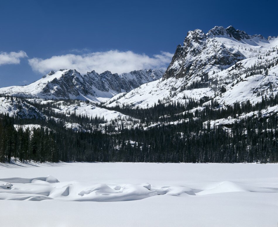
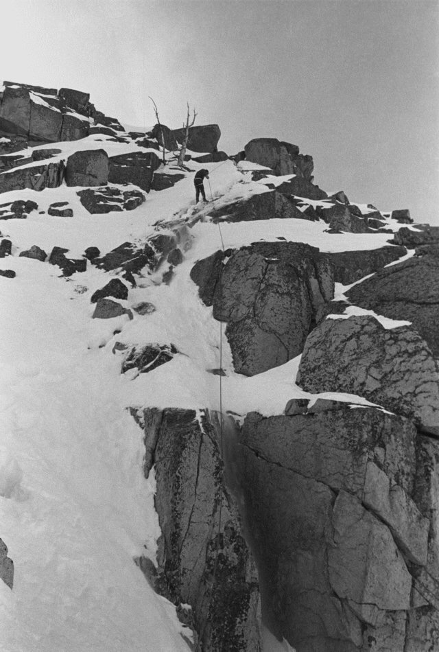
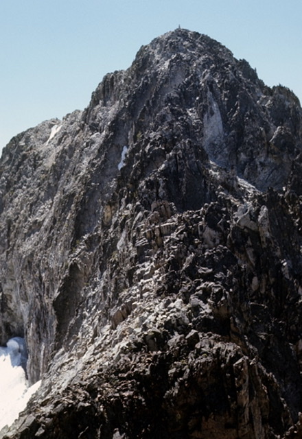
    The food box Dave and the Underhills had packed for eight days was nearly empty, but they decided to stretch their food and go down the South Fork Payette Trail to Grandjean, then up Trail Creek to near 10,190-foot Mount Regan and climb it before going out to Stanley Lake and roads. They discovered Trail Creek was badly named and they had more adventures getting their horses up it. After camping west of Mount Regan, they tried to climb Mount Regan by the northwest ridge the next day, but were defeated on their first attempt by what Miriam describes as a 20-foot wide gap. They had to go back down, circle the mountain, and make a first ascent of it by the southeast ridge.

    Mount Regan at center, its northwest ridge at right, Sawtooth Lake, and the author. Dorita Hoff Photo (2019)

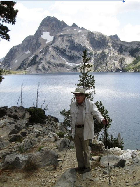
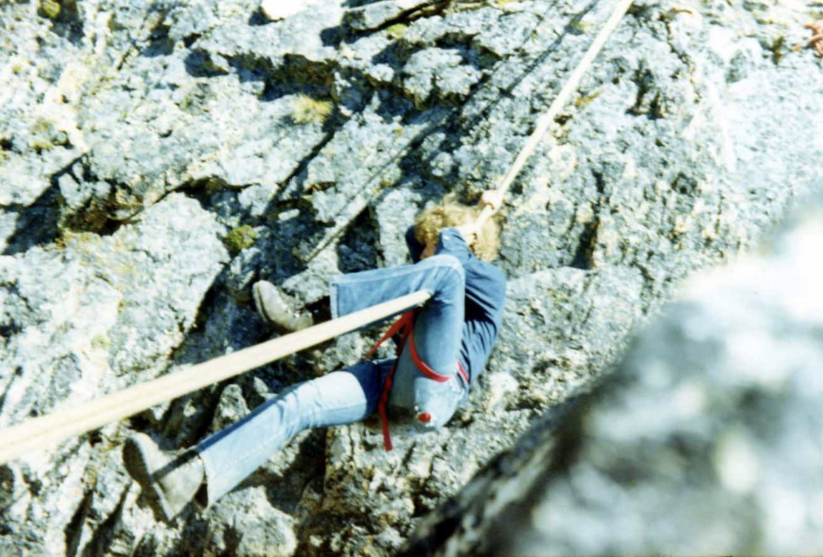
    I climbed Mount Regan via the northwest ridge in August of 1970 with three friends. It was my first Sawtooth peak and all we knew about it was that it had been climbed. We found it on a Forest Service map, hiked up a good trail to Sawtooth Lake and camped under the east side of Mount Regan. During the evening, we agreed on a likely route and the next morning, we scrambled up the peak. We had a 120-foot Goldline rope and some climbing gear with us and our best climber, Harry Bowron, did a little engineering to rig our rope across the gap that stopped the Underhills and Dave, so the rest of us could slide across the rope in what’s now called a “Tyrolean Traverse.” I was somewhat surprised to learn a few years back, that minor obstacle had stopped the Underhills. What is more interesting is Bob Underhill posted this footnote to their climb in his 1938 article on their Sawtooth adventures in Appalachia Magazine. “Nor do I think it could be crossed by a rope traverse at least at any point we investigated.”

    Gordon Williams on our Tyrolean Traverse on the Northwest Ridge of Mount Regan. Ray Brooks Photo (1970)

    The Underhills and Dave Williams were from very different backgrounds, but they had shared a grand 10-day adventure and were now lifelong friends. Before they parted, they were already planning another pack trip to explore the peaks of the Sawtooth Mountains. Bob Underhill was employed as a Harvard instructor, first in Mathematics, then he became a philosophy professor there and perhaps those responsibilities led to him and Miriam not being able to visit the area again until early September 1935.

    Dave Williams met them at the Shoshone train station, 118 miles south of Stanley. This year, they only had a 3-week break from responsibilities and had journeyed by train to Idaho from Boston. Dave had plans to pack along a larger tent and a camp stove he carried when packing hunting parties, to deal with cold Fall nights in the mountains. Miriam noted one of Dave’s lighthearted remarks on the drive from Shoshone to his ranch. “I can’t understand you Bob, he observed thoughtfully. In my experience there’s just two reasons for a man to go off into the woods. One is to get away from his wife and the other is to get drunk. But you bring your wife with you and you don’t bring no whiskey.”

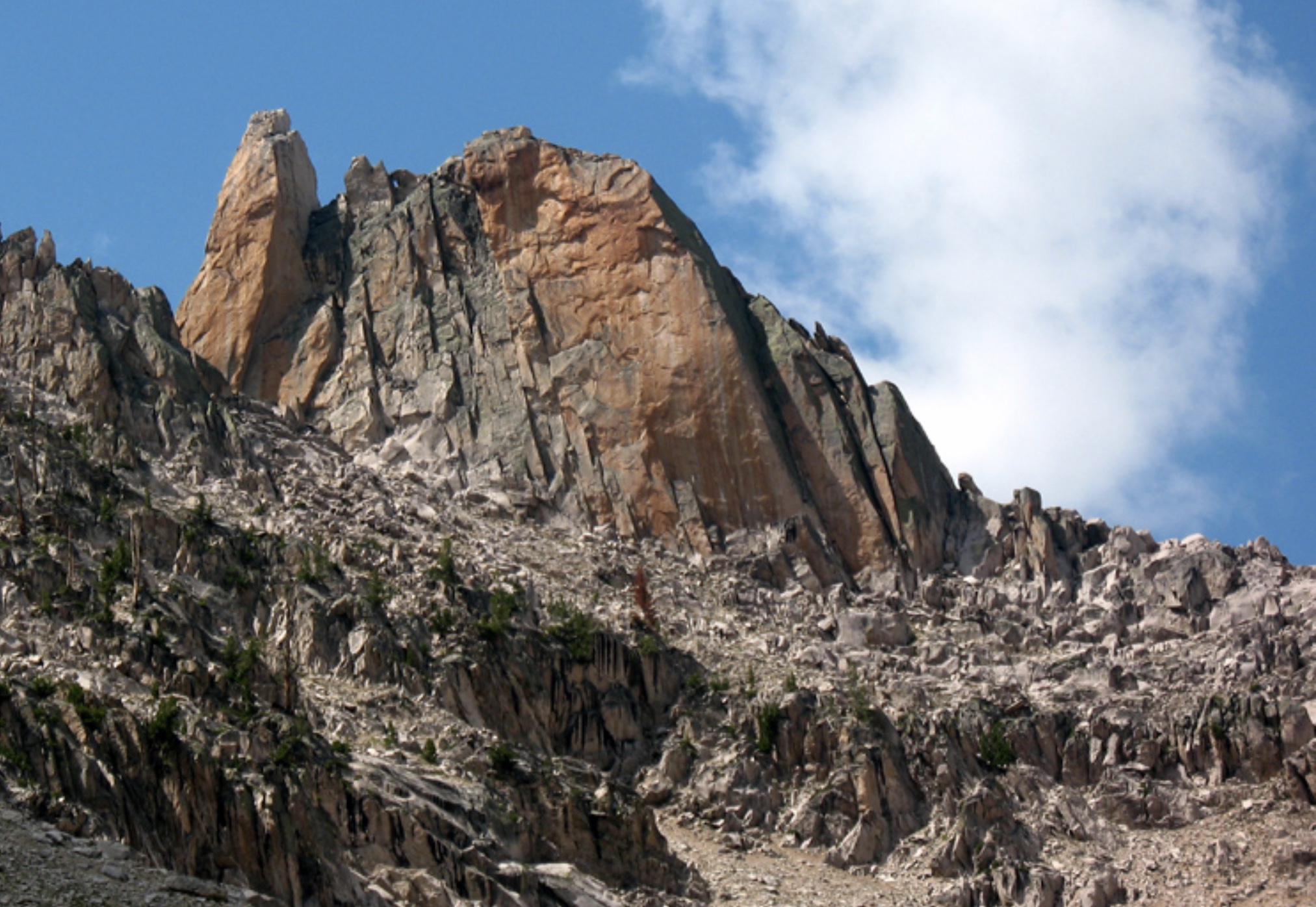
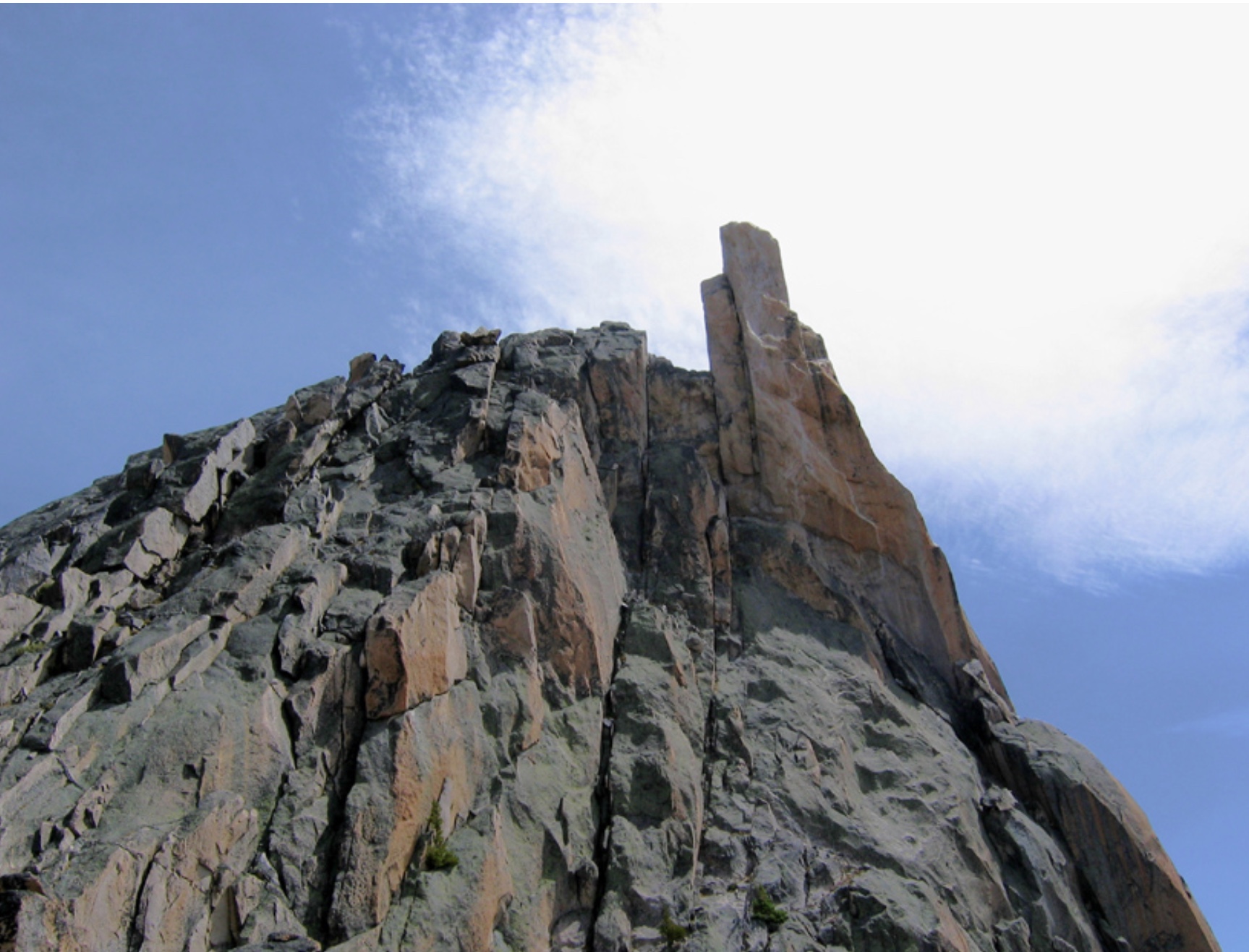
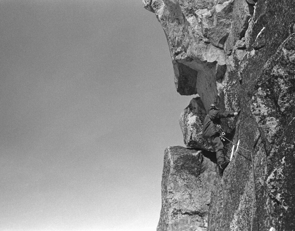
    The first 1935 trip objective was Mount Heyburn just west of Redfish Lake. The Underhills and Dave Williams went up the long decomposing granite slopes on the south side of Mount Heyburn from Redfish Lake Creek and after exploring three of Heyburn’s possible high points, succeeded in making a first ascent of the highest summit via the 5.6-difficulty Southwest Ridge Route. Bob was moved to describe the crumbly granite on the ridge: “The smooth gables and humps which formed the crest of the ridge were surfaced with a gravelly material that crumbled off like well-caked mud.” Later Sawtooth climbers would describe the southern slopes of Mount Heyburn as being composed of “ball-bearing granite.”

    The complex and often rotten south side of Mount Heyburn. Ray Brooks Photo (2011)

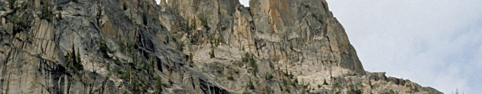
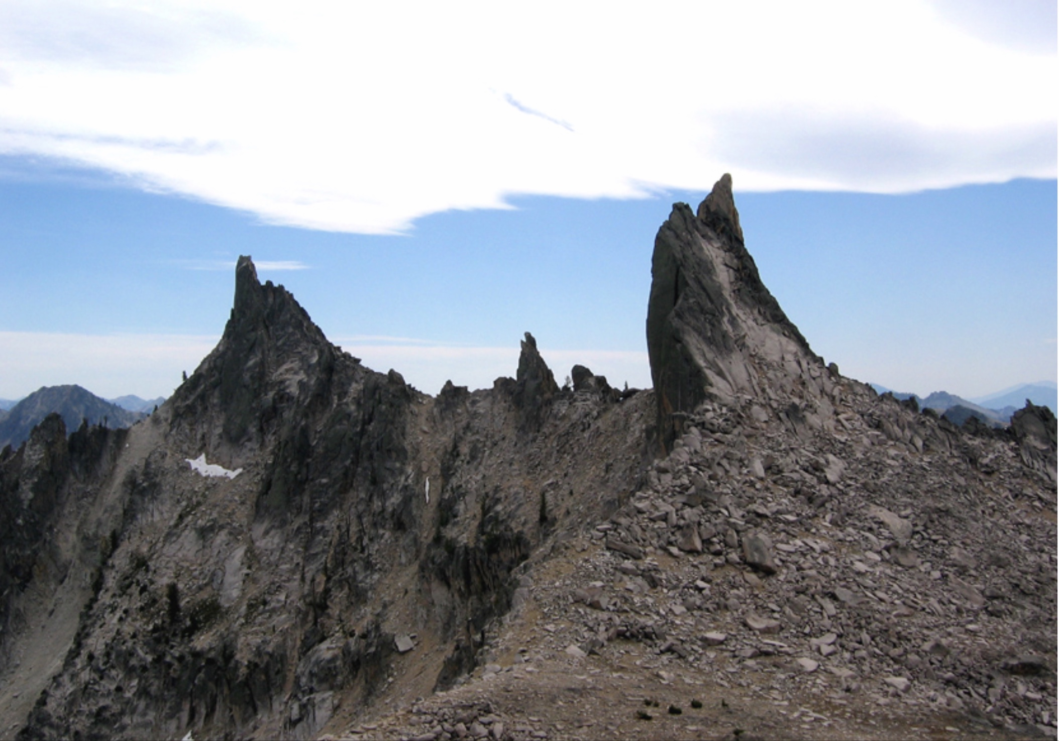
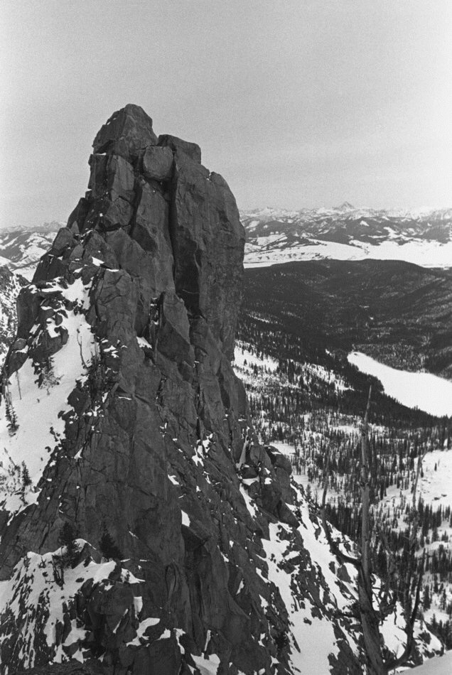
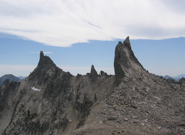
    During the two days they spent exploring Mt. Heyburn’s rotten rock, Bob was also most impressed with what were later named the Black and Grand Aiguilles, located in a small cirque adjacent to and just southwest of Heyburn.

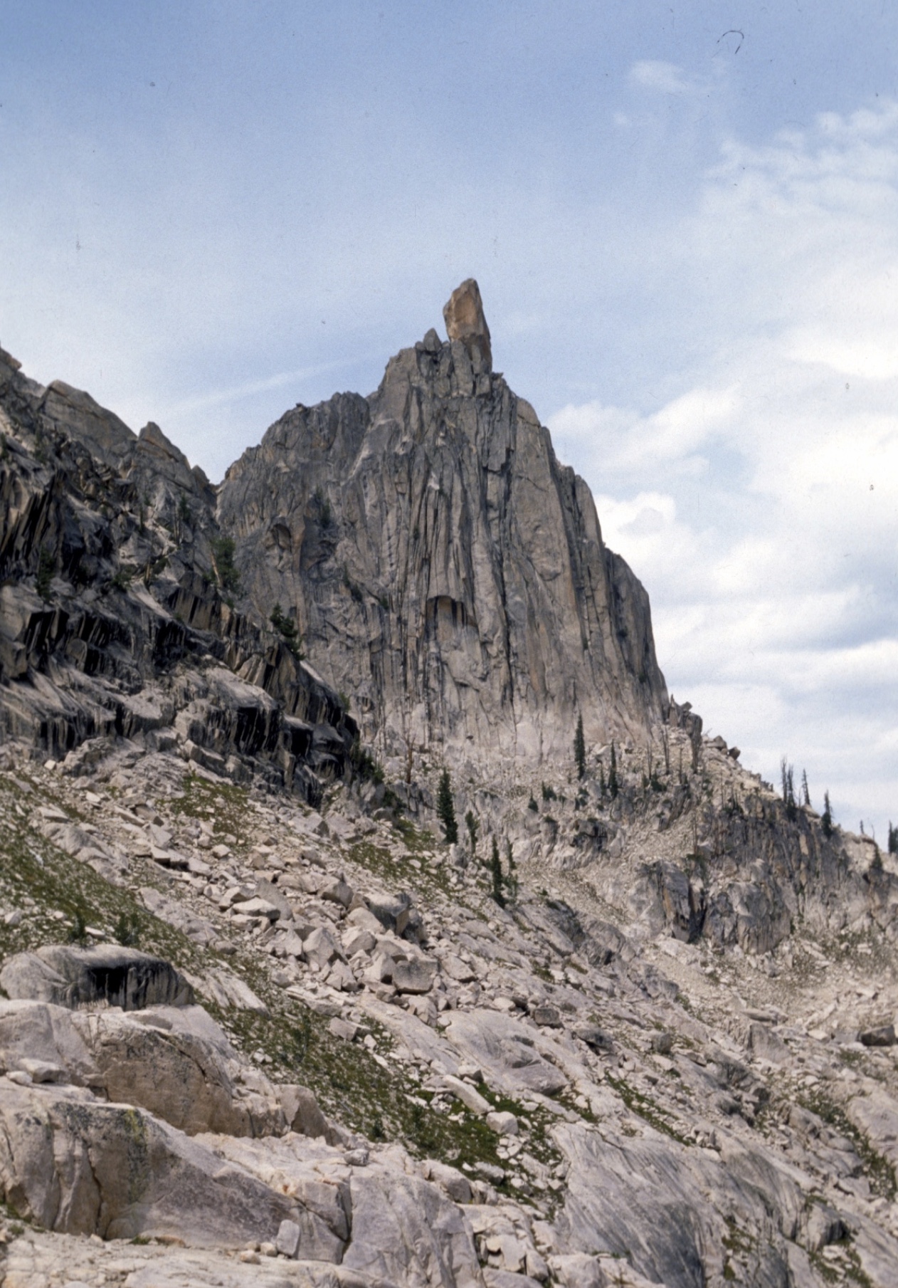
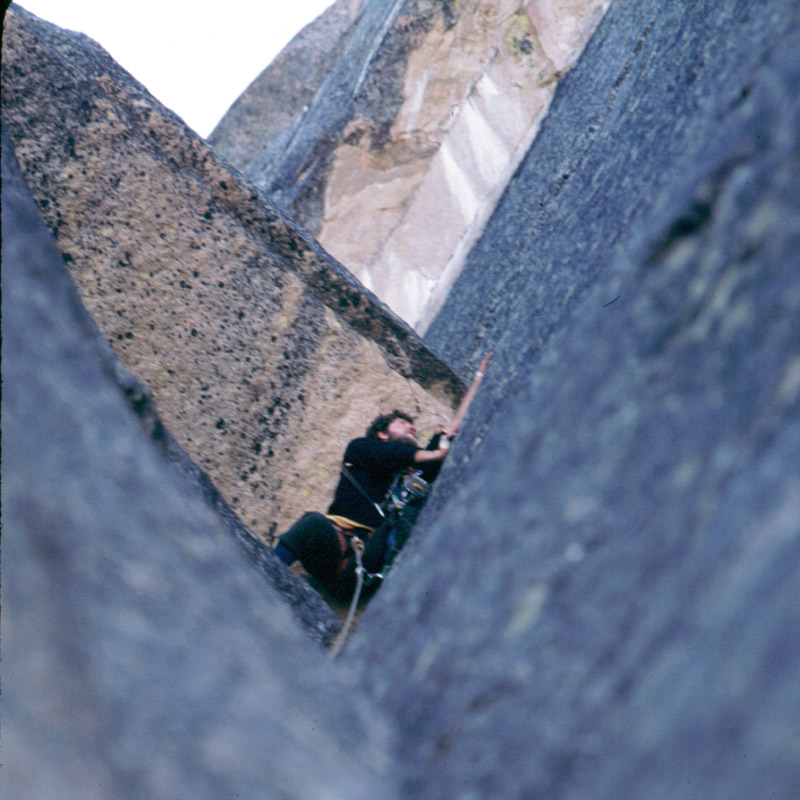
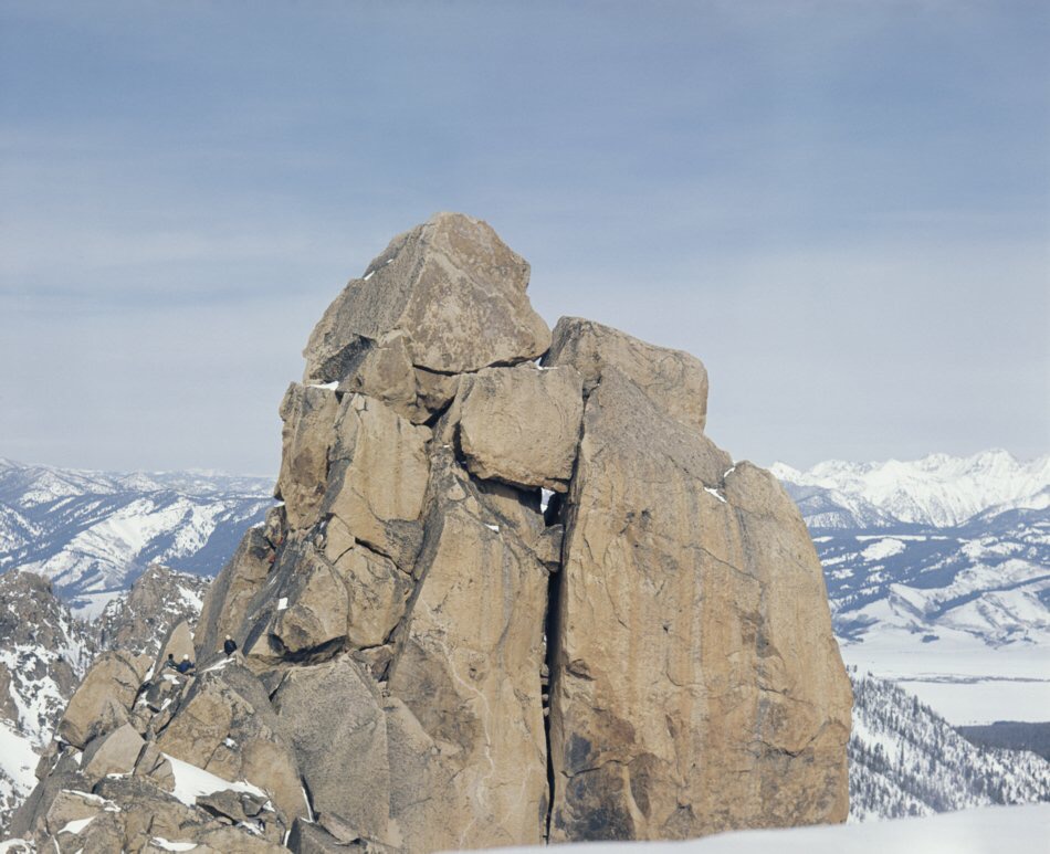
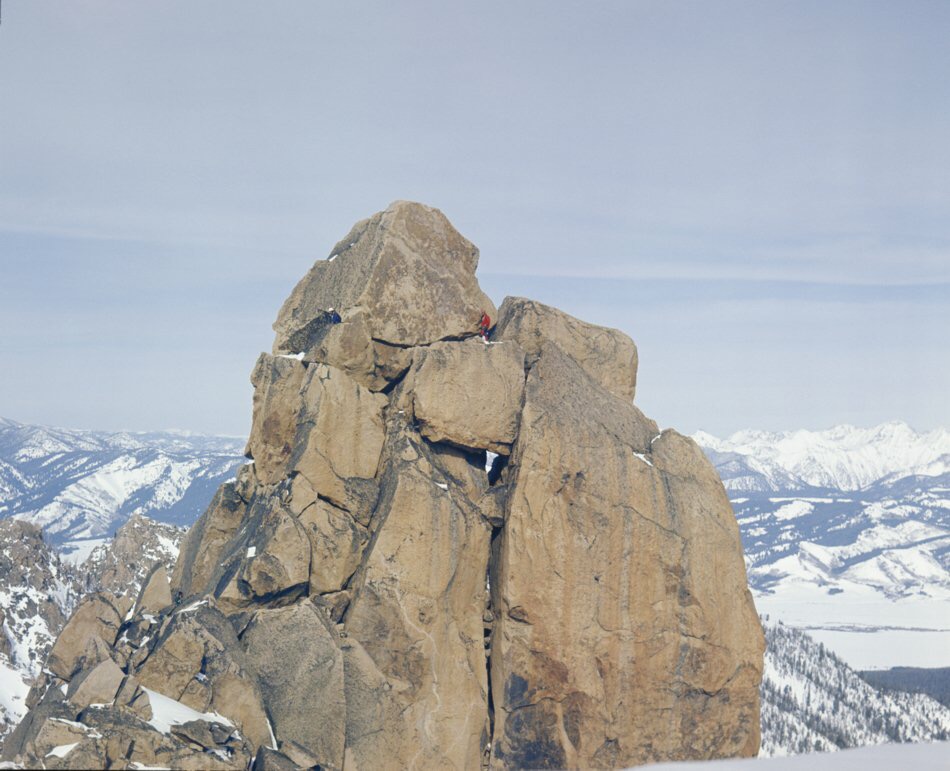
    Bob wrote that they were genuine Chamonix-type aiguilles that would provide magnificent ascents if they could be climbed without artificial aids. That conclusion was reached after they made attempts on each summit. These aiguilles and others nearby, were later considered major Sawtooth challenges and most of them were climbed in the 1940s by routes not considered difficult by modern standards. I never visited them until my wife Dorita and I hiked up to the Grand Aiguille in 2011 with a light rack of climbing gear and a 9mm rope, expecting to “knock-off” the 5.4 route it was first climbed by in 1946. When I got up close to the Grand Aiguille, I was suddenly just as impressed with it as Bob Underhill was in 1934. I simply could not see an easy route up it and notes from the 1946 first ascent mentioning “The third pitch leads to some large granite flakes out on the face. (These flakes are shaky when pulled outward, but are secure when downward pressure is placed directly on them.)” were worrisome to me. I found myself wondering just how shaky those flakes now were, 66 years after the first ascent. It was a nice scenic cirque and Dorita and I spent the rest of the afternoon exploring it and enjoying the views after I gave up on the climb.

    North face and northwest ridge of the Grand Aiguille. Ray Brooks Photo (2011)

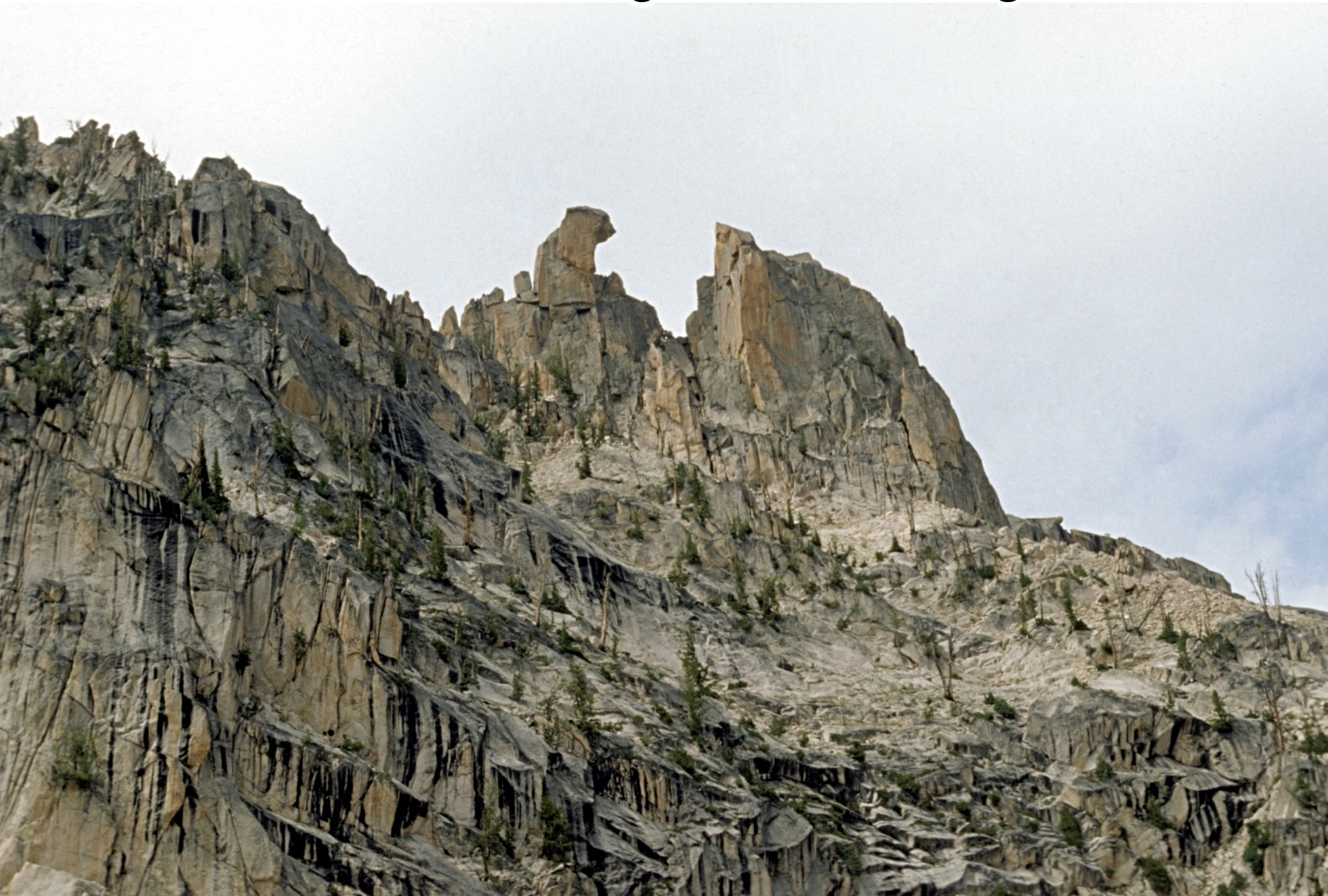
    From their camp below Mount Heyburn, Dave’s horses carried them up Redfish Lake Creek to another camp spot. They spent two days exploring peaks to the northwest and made a first ascent of another of the highest and most scenic peaks in the range, Packrat Peak (10,240 feet). Bob mentions an attempt on another peak bordering Redfish Lake Creek which they could not complete, since they had neglected to bring a rope and Miriam mentions achieving other ascents “up Redfish Creek.” Although I can’t find any specific mention in the Underhill’s Sawtooth stories, they are also credited with a first ascent of the next peak south of Packrat. The 10,160-foot peak is now named Mount Underhill in their honor. Both Bob and Miriam stayed discretely silent about the many unclimbed sharp and technical summits just north of Packrat Peak. Perhaps they planned on another Sawtooth trip that never happened?

    Harry Bowron and David Thomas with Packrat Peak in the background. We and the Underhill party climbed the camera-facing east side of the peak. Ray Brooks Photo (1972)

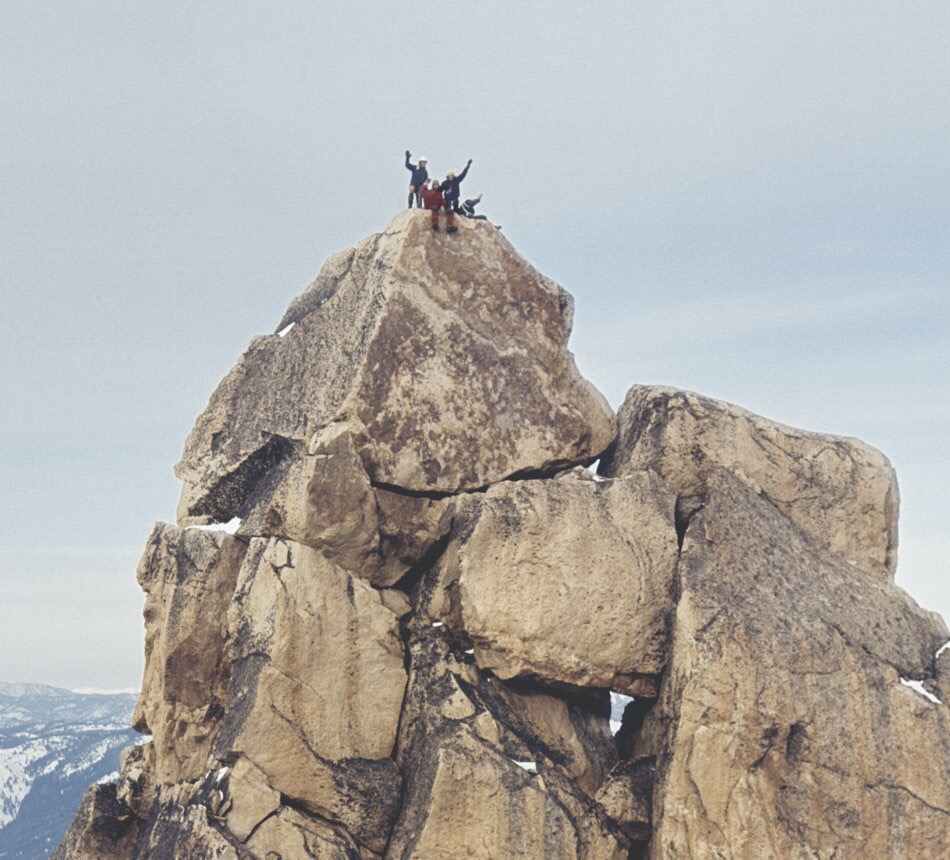
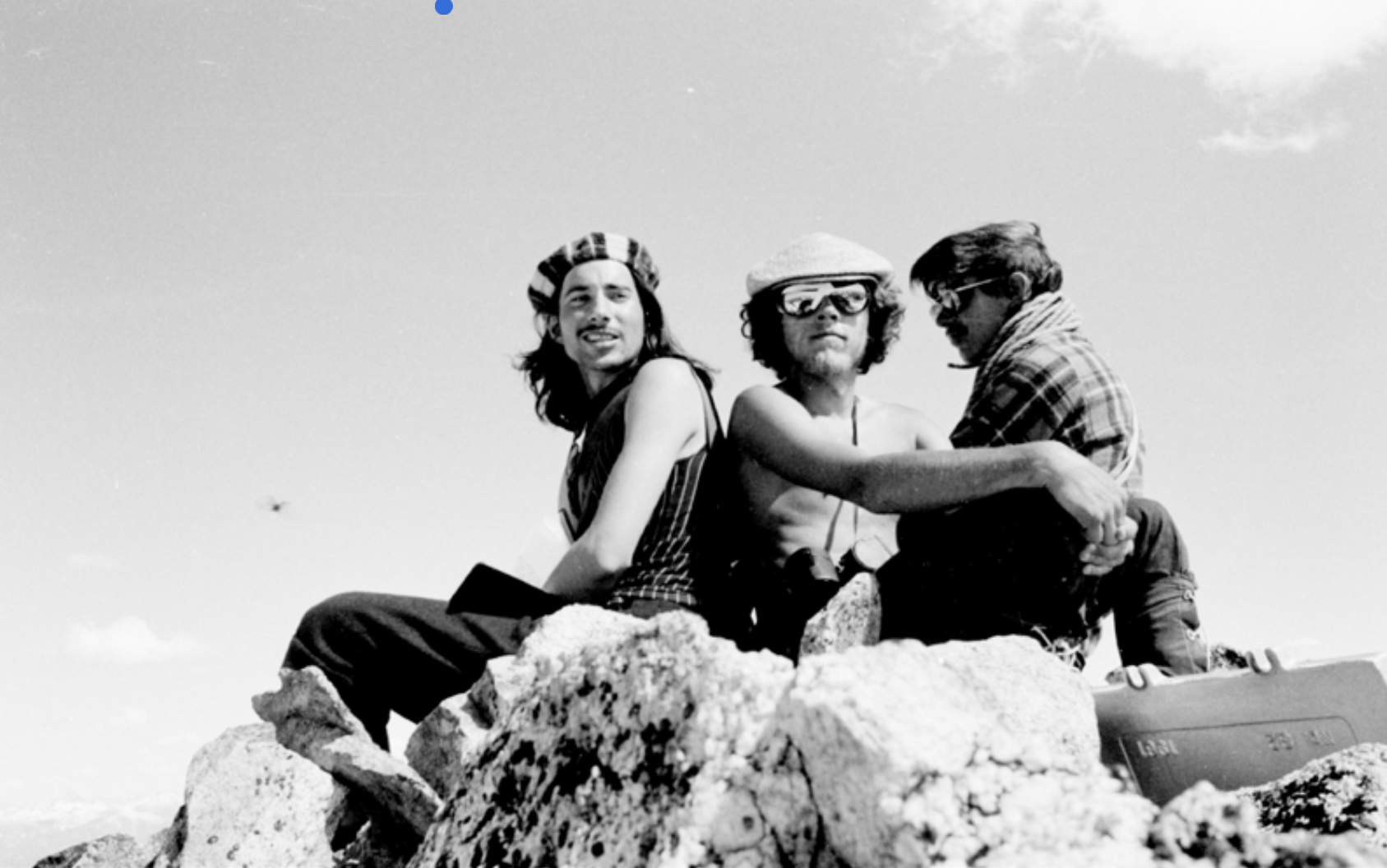
    Then Dave and the Underhills traveled back down to Redfish Lake and up Fishhook Creek, the other main tributary stream of Redfish Lake, and camped. From there, they made the first recorded ascent of the highest of the Sawtooth Mountains, 10,751-foot Thompson Peak. It is difficult for me to follow Bob’s description of how they approached and climbed Thompson, so I won’t attempt to share it. Dave and the Underhills also hiked 0.8 mile north from the summit of Thompson and made the first ascent of what is now named Williams Peak in honor of Dave Williams. Thompson was the second Sawtooth peak I climbed in June 1971 with my friends Harry Bowron and Gordon Williams, and we managed a summit group portrait.

    On the summit. Ray Brooks Photo

    That was it for the Underhills in the Sawtooth Range. On their 1935 visit, they also made the second ascent of nearby 11,815-foot Castle Peak in the White Cloud Mountains. However, their visits were noted by Idaho’s largest newspaper in two articles and their Appalachia Magazine articles were noted by other U.S. climbers. They had “opened up the range” and other climbers would slowly follow them after the Great Depression and WWII ended.

    With that future in mind, Bob also wrote some notes on the Sawtooth Mountains in his 1937 Appalachia article aptly titled  “The Sawtooth Mountains of Idaho.” “The major Sawtooth peaks are between 10,000 and 11,000 feet high. The mountain valleys from which those peaks rise immediately may be situated anywhere from 8,000 to 9,000 feet. In point of elevation, therefore the climbs generally amount to very little.   Furthermore, it may as well be confessed at once that on the average they are not difficult…”

    “Much of the climbing pleasure the Sawtooth region can afford is therefore reserved exclusively for its first explorer, for whom everything has at least the fascination of being unknown and problematic. Nevertheless, I think there is quite a lot here to engage the interest of the rock climber as such – though to be sure he should be a rock climber who is willing for the moment to turn aside from long expeditions to shorter days spent largely in the lighter exercise of his craft—and preferably one who is content to accept as part of his reward the great charm of the country and of the camp life it permits…”

    Bob Underhill’s thoughts led to a strong local climber ethic about the Sawtooths that my friends and I embraced when we started climbing there in the early 1970s. Simply stated, it was “Don’t ask, don’t tell.” We all knew the fun in the Sawtooth Mountain lay in the adventure and too much knowledge of the area ruined the adventure.

    Jumping forward to 2020, it is increasingly more difficult to maintain the adventure, for those who want to discover their own new valleys, new peaks, and new routes in the Sawtooth Mountains. I realize many younger climbers crave “beta” (information and details) on routes, like we used to crave adventure. However, folks can climb in other mountain ranges and enjoy exact details on approaches, peaks, and routes. In the Sawtooths, it is still a lot of fun to just go in, pick out a peak, and attempt to climb it.

    Try it, you might like it.

    My thanks to Christine Woodside and Becky Fullerton at Appalachia Magazine for their assistance with sharing Miriam Underhill’s 1934 article, and to Tom Lopez, author of Idaho A Climbing Guide for his assistance.

    Ray Brooks. Copyright March 5, 2020

  • Fred, Pete and Jack’s Big Sawtooth Adventure by Ray Brooks

    Fred, Pete and Jack’s Big Sawtooth Adventure by Ray Brooks

    The Summer of 1949: Fred Beckey, Pete Schoening and Jack Schwabland went into Idaho’s Sawtooth Range to finish “some business” with two peaks that had repulsed their climbing attempts the previous Summer. They also had a shopping list of other unclimbed peaks in the Sawtooths. Their “Idaho adventure” may well be the most exciting epic in Idaho’s climbing history.

    Fred Beckey passed away at age 94 in 2017, after becoming a “living legend” in climbing circles as the man who had done the most first ascents and new routes in North America. Pete Schoening is most famous for saving 5 of his team-mates when they fell on K-2 during a 1953 expedition. Pete was also part of the group that made the first ascent of Gasherbrum I in 1958, the only 8,000 meter peak first climbed by Americans. Jack Schwabland was a highly respected climber who took part in many first ascents in the Northwest.

    The only write-up I have been able to find of their Sawtooth adventures is an photo-less article by Jack Schwabland in the 1950 American Alpine Journal: “Sixth-Class Climbing in the Sawtooth Range.” To chronicle their “Big Sawtooth Adventure,” I will include extracts from that article along with my own photos and experiences on these peaks.

    Their “shopping list” for the trip included: Fishhook Spire (i.e., El Pima) and Big Baron Spire (i.e., Old Smoothy) in the Baron Creek drainage, Red Finger (i.e., North Raker) in the South Fork Payette drainage and The Grand Aiguille in the Redfish Lake drainage.

    Fred, Pete, and Jack entered the Sawtooths by boating across Redfish Lake, then hiking 5 steep miles to Alpine Lake, where they left their “base camp” with a reserve cache of food and equipment. Then, with somewhat less-heavy packs, they hiked north over a pass to Baron Lakes and their first objectives. This was the era of heavy war-surplus gear and canned food for climbing trips, so their original packs likely each weighed in the 70 pound range. In 1948, Fred and Jack had been part of a group that failed in attempts on both Fishhook Spire and Big Baron Spire. On this trip, they had bolt equipment and more gear. They planned on achieving first ascents of each.

    View north from the Redfish Cr./Baron Creek divide of some of the many rock towers above Baron Lakes.   Fishhook Spire (now El Pima) at top left.  Big Baron Spire is on the far right. The 1949 route up Big Baron Spire starts below the V notch with snow, well left of Big Baron Spire, then traverses horizontally across the light colored area to the closer notch, and up the ridgeline. Ray Brooks Photo
    View north from the Redfish Creek/Baron Creek Divide of some of the many rock towers above Baron Lakes. Fishhook Spire (El Pima) is at top left. Big Baron Spire is on the far right. The 1949 route up Big Baron Spire starts below the V notch with snow, well left of Big Baron Spire. It then traverses horizontally across the light-colored area to the closer notch and up the ridgeline. Ray Brooks Photo
    Map of the Sawtooth adventure area with routes taken marked in red.  
    Map of the Sawtooth Adventure area with the routes marked in red.

    On the first day at Baron Lakes, they hiked up to Fishhook Spire’s East Face, donned tennis shoes and “wiggled up a series of steep dirt-filled chimneys to a tilted rock pile some hundred feet directly below the great overhang on the summit block.”

    The South-East-face of Fishhook Spire, at top center.  Becky route follows line of weakness to notch, at right of hook, then goes behind the spire. Ray Brooks Photo
    The Southeast Face of Fishhook Spire (El Pima) at top center. The Beckey Route follows the line of weakness to a notch at right of hook, then goes behind the spire. Ray Brooks Photo

    From there, they climbed a short jam crack and moved around to the North Side.

    “Pete gave Fred a shoulder stand from the chockstone. Fred appeared to be stymied for a moment. It was the sort of pitch you almost wanted to try to climb free, but didn’t quite think you’d make. We decide to give the pitch the benefit of the doubt and resort to direct aid. Fred gingerly stepped on top of Pete’s outstretched hands and managed to drive a spoon piton at the limit of his reach. It was only partially in, but seemed solid enough for tension, so Fred went up on it until he could reach another crack. Two more very insecure pitons and he was able to hunch himself around onto a sloping ledge at the right from where the route became easy. Pete and I swung rapidly up on the rope to find Fred reclining on a large slab. A quick shoulder stand put us on the exposed summit.”

    I climbed Fishhook Spire in 1971 with Harry Bowron by about the same route, although we knew nothing about the previous ascents. Toward the top,  I gave Harry a shoulder stand, and later he made one aid move using a postage stamp sized piton called a RURP (realized ultimate reality piton). Our ascent was only the 3rd one since 1949.

    Harry Bowron on top of Fishhook Spire, (now El Pima) 3rd ascent 1971.    Lower right side of picture shows the summit block of Big Barron Spire. Ray Brooks Photo
    Harry Bowron on top of Fishhook Spire (El Pima) on the 3rd ascent (1971). The lower right side of the photo shows the summit block of Big Baron Spire. Ray Brooks Photo

    Fred, Pete and Jack still had lots of time left in the day and decided to reconnoiter a route on Big Baron Spire. “We had no illusions about climbing it that day, but wanted to go as high as possible and find out what to expect.”

    Southeast side of Big Baron Spire. Becky route traverses to just below the notch from cliffs on left of photo, then stays near ridgeline to the summit block. Ray Brooks Photo
    The Southeast Side of Big Baron Spire. The Beckey Route traverses to just below the notch from cliffs on the left of the photo, then stays near the ridgeline to the summit block. Ray Brooks Photo

    Every approach looked difficult, but they found some surprising lines of weakness that took them to the notch below the final ridge without roping up. Even above the notch, out on the West Face, they were able to scramble still higher before finally wanting ropes for safety. They then had some difficult climbing to the bottom of the 110 feet-high summit monolith.

    “We found ourselves perched on the North Shoulder of the peak with smooth walls plunging away beneath us on 3 sides and the summit soaring directly above, some 110 feet away. As we looked up at the great block, we could understand why the Iowa Mountaineers had dubbed it ‘Old Smoothy.’  It was a magnificent piece of rock, resembling nothing so much as a monster egg standing on its end atop the rest of the mountain. It overhung all the way around and, search as we might, we could not find a single crack or hold anywhere. Reluctantly, we hauled out our drills and bolts and prepared to do battle.”

    The crack-less 110 Ft. high summit block of Big Baron Spire. The 1949 bolt ladder goes up it, near the left skyline. Ray Brooks Photo
    The crackless 110-foot summit block of Big Baron Spire. The 1949 bolt ladder goes up it, near the left skyline. Ray Brooks Photo

    “We decided to climb alongside the Northwest Corner, since that offered only 25 feet of overhang, followed by 35 feet of 75-degree slab, to a ridge where we hoped to find a hold or two. Pete mounted our shoulders to drill the first hole—-hurrying, because black clouds were rolling in from the southwest. Taking turns at drilling, we managed to place 7 bolts up the overhang and just get over onto the great slab before the rocks started buzzing with static electricity and an ominous rumbling informed us the storm was at hand.”

    “We huddled under an overhang for more than an hour while lighting crackled about us and hail danced off the rocks.  By the time the rock had dried enough to let us climb safely again, it was nearly dark. Leaving the hardware and one rope in place, we descended to camp, resolved to start early in the morning.”

    Day Two of the climb on Big Baron Spire was long and exciting, and nearly resulted in the deaths of the climbers.

    “As soon as it was light enough to see, we were pushing up the lower slopes again. The preliminary Class 3 and Class 4 rock climbing went rapidly and we found ourselves huddled on the shoulder once again while the sun was still near the horizon. Although it was bitterly cold, the weather was beautiful and we had high hopes of standing on the summit before sunset.”

    “The drilling took much longer now, as the drills were getting duller and duller with each hole.  We took turns at this unpleasant chore. Each man would place 2-3 bolts while the second man belayed and the third sharpened the extra drills.  Late in the morning, I placed the 14th bolt just under the crest of the ridge, then dropped on tension to the shoulder. Fred replaced me on the rope and was hauled up to the highest bolt. By working up the sling and using his hands for balance, he succeeded in standing on the bolt and hauling himself astride the steeply-pitched ridge. Fifteen feet away was a tilted depression where, it seemed, a man might stand. This ‘bowl’ was the closest thing to a belay point on the whole summit block. Fred wormed over to it and put in a bolt for an anchor. He peered upward and saw that the arête above steepened again almost to the vertical. There appeared to be an occasional hold, but it still looked like a bolt job all the way.“

    With the summit only 40 feet away, Fred had to rappel off the summit block when a new storm appeared.

    “We held a council of war and determined to wait and try to finish the climb when the storm blew over. Hours passed by, while hail and freezing rain soaked us to the skin and lightning flashed in the murky sky. Finally we could see that it was getting dark and we decided to make a run for camp while we still could.  We skidded around the slabby corner and raced down the ledge toward the wall above the finger traverse.”

    “The rock was running with water, and every hold was packed with hail as we climbed down the wall. Pete started across the traverse just as the storm picked up in intensity. Lightning struck within 200 feet of us 3 times in quick succession. Pete reared back, blinded by the flashes, and it was several minutes before he could go on.”

    “As the storm increased in fury, we all wondered whether we were to get down alive. The ’V’ crack was a terrible thing with water sluicing down its twisting length and lightning knifing all around. Fred and I took tension from the rope, while Pete half climbed, half fell as best he could. The remaining pitches were easier, but the lightning was still striking terrifyingly close.”

    Back in camp, the beat-up climbers watched the storm clear and wondered if they were ever going to climb Big Baron Spire. The next morning, Pete had a wrenched shoulder and Dick a very sore ankle. Of course, they went back up on the mountain. This time both Fred and Pete climbed up to the top of the bolt ladder and Pete started to the top.

    The top of the summit block. The bolt route goes up the right skyline. Ray Brooks Photo
    The top of the summit block. The bolt route goes up the right skyline. Ray Brooks Photo

    After a shoulder stand and four more bolts: “Pete was clinging to a tiny projection only 15 feet from the top. Things were looking up.”

    Pete climbed free to the summit and clasped his hands in the victory sign. A total of 20 bolts had been placed. The climbers were so wary of another approaching lightning storm, that Jack didn’t follow Pete and Fred to the summit. However, they had no more storms that day and were able to go back over to their base camp at Alpine Lake.

    In the 1970s, I climbed Big Baron Spire 3 times by two different routes that Harry Bowron and I pioneered. When we first arrived at the bottom of the bolt ladder in 1971: what we saw was a long line of rusted and bent ¼” diameter bolts without hangers. The bolts looked horrible, some appeared to be missing, and we did not have the gear to climb the dilapidated bolt ladder. On a 1977 ascent, we brought bolt hangers and bolting gear, but were thwarted by a thunderstorm that forced us back off the mountain.

    Since I was last at the summit block in 1977, some Good Samaritan had put hangers on the old ¼” bolts and replace those that were missing when we were there. In 2009, I shared emails with Radek Chalupa, who climbed the bolt ladder in late Summer 2009. From his account, it appears that at least some of the missing or unusable bolts have been replaced, but the classic Fred Beckey drill bit remains.

    Fred Becky’s drill-bit/critical aid placement, with a modern wired stopper in place of a bolt hanger. Ray Brooks Photo
    Fred Beckey’s drill bit/critical aid placement, with a modern wired stopper in place of a bolt hanger. Radek Chalupa Photo

    During a rest day back at their Alpine Lake base camp, Fred and Pete made the decision to make the long off-trail hike west into the South Fork Payette drainage to the remote “Red Finger” (i.e., North Raker). Jack would stay at Alpine Lake, and rest his injured leg.

    Besides presenting an enticing profile, when viewed from afar, the attraction of North Raker was that climbing legend Robert Underhill had attempted it during the first of his two Summers of exploration and climbing in the Sawtooth Range in 1934-35. Underhill may have been the best male rock climber in North America at the time and his wife Miriam was certainly the best female climber, but they were not able to climb North Raker. No recorded attempts on its remote summit had been made since 1934. [Miriam Underhill, “Give Me The Hills,” 1956]

    The North Raker, at top center skyline, from high up in the Baron Creek drainage. Ray Brooks Photo
    North Raker (at top center skyline) as viewed from high up in the Baron Creek drainage. Ray Brooks Photo

    Fred and Pete worked south from Alpine Lake and traversed off-trail into the Upper Redfish Lakes Basin. They ignored nearby attractive summits and slogged up a 10,074-foot pile of rubble called Reward Peak. The summit of Reward, which sits on the divide between the Redfish Lake Creek drainage and the South Fork Payette drainage, gave them a good view of the approach to North Raker. From Reward Peak, they dropped 3,400 vertical feet to the South Fork Payette, forded it in hip-deep water and explored up Fall Creek on the South Side of The Rakers (there is also a South Raker that the Underhills did climb in 1934).

    I hiked with my wife Dorita and 2 fit young friends up the South Fork Payette in late August 2009 and, with some searching, discovered a large log spanning the river just above Elk Lake. Our group found the trail-less terrain leading up Fall Creek to be difficult, wet, loose and brushy. Fred and Pete likely thought it almost pleasant, when compared to their usual cold-jungle bushwhacking in the North Cascade Range.

    After camping a couple of miles up Fall Creek, the next morning Fred and Pete followed grassy open hillsides to a lake basin on the East Side of The Rakers. From there, North Raker looked rather difficult to them.

    The North Raker from the east, with the highest summit at left. Ray Brooks Photo
    North Raker as viewed from the east with the highest summit at left. Ray Brooks Photo

    They hiked up to the saddle to the right/north of North Raker and then discovered that its West Face was more welcoming to climbers. Without roping-up, they were able to scramble to the cairn that marked the high point of Robert Underhill’s 1934 attempt. From this point, it was less than 100 feet to the top of the summit tower, but the route looked hopeless from all sides.

    South Raker at left, North Raker at right. Ray Brooks Photo
    South Raker (left) and North Raker (right). Ray Brooks Photo
    The final summit problem on the North Raker, at top-right. Fred & Pete climbed the overhanging side that faces the camera. Ray Brooks Photo
    The final summit problem on North Raker at top-right. Fred and Pete climbed the overhanging side that faces the camera. Ray Brooks Photo

    “A rope-length traverse was made over considerable exposure to the notch on the North Corner of the peak. Fred anchored to a piton and the climb began.” “Pete traversed right about 15 feet and reached an overhanging crack that appeared to lead somewhere.The crack was composed of a crumbling granitic rubble which took several direct-aid pitons in one place at one time to be even reasonably safe.“

    “Fifteen feet of this, over a space of an hour, convinced Pete that he wanted a rest. Accordingly, he lowered himself back to the notch and Fred took over. He hammered in a giant angle piton behind a loose chockstone, hoping it would act as a wedge and tighten everything up.

    Above this, the crack being absolutely smooth and rather useless for a way, Fred drilled a hole and drove in a solid-sounding bolt. This had a decidedly reassuring effect on his jangled nerves, since the drop was still 500 feet and the quality of the pitons below him was such that any kind of fall would have made them all pop out like buttons from a shirt.”

    Pete took over again and managed to place two pitons and a bolt (their drill was so dull, it was nearly useless) before switching with Fred. Fred placed another piton and another bolt and could see the end of the overhanging section just above. After another trade, Pete was able to climb a 3” wide jam-crack to a ledge. Then with the help of a shoulder stand, Fred jam-cracked another 12 feet to the summit.

    They enjoyed the tiny summit for a few minutes, Pete claimed a lone-eagle feather and then started down. By nightfall, they were back across the South Fork Payette and had climbed to within only 1,100 vertical feet of the pass into Redfish Lake Creek.

    Reward Peak at top center, from near the North Raker.   Fred & Pete went 3,400 vertical feet up and down the appropriately named Drop Creek drainage, below Reward Peak. Ray Brooks Photo
    Reward Peak (at top center) as viewed from near North Raker. Fred and Pete went 3,400 vertical feet up and down the appropriately named Drop Creek drainage below Reward Peak. Ray Brooks Photo

    The next day, they returned to camp at Alpine Lake after making the 3rd ascent of Packrat Peak 10,240 Feet. They loosely followed the route Robert Underhill used to make the 1st ascent of Packrat with his wife Miriam and local packer Dave Williams in 1934. Fred and Pete had a pleasant Class 3-4 scramble on the complex but forgiving East Face.

    Harry Bowron & Dave Thomas, just before we climbed Packrat in 1972.  The East Face route, is to the left in this photo.  We stayed more on the prominent rib at left center. Ray Brooks Photo
    Harry Bowron and Dave Thomas just before we climbed Packrat in 1972. The East Face Route is to the left in this photo. We stayed more on the prominent rib at left center. Ray Brooks Photo

    When they arrived at Alpine Lake in the late afternoon, they found a note from Jack that he had departed for the social life at Redfish Lake. Fred and Pete packed up the remaining gear and trudged back down the trail to the upper end of Redfish Lake and camped, since they planned to climb the nearby Grand Aiguille the next day. Jack picks the story back up at this point.

    “As a gesture of friendship, Fred decided to hike around the lake (5 miles with quite a bit of elevation gain and loss) to the lodge to tell me of their plans in case I could go with them. He arrived just in time to join me at a beach party I was having with a couple of heartening samples of the unattached females who infested the place.  I reluctantly informed him that I would not be able to climb in the morning, but that I would be glad to row him back to save him the 5-mile walk. Thus 4:30AM found us sleepily stroking a rowboat up the lake. Unearthly yodels as we rounded the point informed us that Pete was up and had breakfast ready. An hour later, they started off while I hitched a ride back on the ever-present tourist launch.”

    The Grand Aiguille is a prominent formation above the South End of Redfish Lake. Its first ascent in 1946 is rated Class 5.4 and apparently the rock tower was of interest to Fred and Pete. It is described in Tom Lopez’s fine book “Idaho: A Climbing Guide,” but that area of the Sawtooth Range has a reputation for “ball-bearing” granite and I had never trudged up to the small cirque it is in until early September 2011.

    Early-morning alpenglow on the Grand Aiguille, at center of photo. Ray Brooks Photo
    Early-morning alpenglow on the Grand Aiguille (center). Ray Brooks Photo

    It is several miles and about 3,000 vertical feet from Redfish Lake to the top of the Grand Aiguille. Fred and Pete knocked the 2nd ascent off and were back at Redfish Lake Lodge shortly after noon.

    “They reported a spectacular Class 4 and Class 5 climb on good rock, the crux of which was a vertical crack jammed with overhanging chockstones.”

    After hiking up to the route with Dorita, equipped with a 9mm rope and minimal technical climbing gear, I suffered a reality check when looking for possible easy routes. I can only commend Fred and Pete for their fortitude and speed on the Grand Aiguille. It looked like more of a challenge than I wanted at the time.

    The North-east side of the Grand Aiguille.   The route goes up the snowy gully to the ridge, then apparently follows the ridge, until it goes out of sight to the right. Ray Brooks Photo
    The Northeast Side of the Grand Aiguille. The route goes up the snowy gully to the ridge then apparently follows the ridge until it goes out of sight to the right. Ray Brooks Photo
  • The Decker Flat Climbing & Frisbee Club By Ray Brooks

    The Decker Flat Climbing & Frisbee Club By Ray Brooks

    I guess we were the Decker Flat Climbing & Frisbee Club (DFC&FC) before anyone, including us, knew. The little guy in the back of my mind liked the way the words fit together. Until the name popped into my head we were simply a group of like-minded climbers who lacked an identifying name. However, on a fateful morning in the mountains of Idaho, adversity transformed us from a nameless, ragged band of climbers into an organization that would accomplish endless deeds of climbing derring-do.

    The fateful day was a hot one in late July 1970. We were hiking into Mount Regan above Sawtooth Lake. Our packs were heavy, each with 60-70 pounds of climbing and camping gear. In addition to the heat, it was a humid and windless morning. We were sweating hard and were being chased mercilessly by a full-strength squadron of horseflies.  

    Flies dive-bombed us incessantly, trying to break through the curtain of insect repellent we had drenched ourselves with. They grew in numbers, until it was difficult to see the sun through the voracious fly swarm above our heads. Frenzied buzzing horseflies became noisily trapped in our long hair and select kamikaze flies would creep between our sweaty fingers to inflict amazingly painful bites.

    It was starting to look like we might become the first known case of climbers eaten by flies when suddenly all the horseflies dipped their wings, did a double roll and turned tail. They flew off down-canyon–a roaring cloud of instant misery. The reason for their retreat stood by the trail snarling evilly, shovel in hand. Even horseflies don’t mess with SMOKEY THE BEAR!!  Of course, a sudden breeze might have helped too.

    We had arrived at the Wilderness Boundary! There beside the plywood Smokey was an 8-foot tall, solid redwood sign proclaiming:

    ENTERING SAWTOOTH WILDERNESS AREA
    CHALLIS NATIONAL FOREST
    PLEASE REGISTER FOR YOUR OWN
    PROTECTION!

    We had some fun filling out the overly-detailed registration form, but then none of us wanted to put our name on it as group leader. In a moment of inspiration, I exclaimed “Let’s call ourselves the Decker Flat Climbing & Frisbee Club” and, since I thought of it, I get to be manager.

    We had elections on the spot and Gordon chose to be Social Chairman, Harry Bowron, Treasurer, and Joe Fox, Member at Large. The next day we climbed Mount Regan (which was somewhat challenging) and had a great time. Our mountain fun was just starting. We never had scheduled meetings or dues but, in order to become a member, you had to go climbing with another member. Of course Gordon took his duties as Social Chairman seriously. He was soon adding females to our club. I must admit to being jealous of Gordon’s social skills in the 1970s and 1980s. His girlfriends were always attractive, assertive and intelligent. Gordon was a “babe-magnet” of the first magnitude. Thus, he was the perfect Social Chairman.

    The rest is history, and we did climb Mount Regan the next day.

    Gordon Williams on a Tyrolian Traverse near the summit of Mt. Reagan. Note the vintage Goldline rope.
    Gordon Williams on a Tyrolean Traverse near the summit of Mount Regan. Note the vintage Goldline rope.

    After our spur of the moment start in July 1970, we never had regularly scheduled meetings, but we enjoyed a 4th of July group outing in the Pioneer Range and another outing in 1971, with about 20 friends attending. For the most part, DFC&FC members climbed together in small groups.

    A Gordon Williams photo of most of the 1970 party group. I’m at the left of the front row.
    A Gordon Williams photo of most of the 1970 party group. I’m at the left in the front row.

    In the early 1970s, Idaho mountaineering was a different world than now. It was a world without good USGS maps, climbing guidebooks, cell phones, GPS devices, an internet to access for climbing information and satellite rescue beacons. Thus, we suffered considerable obstacles to safe and sane mountaineering, but let me assure you, rock climbing and mountaineering in Idaho was a helluva lot more adventurous and a lot more fun then than it is now. Amazingly, although some of our climbing students suffered long scary slides on steep snow slopes, there are no serious climbing injuries or deaths in the history of the DFC&FC.

    In keeping with the local ethics of Sawtooth climbing which sought to keep the Sawtooth Range unpublicized, club members did not (for the most part) publish their climbing exploits. Still, members made some impressive ascents and all of us were actively invested in exploring the nearby mountains.

    In the early 1970s, Gordon Williams was instrumental in leading groups which pushed the limits of Winter climbing in the Sawtooth Range. There were some setbacks, but under Gordon’s leadership, there were successes. The two most notable Winter first ascents were the Finger of Fate and Mount Heyburn.

    Harry Bowron and I completed several notable new routes in 1971 and 1972 in the Sawtooth Mountains, including two new routes to the summit block of Big Baron Spire and a new route on the South Side of Warbonnet. Contrary to local ethics, I did publish an account of a new route I achieved with Mike Paine and Jennifer Jones on Elephant’s Perch in 1967. My ethical breach insured that no other climbers would climb the same route and claim the glory of a first ascent on the biggest wall in the Sawtooths.  

    Here’s a group of us at our 4th of July 1971 gathering. Gordon at left in the back row others pictured include William Michael Bird, Gordon K Williams, Ray Brooks, Danny Bell, Vicki Smith and Randy Felts.
    Here’s a group of us at our 4th of July 1971 gathering. Gordon is at left in the back row. Others pictured include William Michael Bird, Gordon K. Williams, Ray Brooks, Danny Bell, Vicki Smith and Randy Felts.

    The only tangible achievement of the DFC&FC was to restore Pioneer Cabin, which sits on a high ridge east of Sun Valley adjacent to the high peaks of the Pioneer Range, in 1972 and 1973. I was in Moscow, Idaho at the time and had nothing to do with the project. Credit for the rehabilitation goes to Gordon Williams, Robert Ketchum, Chris Puchner and others who donated materials, helicopter time and labor.  

    Gordon Williams was insistent on painting our club slogan: “The higher you get, the higher you get” on the roof. Somehow, that painted slogan survives on the roof of Pioneer Cabin to this day. Here’s a link to an Idaho Public TV article on it: Pioneer Cabin

    Long-term club member John Platt recalls another club slogan he heard while skiing potential avalanche terrain into the Finger of Fate in 1972. “Stay High & Spaced Out.” A high-end outdoor magazine, Adventure Journal, published an article on Pioneer Cabin and the DFC&FC link in their second issue in 2018.

    After a high-point with the Pioneer Cabin restoration, the DFC&FC never managed to hold more scheduled events. Nevertheless, members continued to use the name on wilderness registration forms and an informal competition to achieve the most yearly “back-offs” from major rock climbing routes or mountain peaks, persisted into this century. We of the DFC&FC enjoyed fiascos. In the era before decent USGS maps, climbing guidebooks, cell phones, GPS devices, an internet to access for climbing information and satellite rescue beacons, success on routes was not assured and failures were cherished.

    In 2001, Gordon Williams hosted a 30th Anniversary party for a surprising number of DFC&FC members. I recall around 20 attendees, including one who flew in from Alaska for the occasion.

    In 2012 Matt Leidecker interviewed Gordon Williams, Jacques Bordeleau and me for historical information on notable climbs DFC&FC members had achieved in the Sawtooth Mountains. Leidecker included several paragraphs recounting the club’s history in his fine hiking guide “Exploring The Sawtooths.”

    Matt summed up the DFC&FC club achievements in the Sawtooths with a Gordon Williams quote: “I got to thinking what was the shining achievement of our time in the Sawtooths and I came to the conclusion that it was simply to have a good adventure. Once you learn how to do that, you can keep doing it forever.”

    DFC&FC members Chris Puchner, Gordon Williams and Mark Sheehan retreating from their first winter attempt to climb Mount Heyburn. Jacques Bordeleau Photo
    DFC&FC members Chris Puchner, Gordon Williams and Mark Sheehan retreating from their first Winter attempt to climb Mount Heyburn. Jacques Bordeleau Photo
  • Gordon K. Williams by Ray Brooks

    Gordon K. Williams by Ray Brooks

    Editor’s Note: see additional photos assembled by Jacques Bordeleau at the following link: Gordon K. Williams Photos


    My friend, high school classmate, climbing and adventure buddy Gordon Williams (aka Stein Sitzmark and, on occasion, “Imstein”) passed away on Tuesday July 23rd at age 69 and 3/4. He leaves a lot of good friends and his loving family behind.

    Gordon was trained to be a registered surveyor but was also an artist by choice and inclination. Many folks enjoyed his keen wit and loquacious manner. He was interested in many, many things, but his photography has been a major achievement since the late 1960s.

    I met Gordon soon after his family moved to Ketchum in the mid-1960s.  Although I was a year ahead of him in high school, we were almost the same age. Like many have since, I found him interesting and likable, but we were not close friends in high school. However, I must confess to being the person who introduced him to roped rock climbing.

    The Early Days

    In the Summer of 1969, Jim Cockey took an afternoon to teach his younger half-brother Art Troutner and me some key elements of roped rock climbing near McCall. We learned how to belay climbers with a rope, hammer in pitons to anchor belays and rappel off a rock cliff, in a few short hours of instruction. I went home to Ketchum and ordered a climbing rope, some soft-iron pitons and aluminum carabiners from REI. I then proceeded to share my inadequate and dangerous knowledge of the rudiments of roped technical climbing with Gordon and his high school classmate, Chris Hecht. They were instant converts and soon Chris thereafter ordered better climbing gear. That Winter, we read up on climbing techniques and practiced climbing knots until we could tie them while stoned.  

    By the Summer of 1970, we were ready for real mountains. Gordon, Chris and I started with a bang by climbing 10,981-foot Boulder Peak near Ketchum in early June. Next, we convinced a number of friends to hike into Wildhorse Canyon in the Pioneers for the 4th of July weekend. But during that weekend, Chris, Gordon and I encountered steep and difficult rock on the North Face of 11,771-foot Old Hyndman Peak and an oncoming thunderstorm convinced us to retreat.

    The Decker Flat Climbing & Frisbee Club

    For our next trip into the Pioneers, we were mentored by my “somewhat” experienced climber-friend Harry Bowron, who summered in Stanley. Harry had been exposed to roped climbing on various Sierra Club trips and had recently survived a long National Outdoor Leadership School (NOLS) outdoor skills course in the Wind River Range. His knowledge and abilities helped our climbing skills considerably.

    It was a hot day in late July 1970, during our hike into Mount Regan above Sawtooth Lake. Pursued by evil, we hurried up the dusty trail. Our packs were heavy, each with 60-70 pounds of climbing and camping gear. It was a hot, humid and windless morning. We were sweating hard and were being chased mercilessly by a full-strength squadron of horseflies.  

    Flies dive-bombed us incessantly, trying to break through the curtain of insect repellent we had drenched ourselves with. They grew in numbers until it was difficult to see the sun through the voracious fly swarm above our heads. Frenzied buzzing horseflies became noisily trapped in our long hair and select kamikaze flies would creep between our sweaty fingers to inflict amazingly painful bites.

    It was starting to look like we might become the first known case of climbers eaten by flies when suddenly all the horseflies dipped their wings, did a double roll and turned tail. They flew off down-canyon–a roaring cloud of instant misery. The reason for their retreat stood by the trail: snarling evilly, shovel in hand. Even horseflies don’t mess with SMOKEY THE BEAR!!  Of course, a sudden breeze might have helped too.

    We had arrived at the Wilderness Boundary!! There beside the plywood Smokey was an 8-foot tall, solid redwood sign proclaiming:

    ENTERING SAWTOOTH WILDERNESS AREA
    CHALLIS NATIONAL FOREST
    PLEASE REGISTER FOR YOUR OWN
    PROTECTION!

    We had some fun filling out the overly-detailed registration form, but then none of us wanted to put our name on it as group leader. In a moment of inspiration, I exclaimed “Let’s call ourselves the Decker Flat Climbing & Frisbee Club” and, since I thought of it, I get to be manager.

    We had elections on the spot and Gordon chose to be Social Chairman, Harry Bowron, Treasurer and Joe Fox, Member at Large. The next day we climbed Mount Regan (which was somewhat challenging) and had a great time. Our mountain fun was just starting. We never had scheduled meetings or dues but, in order to become a member, you had to go climbing with another member. Of course, Gordon took his duties as Social Chairman seriously. He was soon adding females to our club. I must admit to being jealous of Gordon’s social skills in the 1970s and 1980s. His girlfriends were always attractive, assertive and intelligent. Gordon was a “babe-magnet” of the first magnitude. Thus he was the perfect Social Chairman.

    In the early 1970s, Idaho mountaineering was a different world than now. It was a world without good USGS maps, climbing guidebooks, cell phones, GPS devices, an internet to access for climbing information and satellite rescue beacons. Thus, we suffered considerable obstacles to safe and sane mountaineering but, let me assure you, rock climbing and mountaineering in Idaho was a helluva lot more adventurous and a lot more fun then than it is now. Amazingly, although some of our climbing students suffered long scary slides on steep snow slopes, there are no serious climbing injuries or deaths in the history of the Decker Flat Climbing & Frisbee Club.

    June 1971, my photo of Gordon glissading “way too fast” on our way down from climbing the highest peak in the Sawtooths.
    Gordon glissading “way too fast” on our way down from climbing the highest peak in the Sawtooths (June 1971).

    Gordon As A Climbing Pioneer 

    In the early 1970s, Gordon was active in attempting the first Winter ascents of some Sawtooth Range peaks which even difficult to climb in Summer. There were some setbacks, but he was integral in the first Winter ascent of the difficult pinnacle, The Finger of Fate, and a large peak with no easy way to the summit, Mount Heyburn.

    In mid-March 1971, Gordon, his Seattle friend Roxanna Trott and I enjoyed a somewhat unconventional moonlight Winter ascent of Boulder Peak. We knew the snow was very firm with near zero avalanche danger (despite our lack of avalanche awareness training). Gordon and I departed Whiskey Jacques at 1:00AM with a drink, picked up Roxanna at her place, drove to Boulder Flat and skied into the Southwest Side of Boulder Peak on Styrofoam-hard snow under a full moon. We arrived on the summit at dawn and were back in Ketchum for a late lunch.

    Here’s my photo of Gordon & a friend Roxanna Trot, on a winter moonlight ascent of 10,891’ Boulder Peak near Sun Valley.
    Here’s my photo of Gordon & a friend Roxanna Trot, on a winter moonlight ascent of 10,891’ Boulder Peak near Sun Valley.

    Pioneer Cabin

    In 1972-1973, Gordon, Chris Puchner, Robert Ketchum and others worked on the now locally-famous restoration of Pioneer Cabin above Sun Valley. Pioneer Cabin (a 1937 Sun Valley Company high mountain ski hut) sits on a scenic ridge at the edge of the Pioneer Mountains. Here’s a link to an Idaho Public TV article on the cabin which mentions the history: Outdoor Idaho. Gordon’s hard work on Pioneer Cabin and his insistence on painting the DFC&FC slogan “The Higher You Get, The Higher You Get” on the newly-repaired roof of Pioneer Cabin made both him and our club famous in western mountain lore. The story has appeared in several outdoor magazines.

    Gordon and the Finger of Fate

    Gordon was active at rock-climbing and mountaineering through the 1970s. Gordon really enjoyed climbing the challenging Open Book Route on the Finger of Fate in the Sawtooths. By 1978, it was a routine climb for him and Mark Sheehan. On one of these outings in 1978, they were hit by a severe thunderstorm just below the top of the Finger. Suddenly lightning was hitting nearby peaks and it was raining hard. They could not climb the final difficult summit pitch in the rain and with their single rope, descending the Open Book Route was unthinkable. Getting off the rock was essential and they started to down climb on what seemed to be a safer alternative. As Gordon rappelled, the rope slipped . . . but I will let Gordon tell the story.

    Gordon’s Close Call by Gordon K. Williams

    In late July 1978, I hiked into Idaho’s Sawtooth Mountains with my friends Mark and Gail Sheehan. We were off to do our favorite rock climb, the Open Book Route on The Finger of Fate. By 1978, I had climbed the classic Class 5.8 route a number of times and it had become normal for us to hike in, climb the route and return back to Ketchum on the same day.

    The Finger of Fate from the Southeast.
    The Finger of Fate as viewed from the Southeast.

    Perhaps we made a bad choice. The weather was deteriorating and we put on the climb anyway. That is how we first met Brent Bernard. When Brent and several of his friends had arrived at the base of the Open Book, we hadn’t yet finished the first pitch. They sat down to wait for us. While waiting, they looked at the sky. The sky told them to back off. They walked away. That was a good choice.

    Twenty feet of steep snow guards the bottom of the climb. In early July, it is cold on the North Side. First thing in the morning, that snow is hard. We chopped steps, kicked the snow off and gingerly stepped onto the rock. You must immediately swarm up a blank section with wet boots. This may be the crux. There is no warm up. There is not much to work with. Go up or go home.

    From the belay ledge, I watched Mark Sheehan levitate up the first pitch. It is the only place big enough for two and a welcome refuge after working around the foreboding overhang. Looming at the top of a perpetually cold jam crack, the clean overhang extinguishes hope. There appears to be no way around it. One must push up under that overhang then exchange heel for toe in the crack. Turning around to face out puts your head where the next move becomes visible. Exit right onto the face for a “Thank God” handhold that is nearly beyond your reach. Swinging across on one hand brings you to where it is possible to work up the face and mantel on the ledge. Some consider this the crux problem. On arrival, Mark expressed pleasure. We were having fun.

    Gordon at the top of the jam-crack lead on the second pitch of the Open Book. The crack ends under the overhang and climbers are forced out right onto thin holds. Mark Sheehan Photo
    Gordon at the top of the jam-crack lead on the second pitch of the Open Book. The crack ends under the overhang and climbers are forced out right onto thin holds. Mark Sheehan Photo

    Our plan had been to travel light and fast. One rope, three slings and about a dozen chocks would be enough. We had everything necessary and nothing more. Heavier clouds were beginning to build. They told us to pick up the pace. Two more pitches would bring us to the top of the Book. Then send a short pitch up the ski tracks, crawl under the summit block, jump the gap and bag the summit. We would rappel from an old bolt and down climb to another short rap above the saddle. Our plans began to change half way through the third pitch.  

    Lichens cover most of the rock on the Finger. Lichens are composite organisms consisting of a symbiotic relationship between an alga and a fungus. The fungus surrounds the algal cells, enclosing them with complex fungal tissues unique to lichen. Lichens are capable of surviving extremely low levels of water content. When fully hydrated, the complex fungal tissues become slippery. Rehydration requires several minutes. We were still adapting to light rain and slippery rock when thunder started echoing off nearby mountains.

    Suddenly our location near the top of a prominent pinnacle seemed imprudent. We were climbing a lightning rod. Mark and I are both afraid of lightening. We wanted to get down fast. From the ridge above the Book we had two choices. Knowing the South Side to be much shorter, we decided to rappel that way. Mark split the coil while I threw a sling over a horn on the ridge. No time to tie knots at the ends – throw the rope. More thunder and louder now we were in a panic to get off. Assemble four carabiners as a brake, clip into the line and ease gingerly to the edge. Wind was whipping rain from every direction. I would be careful not to slip on the wet rock or rap off the end of the rope.

    Starting down with feet spread wide I was leaning back perpendicular to the wall so my boots wouldn’t slip. Descending slowly and looking down for more foot placements, I felt the line above release. Turning my head to look up, I saw the rope and anchor sling whipping against the sky above. My rappel anchor had slipped off the rock horn and I was accelerating in free-fall with hundreds of feet to the floor… a dead man falling.

    Instantly I understood this to be the end. There was no hope of surviving such a fall. Anxiety and fear disappeared. Perhaps I stopped thinking. Time did not compress or elongate. There was certainly no flipping through old photos or videos of past events no life flashing by. This was the end of the film, the part where the screen goes blank.

    I have no recollection of hitting the wall. It knocked the wind out of me. I came to my senses gasping for air, unable to get the first bite. It was a raw shock, being jerked from some quiet place back into my body. Everything was confusing. I was hanging upside down pressing lightly against the rock wall. Nothing made sense. How could Mark have caught me? My hands found the rope and I struggled to get back upright. Stepping onto a toehold produced sharp flashes of pain in my left ankle. It was broken.

    Mark was peering down from the ridge. Raindrops were hitting my face. The situation was coming into focus. He hadn’t caught the rope. Instead, it had snagged on the rock face. My rappel brake was jammed. This had prevented my sliding off the end of the rope after slamming into the wall. I used one hand to loosen the brake while holding onto the wall. Easing weight onto the rope again, I rappelled to a ledge fifteen feet below. Off rappel, a flick on the rope set it free from the snag… first try.

    Mark was stranded on the ridge and the threat of lightening was not yet past. He had to get down. We were too far apart to throw the rope back up so Mark rummaged into his pack for cord. He lowered it… too short. Next he pulls out his boot laces and tied them onto the cord. Altogether it reached and I sent the rope up. Mark set a new anchor and rappelled to my level. We followed the ledge system around the East Side back onto the North Face trying to find the top of the PT Boat Chock Stone. We had enough gear to set two more rappel anchors and it would take five to get off the pinnacle. Several years earlier, we had left slings retreating down the Chock Stone route. In spite of their age, we hoped they might still hold our weight. They did.

    Gail Sheehan was waiting at the bottom, wet and worried by our extended absence. We were greatly relieved to be off the rock. Climbing with a broken ankle was difficult, but hiking was out of the question. We had several miles of rough terrain to negotiate before getting to the lower end of Hell Roaring Lake. From there, another two miles of easy trail ran back to the car. Again Mark rummaged into his pack pulling out a Swiss army knife with a saw. He cut free some planks about an inch thick from the shell of a rotting hollow log. He then fashioned a splint that allowed me to walk by transferring some of my weight past the ankle and onto my left hand. It worked pretty well. Gail had taken all of the weight out of my pack and we three set off down the mountain. It was torture. By the time we reached the lake, I was exhausted and ready to confess. Mark offered to carry me. I said yes.

    We rearranged the rope into a long mountaineer’s coil, split the coil into halves from the knot and draped it over Mark’s shoulders with the knot behind his neck. My legs ran through the coils transferring my weight onto his shoulders in a piggyback carry. Mark didn’t have to hold my weight with his arms. Gail carried our three packs. We set off down the trail. It was torture. After a few hours, Mark was exhausted and ready to confess. Gail was pretty much used up too. It was raining and the three of us were sitting on a log in the dark. We were too tired to start again. It was a low point. That is when Brent arrived.

    They had waited at the cars. They knew something was wrong and were just about ready to drive out to call for help. Brent decided to walk up the trail a short way and see if he might find us. That is what he did… barefoot in the dark. We put my shoes on Brent and he carried me the rest of the way out to the road. Our self rescue had come to an end.

    Life After Climbing

    Around the time of the accident, he and Mark Sheehan bought an old hotel/boarding house at the onetime mining town of Triumph a few miles southeast of Sun Valley. In the early 1980s, they remodeled it into two separate two-story homes, with lots of room for possessions and the range of woodworking machinery he had acquired. Gordon’s half of that project provided him the comfortable home he had lived in since then.

    Gordon knew he was lucky to have survived the accident and as a result he climbed less after that near disaster. I think flashbacks of his near death fall continued to bother him. By the 1990s he was hardly climbing at all, but Kim Jacobs talked him into climbing the Open Book on the Finger again in 2003, although she led all the pitches. 

    Somewhere along the way, Gordon and I adopted a toast that amused us both. We had both suffered close calls in our climbing and whitewater rafting careers and we both knew we were somewhat lucky to still be alive and healthy. Thus was born our, “Here’s to cheating death” toast at the end of every day of outdoor adventure. As some of us may have noted, “Life is so uncertain” and Gordon and I, and our friends appreciated that we had lived, for the most part, lucky and blessed lives.  

    In the late 1990s, Gordon started going to Nepal with small groups that were guided by his old friend Pete Patterson and Kim Jacobs. Gordon fell in love with Nepal, its people, and especially its mountains. He made 7 trips to Nepal between 1998-2008. I was lucky enough to accompany him and a small group of friends on two 16-day treks through some of the most spectacular mountains in the world.

    Gordon was not doing what we considered mountain climbing but, in 2005, we did steep hiking up to a 17,500-foot summit for a spectacular view of nearby Mount Everest.

    In 2010, my wife Dorita and I started doing regular multi-day climbing trips to the spectacular City of Rocks. Gordon was invited and soon joined in enthusiastically, but didn’t climb much. With the urging of our “old” friend, noted climber Jim Donini, we started sponsoring yearly camp-outs for mostly older climbers. Although Gordon seldom climbed at these meetings, he enjoyed being around other climbers and the scenic crags of the area.  

    At our gatherings, climbers from all over the U.S. enjoyed Gordon, his good temper, his stories, his wit, and his wisdom, as did we all. This year, including 4 nights at the City of Rock outing, my wife Dorita and I got to enjoy Gordon’s fine company on some, or all, of 10 precious days.

    Here’s my 2008 photo of Gordon & a merchant of Lo Manthang in remote Mustang, Nepal.
    Here’s my 2008 photo of Gordon and a merchant of Lo Manthang in remote Mustang, Nepal.

    Gordon also became involved in white-water rafting in the 1980s and survived many challenging river trips, including two Grand Canyon adventures. In 2016, we finally enjoyed a multi-day river trip with him, thanks to our mutual friend Chris Puchner. We loaned Gordon our “sportscar” raft and he navigated it down the large and sometimes scary rapids of Idaho’s Main Salmon River without mishap.

    Part of the fun of being around Gordon was his rich imagination. His little plastic friend Piglet traveled many places with him and proved fascinating to Gordon’s many female friends.

    Here’s Gordon at the City of Rocks sharing a drink with Piglet while my wife Dorita politely averts her gaze.
    Here’s Gordon at the City of Rocks sharing a drink with Piglet while my wife Dorita politely averts her gaze.

    Although Gordon continued to work part-time, he was usually willing to go explore old mines or Native American rock art with us.

    This photo of Gordon was taken this spring as we were hiking back from a 1880’s mine we explored west of Hailey.
    This photo of Gordon was taken this Spring as we were hiking back from a 1880s mine we explored west of Hailey.

    Final Thoughts 

    I deeply appreciate that except for a miraculous catch of Gordon’s falling rappel rope by a rock flake, during a thunderstorm on the Finger of Fate back in 1978, we almost certainly would have lost Gordon 41 years ago. So we have been in the bonus Gordon round for many, many years, which I know we are all grateful for.  

    So we have been blessed that Gordon survived not only that 1978 storm and rappel failure, but he also graced us with his lively presence until now.

    I miss him.

  • The First Winter Ascent of the Finger of Fate by Jacques Bordeleau

    The First Winter Ascent of the Finger of Fate by Jacques Bordeleau

    The first winter ascent of the Finger of Fate was made on March 19, 1973 by James Christopher Hecht, Harry Bowron, Gordon K. Williams and Joe Fox. I was part of the support team which also included Art Troutner and John Platt. I took the color photos. I developed the black and white photos that were shot by the ascent team.

    1. Our first day was spent skiing up Hell Roaring road down in the forest, the end of the road being Camp I. Semi-unplanned as it was we hooked up with a Boise contingent of the DFC&FC* on the ski in, boosting our group to seven adventuresome lads. The second morning we were greeted with scenery. The fickle "Finger of Fate" is seen pointing skyward in this view from the outlet at Hell Roaring lake, flanked by the Arrowhead and the Birthday Cake on the skyline. * Decker Flats Climbing & Frisbee Club
    Our first day was spent skiing up Hell Roaring Road down in the forest, the end of the road being Camp I. Semi-unplanned as it was we hooked up with a Boise contingent of the DFC&FC* on the ski in, boosting our group to seven adventuresome lads. The second morning we were greeted with scenery. The fickle “Finger of Fate” is seen pointing skyward in this view from the outlet at Hell Roaring Lake, flanked by the Arrowhead and the Birthday Cake on the skyline. *Decker Flats Climbing & Frisbee Club
    2. Looking SW from the Hell Roaring Lake outlet, toward Imogene lake, which is up and around the spectacular canyon beyond. This was my first winter expedition and at this point I remember being extremely impressed with the snow forms on the mountains. Everything about the Sawtooths was magnified by being there in winter. I was 22 years old in 1973 and it may as well have been the Himalayas to me.
    Looking southwest from the Hell Roaring Lake outlet toward Imogene lake, which is up and around the spectacular canyon beyond. This was my first Winter expedition and, at this point, I remember being extremely impressed with the snow forms on the mountains. Everything about the Sawtooths was magnified by being there in winter. I was 22 years old in 1973 and it may as well have been the Himalayas to me.
    3. The second day we humped from the road end to Hell Roaring lake, where the climbing began. Carrying heavy packs up to high Camp II was tough. The 3rd morning dawned a little funky but cleared up after a while.
    The 2nd day we humped from the road end to Hell Roaring Lake, where the climbing began. Carrying heavy packs up to High Camp II was tough. The 3rd morning dawned a little funky but cleared up after a while.
    4. The North Face of the Finger, showing the "Open Book" route in deep shadows, not a nice climb in winter. It was attempted repeatedly before selecting an alternate plan.
    The North Face of the Finger, showing the “Open Book” route in deep shadows, not a nice climb in Winter. It was attempted repeatedly before selecting an alternate plan.
    5. Gearing up in the morning. Nice equipment, huh? I believe those are my hickory 215 cm Sundins Mountain Skis from REI, with screwed in metal edges, and my surplus canvas + aluminum frame pack. I fondly remember treating the ski bases with Pine Tar so wax would adhere properly. I don't miss doing it anymore though. The Silveretta cable bindings were versatile and enabled amazing winter travel, though stylish turns were difficult. Also my classic aluminum cup.
    Gearing up in the morning. Nice equipment, huh? I believe those are my Hickory 215CM Sundins Mountain Skis from REI, with screwed in metal edges and my surplus canvas + aluminum frame pack. I fondly remember treating the ski bases with Pine Tar so wax would adhere properly. I don’t miss doing it anymore though. The Silveretta cable bindings were versatile and enabled amazing Winter travel, though stylish turns were difficult. Also my classic aluminum cup.
    5. Gearing up in the morning. Nice equipment, huh? I believe those are my hickory 215 cm Sundins Mountain Skis from REI, with screwed in metal edges, and my surplus canvas + aluminum frame pack. I fondly remember treating the ski bases with Pine Tar so wax would adhere properly. I don't miss doing it anymore though. The Silveretta cable bindings were versatile and enabled amazing winter travel, though stylish turns were difficult. Also my classic aluminum cup.
    Gearing up in the morning. Nice equipment, huh? I believe those are my hickory 215 cm Sundins Mountain Skis from REI, with screwed in metal edges, and my surplus canvas + aluminum frame pack. I fondly remember treating the ski bases with Pine Tar so wax would adhere properly. I don’t miss doing it anymore though. The Silveretta cable bindings were versatile and enabled amazing winter travel, though stylish turns were difficult. Also my classic aluminum cup.
    7. Soft morning light kisses the powder snow 'Good Morning', as Gordon leads off toward the climb on Day 3.
    Soft morning light kisses the powder snow ‘Good Morning’ as Gordon leads off toward the climb on Day 3.
    Skiing up from Camp II the morning of March 19, 1973. A cloudy dawn turned into a fine day.
    Skiing up from Camp II the morning of March 19, 1973. A cloudy dawn turned into a fine day.
    9. A closer look at the Open Book route.
    A closer look at the Open Book Route.
    Ascending the colouir to the West Ridge saddle.
    Ascending the colouir to the West Ridge saddle.
    11. Looking back down the col toward Camp II, with someone working their way up the track way below.
    Looking back down the col toward Camp II, with someone working their way up the track way below.
    12. Sitting atop the buttress west of the Finger, making a plan, before the climbers go scramble back down to the saddle and head up the West Ridge route.
    Sitting atop the buttress west of the Finger and making a plan before the climbers scramble back down to the saddle and head up the West Ridge Route.
    16. Rappelling down the Buttress back to the saddle.
    Rappelling down the buttress back to the saddle.
    The Finger of Fate viewed from the buttress, with Hell Roaring Lake snowed over down below, looking east toward the Sawtooth Valley. Our cars are waaaay out there. Big bad Castle Peak on the horizon.
    The Finger of Fate as viewed from the buttress, with Hell Roaring Lake snowed over down below, looking east toward the Sawtooth Valley. Our cars are waaaay out there. Big bad Castle Peak is on the horizon.
    15. If you see the rope, follow it upward and you'll notice Gordons' head (center) peering out from a belay position above a pitch.
    If you see the rope, follow it upward and you’ll notice Gordon’s head (center) peering out from a belay position above a pitch.
    A casual belay.
    A casual belay.
    Looking down at the saddle.
    Looking down at the saddle.
    The Buttress west of the Finger, as seen from the Finger. I took up a position on top of the buttress with my Graflex to shoot pics back toward the Finger, while the rock climbers worked on their goal. You see the route up and down the buttress in the disturbed snow.
    The Buttress west of the Finger as seen from the Finger. I took up a position on top of the buttress with my Graflex to shoot pics back toward the Finger while the rock climbers worked on their goal. You see the route up and down the buttress in the disturbed snow.
    Looking toward the Arrowhead, Sevy Peak and the Birthday Cake displayed prominently on the skyline.
    Looking toward the Arrowhead, Sevy Peak and the Birthday Cake displayed prominently on the skyline.
    West view from the Finger of Fate, Chris coming up.
    The view west from the Finger of Fate. Chris is coming up.
    Belay on! View is to the NNW, with Decker Peak the more distant summit on the right.
    Belay on! View is to the NNW with Decker Peak the more distant summit on the right.
    Harry leads a nice pitch.
    Harry leads a nice pitch.
    The lads are now seen lower left if you look closely, watching as Harry leads a line. These are the pics I shot from over on the buttress.
    The lads are now seen (lower left if you look closely) watching as Harry leads a line. These are the pics I shot from over on the buttress.
    Looks like Gordon belaying the next climber up, while Harry pokes around.
    Looks like Gordon is belaying the next climber up while Harry pokes around.
    Making a leap of faith. There is a large gap from one boulder to the next, which takes a measured leap to do properly. Don't come up short, but really don't overshoot the landing.
    Making a leap of faith. There is a large gap from one boulder to the next, which takes a measured leap to do properly. Don’t come up short, but don’t overshoot the landing either.
    Harry on the summit block.
    Harry on the summit block.
    Detail summit photo, First Winter Ascent, March 19, 1973. L to R > James Christopher Hecht, Harry Bowren, Gordon K. Williams, Joe Fox.
    Detail summit photo of the first Winter ascent (March 19, 1973). Left to right: James Christopher Hecht, Harry Bowren, Gordon K. Williams and Joe Fox.