Category: Idaho Climbing History

  • A 1949 Climb Up Borah

    A 1949 Climb Up Borah

    This article was published in the Aberdeen Times on August 18, 1949.Since 1940, only 62 people have climbed Mount Borah, Idaho’s tallest mountain. Among these are 4 amateur mountain climbers from Aberdeen who scaled the 12,655-foot peak last Monday morning. Stanley and Horace Nealey, Howard Morton and Norman Brown put on a good pair of shoes last Saturday afternoon and drove to the base of Mount Borah where they started the climb the next morning.  

    “We stopped at a farmhouse at Dickey and got all the information we could get,” Horace Neeley said, “but we found out that there are no regular trails up the mountain and that climbing it would be up to us.”  

    “We camped that night at the base of the mountain. We had driven as far as possible in our pickup truck, but found that we had about 7,000 more feet to climb on foot the next morning,” Neeley said. He also said that although the mountain is plenty steep, spiked shoes and ropes were not necessary for the climb. ‘‘All you need for Mount Borah is a good sturdy pair of shoes,” he said. “The climb is nearly all rock and it’s easy to wear out a pair of ordinary shoes.” 

    “On the way up, the air kept getting thinner,” Horace said, “and near the top, we had to rest quite frequently.” 

    “The top of the mountain is quite a ways above the timberline. We saw some huge snow drifts and ran into a snowstorm. The snowstorm wasn’t like a regular blizzard because it was caused by a Summer thunderstorm that turned to snow at that high altitude. We had coats with us but it got mighty cold anyway. After about 20 minutes on the summit, we turned back down the mountain. We had left our camp at 7:35 in the morning and got to the top at 12:20PM, approximately five hours of climbing. Although we covered about two miles, it was about a mile from base to summit in a straight line.” 

    “From the top of the mountain, we could see a lake below us with a small iceberg floating around in it. We saw few animals . . . only one herd of about a dozen antelopes. We found a box at the top that had been placed there by the Mazamas Club in 1940. The Mazamas Club is a mountain climbers organization. Only people who have climbed to the top of the mountain where there is perpetual snow qualify for the club. We signed our names to the list. Only 62 people have climbed Mount Borah since 1940. Apparently, the trip back was considerably easier, but it still took the group three hours to go the two miles down.”  

    The boys advise potential mountain climbers to wear a good strong pair of shoes and to take a lunch along on the climb. And, climbers should take a canteen of water, although there will probably be enough snow at the top to take care of thirst. A good truck is needed to get over the rough roads to the base of the mountain because a car won’t clear some of the obstacles.  

    Horace Neeley has been climbing mountains for quite some time and has scaled several in Idaho. He’s climbed Bannock Peak, Mount Sedgwick beyond Lava, and Mount Hyndman near Sun  Valley. The latter is 12,078 feet high. The next mountain on the list to be climbed is Mount Leatherman near Mount Borah. “It’s not quite as high as Borah,” Horace said, “but they say the climb is a lot tougher.”  “I like mountain climbing, but I haven’t reached my ambition yet. Someday, I’m going to climb the Grand Teton, north of the Jackson Hole country.”  Want to keep cool this summer? Go find a nice, tall mountain and sit on top of it.

  • 1929 Borah Declared Idaho’s Highest Peak

    1929 Borah Declared Idaho’s Highest Peak

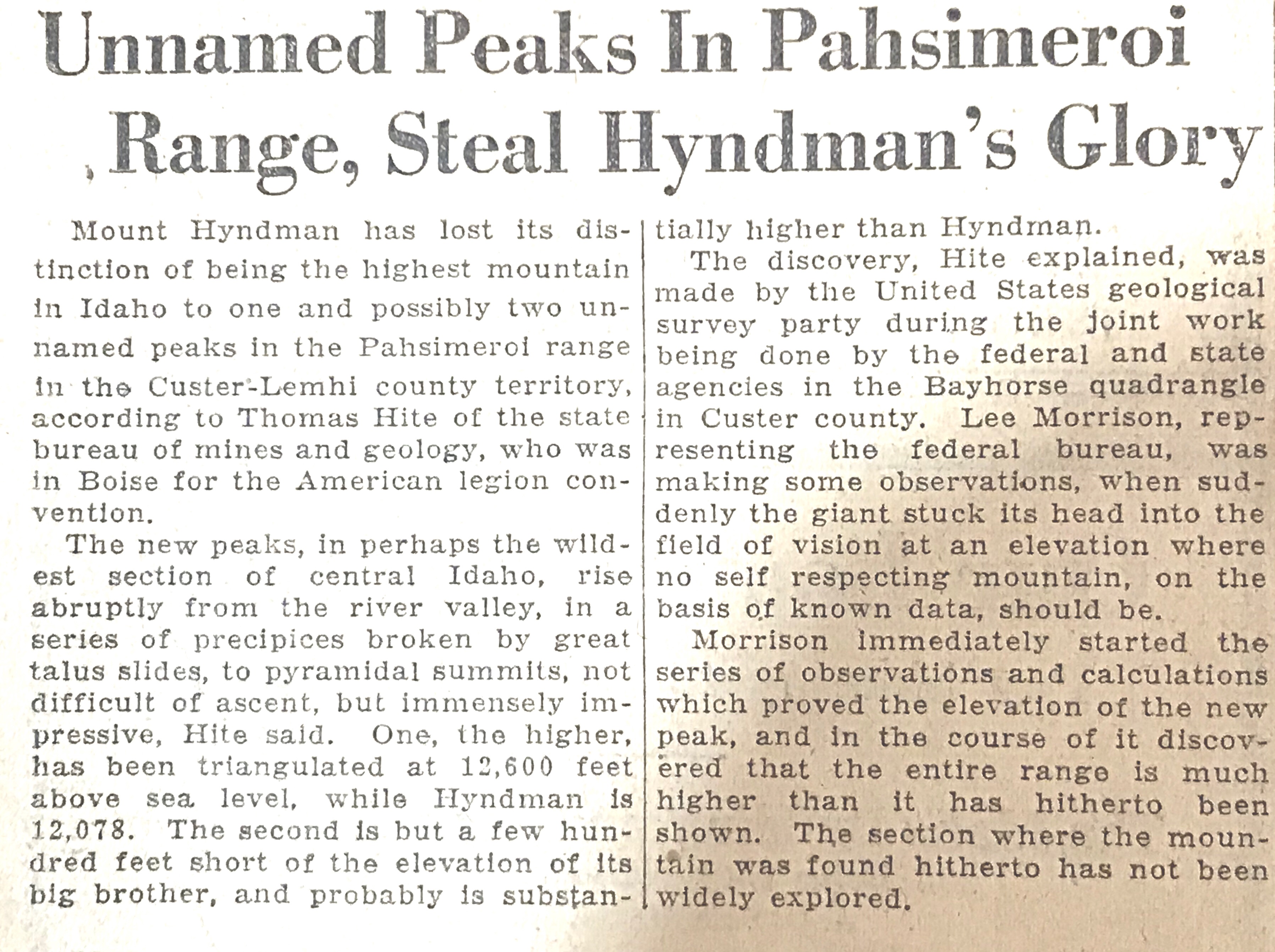
    The book discusses the discovery of Borah Peak as the highest point in Idaho on Pages 16 and 17. This entry expands on that discussion and adds source documents relating to the issue as well as documentation for T.M. Bannon’s first ascent in 1912.


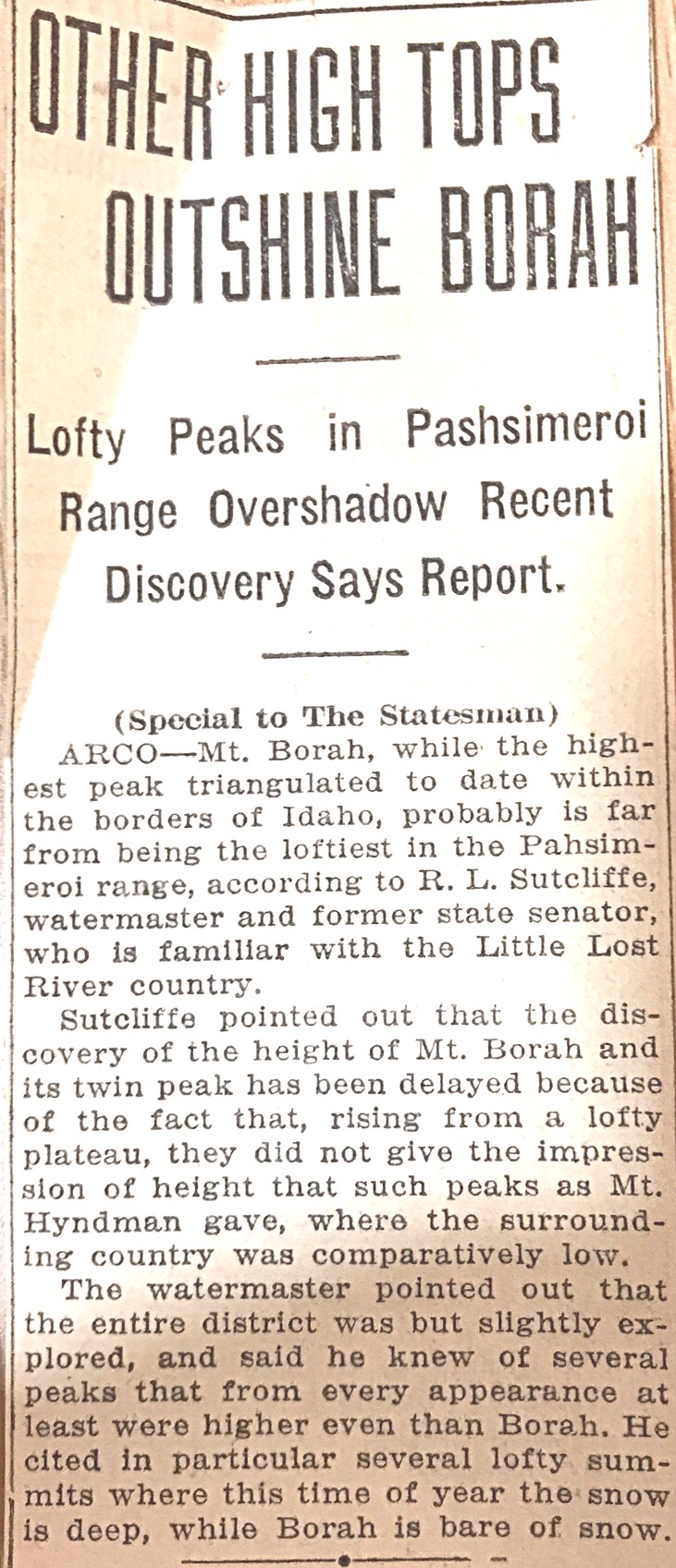
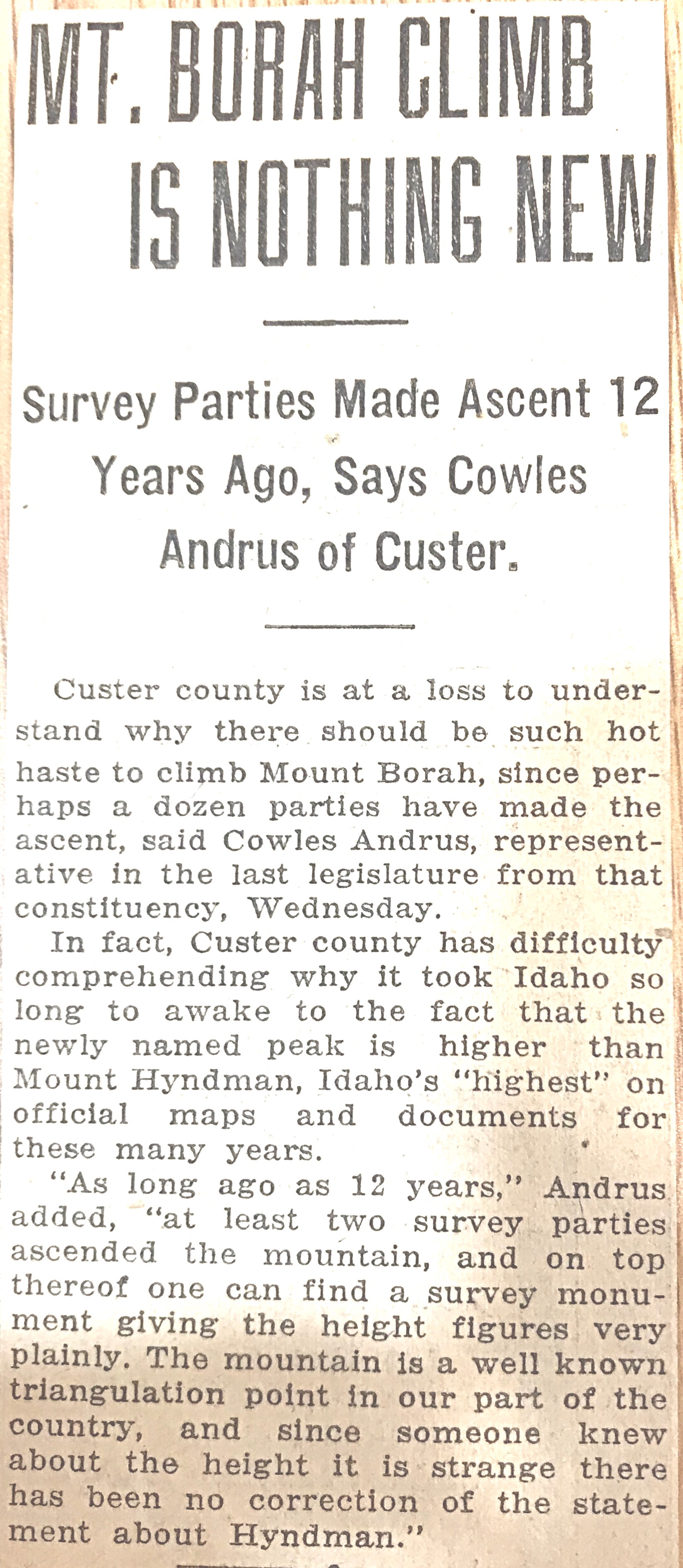
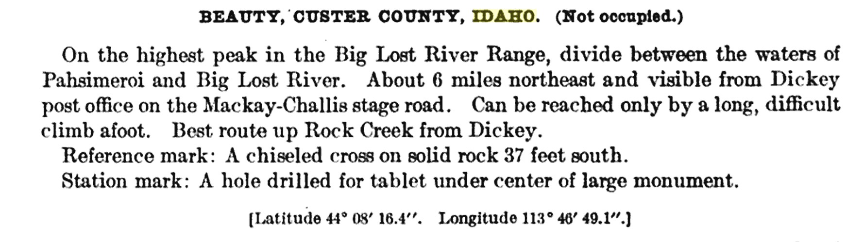
    The following 1929 article from Idaho Statesman declared to the world that Borah Peak, also known as Mount Borah, was Idaho’s highest peak. However, the second article on this page demonstrates that not everyone was willing to accept that Borah was the highest peak. The third Idaho Statesman article on this page disputes the fact that many knew before 1929 that Mount Borah was taller than Hyndman. Interestingly, there is support for this proposition (see below) as T.M. Bannon, a government surveyor, placed the Beauty Benchmark on the summit in 1912, although it does not appear he mapped an elevation at the time. Click on the articles to expand and enjoy.

    Idaho Statesman, November 29, 1929.
    Idaho Statesman December 19, 1929.Except from the Thirty-Third Annual Report of the Director of the United States Geological Survey, 1912.

    This 1912 entry is one of many by T.M. Bannon and covers his work on Mount Borah and briefly describes his first ascent route.
    This 1912 entry is one of many by T.M. Bannon and covers his work on Mount Borah. It briefly describes his first ascent route.


  • Climbing the Slopes of Mount Borah—the Dean of Idaho Peaks

    Climbing the Slopes of Mount Borah—the Dean of Idaho Peaks

    Editor’s note: This article from The Idaho Statesman (February 10, 1935) was written by Lyman Marden, one of the participants in the 1934 USGS mapping of the 15-minute Mount Borah quadrangle. 


    The Idaho Statesman (February 10, 1935).

    By Lyman Marden 

    During the season of 1934, the United States Geological Survey began the mapping of the Borah Peak quadrangle that includes about 900 square miles of territory around Mount Borah. In charge of the work as chief of party was Lee Morrison, topographic engineer, who first announced in 1929 that his calculations had identified an unnamed peak in the Pahsimeroi Mountains of the Lost River Range as being much higher than Mount Hyndman. It was officially named for Idaho’s famous senator, William E. Borah, about a year later. 

    This veteran Idaho topographer returns each year to the state to advance the mapping of many sections, and each year a great fund of information becomes accessible to parties interested in the terrain covered. This is a part of the plan to eventually map the entire United States on a practical, useful scale. The map of this quadrangle will be of great use to the Forest Service in the Lemhi National Forest and to ranchers and agencies in the area. 

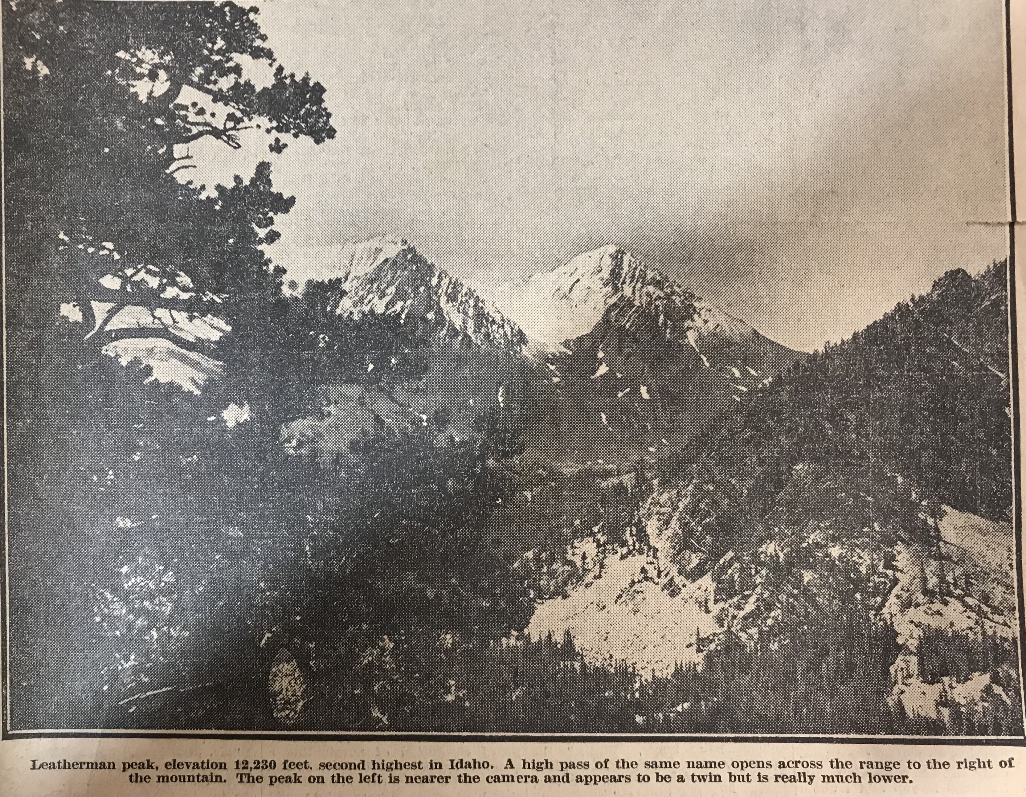
    For general information, it now becomes known that Idaho has several peaks that are higher than Mount Hyndman. From memory these are as follows: Mount Borah (12,655 feet); Leatherman Peak (12,230 feet); Diamond Peak (12,200 feet). Diamond Peak is in the Little Lost River Mountains [Lemhi Range] and, out of curiosity, we calculated its elevation. Since this was done from a distance of 20 miles, it may be slightly in error but hardly enough, we think, to change its allocation among the high points. Then comes Mystery Peak [Mount Idaho] at 12,120 feet and after that, so far as we now know, comes Mount Hyndman at 12,078 feet. Mystery Peak is our name for a mountain peak next to Mount Borah and we so named it because of its elusive-appearing summit.  From no two views does it look the same and at first we thought it must have a double summit, but later learned that its shape gives it a different skyline from the varied views. 

    Among the states’ highest points in the United States, Mount Borah is ninth in elevation, eight states having as high points a peak of greater elevation than Idaho. All these high points are in the west. As a graphic example, there is no elevation east of the Rockies that quite comes up to the altitude of Shafer Peak, just north of Boise, at 7,591 feet. 

    To make up the engineering party that would begin the accumulation of these facts, men were assembled from various points in the state by orders from H. H. Hodges, division engineer in Sacramento, California (his initials distinctive in repetition), arranged quickly a party of absolute strangers whose only common bond was engineering and orders from H. H. H.

    L.C. Walker of Twin Falls and the author unknowingly rode the same train into Salt Lake to meet the chief and Mrs. Morrison. From there, we took two trucks and supplies back into Idaho and on to Mackay where we met F.F. Hayford of Boise, who had been ordered to meet us there. Additional supplies came from the survey stores in Idaho Falls and a reserve warehouse in Challis. L.V. Carothers from the East Fork of the Salmon met us in the first camp with horses and packs. Accompanying him came Jim Bruce of Challis and the party had come together as smoothly as synchronized cogwheels.  

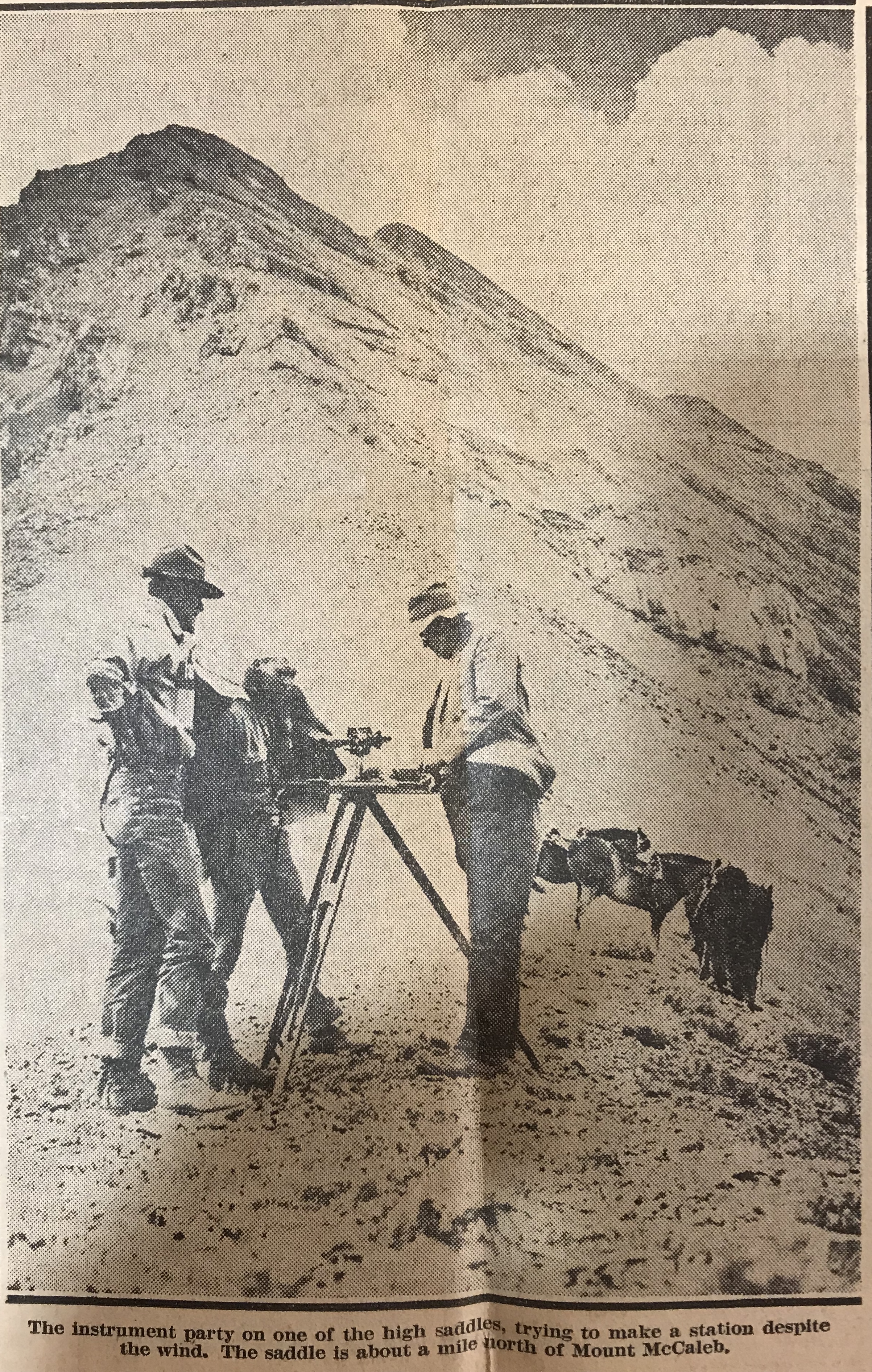
    From this first camp at the foot of Mount Borah, the work began in earnest. We had already begun the mapping and some of the Lost River Range was taking form in contours on the paper. For persons familiar with the country the south edge of the quadrangle runs just behind Mount McCaleb and north of Mackay and crosses the Lost River Valley cornering south of Chilly. From memory again, Mount McCaleb is 11,595 feet high. From this baseline, the map is a square (30 miles on a side) running northward and taking in most of the Pahsimeroi Valley and part of the Little Lost drainage. [Note: these surveyors were working on a 15-minute quadrangle.]

    The interest of the entire party in the climbing of Mount Borah became evident as soon as camp was settled. The pros and cons of possible routes of ascent were argued on many occasions, but we were delayed many times in our plans due to inclement weather. The season was peculiar and good weather was imperative so that we might take the instruments, set the benchmark on top and take pictures. 

    In the meantime, the work gathered momentum through practice and we were soon up to top speed. Moves of the camp and numerous side camps brought all the many the distinct features to light while the map grew like a living thing. Thus, we studied the ascending mountains as they gradually gain altitude to culminate in the state’s highest  point. After reaching Mount Borah they drop off about 1,500 feet and descend toward the Salmon River.  

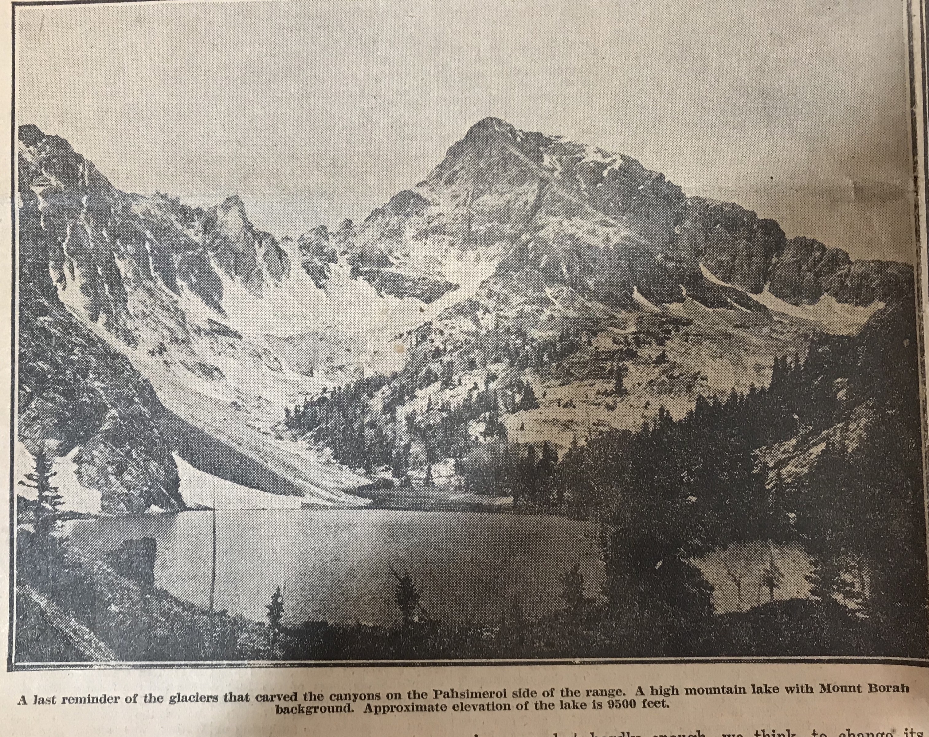
    In the glacial canyons on the Pahsimeroi side, we read the reason why a limestone peak tops Idaho’s basic granite. A very ancient lake bottom of water deposit limestone has been blown upward by a mighty volcanic upheaval that left markings of its power on the faces of sheer mountain walls. Glaciers and violent storms gouged and tore at the mountains until now we may see a range marked differently on all sides and interesting things appear in secluded parts. Several high mountain lakes occupy glacial basins under the sides of Mount Borah and their outlets plunge down hundreds of feet of swift cataracts to the Pahsimeroi River. Much rough and picturesque country may be found under Leatherman Peak and that mountain itself should be a very interesting climb for those so inclined.  

    Of course only a few miles away, Mount Borah rises more than 400 feet higher and takes primary interest. For those who might like to stand some day on the top of Idaho, the peak stands in full view about four miles east of the Al West Ranch at Dickey. It would be a good idea to get directions there before attempting the ascent. Dickey is situated about halfway between Challis and Mackay on the highway and from there one may drive to the foot of the peak.

    Our camp was placed at the Birch Springs at the mouth of an open draw on September 12 and we began the climb the next day. Contrary to the reputation of the number, the 13th was a perfect day. It would have been quite impossible to have picked a better. 

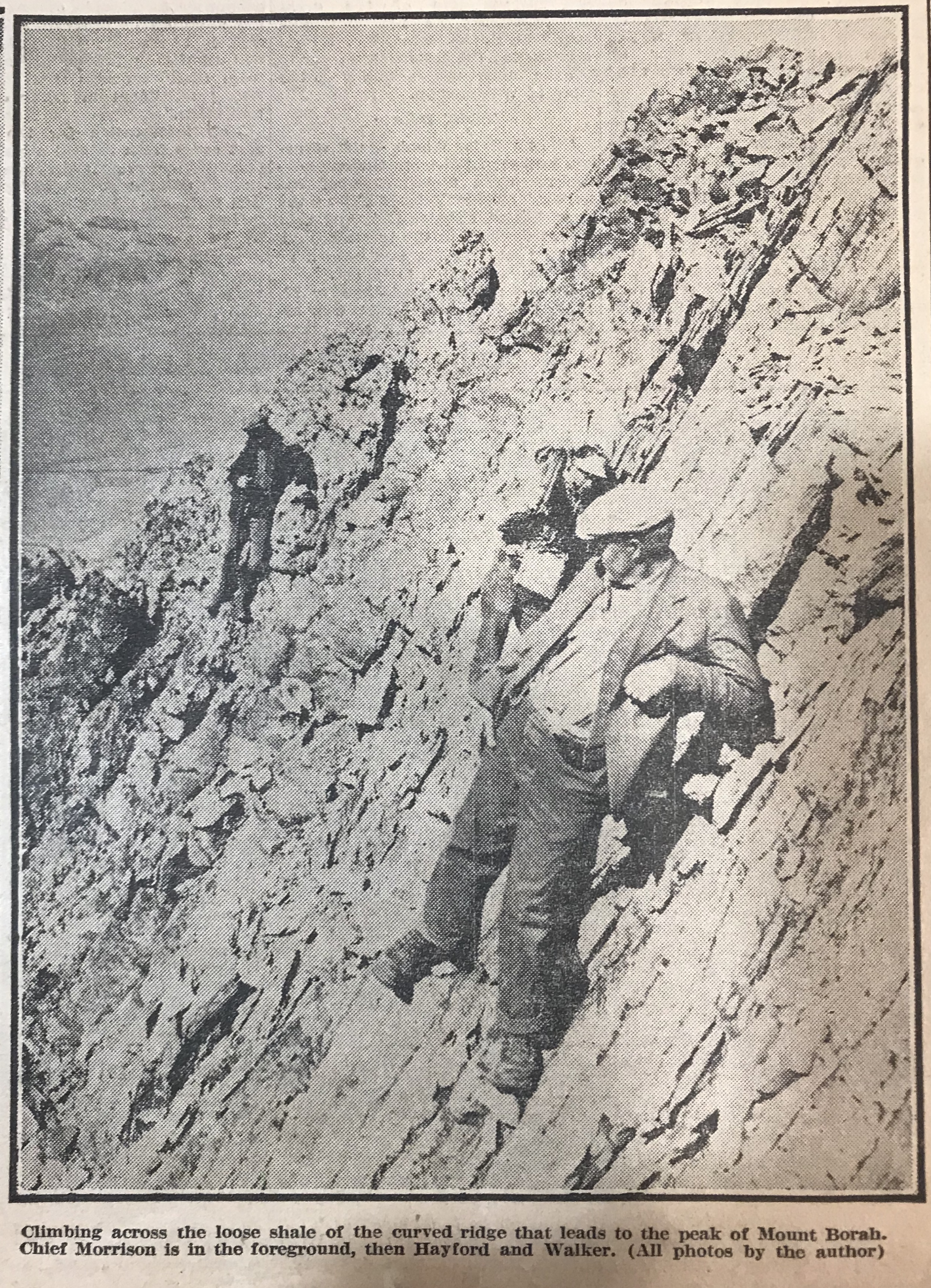
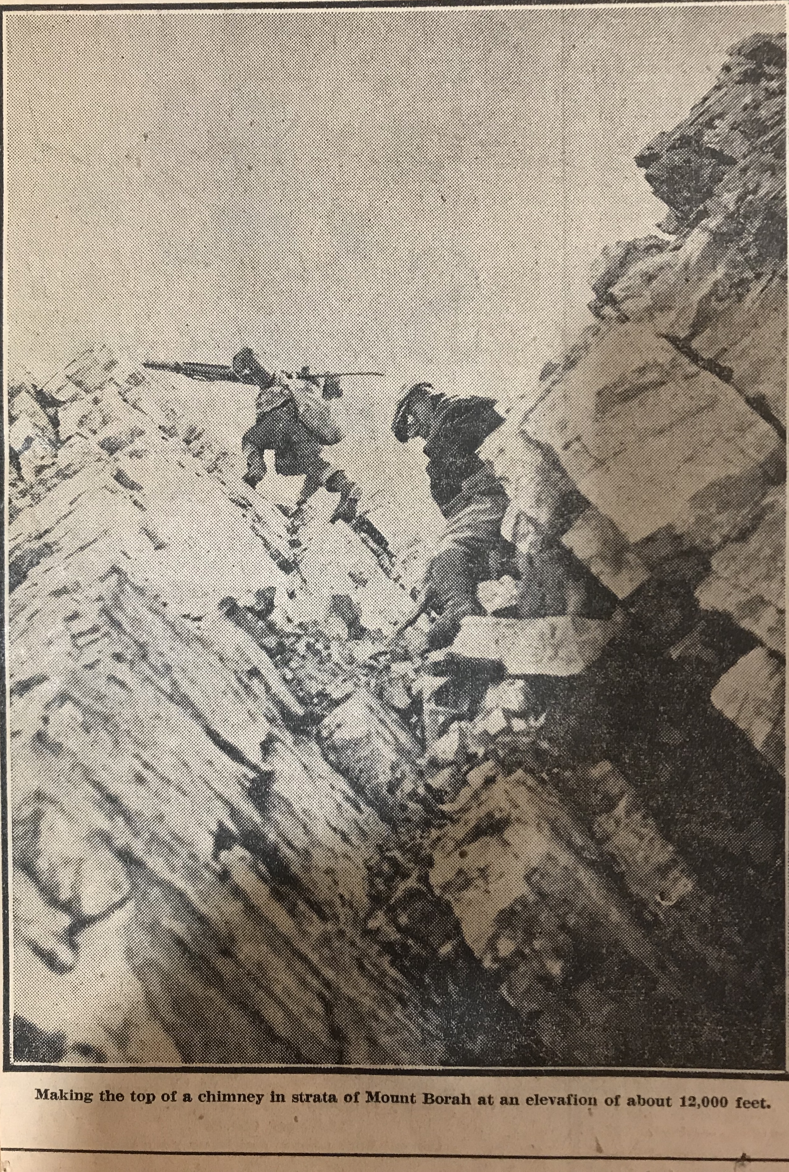
    Straight back of camp the four of us making the climb took our course up the draw to ascend the headwall. On its top, we made our first instrument set-up and checked our elevation at 9,000 feet. From there we approached the edge of a great basin gouged back into the mass of the peak and, after observing it carefully, swung eastward around its edge. Over pinnacles in this edge, as we came close under 12,000 feet, we had our first real climbing. Below, the talus slopes had been fairly uniform though sometimes hard walking presented no other difficulties. Now, however, we were on a ridge that projected shale down steep sides as fast as it loosened weathered limestone is sharp as to edge and treacherous footholds for it loosens easily. 

    It is not our intention to brand the climb as very dangerous or difficult. No special equipment is necessary but ordinary precautions must be taken. The average man should make the top in about six hours or less. Two famous mountain climbers made it in four hours under adverse conditions. Their names are Miriam Underhill and Robert Underhill of Boston, Massachusetts and they are registered at the top.

    Past the knife edge of the ridge, the footing seemed easier and we climbed in a slight curve to come upon the top from a little in back. Close under the rock cairn that marks the exact high point, the footing was again insecure and many large rocks that we trusted with our weight suddenly fell away and bounded into space to shatter far below. We gained the top with no mishap, however, and with excellent weather were able to enjoy the view that is unequalled in the state. Idaho’s mountains stretch out in range on range until the earth meets the sky, while under the peak, the valleys appear small and insignificant. All the territory we had worked was but a drop in the bucket compared to the miles to be seen.

    But our time on top was short. We hurriedly set the benchmarks tablet, that may be found from now on at the base of the rock cairn. While the camera registered every angle of the view. Just an hour and 45 minutes we spent at this spot that we had looked forward to gaining all season and then took up our packs for the descent. We were finishing a record season. When ready for distribution, the Borah Peak quadrangle gives Idaho an other important survey of interesting country.

  • 1948 Idaho Statesman Article: Here’s a Club for You to Join But It’s A Rough Organization

    1948 Idaho Statesman Article: Here’s a Club for You to Join But It’s A Rough Organization

    [Editor’s Note: This September 13, 1948 article was referenced on Page 18 of the book in the Mountaineering History Section. The name “Thatuna Hills” appears in the article. This name, which was not adopted by later map makers, refers to a western extension of the Bitterroot Mountains that now is considered the Northern Clearwater Mountains.]

    THE LION OF IDAHO, Mt. Borah, highest mountain in the state, is a favorite of Gem state mountain climbers. Rising 12,655 feet, the granite crag is often cloud-draped. Mt. Borah is part of the Pahsimeroi Mountains, and is in Custer county in the Lemhi National Forest. The photograph was taken from the Statesman’s airplane, Early Bird Number Four. Inset left shows pole at summit of Borah on Aug. 18 with three-inch layer of rime deposited by cool moisture-bearing wind. Temperature in mid summer rises but little above freezing. Right inset: looking down the other side of Mt. Borah discloses a desolate, rugged, rocky and lifeless mass of granite. Dotted arrow shows route used by several groups of mountain climbers in reaching the summit of Idaho’s highest peak.
    THE LION OF IDAHO, Mount Borah (the highest mountain in the state), is a favorite of Gem state mountain climbers. Rising 12,655 feet, the granite crag is often cloud-draped. Mount Borah is part of the Pahsimeroi Mountains and is in Custer County in the Lemhi National Forest. The photograph was taken from the Statesman’s airplane, Early Bird Number Four. Inset left shows a pole on the summit of Borah on August 18th with a 3-inch layer of rime deposited by cool, moisture-bearing wind. The temperature in mid-Summer rises but little above freezing. Right inset: looking down the other side of Mount Borah discloses a desolate, rugged, rocky and lifeless mass of granite. The dotted arrow shows the route used by several groups of mountain climbers in reaching the summit of Idaho’s highest peak.

    By Jack Anderson 

    Wanna join a club? There’s an exclusive organization which will almost guarantee less than 100 members by 1960. All you have to do to join is climb to the top of a little heap of granite in the middle of Idaho’s rugged area and sign the register atop Castle Peak. There won’t be many names, probably less than 10, on the register. Why climb a mountain? This question is asked to only a handful of Idaho residents, who each Summer go stomping up and down rocky peaks in the Gem state, much to the bewilderment of the majority of inhabitants.

    As an old saw goes, “You don’t have to be crazy, but . . .” Mountain climbers can probably advance a multitude of reasons for their breath-taking hobby. Adventure, danger, artistic ideals, exercise, attainment of skill–all could be bona fide reasons for notching one’s way up and down steep rocky hills. In no state of the union does such a minority group have as vast a field to pursue their reckless hobby. Idaho from the play slopes of its Panhandle to the craggy juts of the Southeast is a series of mountain ranges interspersed with valleys and streams. 

    In the north, the Cabinet Mountains form a purple backdrop for play and fishing on mountain lakes. The Coeur d’Alenes, the Beaverhead Mountains and the Bitterroot Mountains form the eastern boundaries. The Bear River Range, the Blackfoot Range, the Little Lost River Range, the Pahsimeroi Mountains, the Salmon River Range, the Seven Devils, the Thatuna Hills and the Sawtooths round out the mountain fastness.

    The Sawtooths are known as the “American Alps” and aside from evoking “oohs” and “ahs” from tourists, provide the mountain climber with considerable territory. Many of the Sawtooths have never seen the shoe of man atop their snow-locked peaks. In the heart of the Sawtooths, the country is upended. From the summit of Mount Hyndman, a portion of weird country known as the “Devil’s Bedstead” may be seen. Jagged quartz obelisks, jumbled, crumbled, interlaced, present a foreboding warning to travelers. It looks as if Nature took the remnants of orderly creation and threw them in a heap. 

    Who climbs mountains? Many perhaps seriously believe that only escapees from mental institutions would consider climbing to the top of a granite spire and then turning right around and inching back to terra firma level.

    Strangely enough, almost anyone can do it and all occupations have contributed to the ranks of intrepid mountain conquerors in Idaho. A well-known priest has climbed some of Idaho’s roughest pinnacles and several bold damsels have journeyed up lesser peaks.

    Mountaineering, as seen in the movies, consists of dangling out over space, supported by a thin strand of nylon, vainly swiping at a nearby rock with a pick axe. Actually, much fine climbing can be done with little more than a pair of tennis shoes, stout wind, and a determination to get to the top. 

    The lion of Idaho, Mount Borah (12,688 feet up to the topmost point), is a stern-looking, starkly impressive crag of grey granite. It rises in insular majesty from the sage-dotted plains of the Little Lost River Valley. Yet it can be climbed in a day with no more equipment than good tennis shoes, warm clothes and a camera for proof. The azure-scraping rocky peak is often cloud-draped and subject to squallish Summer storms and lashing lightning. On a clear day, Borah is a full day’s work but climbable.

    In the early days, Mount Hyndman (near Hailey) was considered by settlers to be the highest hill in the state. Recent topographical measurements give Borah the edge by about 150 feet. Hyndman is another boot hill or even a tennis shoe Teton for the average man. However, it is a rough 10-mile walk from car to summit, and vice versa, so most leisurely hill toppers take it as an overnighter. Boulder Mountain, Silver Peak, and Mount McCaleb are all climbs for the amateur with no fancy equipment.

    Farther into the canyons (where somber shadows live) rise mountains which have given some of the yodeling Swiss a few bad moments, and caused many to go home empty-sighted of mountain-top views. The Finger of Fate, a needle-like point of non-imposing  altitude, baffled a Boston, Massachusetts mountain climbing couple for an entire Summer. They finally gave up and went home to write a book about Idaho mountains. Many of the Alp-type mountains (termed “horn” mountains) have  precipitous sides which can be traversed only by “graveling.” Using ropes, spiked shoes and pitons is required on many Idaho mountains.   

    What’s up there? At the top pf some mountains will be found a pole and a stout iron box. Inside the water-proof container will be a register which the successful sign for posterity and relate the travails of their upward journey. An occasional hawk screams at the violation of his solitude. Trees show the battle with the elements and often have the bark shorn off the windward side from the battering of hailstones and buffeting gales. Lightning scars, snow slides and other examples of nature’s violence in the eons of chipping down the mountains are to be seen.  

    Caution is the watchword in mountain climbing and the violator seldom gets another chance. An experienced woman climber fell from the cliff-edge of Mount Leatherman nearly 1,000 feet to her death and several other lives have been lost. Although there is no official Idaho mountain climbing club, a group of Oregon mountaineers have formed the Mazamas Club and make mass jaunts up northwest peaks, placing the register boxes for one of the most exclusive clubs in the world.

  • Robert Fulton

    Robert Fulton

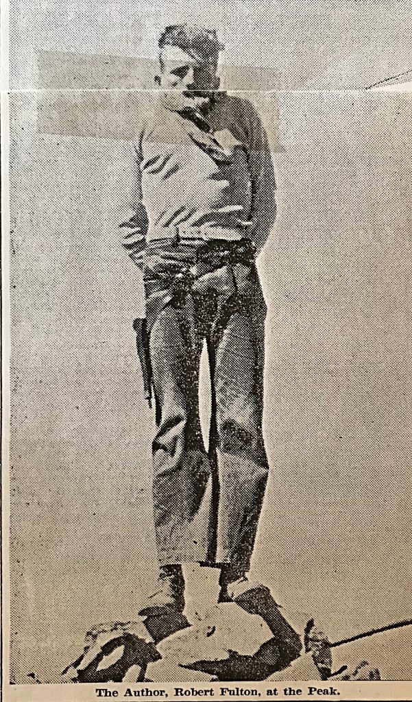
    Robert Fulton was an active Idaho climber in the 1930s. Robert was was fascinated with Mount Borah and wrote several articles chronicling the peak’s early climbing history. His 1935 article in the Idaho Statesman covering his second ascent of the peak (discussed on Page 17 of the book) is set out below.

    A TRIP TO THE TOP OF IDAHO

    By Robert Fulton

    The opening paragraph of a recent biography of a great man or our day states: “During every session of Congress since 1907, a certain magnificent and mysterious man has dominated the Senate chamber even as a certain high, rugged mountain dominates the jagged skyline back home in Idaho.”

    The man referred to, of course, is Senator Borah, and the high mountain mentioned is Borah Peak. Today there are being organized “Borah for President” clubs. To complete the author’s metaphor of the first paragraph, I want to tell you of another club: The “Borah Mountain” Club. The membership fee includes $2 or $3 worth of good shoe leather and a generous helping of ambition and energy. This writer claims right of “potential candidate for president” of the Club by virtue of having twice paid the fees mentioned.  

    In August 1930, Mr. Ray Odle (then of Fort Collins, Colorado) and I deposited the first register in the rock cairn at the summit of Borah Peak. Before 1930, even before recognized as Idaho’s highest, several men had ascended the mountain. Among these are Clyde Jenkins of Twin Falls, Idaho; Norman Wilson from some place in Califonia; and Will Bascom, well-known taxidermist from Mackay, Idaho.

    Twenty Climb Peak  

    Since we established the register in 1930, 20 individuals have accepted the rocky challenge of Borah Peak and have conquered her. During the Summer of 1934, a new government register was placed under the cairn. This was done by the United States Geological Survey group. This last Summer I was working on the German H. Ranch a few miles from Borah Peak. Three of us from the German H. (David Fulton, Fred Strasser of Texas and I) and Francis Smith, representing the Al West Ranch at Dickey, decided to climb the mountain. We selected Sunday, August 25th as the  day for the trial. 

    After an early breakfast at the ranch, we drove to the foothills in an auto. We arrived at timberline soon after 10 o’clock. We found quantities of scattered dead wood just above the timber and, as the Wind was blowing up the mountainside, we decided to build a small signal fire for those at the ranch to see. We rested for several minutes until the fire died before renewing the battle. A few hundred feet above timberline, we reached the top of a long horseshoe-shaped ridge, inclining ever upward and eventually leading to the summit.
    Those who have viewed the western face of Borah peak will probably remember this ridge as one of the distinguishing features of  the mountain. Many will remember this, as the state highway between Mackay and Challis presents many interesting and inspiring views of this side. This ridge starts far below timberline (heading south) and, after ascending a thousand feet or more above timber, it doubles completely back to the north forming the South Slope of the peak. Within this horseshoe curve is a mighty mountain canyon varying in depth from hundreds of feet on the West Rim to more than 2,000 feet on the east or mountain side of the ridge. This ridge presents a less precipitous trail to follow than if one endeavored to climb directly up the mountain from the North Slope.

    We arrived at the top of the ridge rather abruptly and, just as abruptly, the entire bulk of Borah Peak was thrown into bold relief against the morning sky. However, it still seemed far above.  

    From the top of the ridge, the climbing is often more difficult. There are frequent, almost perpendicular, cliffs to overcome. It is necessary to climb with hands as well as with feet. For this reason, the prospective climber should wear leather gloves.

    See Mountain Sheep 

    Far down the ridge to the right of us, we saw white dots. Mountain sheep? I aimed a revolver high over them and fired. They moved. Convinced that here was real wild game, we planned to get close enough for a shot at them with a camera. We proceeded quietly and soon, when going over the top of a small ridge, we saw (close-up) several head of the same creatures. No, not mountain sheep, just domestic sheep. We figured that they must be lost members of some band and decided to take them home with us on the return.  

    After more weary minutes that stretched into an hour and then another half, we had rounded the bend of our horseshoe ridge and there opened up (to the right of us) another valley. It was higher, narrower and more mountainous than the one we had left early in the morning. It was dotted here and there with small glacial lakes and high spots of snow. It was the Little Lost River Valley. It is to the east of Borah Peak.  

    1000 Feet to Go

    We had reached the base of the peak itself with only a thousand feet or so of climbing left. Far below us nestled close against the overhanging cliffs was an emerald lake and straight above us towered the elusive summit. We reached the top four hours and 20 minutes after leaving the car. Francis and David were ahead of Fred and me. Fred and I had stopped once too often to rest than had the other two.

    It was with a feeling of relief that we saw them contentedly sunning on the windless side of the peak. We joined them in a moment and sprawled immediately to rest. Fred saw a rather large bulky package in David’s hand. “What’s in it?” he asked.   “My lunch” said David.  “No, I carried yours and mine.”  Fred assured him, showing both lunches. Francis glanced at the package and burst into laughter.  

    Lunch in the Skies  

    We all questioned him but he could not talk. Instead he tore a hole in the package exhibiting a shirt, a pair of gloves and a pair of socks which he had bought the to the top, not aware of what it contained. We ate lunch on top–2 sandwiches each. As we finished the last crumbs, I believe we must all have been thinking the same thing: “Just wait till supper.” 

    We read through both registers. The following people have stood on top of Idaho since August 31, 1930: 

    Roy J. Davis, Pocatello, Idaho. This presents rather an interesting coincidence. I met Davis back in April 1931, at a YMCA gathering at Gooding College. Doctor Davis accompanied the U. of I. southern branch delegation and he was my room guest during that time. Finding his name on top of Borah Peak was the first I had seen it since 1931. R.C. Thoma, C. J. Henecheid, C. V. Hockaday (all of Rupert) were registered, Miriam E. Underhill and Robert M. Underhill of Boston,  Massachusetts.

    These latter two gentlemen (sic) are famous mountain climbers and they hold the time record for climbing Borah Peak in four hours under adverse conditions. The following men were members of the U. S. Geological Survey party who were engaged in mapping the Borah quadrangle in the Summer of 1934: Lester C. Walker, Twin Falls; Spotty Bruce, Challis; Lyman Marden, Boise; Lee Morrisson, Sacramento; Fred Hayford, Boise; William Eskeldson, Boise; James Wilson, no address given; E. J. Hughes, Portland; and A. H. Marshall, Vancouver, Washington.

    “A Stiff Workout”  

    I talked with these men after they had descended the mountain. They have been to the top of many high mountains in the western states, including our once “highest” Hyndman Peak. They stated that Borah offers a stiffer workout than does the average mountain. Ray Odle (Fort Collins, Colorado) had previously been to the summit of the famous Long’s Peak of his home state. His reaction was that for primitive mountain  grandeur, Borah peak outclasses the scenic Colorado attraction. 

    Two members at least of our party can boast second-best time by having reached the summit in 4 hours and 20 minutes. They are Francis Smith of Darlington and David Fulton of Eden. Fred Strasser of El Paso, Texas and I brought up the rear guard some 15 minutes later. This completes the Borah Mountain Club’s roll call.  

    Standing on top or the rock cairn, Fred waved his arm over the vast expanse of mountains and valleys and said, “It’s all mine.” We beat him out of most of it, however, before night. It is difficult to say exactly how far one can see from the top. There are two fairly distinct ranges of mountains running north and south far to the east. The second range is the Continental Divide, which marks the boundary of Montana. To the south, the big Blackfoot Butte and the Albion Mountains can easily be distinguished. To the north and west, the Salmon River Mountains and the Sawtooth peaks of Stanley Basin are scattered far below. The scenic grandeur stretching out in every direction cannot be described. It can only be witnessed.  

    Sheep Left Behind  

    We left the top after an hour and a half. On the way down, Francis Smith asked us what we intended to do about our sheep. We were all rather tired and did not feel spry enough to chase these woolies down the mountainside, but Fred was the first one to think of a credible way to back out. He stated that he had about decided to leave his until next year when there would be twice as many. This suggestion seemed very reasonable and we all subscribed to it.

    We reached the car eight hours and five minutes after leaving and, with razor-sharp appetites, we returned to the ranches. The next day I asked Fred what he thought of Borah Peak. In his easy Texas droll he responded, “Sometime I may even ‘discuss’ climbing it again.” The satisfaction it gives one to conquer this huge pile of granite is worth many times the investment of time and energy required and, whether he ever wishes to return or not, I am sure that no one will regret having once made the climb.  

  • Iowa Mountaineers

    Iowa Mountaineers

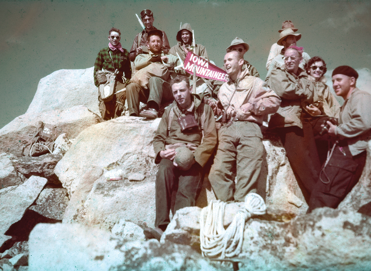
    The Iowa Mountaineers climbing club was a major player in the in early Sawtooth Range exploration. The club was founded by John and Ede Ebert in 1940, as the University of Iowa Mountaineering Club. The club later incorporated as a not-for-profit Iowa corporation and became a major force in sponsoring climber education and expeditions throughout the world.

    Schwartz Pinnacle, Harriets Pinnacle, Mount Bruce, Mount Ebert, the Elephants Perch and, of course, Mount Iowa all owe their names to the Iowa Mountaineers. You can read about the Club’s Sawtooth explorations and first ascents on Page 19 of the book as well as in numerous entries in the Sawtooth Range chapter. A 2018 article in the University of Iowa Alumni magazine provides a good history of the Club: Mountain Roots by Josh O’Leary.

    Photo courtesy of the University of Iowa Alumni Magazine and the Ebert Family.
    Photo courtesy of the University of Iowa Alumni Magazine and the Ebert Family.
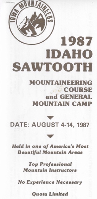
    This is the front page from a 1987 brochure advertising the club’s upcoming climbing school in the Sawtooth Range.

    Other Resources

    Iowa Mountaineers, Inc. website.

    theIowaMountaineers.blogspot