Category: Mount Borah
-

T.M. Bannon by Rick Baugher
Thomas M. Bannon was also a self-taught mountaineer. Although his name is not widely known in mountaineering circles, during his surveying career from 1889 to 1917 he climbed nearly one thousand summits in the American West. More than two hundred of these summits were in Idaho. Bannon’s cryptic reports, supplemented by the rock Cairns, Wooden triangulation signals, chiseled cross-reference marks; and brass benchmarks that he left behind tell his fascinating story. More than one hundred of his Idaho ascents were probably first ascents. These climbs included many of Idaho’s highest and most famous peaks, including Mount Borah (which he called Beauty), Leatherman Peak, and Invisible Mountain in the Lost River Range; Diamond Peak (which he called Thumb), Bell Mountain (Bannon’s Finger), Lem Peak, and May Mountain (Bannon’s Hi Peak) in the Lemhi Range; Standhope Peak and Smiley Mountain in the Pioneers; Castle Peak in the White Clouds); and Mount McGuire in the Salmon River Mountains. Bannon’s death at 48 cut short an extremely active life.
I spent a good part of the 1990’s investigating pioneer government surveyors in the Idaho and western US mountains. This involved recovering some 100 mountain top triangulation stations placed by Bannon & party in Idaho from 1911-1915. In his career as USGS Topographical Engineer 1894-1917 T.M. Bannon had a hand in making ~50 topographic maps.
Having grown up myself in Maryland, a highpoint was a July 1995 pilgrimage to the Bannon burial plot at St Lawrence Martyr R.C. Church in Jessup. Bannon family monument (like T.M.’s triangulation monuments) occupies a prominent position in the church graveyard.

Photo on right is T.M.B. gravestone. Rick Baugher Photo Obituary notice from Washington Evening Star, Feb 6, 1917:
THOMAS M. BANNON DIES AFTER A BRIEF ILLNESS
Was Engineer of Topographic Branch Geological Survey- Funeral Thursday at Jessups, Md.
Thomas M. Bannon, engineer of the Topographic Branch of the geological survey and a prominent resident of Anne Arundel county, Md, died Sunday evening at Maryland University Hospital in Baltimore. Mr Bannon had been ill only a short time. [Author’s Note: USGS said field worker deaths at that time often attributed to typhoid fever].
Mr. Bannon had been connected with the geological survey since 1888, the greater portion of his service having been given to topographic and geodetic surveys in different western states.
Prior to the organization of the United States reclamation service, Mr Bannon was detailed to collect the data which that organization used in connection with the development of its projects in Idaho and Utah [Author’s Note: chiefly Bear River drainage].
In 1908 he was detailed to the Porto Rican government and placed in charge of surveys in developing irrigation of the semi-arid portion of the island.
During the last few years Mr Bannon’s efforts had been directed to the extension of geodetic work in western Montana and eastern Idaho and in mapping portions of the national forests in Idaho.
In addition to his official duties with the government Mr Bannon served seven years as a member of the board of governors of the Maryland board of correction and was active in many local and charitable organizations of Anne Arundel county.
Mr Bannon was unmarried, is survived by two sisters, Mary and Francis Key Bannon, and three brothers, James T., Phillip M., and Joseph Bannon.
Final notes: It is believed Bannon thru his mother Evaline was related to Francis Scott Key. Bannon’s federal appointment as an 18 year old was thru Rep. Barnes Compton, also an F.S. Key relative. Survey director John Wesley Powell was chided for hiring “Congressmen’s nephews”. Bannon estate in Jessup was demolished in 1950 to make way for Baltimore Washington Expressway.
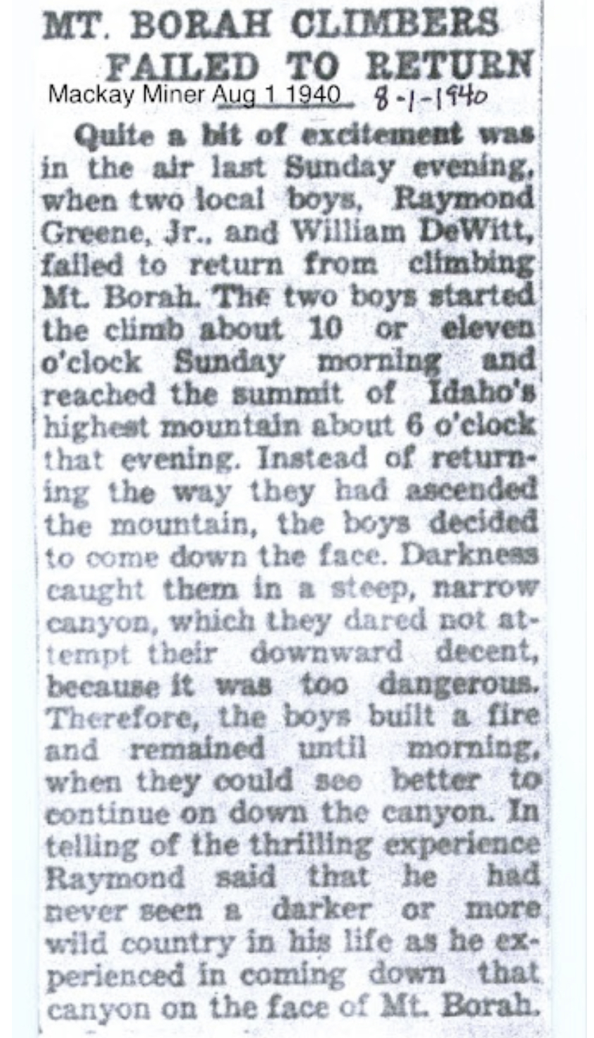
See also: Appendicitis Hill and T.M. Bannon and 1929 Borah Declared Idaho’s Highest Peak
-
Sawtooth Mountaineering by Frank Florence
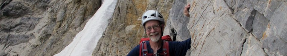
Editor’s Note: Sawtooth Mountaineering was Boise’s first climbing shop. It was founded by Lou and Frank Florence. The shop was an important link between many of Idaho’s premier climbers and the development of Idaho’s technical climbing scene. Bob Boyles (quoted on Page 23 of the book) noted the shop’s importance as a hub for local climbers, stating “The thirty or so most dedicated climbers in the Boise Valley often hung out at Sawtooth Mountaineering to share stories . . ..” This group of climbers, centered on the shop, are credited with some of the most challenging first ascents in Idaho. In this article, Frank recounts his and the shop’s history.
I grew up on Long Island (New York), hardly a mountainous setting. My early camping and hiking trips were in the Appalachian and Adirondack Mountains and I was introduced to mountaineering in 1970 as a student in NOLS. I stayed on with NOLS, eventually working as a course instructor in Wyoming and Washington State.
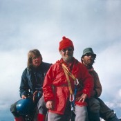
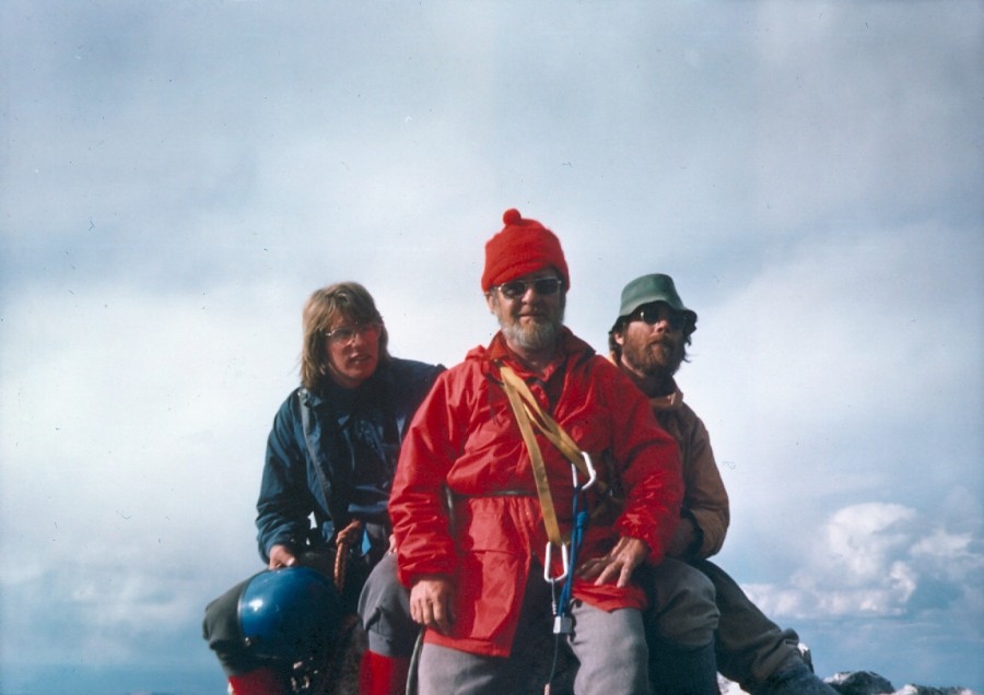
Bob Boyles and Lou and Frank Florence on the summit of Grand Teton. Mike Weber Photo In 1972, I joined my father, Lou Florence, in bringing a small outdoor recreation equipment store to Boise. Our business (Sawtooth Mountaineering) promoted climbing, hiking, and cross-country skiing across Southern Idaho, from Slick Rock to the Lost River Range. We offered introductory climbing classes and fostered enthusiasm for climbing by hosting a speaker series with some of the leading climbers and alpinists of the day, including Royal Robbins, Henry Barber, Doug Scott, Bill March, and Sawtooth pioneer Louis Stur.
British Mountaineer Doug Scott lectured twice at our shop. The first time was in 1975. Scott came to Boise to give a talk about his recent ascent of the Southwest Face of Everest. He wanted to get in some climbing while in town and a posse quickly assembled. We went out to the Black Cliffs for what turned out to be a toasty day. Scott asked what had been done and what hadn’t and then led through a couple of each.
Scott came through Boise again in 1977 to give a slide show at the shop after his epic descent off The Ogre. And again I and a few others got a chance to climb with a famous alpinist. That time we returned to the Cliffs and he led what is now called the Doug Scott Route. Nice route, too. I remember Scott stopped at one point after trying a move and then pondered it a bit before he led through the sequence. When he came down, I asked him what he thought about it, especially that one section. “It’s all there,” he replied. “Just a lack of balls.”

Doug Scott at the Black Cliffs (1975). Left to right Bob Boyles, Bob Henry, Doug Scott and myself. Lou Florence Photo Through Sawtooth Mountaineering, we conducted popular introductory clinics in cross-country skiing and helped develop an early network of ski trails around Idaho City. Long-time staff members Ray York and Gary Smith, as well as Lou and I, trained and volunteered with Idaho Mountain Search and Rescue. Days off were spent exploring the many crags local to Boise: Stack Rock, Slick Rock, Table Rock, Rocky Canyon, Morse Mountain and the Black Cliffs.
I frequently partnered with Bob Boyles and Mike Weber on technical climbs, but in the mid 1970s, there was a free-wheeling mix of local climbers who swapped leads including Tom McLeod, John Platt, Art Troutner and Charley Crist. It was a time of discovery as there was little in the way of guide books and, championing clean climbing ethics, we clanged our way up the cliffs using hexes and stoppers. We became better climbers as we challenged one another on new routes locally and expanded our alpine skills into the Sawooths and Lost River Range. In the Winter of 1974, John Platt, Jerry Osborn, Walt Smith, and I skied across the White Cloud Mountains from Obsidan to Robinson Bar. In 1976, I summitted Denali with friends from Seattle and the following year made the first Winter ascent of Mount Borah’s North Face with Art Troutner, Mike Weber and Bob Boyles.
Sawtooth Mountaineering closed in 1980 and I returned to college and a career in geology. That took me out of Boise but, from time to time over the years, it’s been my pleasure to renew my acquaintance with the Sawtooths and the Lost River Range and those same partners from back in the day.
During one of Doug Scott’s lectures at Sawtooth Mountaineering, Bob Boyles secured a signed copy of the famous climber’s posters. -
Mount Borah: Dirty Traverse and Northeast Ridge Variation – East Face by Bob Boyles
Bob Boyles provided the following history and, with Wes Collins, the route descriptions (below) for these two East Face Routes.
I first visited the East Side of the Lost River Range (The Pahsimeroi Valley) in 1972, while working on a helicopter contract for the Forest Service. Flying through the range provided me a view that few ever get to see. While all of the range is impressive from the eastern side, one face stood out from the others.
When our contract with the USFS finished at the end of Summer, I took a break from the 24/7 aviation life I was accustomed to. During this down time, I happened to notice an ad for an introductory rock climbing class and thought, “Wow. Cool. Ropes and everything, I’m game for this!” I talked a couple of friends into joining me for the class. After completing our class, we were ready to test our newly-learned skills on a real mountain but Winter soon arrived and we put our plans aside until the next Summer.
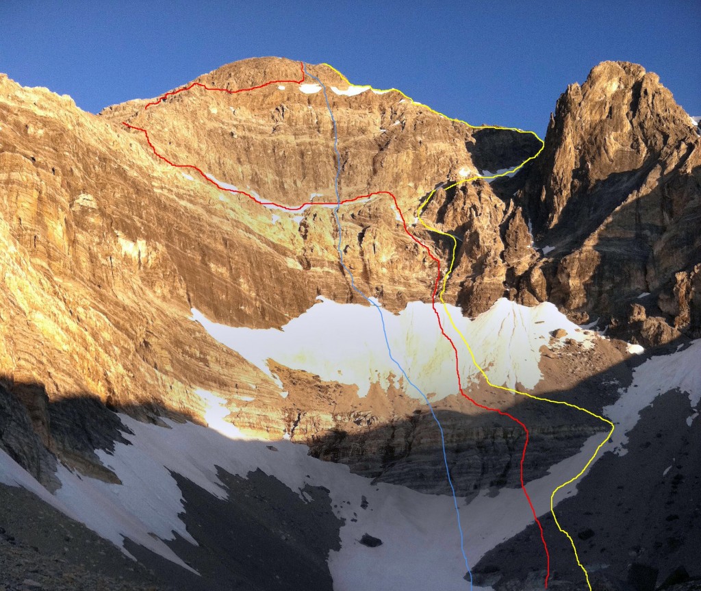
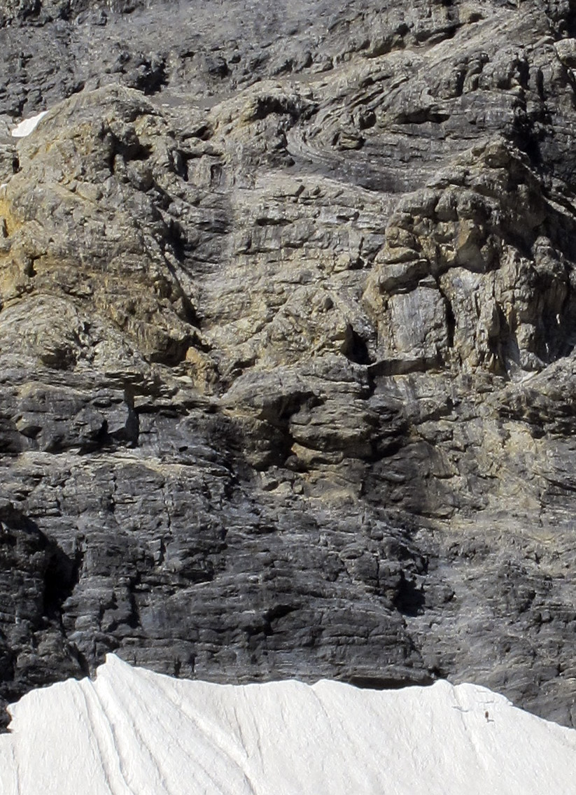
East Face Routes. The Direct East Face (blue line), the Dirty Traverse (red line) and the Northeast Face Variation (yellow). Wes Collins Photo
Summer came late in 1973. It wasn’t until the end of June that we were able to get in for a closer look at the East Face. As the morning sun warmed the snow high in the cirque, we watched slide after slide tear loose and nail virtually every approach to the mountain. Along with the snow slides came a lot of rock fall as well. After sitting and studying the face, it looked to be climbable. There was no doubt, however, that the attempt would have to be made during the dry season. In 1974, we returned for another exploratory trip and picked out a line on the face that followed some water streaks in a nearly straight path to the summit. We decided that this was the route we would attempt on our next visit.
A couple of years passed. In trying to sell potential climbing partners, I described this face as “Idaho’s Eiger” but at the time, the range had no technical rock routes. Idaho has so much fine granite it was hard to justify a trip to the Lost Rivers, where the limestone rock had a reputation for being nothing but choss.
In the Fall of 1975, Mike Weber and I decided to throw caution to the wind and give this face a serious attempt. We loaded up all of the gear we thought we’d need and made the brutal drive to the end of the road up the West Fork of the Pahsimeroi River. Hiking through open sagebrush, we made quick work of the approach and found a nice grass-covered spot for our camp at the lower tarn just above timberline. Curious to see the face up close, we grabbed our crampons and axes and headed up the snow and ice to where the bare rock began.

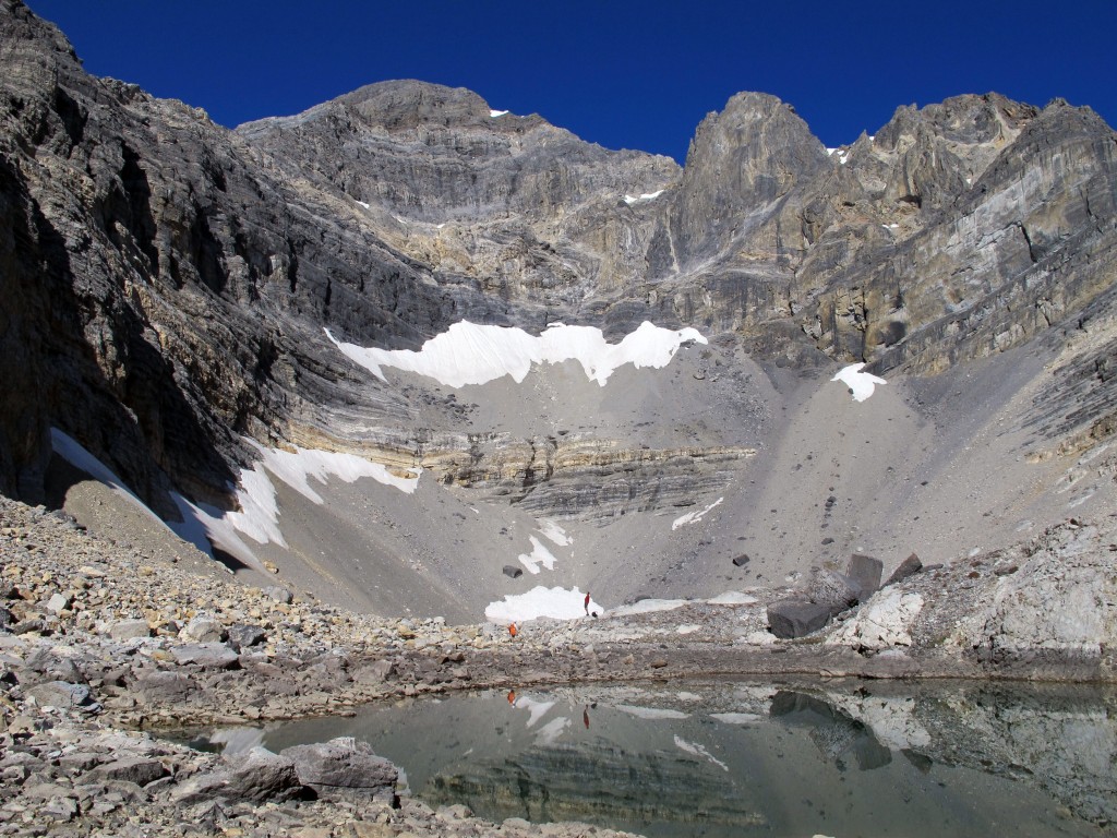
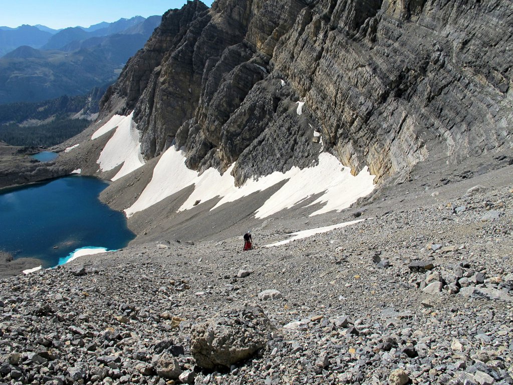
A picture-perfect September day in the Lost River Range (9/24/11). The vertical rise from the lake to the summit is 2,440 feet. Bob Boyles Photo
Just as we were approaching the final section of snow and the start of our proposed route, we heard a rumble from above, freezing us in our tracks. A Volkswagen-sized rock was flip-flopping down the face. Within seconds, it reached terminal velocity bouncing back and forth down the face. We stood motionless in our stances trying to figure out if we should go left, right, or just clasp our hands and pray. Fortunately, the rock deflected about 40 feet to our right. We just stood there watching it tear up snow and bounce to the flats and the tarn at the bottom of the cirque.
We tried to convince each other that the face would be frozen up by morning but neither of us was to be convinced. Around 2:00AM, we were startled awake by a blinding flash of light and, milliseconds later, a rumble of thunder. We both knew our chances to climb were most likely over, so we pretended to go back to sleep. Within minutes, the rain was falling at a rate of an inch or two an hour, and shortly afterward our campsite became a flood zone. We stayed in the tent until it was surrounded by flowing water, our cue to get the hell out of there.
For decades after that ill-fated attempt, my climbing partners and I continued to explore and put up routes in the range. Despite those many visits, we never made it back to the cirque. I pretty much wrote off the East Face as being a very dangerous place and that kind of risk no longer appealed to me. Also, as time progressed, I gained the impression that sport climbing and bolted routes on established climbs were the “new norm” and the pioneering of new alpine routes seemed to have gone by the wayside. It wasn’t until the Spring of 2011, during a discussion of Lost River climbs on the Idaho Summits web forum that a new spark of interest began. When I first described the East Face Cirque, most local climbers did not know what I was talking about. This, despite most of them having climbed Mount Borah multiple times. One did, though.
After reading my description of the face, Wes Collins, a local climber and native of the area, immediately became interested. Soon, a new discussion started about taking a trip to the cirque.
Route Information
The Dirty Traverse
First Ascent – Wes Collins (solo) July 2011
Rating: Grade III 5.4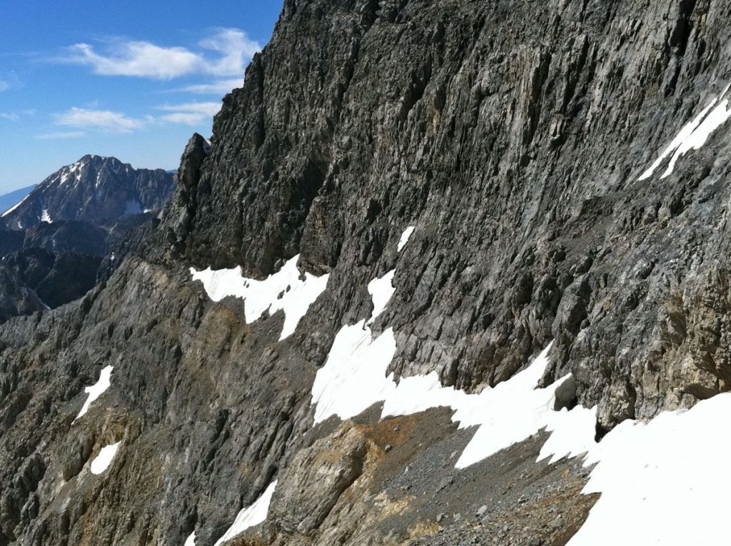
The Dirty Traverse ledge leading out to the East Ridge from the center of the face. Wes Collins Photo
Wes couldn’t wait to see the face up close so he took off on an exploratory trip with his wife and dog. This trip in 2011 started as a recon, but Wes found himself drawn to the face like a magnet. The following is Wes’ account of the first ascent.
Bob got me all fired up to get a look at the East Cirque and what he described as Idaho’s Eiger. I certainly wasn’t disappointed. Susan and I planned the trip as a leisurely backpack into Lake 10204 to take in the views, but I tossed an axe and some light crampons in the truck just in case.
Dirty Traverse-1
Standing on the last of the snow slopes below the first wall. Susan Collins PhotoI spent a lot of time looking at the face before I even thought about a spot for the tent. Stupidly, I’d left my axe and spikes in the truck, but at this point I knew I was going to make a serious try for the summit. It didn’t take long to pick out a couple possibilities, but the most probable line would involve a long traverse across a talus-covered ledge on the lower face. I started thinking of the route as the Dirty Traverse before I even put my boots on it. Morning was an easy laid-back affair. We sipped coffee and we watched the sun line slowly make its way down the mountain. I had to wait until nearly 10:00AM before the snow softened enough for step-kicking. The first, lower snowfield was pretty firm, but the second was much softer.
I’d found a nice, tooth-shaped chunk of limestone that probably wouldn’t have done much more than keep my feet down hill if I took a fall. I was on my own, but it was still embarrassing to have the damn thing in my hand and I had to keep fighting the urge to hide it in my pocket. At the top of the snow, the randkluft was several meters deep and the first tentative moves on rock over the blackness below felt pretty exposed. The rock, however, was surprisingly solid and clean.
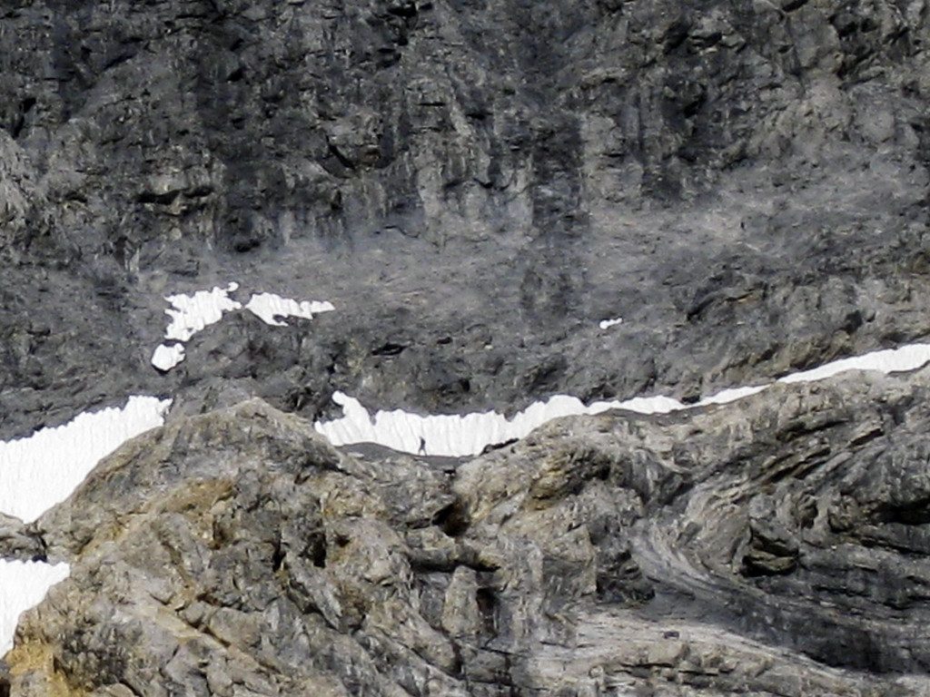
Wes Collins about a third of the way across the traverse. Susan Collins Photo
The scramble to the traverse ledge was fairly sustained Class 4, but the rock was good enough to make me forget about the exposure and enjoy the ride. The traverse ledge was quite tedious though and I wasn’t sure it would go all the way to the ridge until I got there. Once on the ridge, I made my way up an easy Class 5, 70-foot buttress but it could have been easily bypassed by scrambling around its West Side. Most of the ridge above the traverse is Class 3 or easier.

The key to the climb. A tiny col where the East Ridge meets the Upper East Face. Cross the snow field “sky ledge” to get to the summit. Wes Collins Photo
As I continued up the ridge, my doubts got bigger. The entire North Side of the East Ridge is very tall and overhung in several places. More and more I suspected it would dead-end into the headwall but, at the last possible minute, a tiny col opened up onto the uppermost ledge (which we named the “sky ledge”) that crosses the East Face. It wasn’t until that moment that I knew the ridge would go all the way. John Platt summed it up nicely in his trip report of JT peak as the almost magical opening of doors as you climb. This was one of the most fun parts of this outing. I couldn’t agree more.
The descent follows the standard route down the mountain to the big saddle at 11,800 feet. From there, I dropped into the cirque that takes in the South Side of Mount Borah and Mount Sacajawea. There are several sections of Class 3-4 scrambling over short but loose cliff bands and several linkable snowfields, but the glissade run-out potential is pretty dangerous on most of the snowfields. At the 10,400-foot contour, the angle eases up. From there I hiked down and around the bottom of the East Ridge and finally back up to camp.
This link will take you to an astounding video of the route by Mediocre Amature: Dirty Traverse Video.
East Face/Northeast Ridge Variation
Rating: Grade III 5.6 WI2
First Ascent – July 25, 2012 Bob Boyles, Frank FlorenceWhile this route is not overly difficult, it does require a willingness to climb with long run-outs and minimal protection both at belays and while leading. Many of our belays were protected with a single piece of gear and most pitches only allowed for a few placements. Rockfall, both self-initiated and trundled from the summit, is an ever-present danger on this route.
Frank on the approach to the East Face of Mount Borah. Bob Boyles Photo
The route starts slightly to the right of Wes Collins’ Dirty Traverse Route and follows the slab like ramps for about 6 pitches of Class 4 and low-to-moderate Class 5 climbing until you reach the ledge system that allows for an exit to the Northeast Ridge.
From there we climbed two pitches of very steep snow and joined the ridge. On the Northeast Ridge, we encountered a short section of water ice (WI2) and several more pitches of moderate Class 5 climbing until just below the summit, where it turns to easy, but very loose, Class 3 and Class 4 climbing.

Frank on the short snow pitch that leads to the Dirty Traverse ledge. Bob Boyles Photo
This route is probably best done when there is some remaining snow to cover loose scree and talus (June/July) and, during some years, it may not be climbable at all due to the large cornice that can form and block the narrow exit to the Northeast Ridge. Parties willing to solo or simu-climb can reduce the overall number of pitches required on this route.

East Face-Northeast Ridge Variation. Bob Boyles Photo
Return to the main Mount Borah page.
-
Lee Morrison
Lee Morrison was a USGS topographic engineer who led many mapping expeditions in Idaho in the 1920s and 1930s. He announced in 1929 that his calculations had identified an unnamed peak in the Pahsimeroi Mountains of the Lost River Range as being much higher than Mount Hyndman. The peak was soon there after named Borah Peak (aka Mount Borah). In the 1930s, he led the team that mapped the Borah Peak 15-minute quad. Climbers have unofficially named Peak 11367 “Mount Morrison” in honor of his contributions to Idaho.
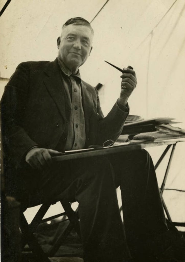
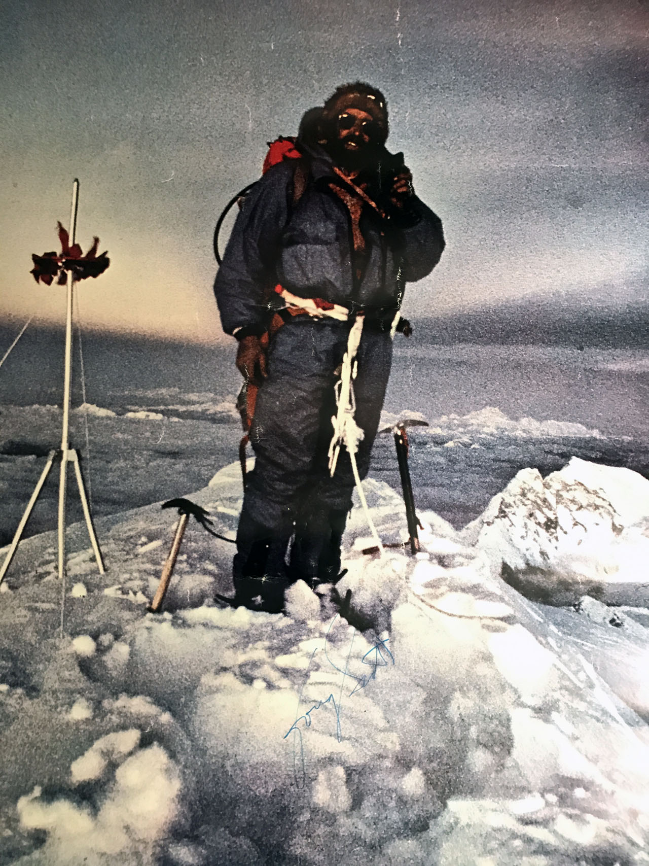
Lee Morrison at the USGS camp for the Borah survey. Lyman Marden Photo -
A 1949 Climb Up Borah
This article was published in the Aberdeen Times on August 18, 1949.
 Since 1940, only 62 people have climbed Mount Borah, Idaho’s tallest mountain. Among these are 4 amateur mountain climbers from Aberdeen who scaled the 12,655-foot peak last Monday morning. Stanley and Horace Nealey, Howard Morton and Norman Brown put on a good pair of shoes last Saturday afternoon and drove to the base of Mount Borah where they started the climb the next morning.
 “We stopped at a farmhouse at Dickey and got all the information we could get,” Horace Neeley said, “but we found out that there are no regular trails up the mountain and that climbing it would be up to us.”
“We camped that night at the base of the mountain. We had driven as far as possible in our pickup truck, but found that we had about 7,000 more feet to climb on foot the next morning,” Neeley said. He also said that although the mountain is plenty steep, spiked shoes and ropes were not necessary for the climb. ‘‘All you need for Mount Borah is a good sturdy pair of shoes,” he said. “The climb is nearly all rock and it’s easy to wear out a pair of ordinary shoes.”
“On the way up, the air kept getting thinner,” Horace said, “and near the top, we had to rest quite frequently.”
“The top of the mountain is quite a ways above the timberline. We saw some huge snow drifts and ran into a snowstorm. The snowstorm wasn’t like a regular blizzard because it was caused by a Summer thunderstorm that turned to snow at that high altitude. We had coats with us but it got mighty cold anyway. After about 20 minutes on the summit, we turned back down the mountain. We had left our camp at 7:35 in the morning and got to the top at 12:20PM, approximately five hours of climbing. Although we covered about two miles, it was about a mile from base to summit in a straight line.”
“From the top of the mountain, we could see a lake below us with a small iceberg floating around in it. We saw few animals . . . only one herd of about a dozen antelopes. We found a box at the top that had been placed there by the Mazamas Club in 1940. The Mazamas Club is a mountain climbers organization. Only people who have climbed to the top of the mountain where there is perpetual snow qualify for the club. We signed our names to the list. Only 62 people have climbed Mount Borah since 1940. Apparently, the trip back was considerably easier, but it still took the group three hours to go the two miles down.”
The boys advise potential mountain climbers to wear a good strong pair of shoes and to take a lunch along on the climb. And, climbers should take a canteen of water, although there will probably be enough snow at the top to take care of thirst. A good truck is needed to get over the rough roads to the base of the mountain because a car won’t clear some of the obstacles.
Horace Neeley has been climbing mountains for quite some time and has scaled several in Idaho. He’s climbed Bannock Peak, Mount Sedgwick beyond Lava, and Mount Hyndman near Sun Valley. The latter is 12,078 feet high. The next mountain on the list to be climbed is Mount Leatherman near Mount Borah. “It’s not quite as high as Borah,” Horace said, “but they say the climb is a lot tougher.” “I like mountain climbing, but I haven’t reached my ambition yet. Someday, I’m going to climb the Grand Teton, north of the Jackson Hole country.” Want to keep cool this summer? Go find a nice, tall mountain and sit on top of it.