Category: Newspaper Articles

  • 1948 Idaho Statesman Article: Here’s a Club for You to Join But It’s A Rough Organization

    1948 Idaho Statesman Article: Here’s a Club for You to Join But It’s A Rough Organization

    [Editor’s Note: This September 13, 1948 article was referenced on Page 18 of the book in the Mountaineering History Section. The name “Thatuna Hills” appears in the article. This name, which was not adopted by later map makers, refers to a western extension of the Bitterroot Mountains that now is considered the Northern Clearwater Mountains.]

    THE LION OF IDAHO, Mt. Borah, highest mountain in the state, is a favorite of Gem state mountain climbers. Rising 12,655 feet, the granite crag is often cloud-draped. Mt. Borah is part of the Pahsimeroi Mountains, and is in Custer county in the Lemhi National Forest. The photograph was taken from the Statesman’s airplane, Early Bird Number Four. Inset left shows pole at summit of Borah on Aug. 18 with three-inch layer of rime deposited by cool moisture-bearing wind. Temperature in mid summer rises but little above freezing. Right inset: looking down the other side of Mt. Borah discloses a desolate, rugged, rocky and lifeless mass of granite. Dotted arrow shows route used by several groups of mountain climbers in reaching the summit of Idaho’s highest peak.
    THE LION OF IDAHO, Mount Borah (the highest mountain in the state), is a favorite of Gem state mountain climbers. Rising 12,655 feet, the granite crag is often cloud-draped. Mount Borah is part of the Pahsimeroi Mountains and is in Custer County in the Lemhi National Forest. The photograph was taken from the Statesman’s airplane, Early Bird Number Four. Inset left shows a pole on the summit of Borah on August 18th with a 3-inch layer of rime deposited by cool, moisture-bearing wind. The temperature in mid-Summer rises but little above freezing. Right inset: looking down the other side of Mount Borah discloses a desolate, rugged, rocky and lifeless mass of granite. The dotted arrow shows the route used by several groups of mountain climbers in reaching the summit of Idaho’s highest peak.

    By Jack Anderson 

    Wanna join a club? There’s an exclusive organization which will almost guarantee less than 100 members by 1960. All you have to do to join is climb to the top of a little heap of granite in the middle of Idaho’s rugged area and sign the register atop Castle Peak. There won’t be many names, probably less than 10, on the register. Why climb a mountain? This question is asked to only a handful of Idaho residents, who each Summer go stomping up and down rocky peaks in the Gem state, much to the bewilderment of the majority of inhabitants.

    As an old saw goes, “You don’t have to be crazy, but . . .” Mountain climbers can probably advance a multitude of reasons for their breath-taking hobby. Adventure, danger, artistic ideals, exercise, attainment of skill–all could be bona fide reasons for notching one’s way up and down steep rocky hills. In no state of the union does such a minority group have as vast a field to pursue their reckless hobby. Idaho from the play slopes of its Panhandle to the craggy juts of the Southeast is a series of mountain ranges interspersed with valleys and streams. 

    In the north, the Cabinet Mountains form a purple backdrop for play and fishing on mountain lakes. The Coeur d’Alenes, the Beaverhead Mountains and the Bitterroot Mountains form the eastern boundaries. The Bear River Range, the Blackfoot Range, the Little Lost River Range, the Pahsimeroi Mountains, the Salmon River Range, the Seven Devils, the Thatuna Hills and the Sawtooths round out the mountain fastness.

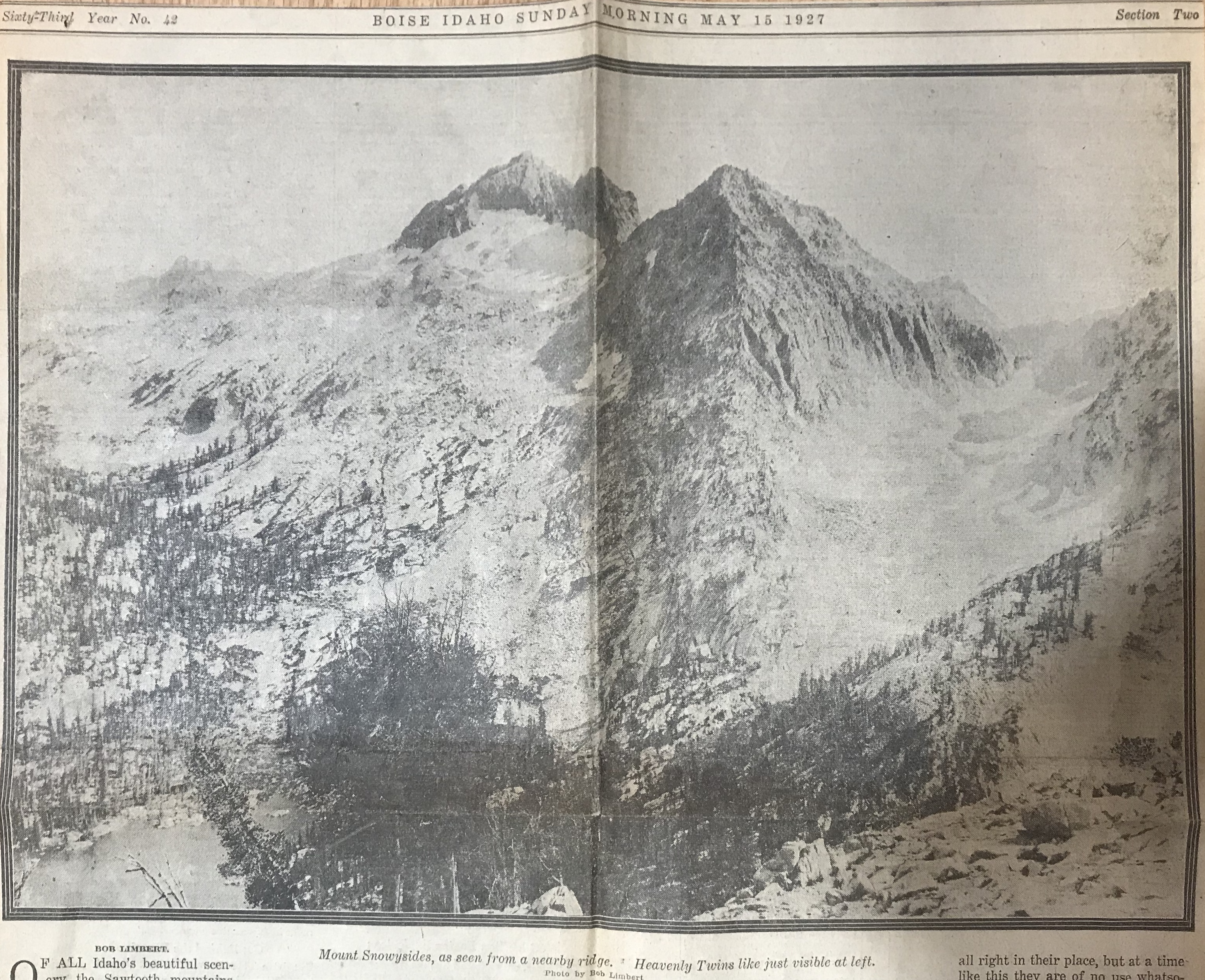
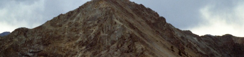
    The Sawtooths are known as the “American Alps” and aside from evoking “oohs” and “ahs” from tourists, provide the mountain climber with considerable territory. Many of the Sawtooths have never seen the shoe of man atop their snow-locked peaks. In the heart of the Sawtooths, the country is upended. From the summit of Mount Hyndman, a portion of weird country known as the “Devil’s Bedstead” may be seen. Jagged quartz obelisks, jumbled, crumbled, interlaced, present a foreboding warning to travelers. It looks as if Nature took the remnants of orderly creation and threw them in a heap. 

    Who climbs mountains? Many perhaps seriously believe that only escapees from mental institutions would consider climbing to the top of a granite spire and then turning right around and inching back to terra firma level.

    Strangely enough, almost anyone can do it and all occupations have contributed to the ranks of intrepid mountain conquerors in Idaho. A well-known priest has climbed some of Idaho’s roughest pinnacles and several bold damsels have journeyed up lesser peaks.

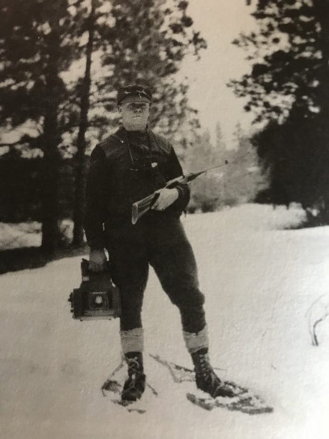
    Mountaineering, as seen in the movies, consists of dangling out over space, supported by a thin strand of nylon, vainly swiping at a nearby rock with a pick axe. Actually, much fine climbing can be done with little more than a pair of tennis shoes, stout wind, and a determination to get to the top. 

    The lion of Idaho, Mount Borah (12,688 feet up to the topmost point), is a stern-looking, starkly impressive crag of grey granite. It rises in insular majesty from the sage-dotted plains of the Little Lost River Valley. Yet it can be climbed in a day with no more equipment than good tennis shoes, warm clothes and a camera for proof. The azure-scraping rocky peak is often cloud-draped and subject to squallish Summer storms and lashing lightning. On a clear day, Borah is a full day’s work but climbable.

    In the early days, Mount Hyndman (near Hailey) was considered by settlers to be the highest hill in the state. Recent topographical measurements give Borah the edge by about 150 feet. Hyndman is another boot hill or even a tennis shoe Teton for the average man. However, it is a rough 10-mile walk from car to summit, and vice versa, so most leisurely hill toppers take it as an overnighter. Boulder Mountain, Silver Peak, and Mount McCaleb are all climbs for the amateur with no fancy equipment.

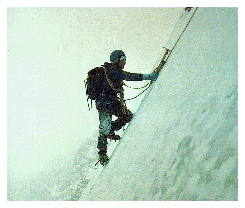
    Farther into the canyons (where somber shadows live) rise mountains which have given some of the yodeling Swiss a few bad moments, and caused many to go home empty-sighted of mountain-top views. The Finger of Fate, a needle-like point of non-imposing  altitude, baffled a Boston, Massachusetts mountain climbing couple for an entire Summer. They finally gave up and went home to write a book about Idaho mountains. Many of the Alp-type mountains (termed “horn” mountains) have  precipitous sides which can be traversed only by “graveling.” Using ropes, spiked shoes and pitons is required on many Idaho mountains.   

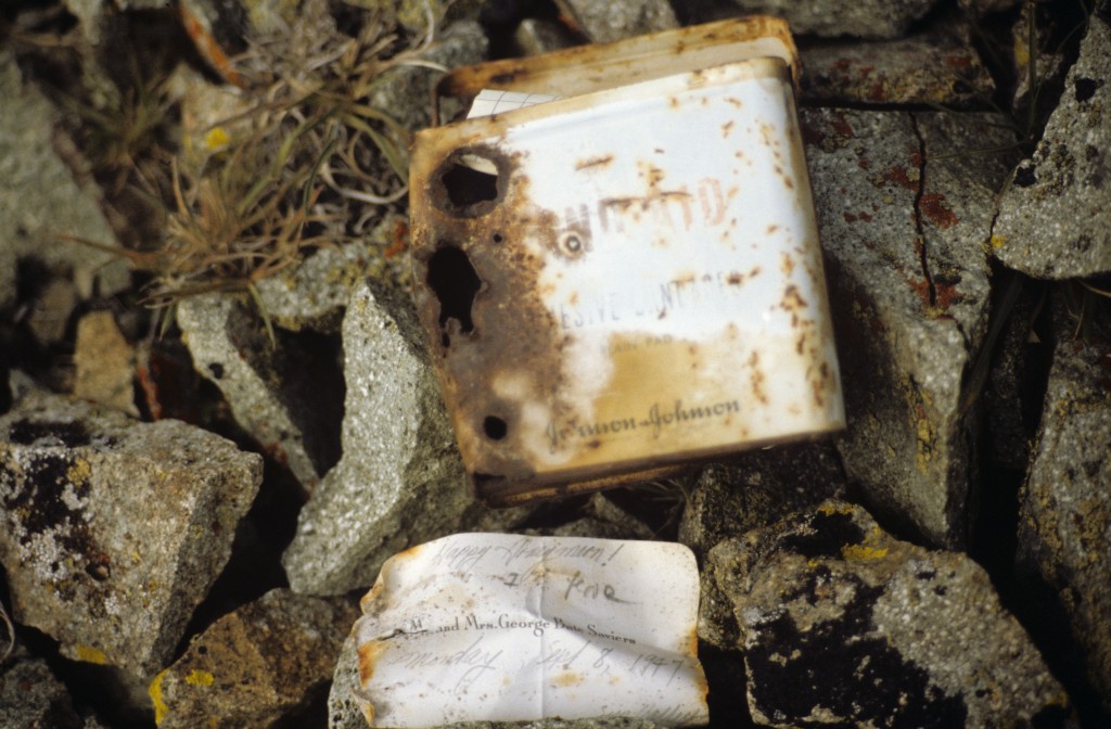
    What’s up there? At the top pf some mountains will be found a pole and a stout iron box. Inside the water-proof container will be a register which the successful sign for posterity and relate the travails of their upward journey. An occasional hawk screams at the violation of his solitude. Trees show the battle with the elements and often have the bark shorn off the windward side from the battering of hailstones and buffeting gales. Lightning scars, snow slides and other examples of nature’s violence in the eons of chipping down the mountains are to be seen.  

    Caution is the watchword in mountain climbing and the violator seldom gets another chance. An experienced woman climber fell from the cliff-edge of Mount Leatherman nearly 1,000 feet to her death and several other lives have been lost. Although there is no official Idaho mountain climbing club, a group of Oregon mountaineers have formed the Mazamas Club and make mass jaunts up northwest peaks, placing the register boxes for one of the most exclusive clubs in the world.

  • Robert Fulton

    Robert Fulton

    Robert Fulton was an active Idaho climber in the 1930s. Robert was was fascinated with Mount Borah and wrote several articles chronicling the peak’s early climbing history. His 1935 article in the Idaho Statesman covering his second ascent of the peak (discussed on Page 17 of the book) is set out below.

    A TRIP TO THE TOP OF IDAHO

    By Robert Fulton

    The opening paragraph of a recent biography of a great man or our day states: “During every session of Congress since 1907, a certain magnificent and mysterious man has dominated the Senate chamber even as a certain high, rugged mountain dominates the jagged skyline back home in Idaho.”

    The man referred to, of course, is Senator Borah, and the high mountain mentioned is Borah Peak. Today there are being organized “Borah for President” clubs. To complete the author’s metaphor of the first paragraph, I want to tell you of another club: The “Borah Mountain” Club. The membership fee includes $2 or $3 worth of good shoe leather and a generous helping of ambition and energy. This writer claims right of “potential candidate for president” of the Club by virtue of having twice paid the fees mentioned.  

    In August 1930, Mr. Ray Odle (then of Fort Collins, Colorado) and I deposited the first register in the rock cairn at the summit of Borah Peak. Before 1930, even before recognized as Idaho’s highest, several men had ascended the mountain. Among these are Clyde Jenkins of Twin Falls, Idaho; Norman Wilson from some place in Califonia; and Will Bascom, well-known taxidermist from Mackay, Idaho.

    Twenty Climb Peak  

    Since we established the register in 1930, 20 individuals have accepted the rocky challenge of Borah Peak and have conquered her. During the Summer of 1934, a new government register was placed under the cairn. This was done by the United States Geological Survey group. This last Summer I was working on the German H. Ranch a few miles from Borah Peak. Three of us from the German H. (David Fulton, Fred Strasser of Texas and I) and Francis Smith, representing the Al West Ranch at Dickey, decided to climb the mountain. We selected Sunday, August 25th as the  day for the trial. 

    After an early breakfast at the ranch, we drove to the foothills in an auto. We arrived at timberline soon after 10 o’clock. We found quantities of scattered dead wood just above the timber and, as the Wind was blowing up the mountainside, we decided to build a small signal fire for those at the ranch to see. We rested for several minutes until the fire died before renewing the battle. A few hundred feet above timberline, we reached the top of a long horseshoe-shaped ridge, inclining ever upward and eventually leading to the summit.

    Those who have viewed the western face of Borah peak will probably remember this ridge as one of the distinguishing features of  the mountain. Many will remember this, as the state highway between Mackay and Challis presents many interesting and inspiring views of this side. This ridge starts far below timberline (heading south) and, after ascending a thousand feet or more above timber, it doubles completely back to the north forming the South Slope of the peak. Within this horseshoe curve is a mighty mountain canyon varying in depth from hundreds of feet on the West Rim to more than 2,000 feet on the east or mountain side of the ridge. This ridge presents a less precipitous trail to follow than if one endeavored to climb directly up the mountain from the North Slope.

    We arrived at the top of the ridge rather abruptly and, just as abruptly, the entire bulk of Borah Peak was thrown into bold relief against the morning sky. However, it still seemed far above.  

    From the top of the ridge, the climbing is often more difficult. There are frequent, almost perpendicular, cliffs to overcome. It is necessary to climb with hands as well as with feet. For this reason, the prospective climber should wear leather gloves.

    See Mountain Sheep 

    Far down the ridge to the right of us, we saw white dots. Mountain sheep? I aimed a revolver high over them and fired. They moved. Convinced that here was real wild game, we planned to get close enough for a shot at them with a camera. We proceeded quietly and soon, when going over the top of a small ridge, we saw (close-up) several head of the same creatures. No, not mountain sheep, just domestic sheep. We figured that they must be lost members of some band and decided to take them home with us on the return.  

    After more weary minutes that stretched into an hour and then another half, we had rounded the bend of our horseshoe ridge and there opened up (to the right of us) another valley. It was higher, narrower and more mountainous than the one we had left early in the morning. It was dotted here and there with small glacial lakes and high spots of snow. It was the Little Lost River Valley. It is to the east of Borah Peak.  

    1000 Feet to Go

    We had reached the base of the peak itself with only a thousand feet or so of climbing left. Far below us nestled close against the overhanging cliffs was an emerald lake and straight above us towered the elusive summit. We reached the top four hours and 20 minutes after leaving the car. Francis and David were ahead of Fred and me. Fred and I had stopped once too often to rest than had the other two.

    It was with a feeling of relief that we saw them contentedly sunning on the windless side of the peak. We joined them in a moment and sprawled immediately to rest. Fred saw a rather large bulky package in David’s hand. “What’s in it?” he asked.   “My lunch” said David.  “No, I carried yours and mine.”  Fred assured him, showing both lunches. Francis glanced at the package and burst into laughter.  

    Lunch in the Skies  

    We all questioned him but he could not talk. Instead he tore a hole in the package exhibiting a shirt, a pair of gloves and a pair of socks which he had bought the to the top, not aware of what it contained. We ate lunch on top–2 sandwiches each. As we finished the last crumbs, I believe we must all have been thinking the same thing: “Just wait till supper.” 

    We read through both registers. The following people have stood on top of Idaho since August 31, 1930: 

    Roy J. Davis, Pocatello, Idaho. This presents rather an interesting coincidence. I met Davis back in April 1931, at a YMCA gathering at Gooding College. Doctor Davis accompanied the U. of I. southern branch delegation and he was my room guest during that time. Finding his name on top of Borah Peak was the first I had seen it since 1931. R.C. Thoma, C. J. Henecheid, C. V. Hockaday (all of Rupert) were registered, Miriam E. Underhill and Robert M. Underhill of Boston,  Massachusetts.

    These latter two gentlemen (sic) are famous mountain climbers and they hold the time record for climbing Borah Peak in four hours under adverse conditions. The following men were members of the U. S. Geological Survey party who were engaged in mapping the Borah quadrangle in the Summer of 1934: Lester C. Walker, Twin Falls; Spotty Bruce, Challis; Lyman Marden, Boise; Lee Morrisson, Sacramento; Fred Hayford, Boise; William Eskeldson, Boise; James Wilson, no address given; E. J. Hughes, Portland; and A. H. Marshall, Vancouver, Washington.

    “A Stiff Workout”  

    I talked with these men after they had descended the mountain. They have been to the top of many high mountains in the western states, including our once “highest” Hyndman Peak. They stated that Borah offers a stiffer workout than does the average mountain. Ray Odle (Fort Collins, Colorado) had previously been to the summit of the famous Long’s Peak of his home state. His reaction was that for primitive mountain  grandeur, Borah peak outclasses the scenic Colorado attraction. 

    Two members at least of our party can boast second-best time by having reached the summit in 4 hours and 20 minutes. They are Francis Smith of Darlington and David Fulton of Eden. Fred Strasser of El Paso, Texas and I brought up the rear guard some 15 minutes later. This completes the Borah Mountain Club’s roll call.  

    Standing on top or the rock cairn, Fred waved his arm over the vast expanse of mountains and valleys and said, “It’s all mine.” We beat him out of most of it, however, before night. It is difficult to say exactly how far one can see from the top. There are two fairly distinct ranges of mountains running north and south far to the east. The second range is the Continental Divide, which marks the boundary of Montana. To the south, the big Blackfoot Butte and the Albion Mountains can easily be distinguished. To the north and west, the Salmon River Mountains and the Sawtooth peaks of Stanley Basin are scattered far below. The scenic grandeur stretching out in every direction cannot be described. It can only be witnessed.  

    Sheep Left Behind  

    We left the top after an hour and a half. On the way down, Francis Smith asked us what we intended to do about our sheep. We were all rather tired and did not feel spry enough to chase these woolies down the mountainside, but Fred was the first one to think of a credible way to back out. He stated that he had about decided to leave his until next year when there would be twice as many. This suggestion seemed very reasonable and we all subscribed to it.

    We reached the car eight hours and five minutes after leaving and, with razor-sharp appetites, we returned to the ranches. The next day I asked Fred what he thought of Borah Peak. In his easy Texas droll he responded, “Sometime I may even ‘discuss’ climbing it again.” The satisfaction it gives one to conquer this huge pile of granite is worth many times the investment of time and energy required and, whether he ever wishes to return or not, I am sure that no one will regret having once made the climb.  

  • Robert Limbert (1885-1933)

    Robert Limbert (1885-1933)

    “Two Gun” Robert Limbert is probably the most interesting personality associated with Idaho Climbing History. You can read about his climbing-related accomplishments on Pages 15-16 of the book. His accomplishments and interests extended far beyond mountaineering. Robert developed Redfish Lodge and he is credited as the moving force behind the establishment of Craters of the Moon National Monument. In fact, the Visitors Center at the monument is named after him.

    Other Resources

    Self Portrait, Robert Limbert (Courtesy Robert Limbert Collection, Boise State University Library.)
    Self portrait of Robert Limbert. Courtesy Robert Limbert Collection, Boise State University Library

    Limbert’s May 25, 1927 article about climbing Snowyside Peak. Click on the photos to enlarge.

    From the Idaho Statesman.
    From the Idaho Statesman.

    A newspaper article about Robert Limbert.

    This article was undated when I found it but more than likely is from late 1920.
    This article was undated when I found it but more than likely is from late 1920.
  • 1977 Borah North Face Winter First Ascent

    1977 Borah North Face Winter First Ascent

    Bob Boyles, Mike Weber, Art Troutner and Frank Florence made the first Winter ascent of Borah’s North Face. Below you will find one of the few photos they took during the 16.5 hours they climbed and photocopies of 2 Idaho Statesman articles published at the time. Below you will find reminiscences of the climb from Bob Boyles and 3 Idaho Statesman articles which covered the climb.

    Bob Boyles offered these details:

    We climbed the North Face on January 8-9, 1977. The only reason we even considered doing the face in Winter was the drought of 1976-1977. The Winter started out very cold and dry, and it had only snowed a couple of times before we went. So we rolled the dice and hoped the face wouldn’t be loaded up and, luckily, it wasn’t. We got into waist-deep unconsolidated sugar snow on our descent, but it went all the way down to the rocks below and wouldn’t slide. It was weird because when you walked through it, it would push the snow 10-20 feet in front of you.

    When asked about avalanche danger Bob pointed out that:

    The North Face of Mount Borah has only been climbed two times in Winter to my knowledge and both were in 1977, two weeks apart. We did it first and another team from Ketchum (or maybe it was Idaho Falls) did it two weeks later after the cold spell passed. It never got cold again all that Winter.

    What made the climb possible was the drought of 1976-77. During a normal Winter, the cirque would be a pretty risky place to climb. A couple of years after our Winter ascent, we went up in late September and, over a mile from the face, ran into the avalanche debris that carried Bruce Otto’s snow measuring equipment out of the cirque.

    When we got over the cliff band and got a close look at the face, we could see that the whole thing had slabbed off leaving behind a 6-foot crown. The bivy site where we usually stayed was covered in maybe 30 feet of rubble. Realizing that more of the slab might come off, we hugged the left side of the moraine and did a different route far to the left of the face.

    Curt and I did the North Face Direct the next year and the crown was still there presenting a short, vertical step that we had to climbed over. A few years later, another one came down the gully that crosses the main trail to Chicken-Out Ridge. Most people walk right through it without realizing what it is. That slide snapped 4-foot trees like toothpicks and ran at least a mile.

    Bob pointed out the 1977 conditions were an extremely rare occurrence:

    I fish for salmon and monitor the USGS Idaho streamflow site daily during the season. From USGS records, most of the all-time low streamflow rates for Idaho rivers were set in 1977. Those kind of conditions don’t happen very often and we knew it before we went for the North Face. We figured we’d get snowed out before we could get a climb in that Winter. If we had waited one more week the temperatures warmed (for the rest of the Winter) and we would have missed the arctic air mass that had set in. But…no one expected we’d see that kind of drought, and the face could have safely been climbed all Winter.

    Bob also warns that “In a normal Winter, like we’re seeing this year, I would not go up on the face. One might be able to make it up the far left side of the cirque to gain the ridge, but that would bypass the entire face.”

     Bob Boyles supplied this photo, the only photo his team took on their winter ascent of the NF in January 1977. Frank Florence Photo
    Bob Boyles supplied this photo, the only photo his team took on their Winter ascent of the North Face in January 1977. Frank Florence Photo

    The first article discussed the upcoming attempt.

    Idaho Statesman Article
    Idaho Statesman Article


    The second article covered was an announcement that the climbers had succeeded. My copy was not in good enough shape to photograph so it is transcribed here:

    By TOM GROTE

    The Idaho Statesman 

    Four Boiseans Saturday successfully reached the summit of Mt. Borah, Idaho’s tallest mountain, the father of one the climbers said. Lou Florence, president of Sawtooth Mountaineering, said his son Frank Florence, Bob Boyles, Art Troutner and Mike Weber completed the climb in the dark about 5:30AM [Editor’s note: The original article listed the climbers addresses.]

    The climb was completed a day earlier than planned, Florence said, because the four did not have to ski part of the way to the mountain. “The wind had blown away the snow and they took  advantage of the good weather,” he said. Three of the 4 weathered in good condition. Boyles suffered frostbite on 3 fingers. “We won’t know how bad until we see them,” Florence said.   

    The climb to the top of the 12,622 foot summit was believed to be the first Winter ascent along Mt. Borah’s North Face. The climb began about 1:30AM Friday, Florence said his son told him during a telephone call from Arco after the climb. “They ran into a snowstorm a few hours after they started, but the weather then cleared,” he said. Two hours into the climb, the party ran into winds of 20-30 miles per hour, adding a significant chill to the 15-degree temperature, he said. All 4 climbers made the summit after. 28 straight hours of climbing, twice as long as expected.  

    The climbers did not stay long at the top and left no mementos, Florence said. “They were very elated when they reached the top,” he said, “but the bad weather forced  them to a take another way down than they had planned.” The four ate snacks during the climb. They were driving toward Boise late Saturday and were expected back around midnight, he said.  

    The usual Winter route to the summit ridge is on the Southwest Face, Florence said. Although the climbers were taking the more difficult route, they did not have the worst conditions possible. Deeper snow and colder temperatures hamper climbers in February and March, but a January ascent still qualifies as a Winter climb, Florence said. All four are experienced climbers, but only Frank Florence had prior experience on Mount Borah. In January 1973, he reached the top but lost the tips of 3 toes to frostbite. Another group tried to climb the mountain in July, but was forced down by winds up to 55 miles per hour.

    The third article sums up the expedition.

    Idaho Statesman Article
    Idaho Statesman article
  • Where Do Mountain Names Come From?

    Where Do Mountain Names Come From?

    The history, evolution and process of naming mountains is discussed on Pages 32-33 of the book. However, the specific origin of official (and unofficial) mountain names is often not documented. The public can submit proposed names for peaks via the U.S. Geological Survey’s U.S. Board on Geographic Names website. But often, and especially before the Internet, names that were not officially designated through the Board tended to come and go with time. Now unofficial peak names are showing up on Google Maps and other websites, giving unofficial names some semblance of approval and permanence.

    This page contains historical information (in alphabetical order) on the origins of Idaho peak names. Do you have an article or another document about the naming of an Idaho mountain? Share it with us through our update form and we will feature it here!  


    Appendicitis Hill (Pioneer Mountains)

    See this link: Appendicitis Hill


    Fenn Mountain (Selway Crags)

    Fenn Mountain is one of the most impressive summits in the Clearwater Mountains and is one the peaks identified as the Selway Crags.

    January 13, 1928. I believe this article is from the Idaho Statesman.
    January 13, 1928. I believe this article is from the Idaho Statesman.

    Frank Fenn was the first supervisor of the Clearwater National Forest headquartered in Kooskia that included all of the Lochsa-Selway country.  Fenn had an illustrious career before taking up public forest management in 1901: he was a student at the first public school in Idaho, at Florence; was a cadet at the U.S. Naval Academy; was a participant in the Nez Perce Indian War of 1877; was Speaker of the House in the first Idaho Legislature; and was a major in the U.S. Army during the Spanish-American War.  He retired from the Forest Service Regional Office in 1920 and moved back to Kooskia, where he died in 1927.

    Major Frank Fenn with his wife Florence and son Lloyd. Date unknown. Penny Bennett Casey Collection, Nez Perce-Clearwater National Forests archives

    Gospel Peak (Gospel Hump Wilderness)

    As explained in this 1949 press release Billie Knox is responsible for the use of the name “Gospel” for north Idaho two peaks, Gospel Peak and Gospel Hill as well as the Gospel Hump Wilderness.


    Mount Heyburn (Sawtooth Range)

    –Idaho Daily Statesman, April 10, 1916


    Kinport Peak (Bannock Range)

    The dispute referenced in the caption found below was eventually resolved in Gideon’s favor.

    An article from the Idaho State Journal. Date unknown.
    An article from the Idaho State Journal. Date unknown.


    Langer Peak (Salmon River Mountains)

    Langer Peak and Lake.

    This memorial at the Langer Lake Trailhead provides the history behind the Langer name.
    This memorial at the Langer Lake trailhead provides the history behind the Langer name.

    Saviers Peak (Smoky Mountains)

    This is the register left by Mr. and Mrs. George Saviers who climbed the peak while on their honeymoon in 1947. Later climbers adopted the Saviers name for the peak.

    Saviers Peak Register
    The summit register found in 1987 and left by Mr. and Mrs. George Saviers who climbed the peak on their honeymoon.

    Shafer Butte (Boise Mountains)

    This excerpt is from an Idaho Statesman Column by Dick d’Easum entitled “The Hills of Home.” The article shows an interesting side of the peak’s namesake.

  • Borah: Where Gray Granite Crags and Idaho’s Azure Skies Meet  By DICK d’EASUN

    Borah: Where Gray Granite Crags and Idaho’s Azure Skies Meet By DICK d’EASUN

    Bob Boyles found and transcribed a scanned copy of the following 1929 article which discusses Mount Borah.


    The Idaho Sunday Statesman
    BOISE, IDAHO (SUNDAY MORNING MAY 29, 1932)

    Where Gray Granite Crags and Idaho’s Azure Skies Meet

    By DICK d’EASUN

    Up at the top of Idaho, supreme among Gem state giants of massive rock, rules Mount William Edgar Borah, mantled now with robes of gleaming snow, defying the elements to cut away its towering battlements. Pounded by millions of years’ geological transformation, ground under the heel of a mighty, rolling glacier, the lofty peak stands bold and tremendous, Idaho’s challenge to the majestic Tetons, the Alps of America.

    Not favored by the scenic beauty of thick timber, blue mountain lakes, and long vistas of granite crags rising abruptly from green forests that makes the Sawtooth Range and Lost River Mountains an inspiring wonderland, Mount Borah commands a little-traveled and only slightly-explored area of East Central Idaho. Though higher by nearly 600 feet than its closest rival, Mount Hyndman, the Dean of state mountains is not spectacular in its soaring glory. The surrounding area is of itself so high that the peak juts out unobtrusively and fails to attract the attention it would if its broad, steep sides of shale were cut in sharp relief in lower ground.

    The mountain, named for Idaho’s senior senator, is 12,655 feet above sea level at its crest. It is located 6 miles east of Dickey, a junction point near Willow Creek on the Mackay-Challis highway. Plainly visible to all persons who pass over the road on clear days, Winter and Summer, the peak is seldom noted by scenery seekers, expecting to find something towering like a church steeple above a city street as the greatest of all crags within the state. From the Snake River Valley more than 100 miles to the southeast, the crest is occasionally glimpsed as a faint outline of dazzling white fading into deep blue of the lower ridges, marking the Pahsimeroi Range, the least-known territory of Idaho.

    Several other points in the lofty ridge between Big Lost River and the Pahsimeroi Valley are only slightly lower than Mount Borah. For some years, it was believed that a peak to the south, not named, was the zenith, but since observations and measurements have been taken from Borah’s cloud-wreathed brow, it has been determined that the senator’s namesake is the King, the Lord of Altitude.

    When the peak was first scaled by a Government party in 1912, a bronze tablet was fixed at the top and the latitude and longitude were determined and inscribed. For survey purposes, the point was designated as the Beauty triangulation station, the name which is found on most old forestry and other Government maps. The peak lies within the Lemhi National Forest.

    During the Summer of 1929 while mapping the Bayhorse quadrangle (an area north and east of Mount Borah), a party of 3 engineers and geologists of the Idaho Bureau of Mines and Geology made several special Sunday trips to investigate the Pahsimeroi giant. Thomas H. Hite, assistant geologist and John T. Carpenter, field assistant scaled the peak and tramped through surrounding ledges and crests gathering information on rock compositions. Triangulation and determination of altitude was done by Lee Morrison, topographer of the United States Geological Survey.

    Many bearings and readings of angles were required from previously-located altitudes known as “benchmarks” and “triangulation stations.” Figures were sent in to the United States Department of the Interior/Geological Survey Department and in December of the same year, the mountain was christened one of the oldest points in the state in geological respects and the newest among named peaks, being less than 3 years old.

    Ascent of Mount Borah is not particularly difficult, and not to be compared with scaling attempts on Castle Peak, Cathedral Rock (Heyburn Peak) or the hazardous climb up the Grand Teton, Wyoming’s pride and the toast of Jackson Hole. Access to the summit of Borah is not readily gained from the West Slope but a fairly good hiker should have little trouble making the trip. Because of snow which lingers long at the summit on the North Side, the best time to scale the peak is in August or September. Even then patches covering 2 or 3 acres remain unmelted. On a climbing trip in September 1929, Hite, Morrison, T. T. Smith and Bert Buchanan (members of the Morrison topographic party) outlined the route now generally taken.

    The party left Challis in an auto, driving to Dickey and over Doublespring Pass where two large cold springs merge a few feet apart. From the pass, the engineers continued to the east and then south to Mahogany Ranger Station which has an elevation of nearly 9,000 feet. After following the road until it became little more than a trail, they were forced to leave the car at a sheep camp and start out on foot. A trail up Leatherman Pass leads to the rugged ridge on which Mount Borah has its throne.

    By working up the rugged ridge, a gradual slope, the summit was reached within a few hours. On either side, sheer cliffs drop away hundreds of feet and gigantic slopes of shale rock stretch away miles and miles down into the canyon to the west. To the east, the country is more wooded and sharp, giving way in the distance to the Pahsimeroi Valley and the typical frontier town of May, where the Old West lives on as glamorous as ever.

    Comparatively few people have been to the top of Mount Borah but the peak is becoming more popular. The view commanded is magnificent. Craters of the Moon are 50 miles to the southeast. Nearer lie rough mountains, high valleys, glacial lakes unexplored and some of the most remarkable geological wonders in the state. Rolling mounds of glacial gravel, Paleozoic strata composed of quartzite and limestone are said to be hundreds of millions of years old, an inconceivable period. The formations were folded into a great arch or anticline in comparatively recent (tertiary) geologic time. A “V”-shaped valley, clearly gouged from mountain peaks by forces of nature and plainly visible from Mount Borah and nearby points, was carved by the Great Ice Age. Glacial moraine is noticeable in all directions.

    Three thousand feet below the top, straggly timber gains a foothold and there are patches of forest here and there a little lower down. Swift streams pour down the sharp declivities and bright eyed rock conies frisk among the shale near their icy banks. Off to the southwest looms Mount Hyndman (12,078 feet), for many years thought to be the highest peak in the state. Each peak is visible from the other.

    On clear days, from the summit of Mount Borah the sharp spire of Castle Peak may also be seen. This peak, owing to its cone shape and visibility from a great distance, is among the more prominent crags of the state. It is very difficult, if not impossible, to scale. Castle Peak (like Mount Borah) lies in Custer County. Rivals of greater charm than ancient Mount Borah are found in the Sawtooth Range where Decker Peak and Cathedral stand out like gigantic teeth of a cross-cut saw against an azure skyline and catch each glint of a gorgeous crimson sunset. Yet Mount Borah stands triumphant, unbowed by time’s crushing blows, guarding the wild Pahsimeroi, holding the secrets of eons in its scarred, proud shoulders Idaho’s most successful thrust toward the infinite blue of unattainable heaven.