Lyman Marden was a member of the USGS team that surveyed the Borah Peak quadrangle. He wrote an article entitled Climbing the Slopes of Mount Borah—the Dean of Idaho Peaksabout the survey. This article appeared in the Idaho Statesman in 1935. In 1950, he wrote the following report for the Boise Public Library.
—An account given to the Boise Public Library on April 15, 1950 by Colonel Lyman Marden, a member of the party that surveyed the Borah Peak quadrangle and placed the benchmark on the top (September 13, 1934).
Located halfway between Mackay and Challis, Idaho. Elevation 12,665 feet above sea level. Highest in the State. Approached via Highway 93 to Challis and Highway 93 toward Mackay or via Highway 20 to Arco, thence to Mackay and toward Challis.
The Challis approach is enriched by the Salmon River country through which Highway 93 runs.
The Arco-Mackay approach is one of great contrast. The Lost River Range, which culminates in Borah Peak, begins as low hills near Arco on the edge of the Snake River Plain. From there, the Range rises to a long series of peaks over 11,300 feet and several over 12,000 feet. See United States Geological Survey, Topographic Map, Borah Peak Quadrangle 1934-35.
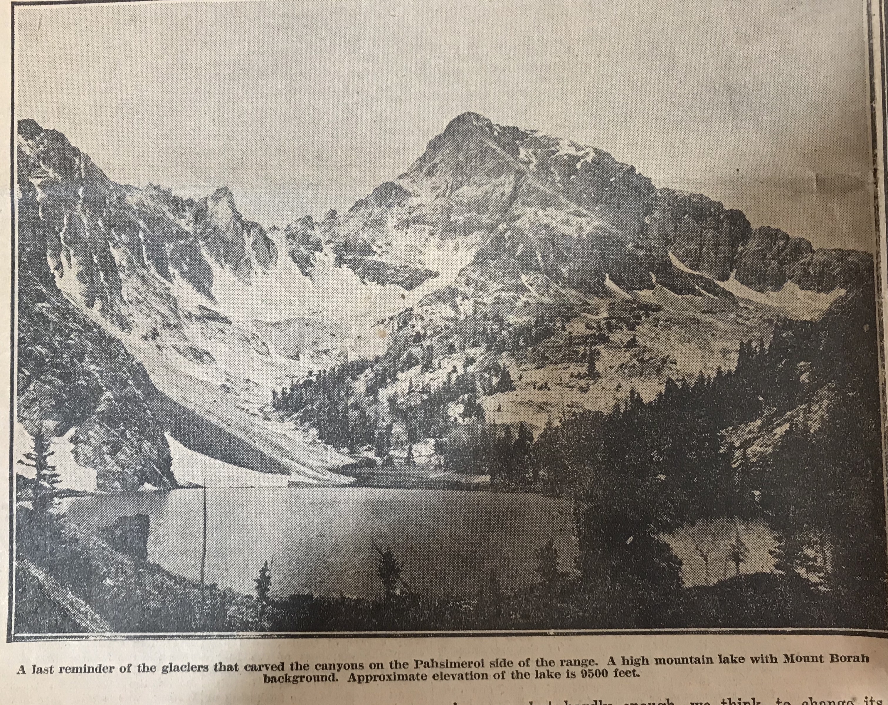
A road crosses the mountains just a few miles from Borah Peak through Doublespring Pass and gives access to beautiful country at the headwaters of the Pahsimeroi River, one fork of which rises from the North and East Faces of Borah Peak. These headwaters are scenic with long, grassy slopes called Horse Heaven and at a higher elevation Goat Heaven, and a backdrop of perpendicular mountain faces carved out by glacier action. Small caves may be found at surprising places in the high ridge between the forks of the Pahsimeroi. Good but limited camp spots are available. Obtain Forest Service advice at Challis or Mackay and local ranchers’ advice on springs, streams, wooded areas, etc.
Rivers and creeks in the near vicinity of Borah Peak are of the Lost River type and are apt to lose themselves in the gravel of the valleys for many miles only to reappear. Big Lost River and Little Lost River lose themselves in the Snake River Plain.
The Pahsimeroi River reappears just before emptying into the Salmon River. Fishermen say it is a peculiar shock to run out of water while fishing downstream. There are many interesting phenomena in the general area. Almost certainly some of the peaks have never been climbed. There are castle rocks and pinnacles, hanging lakes, big springs, and distorted and twisted strata. Just north of Borah Peak on the edge of the Pahsimeroi Valley and east of Doublespring is an old volcanic crater containing a crater lake, part of the volcanic action represented by the Craters of the Moon National Monument many miles to the south. It is believed that a large meteor left a wide pockmark in the Pahsimeroi Valley near the upper edge of a distinctive alluvial fan close to the North Face of the Pahsimeroi Mountains. Those who desire to climb Idaho’s highest peak are advised to seek a road to the base of the mountain that leaves the Challis-Mackay Highway 93 quite close to the Dickey Ranch and Post Office. The view of Borah Peak from Dickey will reveal a long, curved ridge ascending to the top. The base of the ridge nearest Dickey is divided by a shallow draw slightly darkened by scrub timber. Ascend the shallow draw and continue along the converged, sharpened ridge to the top.
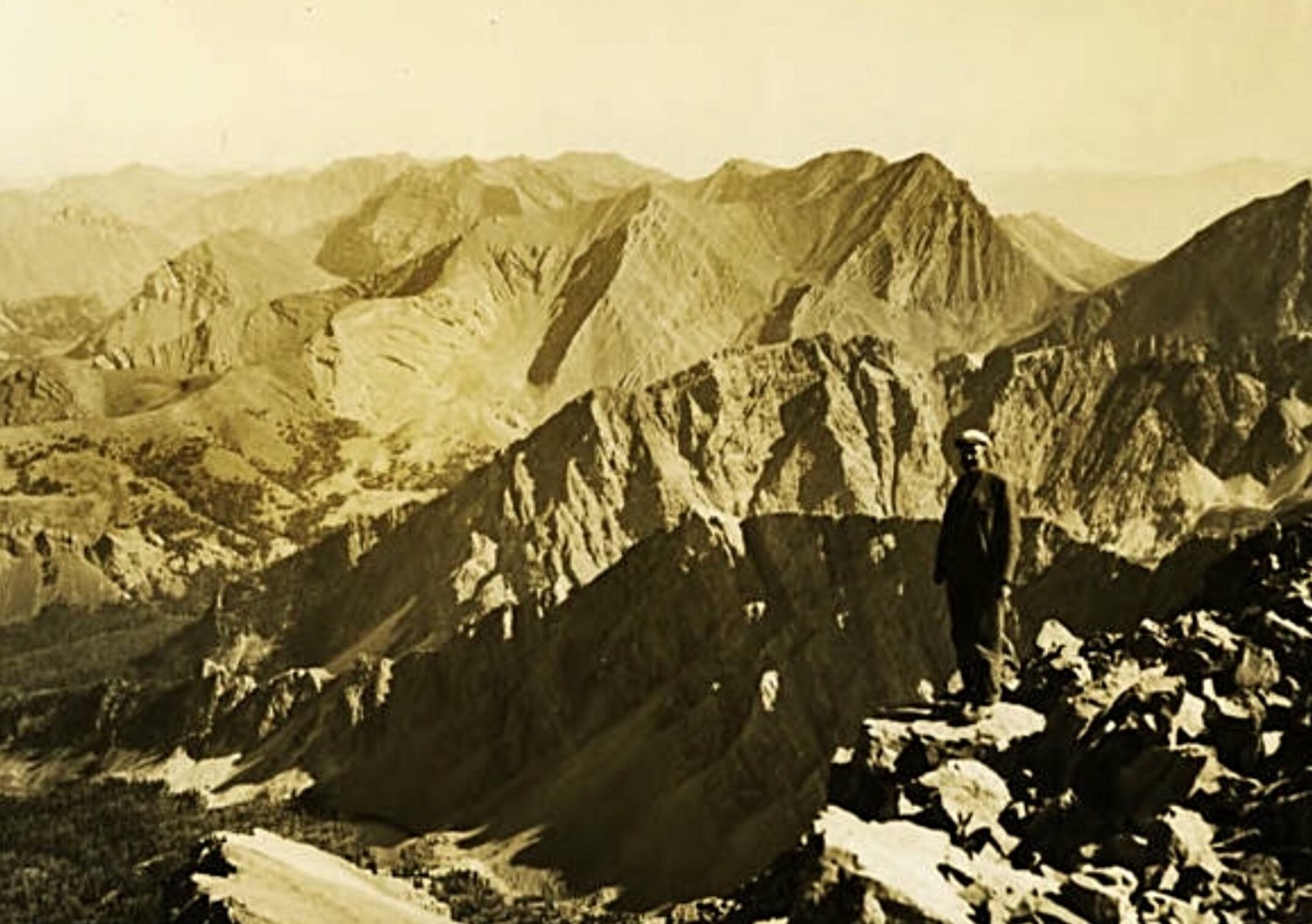
The Lost River Range as viewed from the summit of Mount Borah by Lyman Marden (USGS 1934).
The following article was published in the Salt Lake Tribune. Tribune Intermountain Service. September 25, 1938
TWIN FALLS, Idaho—Climbing Mount Borah, Idaho’s highest peak, is like walking a tight rope for at least a quarter of a mile with nothing underneath you on either side and only loose rock shale in the middle.
That is the warning issued by Walter Williams, Twin Falls mountain climbing enthusiast, one of 16 Idahoans to scale the summit last week in the largest excursion ever to reach the 12,655-foot peak. Four parties from Twin Falls, Mackay and Pocatello made the climb, more than three miles long, taking from 6:30AM to 7:30PM for all to make the round trip.
Williams, with Area Scout Executive Amby Frederick, were the first of the Twin Falls group to reach the summit, making the ascent in 4 hours and 35 minutes. Both agreed the climb is not quite as interesting as that up Mount Hyndman, long thought to be the top in Idaho elevations, but agreed the badly crumbling rock on Mount Borah is more dangerous. Part of the way one must travel a narrow, razor-like hogback, part of which is so narrow that a false step might mean a fatal slide down a 45-degree slope under tons of avalanching shale.
Fast walking to avoid loss of balance on crumbling rock is necessary to pass this stretch, the hikers explain. From the summit, one can see in all directions, the lofty Lost River Mountains extending over the horizon. Mount Hyndman also is visible from the peak along with several other mountains only a few feet lower than Mount Borah itself.
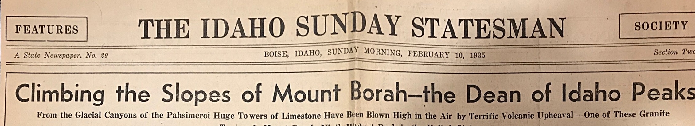
Editor’s note: This article from The Idaho Statesman (February 10, 1935) was written by Lyman Marden, one of the participants in the 1934 USGS mapping of the 15-minute Mount Borah quadrangle.
The Idaho Statesman (February 10, 1935).
By Lyman Marden
During the season of 1934, the United States Geological Survey began the mapping of the Borah Peak quadrangle that includes about 900 square miles of territory around Mount Borah. In charge of the work as chief of party was Lee Morrison, topographic engineer, who first announced in 1929 that his calculations had identified an unnamed peak in the Pahsimeroi Mountains of the Lost River Range as being much higher than Mount Hyndman. It was officially named for Idaho’s famous senator, William E. Borah, about a year later.
This veteran Idaho topographer returns each year to the state to advance the mapping of many sections, and each year a great fund of information becomes accessible to parties interested in the terrain covered. This is a part of the plan to eventually map the entire United States on a practical, useful scale. The map of this quadrangle will be of great use to the Forest Service in the Lemhi National Forest and to ranchers and agencies in the area.
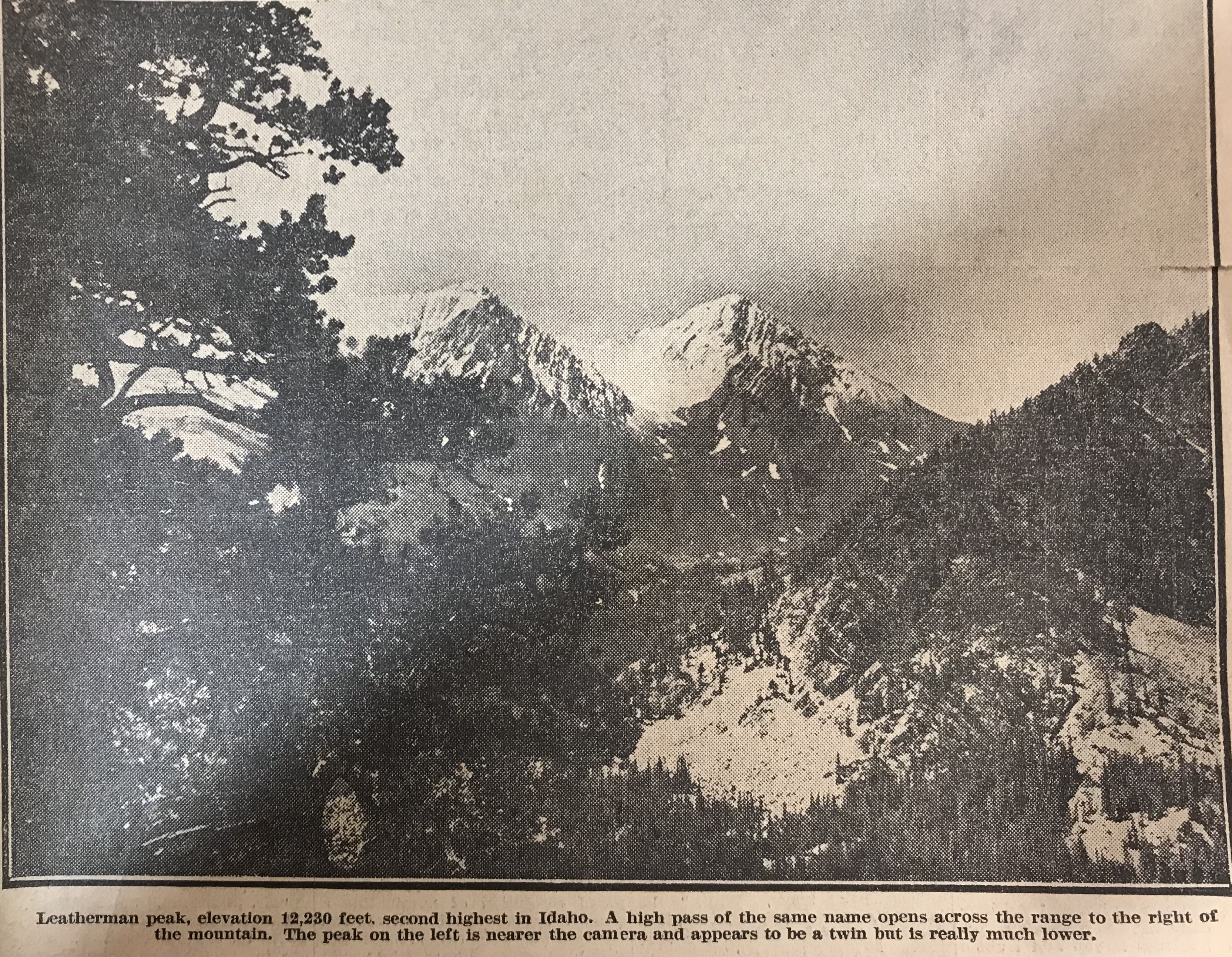
For general information, it now becomes known that Idaho has several peaks that are higher than Mount Hyndman. From memory these are as follows: Mount Borah (12,655 feet); Leatherman Peak (12,230 feet); Diamond Peak (12,200 feet). Diamond Peak is in the Little Lost River Mountains [Lemhi Range] and, out of curiosity, we calculated its elevation. Since this was done from a distance of 20 miles, it may be slightly in error but hardly enough, we think, to change its allocation among the high points. Then comes Mystery Peak [Mount Idaho] at 12,120 feet and after that, so far as we now know, comes Mount Hyndman at 12,078 feet. Mystery Peak is our name for a mountain peak next to Mount Borah and we so named it because of its elusive-appearing summit.From no two views does it look the same and at first we thought it must have a double summit, but later learned that its shape gives it a different skyline from the varied views.
Among the states’ highest points in the United States, Mount Borah is ninth in elevation, eight states having as high points a peak of greater elevation than Idaho. All these high points are in the west. As a graphic example, there is no elevation east of the Rockies that quite comes up to the altitude of Shafer Peak, just north of Boise, at 7,591 feet.
To make up the engineering party that would begin the accumulation of these facts, men were assembled from various points in the state by orders from H. H. Hodges, division engineer in Sacramento, California (his initials distinctive in repetition), arranged quickly a party of absolute strangers whose only common bond was engineering and orders from H. H. H.
L.C. Walker of Twin Falls and the author unknowingly rode the same train into Salt Lake to meet the chief and Mrs. Morrison. From there, we took two trucks and supplies back into Idaho and on to Mackay where we met F.F. Hayford of Boise, who had been ordered to meet us there. Additional supplies came from the survey stores in Idaho Falls and a reserve warehouse in Challis. L.V. Carothers from the East Fork of the Salmon met us in the first camp with horses and packs. Accompanying him came Jim Bruce of Challis and the party had come together as smoothly as synchronized cogwheels.
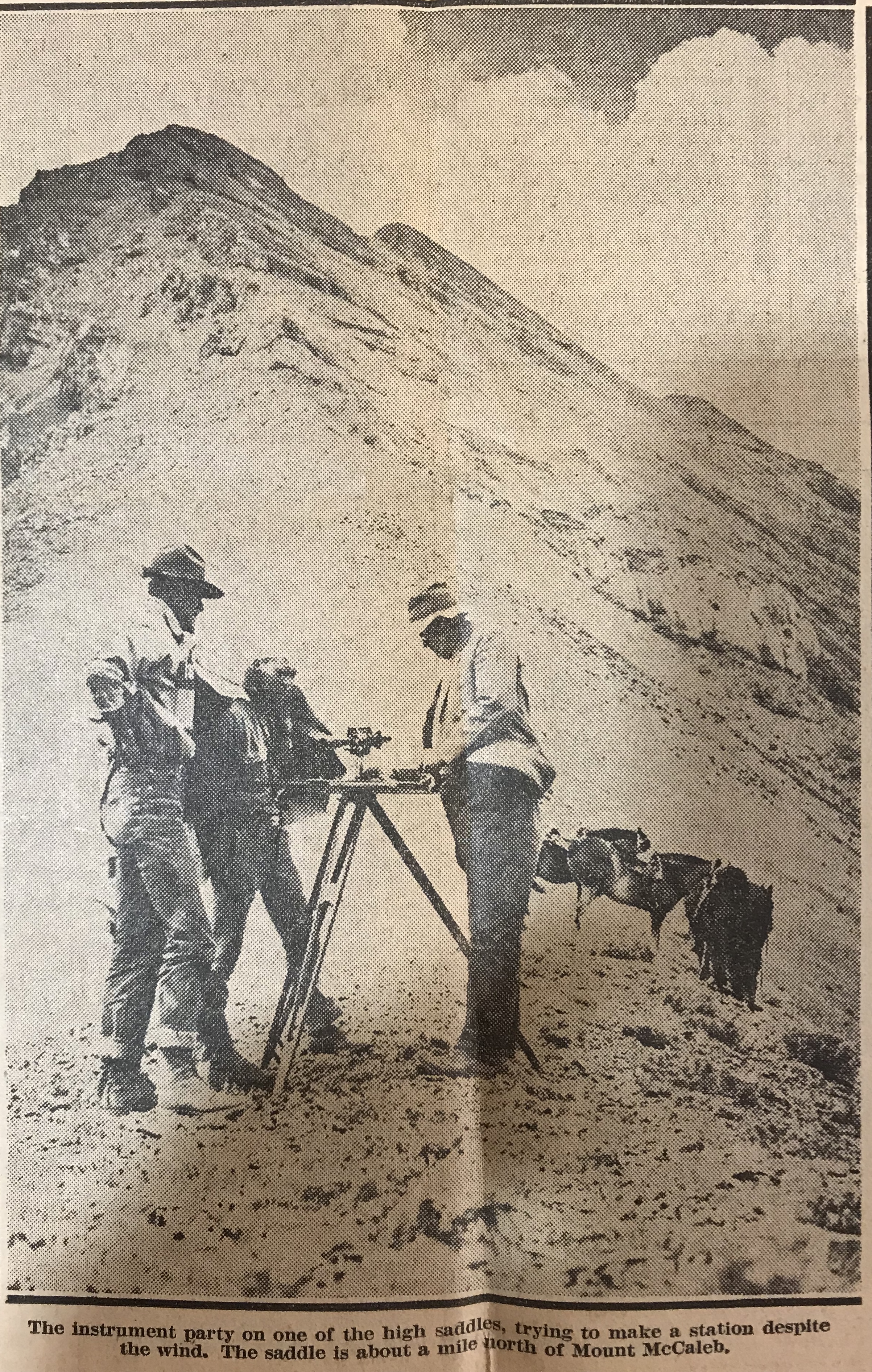
From this first camp at the foot of Mount Borah, the work began in earnest. We had already begun the mapping and some of the Lost River Range was taking form in contours on the paper. For persons familiar with the country the south edge of the quadrangle runs just behind Mount McCaleb and north of Mackay and crosses the Lost River Valley cornering south of Chilly. From memory again, Mount McCaleb is 11,595 feet high. From this baseline, the map is a square (30 miles on a side) running northward and taking in most of the Pahsimeroi Valley and part of the Little Lost drainage. [Note: these surveyors were working on a 15-minute quadrangle.]
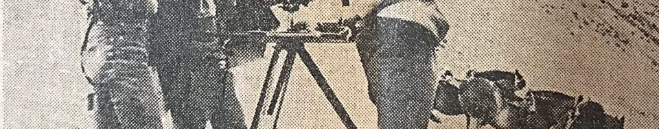
The interest of the entire party in the climbing of Mount Borah became evident as soon as camp was settled. The pros and cons of possible routes of ascent were argued on many occasions, but we were delayed many times in our plans due to inclement weather. The season was peculiar and good weather was imperative so that we might take the instruments, set the benchmark on top and take pictures.
In the meantime, the work gathered momentum through practice and we were soon up to top speed. Moves of the camp and numerous side camps brought all the many the distinct features to light while the map grew like a living thing. Thus, we studied the ascending mountains as they gradually gain altitude to culminate in the state’s highestpoint. After reaching Mount Borah they drop off about 1,500 feet and descend toward the Salmon River.
In the glacial canyons on the Pahsimeroi side, we read the reason why a limestone peak tops Idaho’s basic granite. A very ancient lake bottom of water deposit limestone has been blown upward by a mighty volcanic upheaval that left markings of its power on the faces of sheer mountain walls. Glaciers and violent storms gouged and tore at the mountains until now we may see a range marked differently on all sides and interesting things appear in secluded parts. Several high mountain lakes occupy glacial basins under the sides of Mount Borah and their outlets plunge down hundreds of feet of swift cataracts to the Pahsimeroi River. Much rough and picturesque country may be found under Leatherman Peak and that mountain itself should be a very interesting climb for those so inclined.
Of course only a few miles away, Mount Borah rises more than 400 feet higher and takes primary interest. For those who might like to stand some day on the top of Idaho, the peak stands in full view about four miles east of the Al West Ranch at Dickey. It would be a good idea to get directions there before attempting the ascent. Dickey is situated about halfway between Challis and Mackay on the highway and from there one may drive to the foot of the peak.
Our camp was placed at the Birch Springs at the mouth of an open draw on September 12 and we began the climb the next day. Contrary to the reputation of the number, the 13th was a perfect day. It would have been quite impossible to have picked a better.
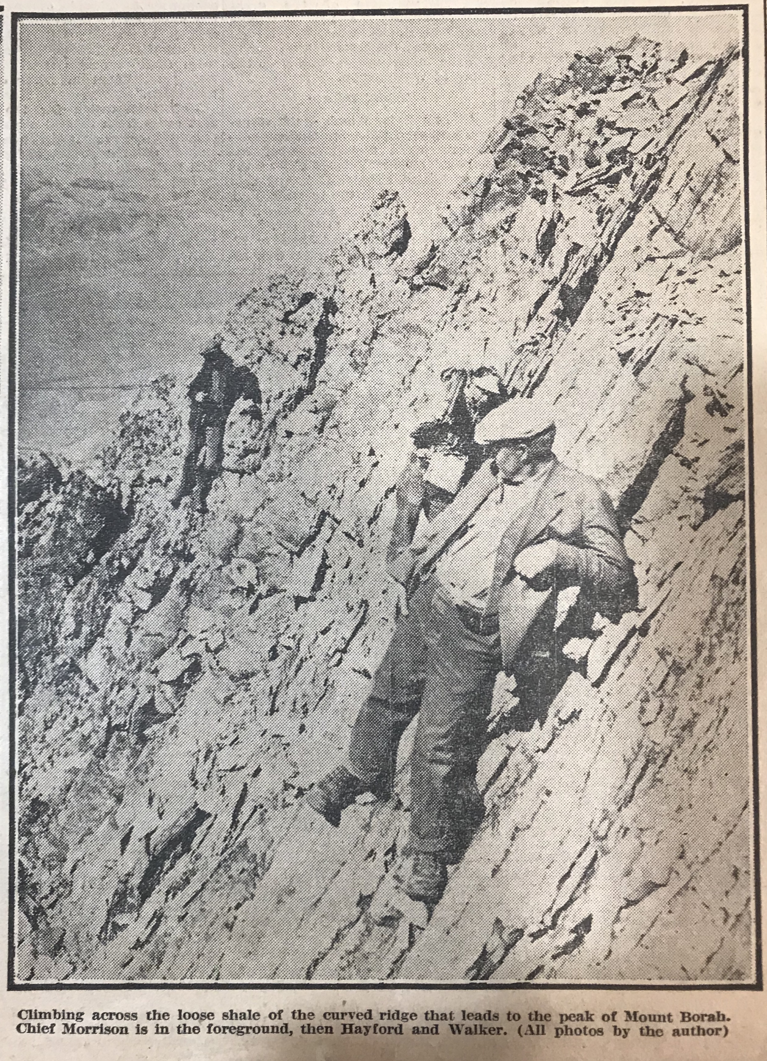
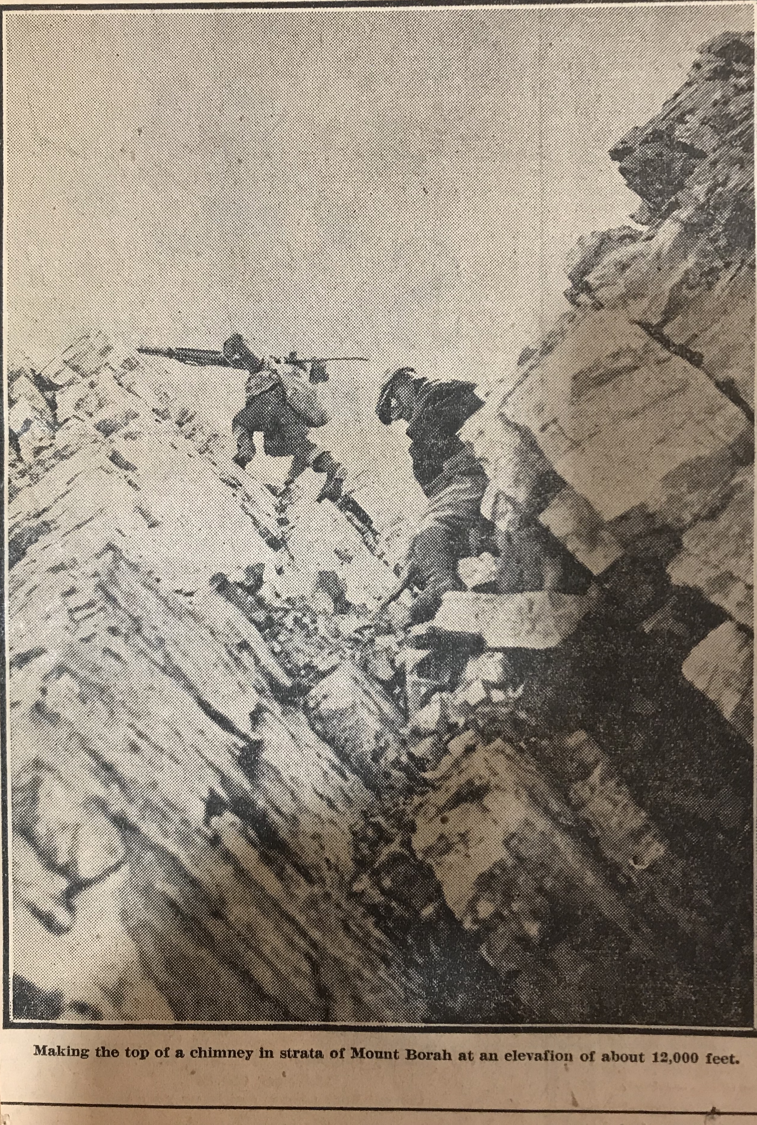
Straight back of camp the four of us making the climb took our course up the draw to ascend the headwall. On its top, we made our first instrument set-up and checked our elevation at 9,000 feet. From there we approached the edge of a great basin gouged back into the mass of the peak and, after observing it carefully, swung eastward around its edge. Over pinnacles in this edge, as we came close under 12,000 feet, we had our first real climbing. Below, the talus slopes had been fairly uniform though sometimes hard walking presented no other difficulties. Now, however, we were on a ridge that projected shale down steep sides as fast as it loosened weathered limestone is sharp as to edge and treacherous footholds for it loosens easily.
It is not our intention to brandthe climb as very dangerous or difficult. No special equipment is necessary but ordinary precautions must be taken. The average man should make the top in about six hours or less. Two famous mountain climbers made it in four hours under adverse conditions. Their names are Miriam Underhill and Robert Underhill of Boston, Massachusetts and they are registered at the top.
Past the knife edge of the ridge, the footing seemed easier and we climbed in a slight curve to come upon the top from a little in back. Close under the rock cairn that marks the exact high point, thefooting was again insecure and many large rocks that we trusted with our weight suddenly fell away and bounded into space to shatter far below. We gained the top with no mishap, however, and with excellent weather were able to enjoy the view that is unequalled in the state. Idaho’s mountains stretch out in range on range until the earth meets the sky, while under the peak, the valleys appear small and insignificant. All the territory we had worked was but a drop in the bucket compared to the miles to be seen.
But our time on top was short. We hurriedly set the benchmarks tablet, that may be found from now on at the base of the rock cairn. While the camera registered every angle of the view. Just an hour and 45 minutes we spent at this spot that we had looked forward to gaining all season and then took up our packs for the descent. We were finishing a record season. When ready for distribution, the Borah Peak quadrangle gives Idaho an other important survey of interesting country.
A. H. Marshall was the first person to visit the high points of the 48 contiguous states, accomplishing the task between 1919 and 1936. He also was the first climber to focus on the Seven Devils Mountains. His efforts in the Seven Devils are covered on Page 18 of the book.
I recently discovered a page on the Highpointers Club website which has links to Marshall’s fascinating journals. Use the following link to visit that page.
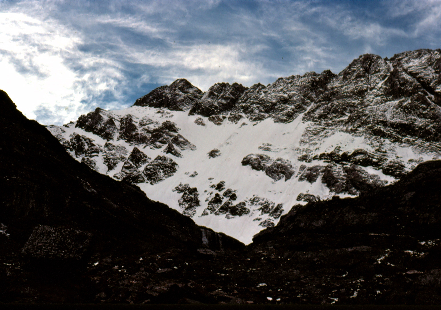
I first saw the North Face of Mount Borah in the Summer of 1972 while working under contract with the U.S. Forest Service. We were flying helicopters near Horseheaven Pass in the Upper Pahsimeroi Valley, where our daily flights offered unrivaled views of the north and east sides of the Lost River Range. But one face in particular stood out from all the others, and that was the North Face of Mount Borah. Lacking any snow, the face was a dark, steely gray color unlike anything I’d seen in Idaho before. I wasn’t a climber at the time but that was soon to change. I never forgot what I had seen that Summer.
Two years later (1974), we made a reconnaissance hike into the cirque below the East Face of Mount Borah with the intent to find a climbing route that would lead to the summit. The lower part of the face held what looked like a large snowfield, but upon closer inspection, we found that it was more than just frozen snow. Underneath the snow was hard ice, the kind that only forms from years of accumulation, where the constant pressure slowly squeezes all of the air out of the ice, leaving it vivid blue in color. To a climber, this find was important because ice climbing generally requires specialized gear that one may not carry if expecting to only climb on snow. To the best of my knowledge, no study was ever made of this ice field before it disappeared.
A year or two later, while attending Boise State University, I heard about Bruce Otto’s discovery of Idaho’s only known glacier on the North Side of Mount Borah. Bruce was a climber and Boise State University geology student who was familiar with Mount Borah and its perennial snowfields. In 1974, while doing research for a class project, he hiked into Borah’s North Face Cirque to study the snowfield and see how much it resembled an actual glacier. What he found in ice was much more than he expected. So the next year he returned with Monte Wilson, his professor and a specialist in the study of glaciers. They would return many times over the next ten years to study the glacier and its annual changes. Bruce’s description of the glacier talks about how it was over 200-feet thick, 1,000-feet wide and 1,200-feet long. He also describes how they determined the glacier was estimated to be 500 or even a few thousand years old. For a relatively short period of time, the glacier was known as the “Otto Glacier.”
Beginning in 1973, my climbing partners and I embarked on an ice climbing binge, seeking ice wherever we could find it. We found a fair amount of seasonal, winter ice in the canyons of Southern Idaho, but rarely found the hard alpine ice we were craving. The Sawtooths were too low in elevation, and while the nearby Tetons were the most likely place to find alpine ice, we found the range’s ice seasonal and unreliable. While volcanos like Mounts Hood and Rainier had glacial ice, climbing into open-ended crevasses, just to practice, didn’t seem worth the effort for the risk. The Canadian Rockies did have what we were looking for, but were just too far away for poor students to consider. So based on my 1972 aerial observations, and with the knowledge of Bruce and Monte’s discovery, we turned to Mount Borah.
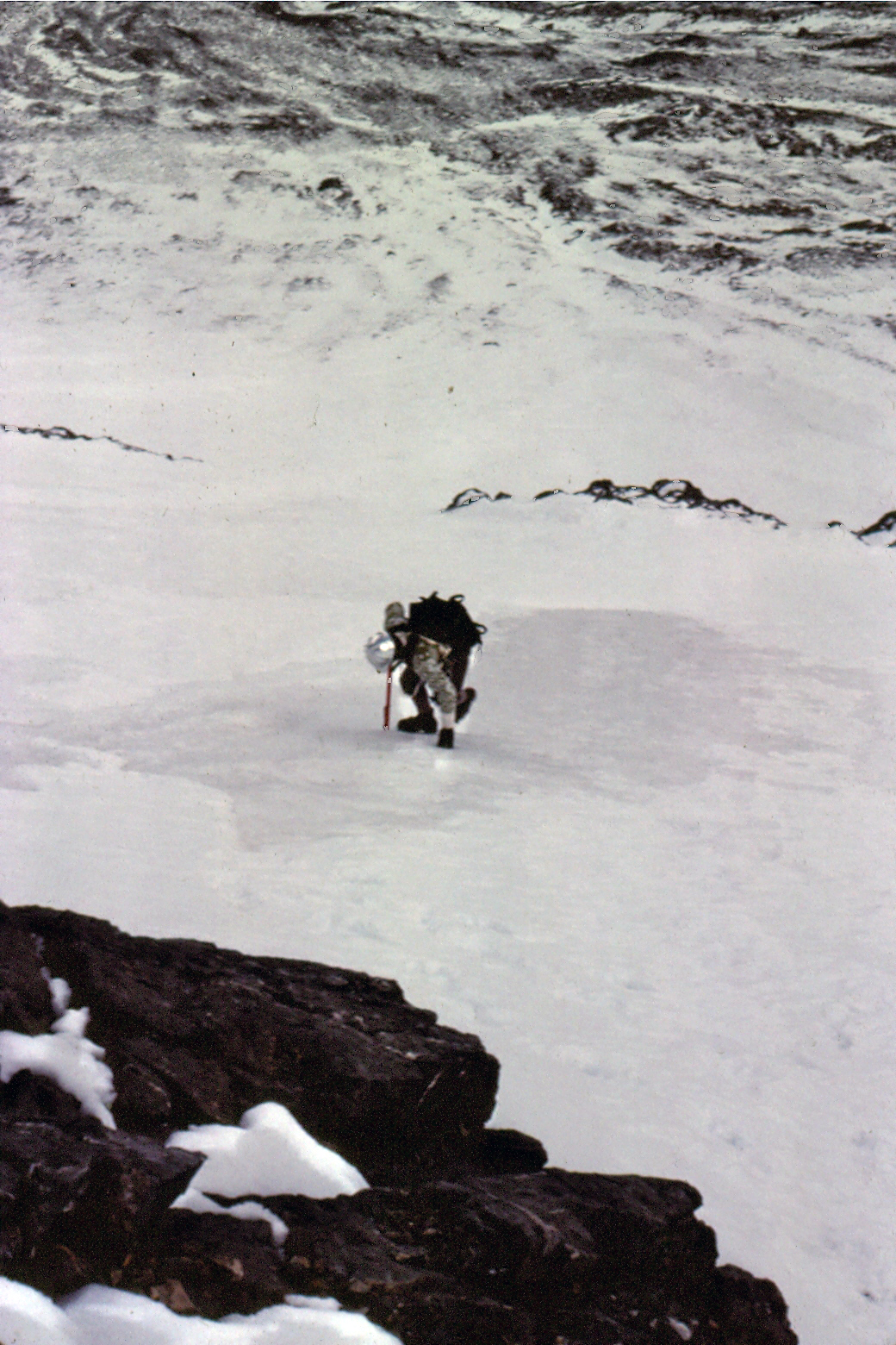
In September 1976, Frank Florence and I made plans to climb Borah’s North Face, but a torrential thunderstorm turned us back before we reached the moraine below the face. Cloud cover obscured the mountain and all we saw was the lower snowfields, leading us to believe that was all we were going to find on this mountain. In late October, Mike Weber and I returned to give it another go. The weather was perfect this time and after climbing the lower cliff band, we finally got a good look at the North Face. The face was covered with a light dusting of snow from the first snowfall of the season. So until we reached the top of the moraine, we were expecting nothing more than a snow climb. At the top of the moraine, Mike and I geared up, and from the very first swing of our ice tools we knew we had finally found what we had been looking for. The ice was thick and rock hard, not brittle like so much of the Winter ice we had climbed before. We half expected the ice would turn to snow the higher we went but it did not. The ice continued all the way to just below the summit. Like Bruce and his discovery of the glacier, we found more than we ever expected.
The East Face of Mount Borah (June 1974). If you look closely, you can see the old blue ice showing in places. Under the snow, the ice appeared to be over 50 feet thick. Bob Boyles PhotoThe North Face of Mount Borah (October 1976). Bob Boyles PhotoMike Weber showing off his French technique on the lower ice fields of Mount Borah. If you look closely, you can see the old blue ice showing in places. Bob Boyles Photo
My partners and I continued to climb the North Face of Mount Borah throughout the 1980s and we just assumed the ice and glacier would always be there. During most of the year, the face was covered with snow but, by the Fall you could count on the underlying ice showing through. On one of our trips in the mid-1980s, we discovered that a massive avalanche had occurred, taking most of the previous Winter’s snowfall with it. Bruce’s snow measuring equipment was wiped out and was carried almost a mile down to where it now sits. Little did we know at the time that we would be part of a small group of climbers who actually got to see, stand, and climb on Idaho’s last, and perhaps only, remaining glacier.
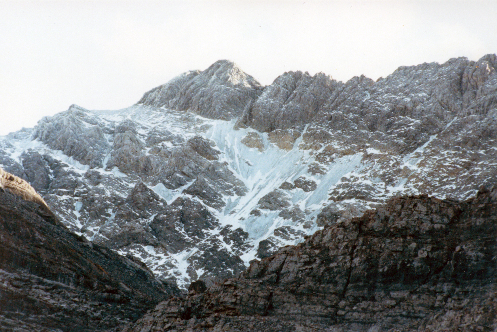
In September 1990, Mike Weber, Curt Olson, and I returned to the North Face expecting to find conditions similar to what we had found for the previous 14 years. We were quickly disappointed when we got close to the base of the North Face. The lower ice fields and the glacier were, for the most part, gone. There was still some remaining old blue ice left on the upper part of the North Face, but the bottom was mostly bare rock.
The remains of Bruce and Monte’s snow-measuring gauge (September 2010). John Platt PhotoThe North Face of Mount Borah (September 1990). Curt Olson Photo
We were in shock. The glacier and lower ice fields were almost gone. This was the last photo we took of the old blue ice that was estimated to be over 500 years old. In 2009, I was contacted by geologists who were doing a study of the Glaciers of the American West, which included Idaho. As a result of that study, Idaho was found to have no remaining glaciers with the exception of perennial snow fields and a few rock glaciers where all of the ice is underground.
In 2017, I was disappointed to read a trip report that highlighted the demise of snow and ice on the North Face. This news was especially troubling as the 2016-2017 winter resulted in a solid snowpack existing above 8,000 feet in the central mountains in June. Many high-elevation basins had more than twice the normal snowpack. I don’t know what it would take for the ice to come back short of another ice age.
[Editor’s note: Robinson Bar Ranch holds a unique spot in Idaho’s climbing history as it became the home of the first guide service in the United States dedicated to backcountry skiing. Joe Leonard tells its fascinating story below. Joe is an amazing human being. Be sure to read a bit about his life at this link: Joe Leonard and about some of his Sawtooth and White Cloud climbs at this link: THE LOST AND WANDERING.]
Paradise has many faces waiting to be discovered.
While Norm, Ron, Bill and I camped at the base of Mount Regan, awaiting first light to begin our ascent of the mountain, we talked about how beautiful the mountains were in the Winter and I mentioned the fact that I just couldn’t understand why more people weren’t out climbing and skiing. I knew in the mountains of Europe, it was quite common. Being somewhat of a entrepreneur, I shared with my climbing partners a dream I had carried in mind for quite sometime. I wanted to start a new business: backcountry ski trips that would start from the doors of a beautiful lodge, such as those I had read about in Europe.
I wanted to share the beauty of the Winter mountains with friends, family and anyone else who had a longing for adventure – wanting to provide them with the opportunity of experiencing what I had, in hopes their lives would be as enriched as mine had been. I must have done a pretty good job of explaining my vision, for when we finished our conversation, all three offered to join me in the dream. We decided right then that our first step would be to find the perfect location in the Sawtooth Valley for our base of operations and in April of 1969 we started looking.
There were two ranches between Sun Valley and Challis that would be perfect for our base: the Idaho Rocky Mountain Ranch and Robinson Bar Ranch. On a beautiful Spring morning in April, Norm and I left Boise early and headed towards the mountains filled with great expectations. We stopped at the Idaho Rocky Mountain Ranch first. It was perfectly situated in the Sawtooth Valley near Stanley and only fifty miles away from Sun Valley, where we hoped we would attract many of our clients. The visit with Mr. Bogart, the eccentric owner of this beautiful property, was disappointing to say the least. His life on the ranch was one of quiet repose and he had turned it into a private museum of sorts. He was not willing to open it to the public and nothing we could say would change his mind.
Discouraged but undaunted, we continued on to Robinson Bar Ranch. We drove through Stanley and followed the Salmon River, crossed the bridge that spans the Yankee Fork of the Salmon River and finally arrived at the turnoff that would lead us into Robinson Bar Ranch. The road into the ranch was still snow-covered but we had our skis and looked forward to some exercise after driving for so many miles. The quaint bridge that crossed the Salmon River into the ranch was built in the 1800s and, at one time, the road was the only access from Challis to Stanley and Sun Valley. It was the original stage coach route between these small western towns and Robinson Bar Ranch was the overnight stopping place. The Ranch was full of history and was undoubtedly one of the most beautiful ranches in the American West.
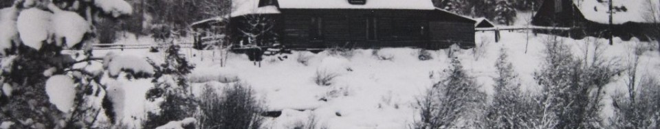
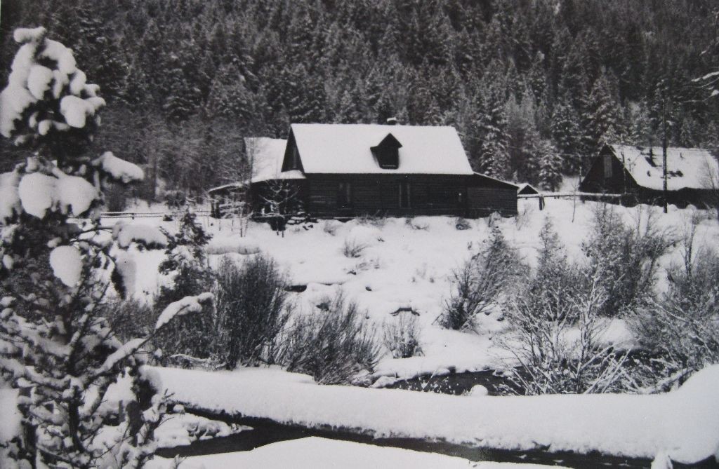
Robinson Bar Ranch in 1974. Joe Leonard Photo
We skied across the bridge and followed the road, which meandered along the river for 3 miles where it began its slow climb up and out of the river canyon into a small valley where the ranch was located. The scene was beautiful beyond description: a majestic 2-story log lodge solidly stood next to Warm Springs Creek with the White Cloud Mountains rising beyond as a backdrop. When once we stopped gazing at the beautiful log building and the cabins lining the creek behind, we noticed the steam rising out of the natural hot water pools. It was breathtaking, and it seemed almost impossible to imagine that this amazing ranch could become the home of my dream.
We met the caretaker who was a nice young man. He was delighted to see us. He hadn’t had many visitors that Winter and was happy to give us as much information about the ranch as we wanted. Everything about the ranch was perfect: good snow in the Winter, plenty of firewood in surrounding forests, every kind of skiing you could want and hot springs to rest a weary body. He told us that the owners and their families would all be arriving the second weekend in May and we could meet them then. He explained that most of the owners were well-connected executives from Idaho corporations and wealthy families from Boise.
May finally arrived and all 4 of us left Boise with high hopes, arriving at the ranch in the afternoon. There were lots of people working outside on one of the cabins, clearing rubble that had accumulated over the years. They were so preoccupied with their project that they didn’t pay much attention to us. After watching them for a while, we realized these folks just might be the owners and, if we pitched in clearing the rubble, we might win some favor when we told them we wanted their ranch. We pitched in and, in short order, all of the rocks and rubble had been separated into 3 or 4 piles.
While we were working, I noticed people quizzing each other trying to figure out who we were and why we were working so darn hard. When the work was finished, Patsy Young (a niece of Idaho Senator Frank Church), who was the manager of the ranch at that time, invited us to dinner. We protested knowing that we had arrived unexpectedly and didn’t want to put them out, but she said there was nothing to worry about. The food was served family style and there was more than enough. We cleaned up at a long metal wash basin, with several faucets from which flowed natural hot water at a pleasant 105 degrees. The smells from the pine forest and meadows, everything in sight, brought back memories of my childhood spent on the ranch at Deer Creek (the other side of the Sawtooth Mountains) and I knew in my heart I had found my new home.
After cleaning up as best we could, we were shown into the dining room and offered cocktails and hors d’oeuvres. We felt welcome and tried to stay calm and relaxed, realizing our moment was soon coming. Dinner, which was fabulous and served with excellent wine, was filled with stories. I shared some of my wild survival tales with them and we finished with the story of our successful first Winter ascent of Mount Regan. Even though it was obvious they all led lives quite different from ours, they seemed to enjoy our company and then the question was finally asked: “What brings you to Robinson Bar?”
I looked across the table, making eye contact with each of them, including their beautiful wives for a brief moment, trying to calm my beating heart I said: “We want to start the first back-country skiing enterprise in the United States this coming Winter and we would like to use your ranch for lodging our skiing and climbing clients. We are not well-financed so, instead of paying you for leasing the ranch, we will winterize all of the cabins and the lodge.”
Nothing but what seemed unending silence and then at last a question: “What is back-country skiing, Joe?” Before we said our final farewells and left the ranch that evening, they said that they would make a decision and get back to us. After what seemed years of waiting, one evening the phone rang and the secretary of one of the owners was on the line: “Is this Joe Leonard?” My stomach was flip-flopping like crazy as I said: “Yes it is.”
“I was told to call you to see if you could meet with a few of the Ranch owners in regards to your proposal. Would six o’clock tonight at John Fery’s office work for you?” At the time John was the vice-president of Boise Cascade. The meeting was going well. All of the owners were very open and friendly, asking many reasonable questions. I was hoping all the while that I was answering them to their satisfaction. The last question they asked was if I realized that we wouldn’t make much money, adding, most probably none.
“That is a possibility,” I said. “But nonetheless, making money isn’t why we are passionate about the venture. Back-country skiing is popular in Europe and will be popular here one day. We will at the least be the forerunners. That is a fact and all of us will share in that reality.”
The owners all agreed to our proposal. We shook hands and in June 1970, I moved back to my mountains, my family in tow. Some things are just to good to be true. The years I spent at Robinson Bar were full of constant wonder and the most exciting of my life. Over the years since, I have had the great pleasure to spend time with the people who we guided, worked with, and visited the Ranch and they, inevitably, felt the same as I. It was magical in so many ways.
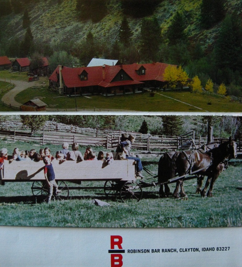
The cover of a Robinson Bar Ranch brochure. Joe Leonard Photo
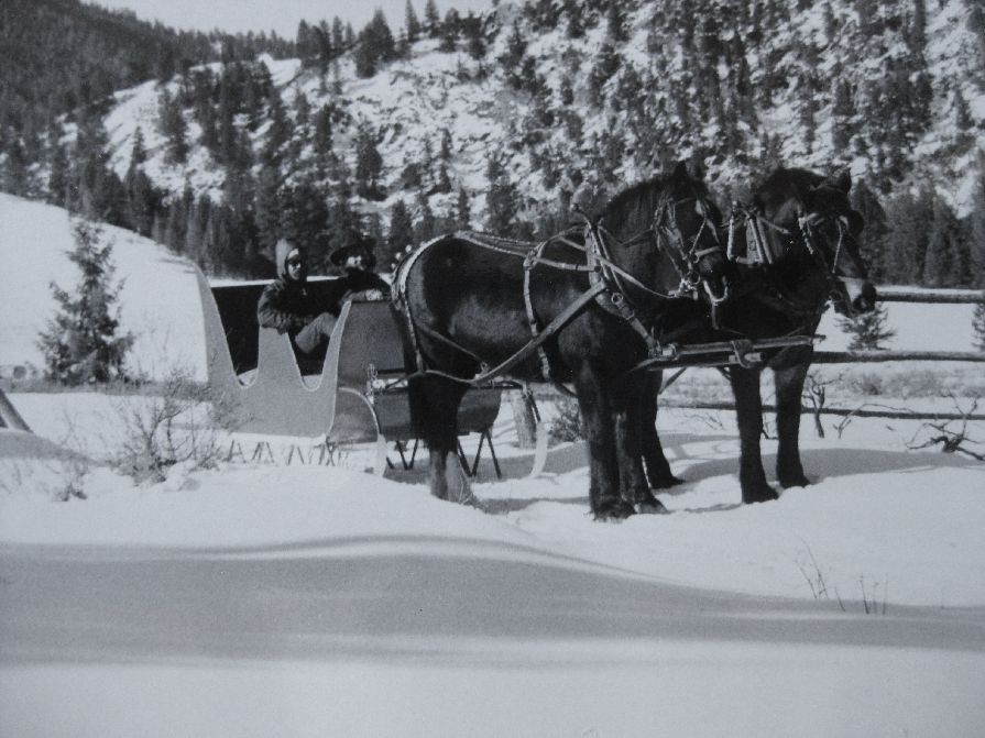
During the Winter months, the only way into the ranch was by skiing or sleigh, pulled by our extraordinary team of Clydesdale horses. As one traveled down the winding road that followed the Salmon River and led to the Ranch, you felt as though you were entering another world, in another time. The lodge had 13 guest rooms and an enormous kitchen and dining area. The living room carried a sense of the Old West, setting ones imagination afire. Our guests came from around the world and many a night, they sat in the warmth of the big stone fireplace listening to tales, old and new. The Ranch became so popular that it was soon opened year-round and we began guiding backpack trips and horsepack trips. In the Summer of 1972, we opened a kayaking school and provided the first guided kayaking trips on the Main Salmon River and Middle Fork of the Salmon River.
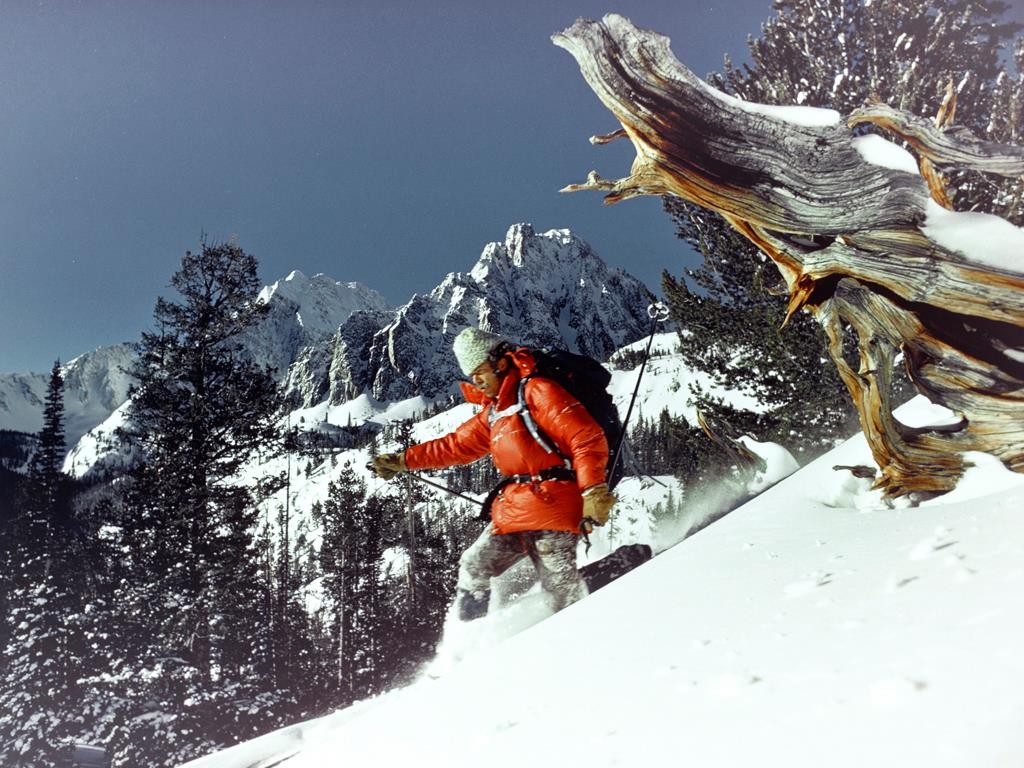
The only way into the ranch during the Winter powered by our Clydesdale horses. Joe Leonard PhotoChuck and Shorty at work pulling a sled. Joe Leonard PhotoJoe Leonard skiing below Castle Peak in 1972. A photo taken by a National Geographic photographer. Joe Leonard Collection
Soon after, we held the first White Water Rodeo in the United States on the Salmon River, just below the ranch. When I look back on those years, I am always filled with deep emotion. That I could have been so blessed to have lived some of my fleeting life in such a remote and beautiful paradise seems a rare gift. I was truly living my dream.
“Whatever you can do or dream, you can begin it. Boldness has genius, power and magic in it. Begin it now.” Goethe