The Lemhi Range’s southern crest between Diamond Peak and Saddle Mountain perfectly frames the northern horizon when viewed from almost anyplace between Idaho Falls and American Falls. This stretch of high mountains with twelve 10ers was constantly on my mind. Sometime in the last few years, I got it in my head that I should traverse the whole thing in a single push.
After some research, it appeared that this traverse had never been attempted or done. I asked Haylee Stocking if she would like to join me on the adventure and she agreed. Josh Smith heard about our plans and volunteered to provide support. His friend, Jenny I believe it is Woolstenhulme, signed on to the support team. With everything in place, we were ready to start Saturday, June 26, 2021.
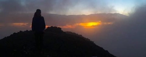
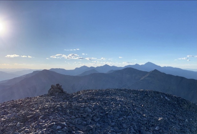
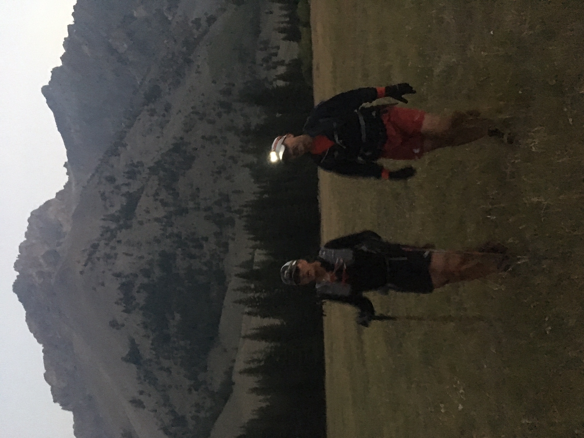
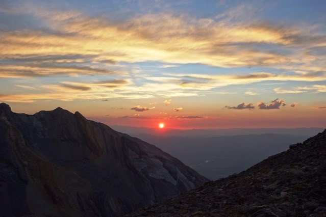
We started the trip with an ascent of Diamond Peak. We reached its summit in 2 hours and 15 minutes, just in time to enjoy the sunrise.
Sunrise on Diamond Peak
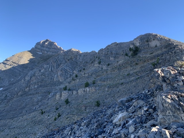
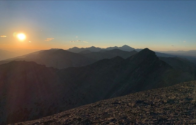
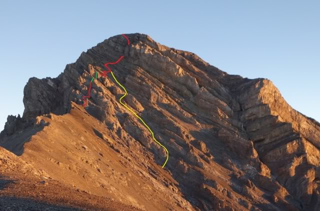
The route south from Diamond Peak has no shortage of rugged/exposed terrain to make things entertaining. The traverse from Diamond to The Riddler was my favorite section of the traverse.
Early morning light on The Riddler as we traverse over from Diamond Peak.Haylee scrambling between Diamond Peak and The RiddlerDescending The Riddler was challenging at times.The late Larry Prescott called this section “close shave” as it is a steep slab on one side and an overhanging drop on the other. The picture doesn’t depict the exposure well, but there was plenty.
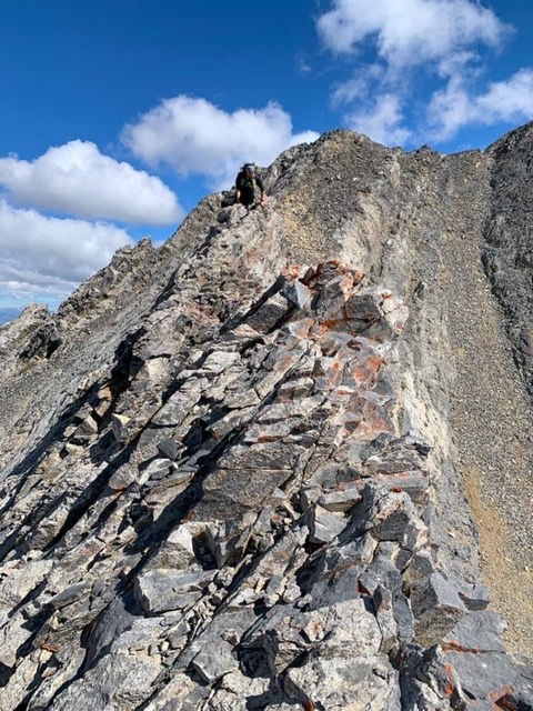
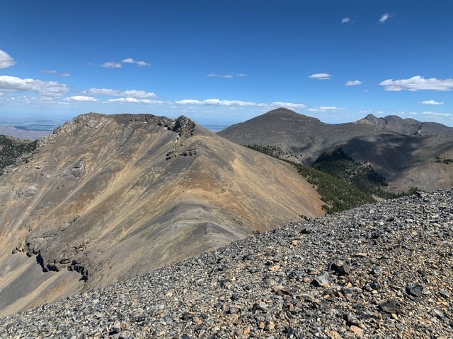
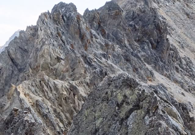
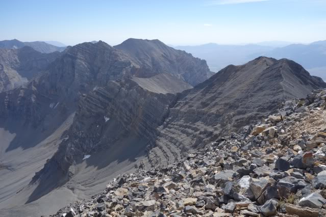
The route across Big Boy, Shoshone John, and Black and White included numerous sections of knife-edge ridge walking on grippy limestone with a few places having lots of exposure.
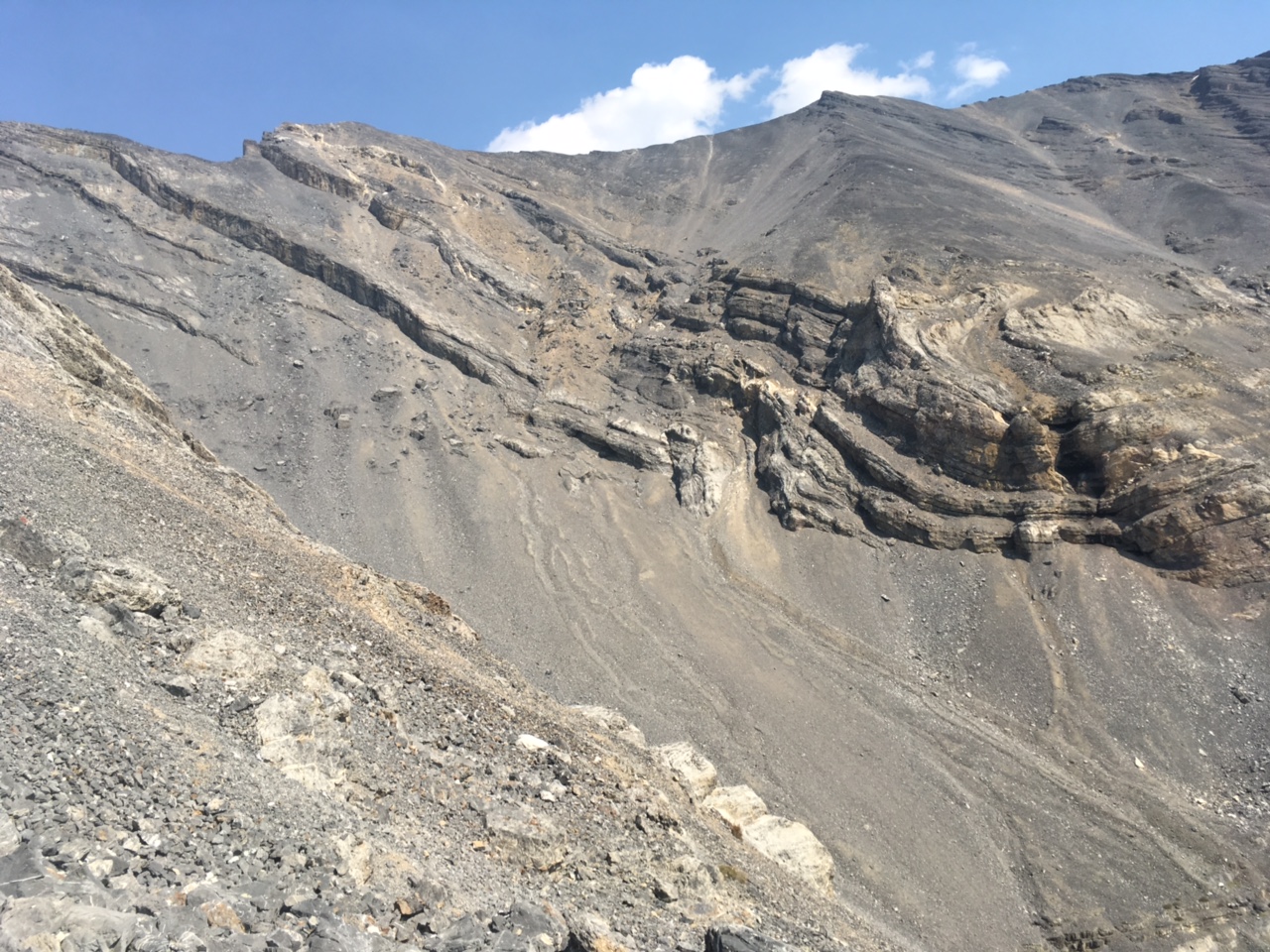
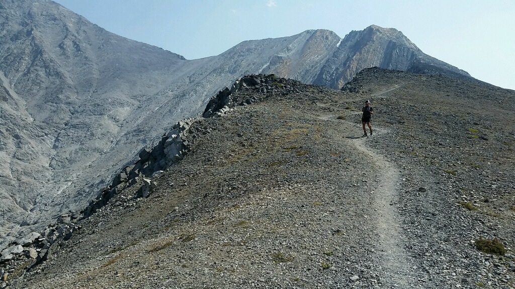
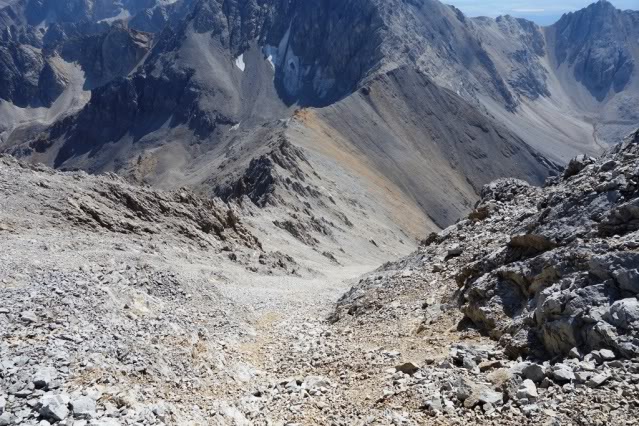
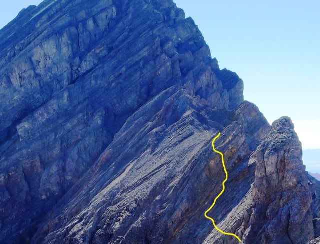
Typical terrain on the traverse north of Pass Creek Summit.
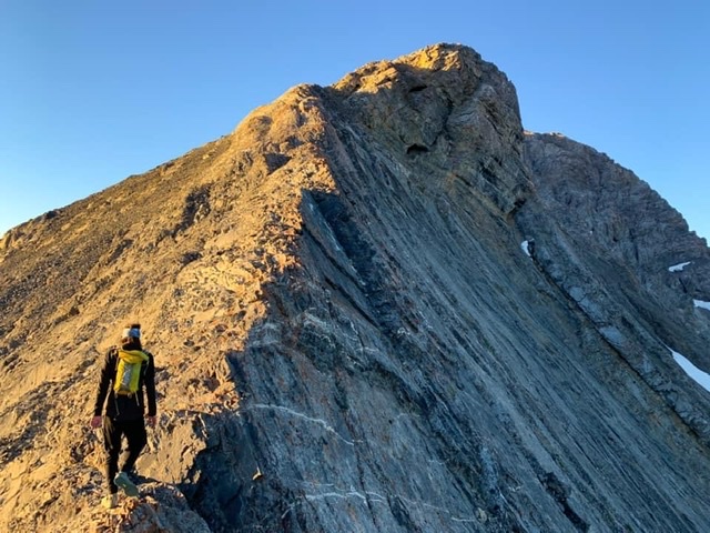
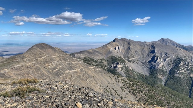
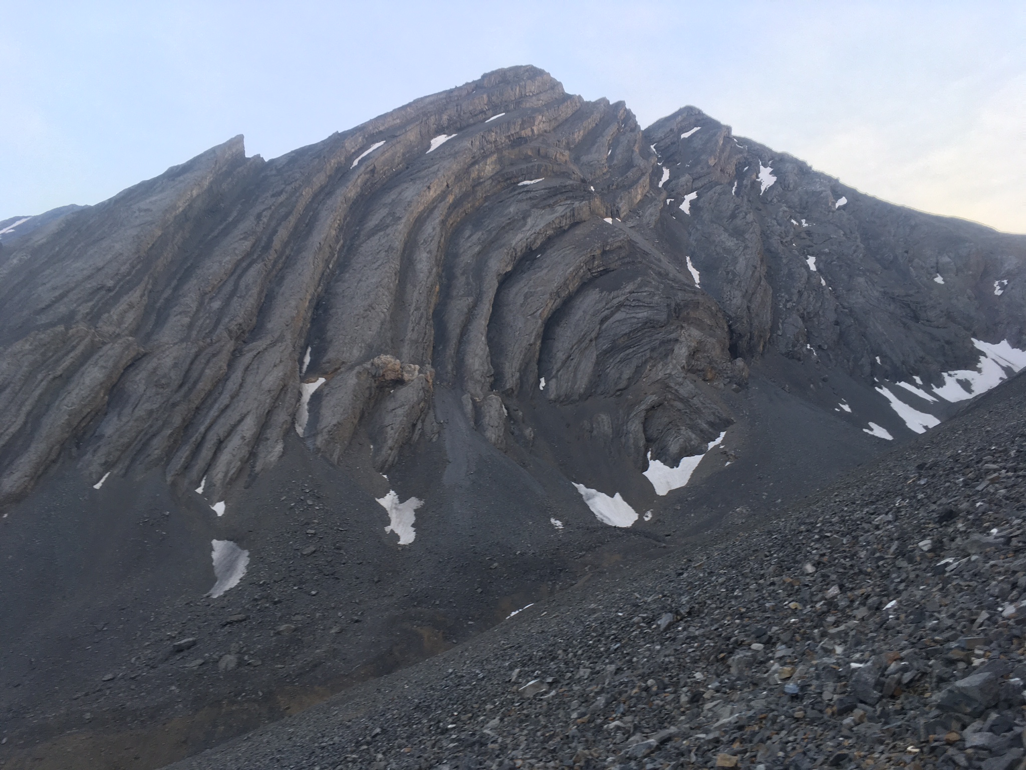
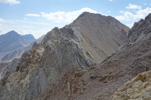
Typical terrain on the traverse south of Little Diamond Peak.
Josh met us on Pass Creek Summit and supplied us with water and energy supplies.
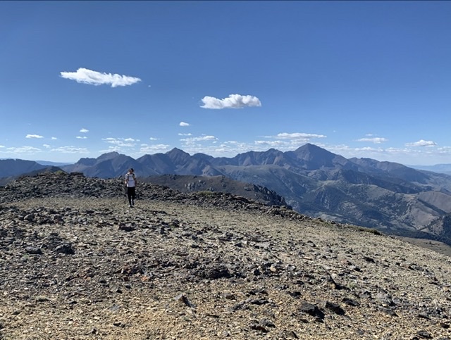
South of Pass Creek Summit, the mountains just kept coming and we summited everyone of them before reaching Saddle Mountain. After refueling, our next peak was Marshalls Mount.
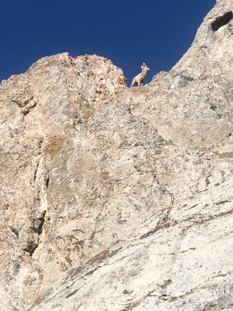
Looking south from the summit of White Bird towards Dome, Shril and Tyler. Haylee Stocking PhotoDaniel approaching summit of Shril Benchmark. Haylee Stocking PhotoGearing up for Striped, Tyler, Hoopes, and Saddle. Haylee Stocking PhotoLooking at the ridge and summit of Tyler Peak. Haylee Stocking PhotoThe day is waning as the shadows spread out from Tyler Peak’s summit. Haylee Stocking PhotoLooking north from the summit of Tyler Peak at everything we’ve climbed. Haylee Stocking PhotoLate in the day from the summit of Hoopes. Haylee Stocking PhotoGoats on Tyler Peak. Haylee Stocking PhotoSomewhere on the crest :). Haylee Stocking Photo
The final test was Saddle Mountain. We knew this would be a test after so many hours above tree line. Our enthusiasm was bolstered because we knew that Josh had climbed Saddle Mountain earlier in the day and left us a cache of food and water. Climbing the north ridge of saddle in the dark was not physically hard with just a few Class 3 sections. However, it was psychologically taxing since we couldn’t see what was above us. Neither of us had climbed Saddle before and I finished my water while climbing Tyler Peak.
Saddle Mountain awaits us. Haylee Stocking Photo
Our effort progressed smoothly with the exception of our descent off of Saddle Mountain in the dark. Finishing off the day with a long tiring slog through the deadfall in Middle Canyon was a chore. Haylee told me “I felt great all day and was loving life until we hit Middle Canyon. That was hell in the dark.”
After 26 hours of climbing, we reached our vehicle and feasted on cold beverages and snacks.
Final Thoughts
Our traverse was 90 percent off-trail and covered a lot of undocumented terrain. As a result, a substantial portion of the traverse involved route finding and scrambling improvised as we traveled. In total, there were three technical cruxes: the traverse between Diamond Peak and The Riddler, the exposure on the south side of Shoshone John, and a short knife-edge between Black and White and Little Diamond. None of this was difficult climbing–just exposed scrambling on sometimes questionable rock. Josh’s logistical support was essential since there was no water or snow along the route.
Haylee told me she really enjoyed her summit time and the “hardest part besides the actual climbing was not being able to stay as long as I wanted on the summits.” In retrospect, the hardest part for Haylee was probably that she constantly had to wait for me. She is a powerhouse in the mountains. Haylee offers the following advice for those thinking about following our route: “Arrange a couple more aid drops so your pack is lighter which will allow you to move a little faster on the easy ‘runnable’ sections.”
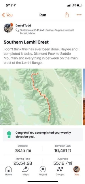
Trip Statistics
Distance: 28.15 miles
Elevation Gain: 16,491 feet
Time: 25 hours, 54 minutes, 28 seconds.
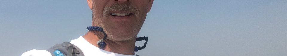
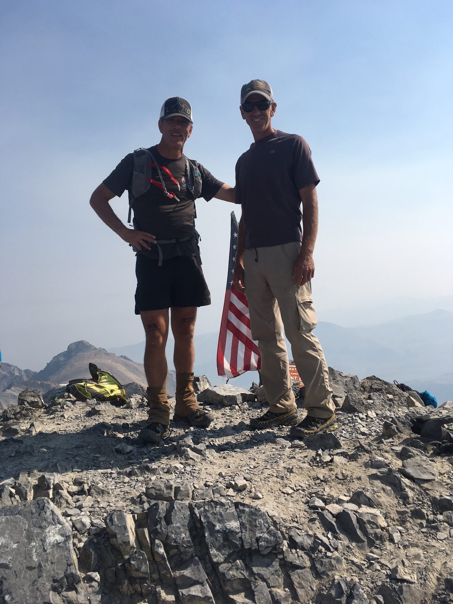
Haylee and Daniel during their 26-hour extravaganza looking no worse for the wear.
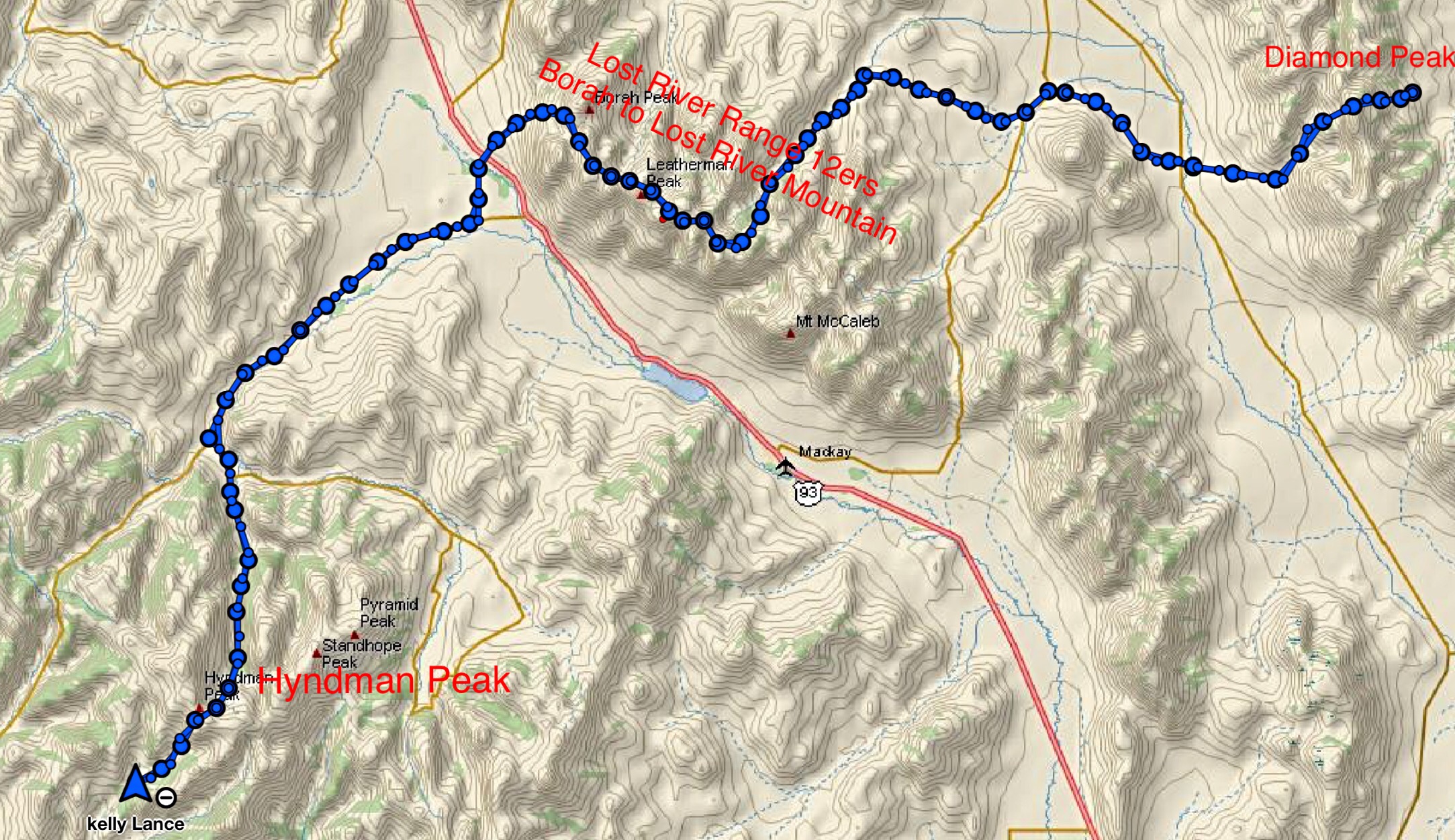
Kelly Lance, a 49-year-old endurance runner from Pocatello, climbed all of Idaho’s 12,000-foot peaks in a 119-mile, 78-hour push starting on September 2, 2017. Unlike the others who have climbed the 12ers in a single push, Kelly did it without resorting to mechanized transportation, the first traverse of its kind and perhaps the most over-the-top accomplishment on these peaks to date. This story is all about endurance, planning, training and determination but, in the final analysis, it is a story about a personal journey of discovery.
Kelly’s GPS track condenses his ordeal into a compact package. In reality his route was a sprawling journey.
Climbers quickly discover that there is nothing easy about climbing these peaks. Each of the 9 peaks test a climber’s mountaineering skills, will power and conditioning. It takes most climbers several seasons to complete the list. While completing all 9 summits places a climber into an impressive and elite group of Idaho peakbaggers, climbing all 9 peaks in a single push without using a motor vehicle to travel between the 3 mountain ranges harboring the peaks is an accomplishment beyond the scope of mere mortal climbers.
The 3 fastest times for the 12ers are 1 day, 4 hours, 18 minutes by Luke Nelson of Pocatello and Jared Campbell of Salt Lake City accomplished in 2014 [1]; 1 day, 13 hours, 44 minutes by Cody Lind of Challis, Brittany Peterson of Boise and Nate Bender of Missoula accomplished in 2016 [2]; and 1 day, 14 hours, 50 minutes by Dave Bingham and Rob Landis of Hailey accomplished in 2006 [3]. All 7 of these record holders are impressive athletes. Luke Nelson and Jared Campbell are essentially professional, sponsored endurance runners. They all used vehicles to shuttle between the 3 mountain ranges and their times are impressive accomplishments. Kelly decided that the next step was to climb all 9 peaks by foregoing vehicle shuttles.
Kelly did it his way . . .
The seed was planted in Kelly’s mind during a conversation with his wife, Michelle. Kelly states: “…a couple years ago, some guys I know [Campbell and Nelson] did a fantastic job with the speed attempt. And kind of jokingly, I said, ‘Nobody’s ever done it without a car.’ Once I said it, I couldn’t get it out of my mind.” He continued, “I had to do it. I wanted a project that would put me out of my comfort zone. I was not a dedicated climber at the time. Attempting the 12ers without the use of a vehicle would, no doubt, put me out of my comfort zone and force me to become a climber.”
Using the standard climbing routes up each peak would require 8 separate ascents, as only two of the peaks are situated next to each other. Additionally, climbing each peak separately would significantly add to the overall distance and elevation gain. To overcome this problem, Bingham and Landis pioneered a route that linked together the 7 Lost River Range 12ers by staying as close as possible to the crest of the Lost River Range between Mount Borah and Lost River Mountain, thereby minimizing distance and elevation gain and loss. Keep in mind that the concept of minimizing elevation gain and loss are relative concepts in such an undertaking. Further, by attempting to stay as high as possible on the crest, Bingham and Landis and those who followed them had to face many other obstacles like cliffs, steep, loose talus slopes, lack of water, falling rock, and route-finding problems.
Planning is an essential prerequisite to success
Once the decision was made, Kelly jumped into planning his climb in earnest. Finding the correct route along the crest of the Lost River Range was the crux of the planning stage. He talked with Jared Campbell about his crossing in 2014 and with Lost River Range expert Wes Collins to get an initial understanding of the route. Most importantly, after tentatively planning a route, he climbed each peak to get a firm handle on the terrain he planned to tie together.
While other speed climbers traversed the 12ers from west to east, Kelly’s scouting convinced him the traveling from east to west would be more efficient. “Primarily, I recognized that to shorten the distance, I needed to traverse the two end peaks [Diamond and Hyndman] rather than following the routes used by the record holders,” Kelly said.
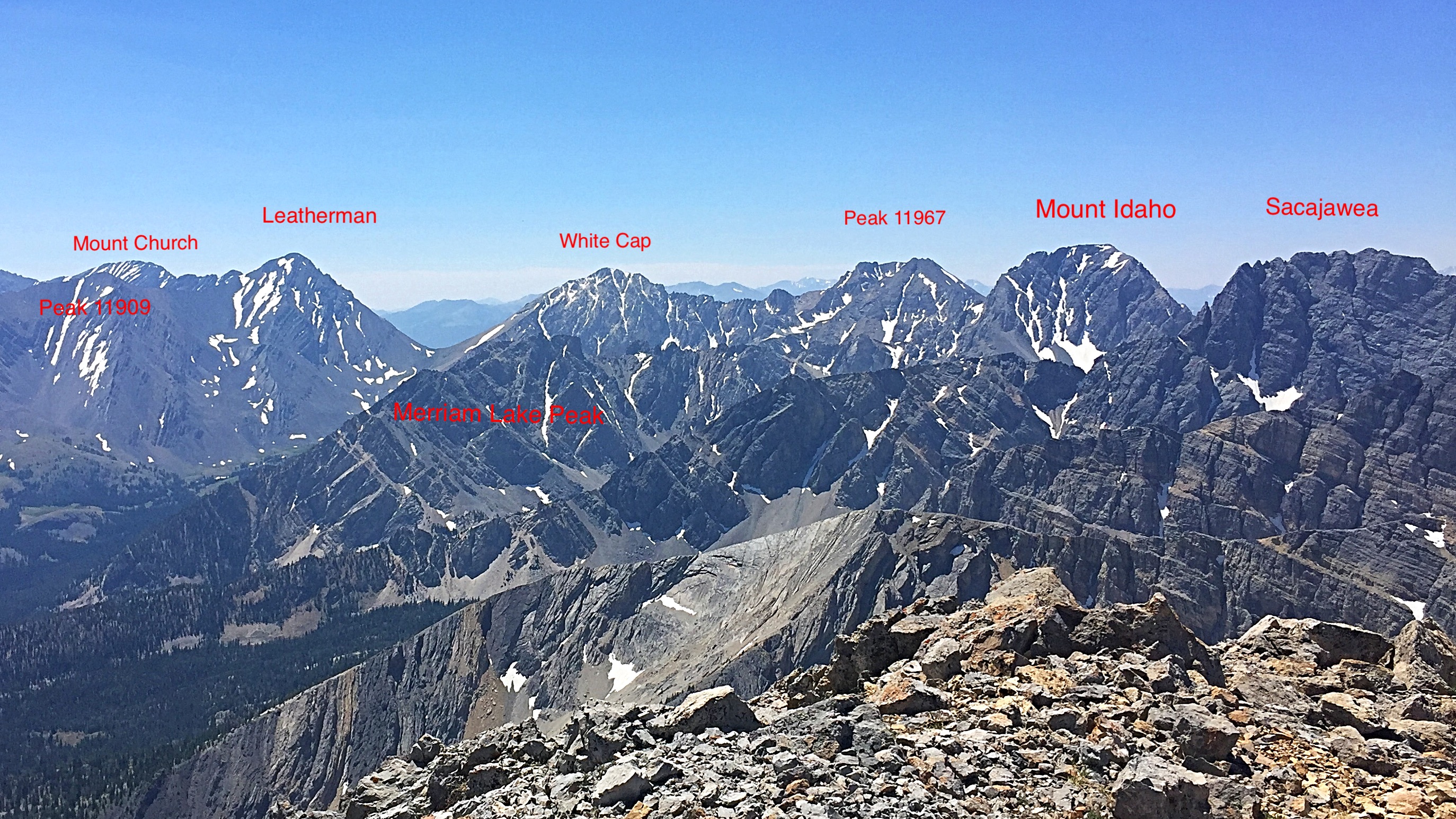
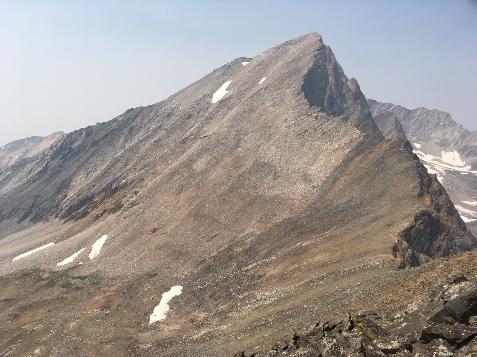
This photo shows perhaps the hardest portion of Kelly’s Lost River Range traverse from Mount Church to Mount Idaho but includes only 3 of the 7 Lost River Range 12ers. Tom Lopez Photo
Kelly also had to plan the logistics necessary to complete the odyssey. This included what equipment would work best, the amount of food needed to fuel his body, how much water to carry, and where and when to rest. “As an endurance runner with many long races under my belt, I had a good understanding of the logistical requirements but coupling this understanding with the mountaineering aspects required a lot of fine tuning,” according to Kelly.
Finally, Kelly lined up a support team he could rely on. His wife Michelle and daughters Charlee and Robbee were already enthusiastic supporters of the quest. Jack and Connie Oar volunteered to provide additional support after he descended Diamond Peak. Andy and Robyn Holmes and their kids joined the support team and Andy signed up to run with Kelly on a portion of route. Doug Lawton agreed to meet Kelly at Pass Lake, the midpoint for the second day’s route, and accompany him on his climbs of Mounts Idaho and Borah. So, with two years of planning under his belt and his support crew lined up, Kelly was ready to go.
Day One: A Diamond Peak east to west traverse and miles to go before . . .
Diamond Peak is the only 12er in the Lemhi Range. It is most often climbed from the east via a sharp, Class 3 ridge that has significant exposure in places. Class 3 routes involve actual climbing where your arms and hands are used to propel yourself up the slope. On September 2, at 10:30AM, Kelly said goodbye to his family and started up the mountain fresh and feeling strong. After traversing 2.5 miles and gaining 5,100 feet, he reached the summit at 12:50PM still feeling strong. One 12er down, 8 to go.
Kelly and his family at the Diamond Peak trailhead—119 miles to go.
Kelly states: “Upon reaching the summit, I was in good spirits. Near the top, an immature Peregrine Falcon dove and landed 10 yards below me. I thought, the falcon was a good omen and even with the smoke in the valley, my plan would be fulfilled, or as Connie Oar said later, it was ‘good MOJO.’ ”
Now, Kelly set out on his descent. He was covering, based on his meticulous recon efforts, familiar country. He descended Diamond’s South Ridge toward the saddle between Diamond Peak and The Riddler. It is likely that fewer than a dozen climbers have ever crossed the South Ridge. From the saddle, his route turned west, dropping down steep slopes toward Badger Creek.
Kelly recalls: “My wife and I had previously traversed the peak during the recon stage. The descent into Badger Creek offered a little scree skiing but most of the distance involves crossing slippery rock slabs covered by scree. I didn’t want to rush the descent as I had several miles and hours ahead of me and so I slowed down. An injury this early would end my quest. I remember that I was in awe of the peaks around me realizing that the rock was once a sea bed. Down lower, the bushwhack made me glad I previously scouted the area with my wife. Further down the canyon, I began cramping when I stopped to refill water near the old miners cabins.”
Badger Creek empties out into the Little Lost River Valley, Idaho’s premier intermountain valley. The wide valley is characterized by sweeping alluvial fans, which have built up over the centuries as the mountains have eroded. This is high desert country, hot and dry. Kelly’s route took him across the Badger Creek Bar and continued down to the Little Lost River where he was greeted by his wife and kids and the Holmes and Oars. He remembers what a great feeling he had when he was greeted “with drums and noise makers.”
It was time for a break and a brief visit with the welcome committee while he ate, cleaned up, and prepared for the next section. From the river, his route continued along the East and North flanks of Hawley Mountain, a large, distinctive peak that projects eastward from the Lost River Range into the valley. Once past Hawley Mountain, his route crossed the broad, high plateau between Wet Creek and Dry Creek. This crossing involved steady but significant elevation gain.
Endurance running and climbing are often complicated by games that your mind plays on you, especially when you travel alone. This portion of the quest proved particularly frustrating. Kelly remembers: “My pace was slower than I hoped and I slowed to a walk at times. I think the unseasonably warm temperatures had something to do with, but it might have been that my first glimpse of the Lost River Range Crest was weighing on my mind. It seemed so far away.”
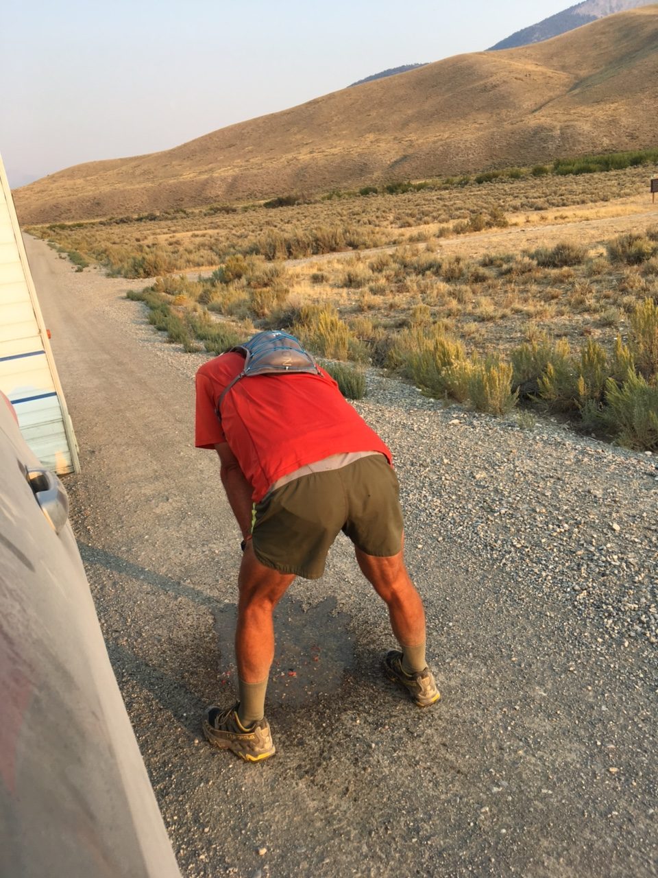
Under stress fueling your body is not always easy. Kelly’s body rejects his snack food.
At 6:30PM, his family met him with their mobile aid station. The fueling stop turned into a good news/bad news incident. He ate a bit and drank a little and started running again. Kelly relates, “I promptly lost all the food I ate, but this actually made me feel better for awhile. Even though I was thrashed, I was once again able to maintain a steady jog. My spirits were low as the sun sank and the moon rose but the support of friends and family made me feel grateful. I realized they were making my quest possible.”
The welcoming committee.
Kelly’s family had pulled a trailer into the Dry Creek drainage, the largest drainage on the East Side of the Lost River Range. He arrived at the camp shortly after 9:00PM. He relates: “I didn’t sit by the welcoming fire, instead I cleaned up and ate. I had originally planned on 4-5 hours of sleep at this stop. Funny, but plans and reality often clash. Sleep never came…cramping, anxiety, hearing every sound. I gave up at 2:30AM, upset and wishing I had just started earlier. I still didn’t have my pack ready for Day 2 and had to pack and eat. Behind schedule, I started out again at 3:45AM.”
Day Two: And now the going gets tough . . .
The first peak to be conquered on this day was Lost River Mountain. Kelly planned to ascend a seldom-used route that climbs up the peak’s treacherous East Face, the Northwest Gully/North Ridge Route, which is rated Class 5. In climbing terminology, Class 5 means roped climbing with the leader placing protection for the safety of both climbers. In other words, the route crosses technical rock climbing terrain usually ascended by a team using a rope for protection from falling. The route can be climbed by a solo climber but at greater risk. If this route was the only obstacle he faced that day, “It would have been an easy day,” Kelly thought.
Running toward the Lost River Mountain headwall.
It is a long way from Dry Creek to the summit of Lost River Mountain, as the drainage is massive. With this first difficult ascent of the day facing him Kelly started off, with Michelle and Andy Holmes running alongside of him, moving up into the incredibly scenic headwaters of Dry Creek. Kelly left his support team before reaching the headwall. Slowing on the headwall’s difficult rock he made his way up the climbing route without serious incident. He started to suffer nosebleeds and found that “trying to pinch my nose while climbing was a hassle.” Nevertheless, distance, lack of good trails, and the technical climbing obstacles, as well as the prior day’s effort and lack of sleep, delayed Kelly’s progress considerably. It took him over 7 hours to reach the summit, making it at 10:56AM.
A brief rest stop before the climb up Lost River Mountain.
It is likely that most climbers would have assessed their slower-than-expected pace, their physical output, and the difficulty of the route ahead at this time, and most climbers would have called it a day. But quitting did not cross Kelly’s mind. As an endurance runner, he has trained to put his mind into a Zen-like trance and continue on. The thought that did cross his mind at this point was an assessment of “How could I make up the lost time.”
After a brief rest, it was time to move on, and he started to descend Lost River Mountain’s North Ridge. Once again, this is not a traditional descent route. But Kelly knew from his recon trips and discussions with both Jared and Wes that staying on or close to the top of the ridge was a feasible route to Mount Breitenbach.
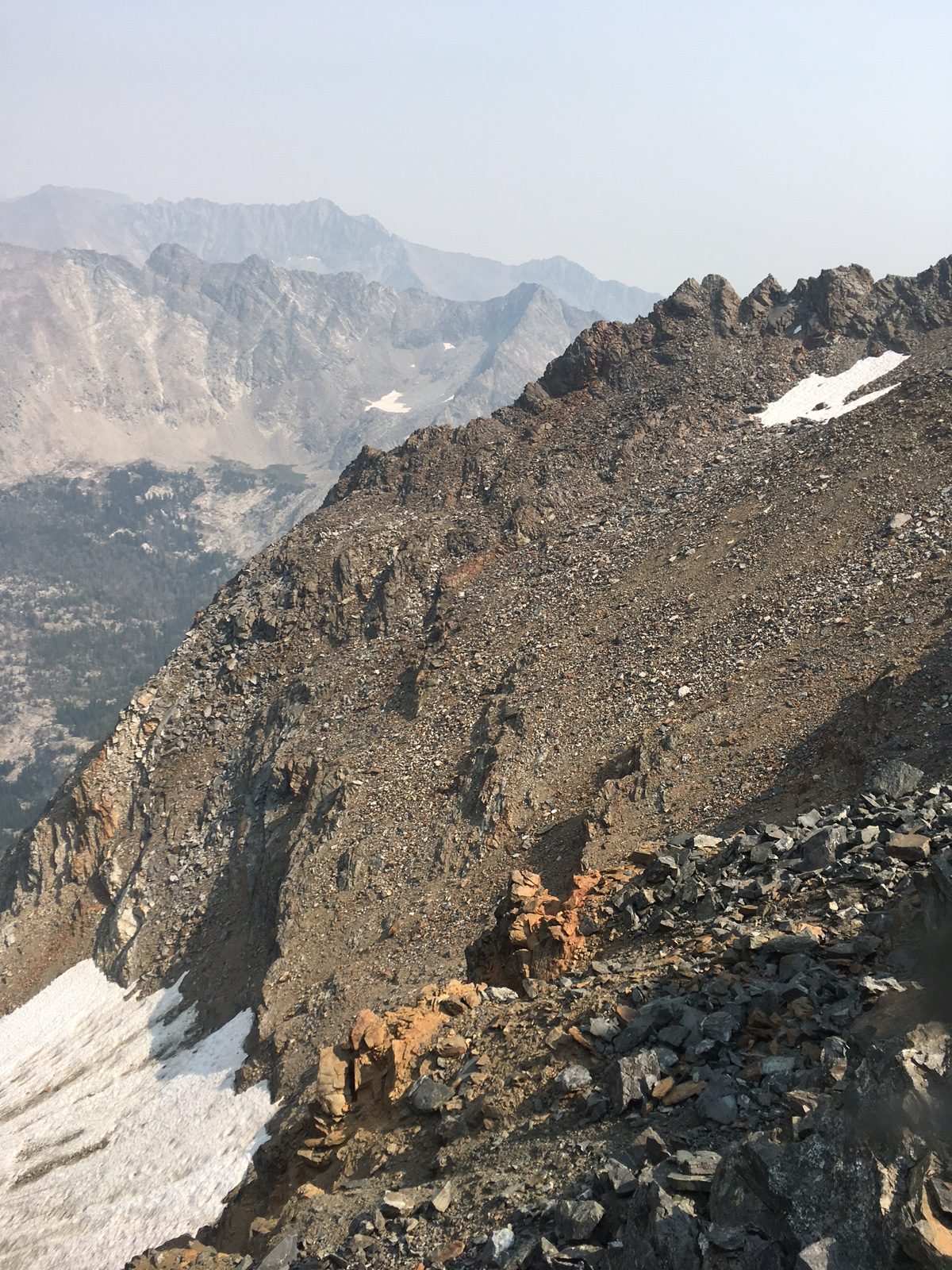
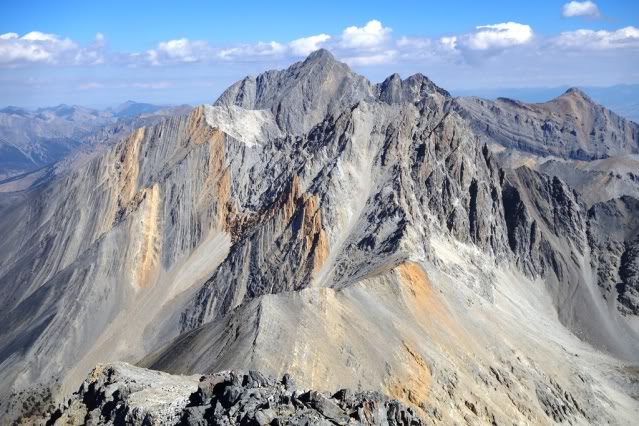
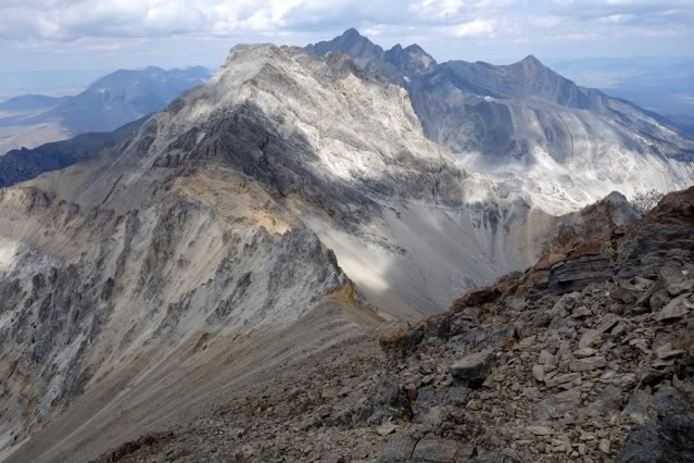
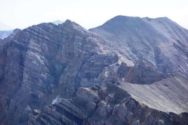
This photo of the Mount Breitenbach/Donaldson Peak Cirque shows the typical terrain found in the Lost River Range between Lost River Mountain and Mount Borah.
Rather than worrying about pace or quitting, Kelly recalls only focusing on the route ahead. “Being behind my ‘schedule,’ I was excited to see how fast I could maneuver along the difficult traverse of Breitenbach, Donaldson, and Church along the ridge. I was also contemplating a last minute ‘Plan B,’ which was to traverse the West Side of the crest after I summitted to get to Leatherman Pass. I knew this would take considerable time and would possibly delay me further, but I was a little nervous about the descent into the East Fork Pahsimeroi River. Based on my recon efforts, I knew the ramps I would have to descend from Mount Church would be covered with melting snow and ball bearings of rotten rock. I was taking a chance going this way, trading elevation loss/gain for side-hilling. A slip could have me rolling all the way to the Pahsimeroi.”
The first section of the traverse to Breitenbach took 2.5 hours but was uneventful. Kelly reached the summit around 1:30PM. Three 12ers, a third of the peaks were now climbed.
Crossing from Mount Breitenbach to Donaldson Peak was a different story, as the ridge top is barred by a series of cliffs and an intermediate peak. Knowing from his recon efforts that the ridge top was a non-starter, Kelly descended by dropping west off the summit into the rugged and unstable Upper Jones Creek Cirque. At 10,100 feet, he crossed to Donaldson’s East Face and started the steep slog up to the summit. He reached the summit after another 3 hours at 4:30PM. Four 12ers down and 5 to go.
From Donaldson’s summit, he was on familiar ground as he crossed over the convoluted Class 3 ridge to Mount Church. He quickly reached the summit after 45 minutes at 5:15 PM. This was the theoretical midpoint of his journey but, in reality, the most difficult terrain was still ahead of him.
The descent from Mount Church crosses these treacherous ribs.
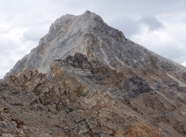
From Mount Church, the Lost River Range Crest leading to Leatherman Peak is blocked by 11,953-foot Bad Rock Peak, a massive pile of broken cliffs, jagged ridges, and towers. In the planning stage, Kelly decided to bypass Bad Rock Peak on its East Side. This route took him down Mount Church’s North Face. He safely crossed the series of rugged ramps that had worried him as he aimed for an unnamed lake at 9,682 feet. He continued down the drainage past the lake until he could cross over Bad Rock’s Northeast Ridge.
Bad Rock Peak is a difficult peak to climb or circumvent at any time. Imagine facing it as the sun is setting with no sleep.
After reaching the bottom of the Northeast Ridge, he was in the headwaters of the East Fork Pahsimeroi River and had, figuratively, a straight shot up Leatherman Peak, which was due west. However, straight shots in the Lost River Range are never straight in reality. Loose rock, short rocky steps and massive amounts of elevation gain are always between the climber and his destination. So, all Kelly had to overcome from the point where he now stood was 3,700 feet of elevation gain over unforgiving terrain. The crossing from Mount Church took 4 hours. He arrived on the summit of Leatherman Peak at 9:15PM. He now had completed 2/3rds of the 12ers with only 3 to go. Another way to understand the energy output at this point is to recognize that since he left Dry Creek, he had been moving in difficult terrain for 17.5 hours after a short sleepless rest stop and after the prior day’s crossing of Diamond Peak and the Lemhi Range.
Kelly remembers: “Upon summitting Leatherman, the ranch lights below looked close enough to touch. The terrain was lighting up from the moon. Halfway down, I noticed the moon shadow of Leatherman was looming over Pass Lake. I probably could have traveled without a headlamp, but I couldn’t seem to get my night vision or depth perception when I would turn my headlamp off. It was mentally perplexing to move in these conditions.”
And now he had to descend, again losing hard earned elevation. He dropped down Leatherman’s North Face while aiming for Pass Lake, which sits in a cirque on the East Side of the crest below White Cap Mountain and Peak 11967 at 10,000 feet. Descending after a tough climb and on loose ground is never easy, and now Kelly was descending in the dark. Kelly notes: “In the dark, I didn’t descend far enough before turning west toward the lake and got caught up in a series of ribs and gullies that slowed my progress.” He arrived at the lake at 11:00PM where Doug Lawton was waiting.
Kelly was happy to meet up with Doug. Kelly remembers “Doug’s offer to meet me at Pass Lake was not pre-defined by a plan. I originally thought he could accompany me to Leatherman Pass if I needed him. At this point, part of me wanted to do the whole thing alone but when I met him, I was thankful he came.”
Kelly continues: “I asked Doug if he had a sleeping bag as I felt I was catching up on my schedule and I was running out of steam. I contemplated napping for a bit in our bivys but, after the previous night, I was afraid I would only lay there for a couple of hours, not sleep and lose time. I wasn’t in a frame of mind to realize the added fatigue and miles would have let me sleep just fine. In hindsight, I think I could have moved faster after a nap. So, with Doug joining me, we started out on the long night slog, first to Mount Idaho and then on to Mount Borah.”
Kelly’s chosen route on Mount Idaho would not be easy even for a rested climber. The route first crossed over Peak 11967’s ragged East Ridge, then dropped steeply down into the next drainage before climbing to the saddle on Idaho’s South Ridge, another big elevation gain of 3,000 feet. Kelly remembers: “The traverse below and to the saddle was slow, tedious, and time consuming. It was like I was stuck in a time warp. Slow rock hopping and not really any way to get into any rhythm other than a slog.” But Kelly and Doug persevered through the ‘time warp’ and arrived on the summit at 4:05AM.
Sacajawea Peak, a peak that is an even larger obstacle than Bad Rock Peak, stands guard on the Lost River Range Crest between Mount Idaho and Mount Borah. Based on his recon, Kelly recognized that the difficulty posed by Sacajawea’s ragged cliffs was best avoided. Thus he chose to drop off the West Side of the crest into the Cedar Creek drainage and traverse completely around the blocking ridge. He accomplished this task by descending Mount Idaho’s West Ridge to 9,800 feet and then dropped due north to treeline. At dawn, after moving steadily since leaving Dry Creek, he had been on the trail for nearly 27 hours. He stopped and slept for one hour.
Any honest person who has tested themselves against difficult physical task will tell you that staying focused in the moment and not second guessing is nearly an impossible task. As they stopped to rest Kelly remembers that he “Mentally would fall into a hole of wondering what I could have done different the past two days to be in a better position time-wise. Doug told Kelly, ‘Not to feed those thoughts,’ which helped me refocus and get through the rest of the morning.”
After this brief refresher, Kelly and Doug climbed due north toward Borah’s summit, still 2,800 feet above the resting spot and once again crossing difficult terrain. Those who travel in the mountains are occasionally rewarded with transcendental experiences. It was now Kelly’s turn. He relates: “After our nap, a group of ewes and lambs suddenly materialized in front of us on the ridge. From this point, Doug and I and the bighorns climbed together at the same pace as if the sheep were guiding us. When we stopped, they stopped as if waiting for us to catch up.”
Kelly and Doug on the Summit of Borah.
After reaching the crest above Chicken-Out Ridge, they followed the climber’s trail to the summit, arriving at 11:15AM. Kelly now had 8 12ers down and one more (Hyndman Peak) to go. Kelly descended the well-beaten climbers trail from Borah’s summit to the trailhead where his support crew was standing by at 2:05PM.
Except for the one-hour nap in Cedar Creek, Kelly had been awake for 55 hours and it had been 34 hours since he left the Dry Creek stop. Kelly relates: “It took me 34 hours to run the Hardrock 100 in the San Juans and I still had to face Hyndman and completely cross the Pioneer Mountains. I really didn’t know what I would feel like after resting and was VERY unsure how I was going to complete the remainder of the trip. Lack of sleep had me worrying how to get my kids to school and wife to work the next day. I thought at the least, I would grab my backpack and just hike the remainder. Even though my mind was running wild, I fell asleep.”
Kelly descending down the relatively tame Mount Borah climber’s trail.
Day Three: The end is just over that ridge up ahead . . .
Waking at midnight, Kelly relates: “I felt amazingly refreshed with the sleep. I thought I would start at a walk but I immediately felt like running. It felt good to be using a different gait and covering the relatively flat ground of the Big Lost Valley. For some reason, I had dreaded the thought of running the road. I guess I was transitioning from a runner to a climber after spending so much time in the mountains. Michelle told me the road miles would fly by and she was right. While I did walk periodically, I ran for the most part. The moon was a deep orange from the smoke-filled skies. I turned my headlamp off. The road’s center line, the moon, and a cold headwind was my world until dawn.”
Running toward that big orange moon, Kelly proceed downhill from camp, crossed US-93 and started running up the Big Lost River drainage on Trail Creek Road to the junction with Copper Basin Road still many miles ahead.
All that stood in his way was the final 12er, Hyndman Peak. After reaching the junction, Kelly’s route briefly followed the road toward Copper Basin to the mouth of Wildhorse Creek. Now, with only one 12er left, a kind of peace descended into Kelly’s mind. “I found my pace getting slower. It was so beautiful in the valley. For the first time, I stopped thinking about my time schedule and wanted to experience what I was going through. I stopped to eat a sandwich, drink from springs (even though I had water), look over the East Ridge of Hyndman and contemplate how it came to be.”
In mountaineering circles, the Wildhorse Creek drainage is known as one of Idaho’s most impressive locales. Steep, glacially-carved peaks surround this valley and Hyndman Peak lords over the upper reaches looking unclimbable to all but the hardiest climbers. Based on his recon and prior ascent, Kelly chose a route up the steep East Wall of the Wildhorse Cirque that climbs 2,000 feet up the North Face of Old Hyndman Peak to the Pioneer Crest, less than 400 hundred feet below Old Hyndman’s summit. Here, he turned north, dropped down Old Hyndman’s Northwest Ridge, and climbed up Hyndman’s South Ridge to the summit, arriving at 3:00PM.
After running since midnight, Kelly still had to climb Hyndman Peak. His chosen route climbed up this steep, rotten rib on Old Hyndman Peak.Once he topped out at the base of Old Hyndman’s summit block, he had to turn north and traverse this ridge to the summit of Hyndman Peak.
He still had the descent to the trailhead but physically, in comparison to the distance he had already traveled, that would be relatively easy. On the summit, Kelly turned on his phone and text messages immediately flooded his screen with messages of support. “I became pretty emotional,” he remembers, “not so much because of what I had done, but because the messages brought home the overwhelming support I had received over the last two years. It was pretty hard to hold my emotions back. Physically, I didn’t feel any pain. It was my mind that was finally relieved to get a break from the constant concentration that I was putting it through.” Kelly had now climbed all 9 12ers and only had the descent from Hyndman to the trailhead. Of course, the trailhead is 5,000 feet below the summit, so it was no easy task after already crossing over 100 miles.
At journey’s end—better spiritually for the wear and tear.
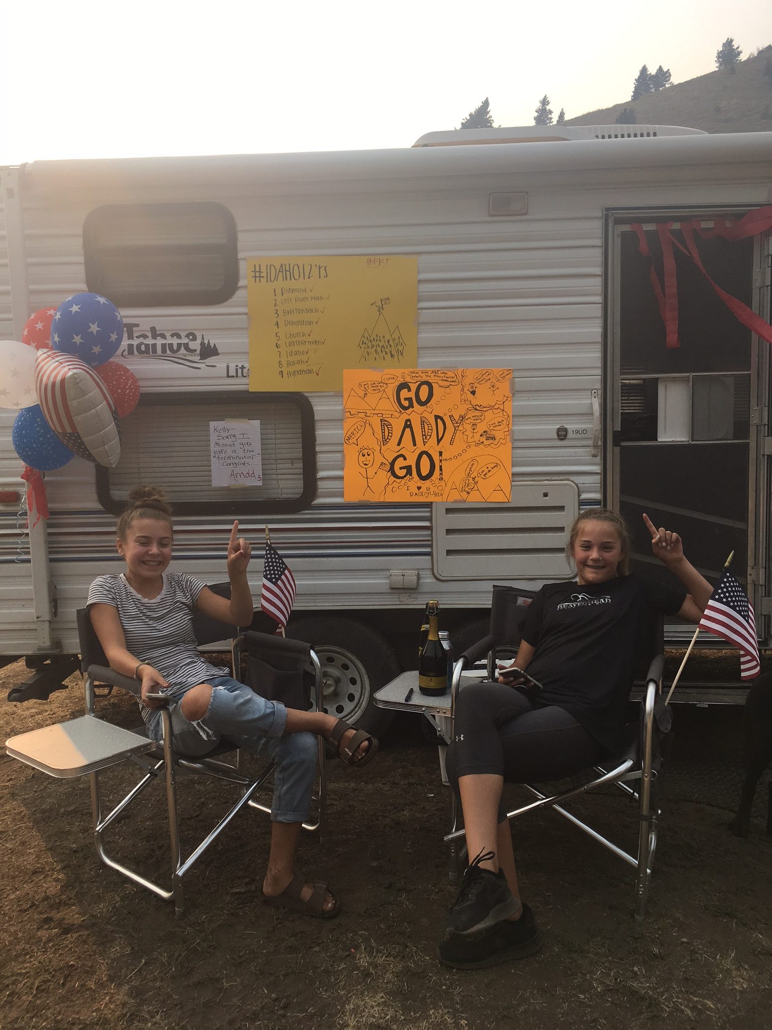
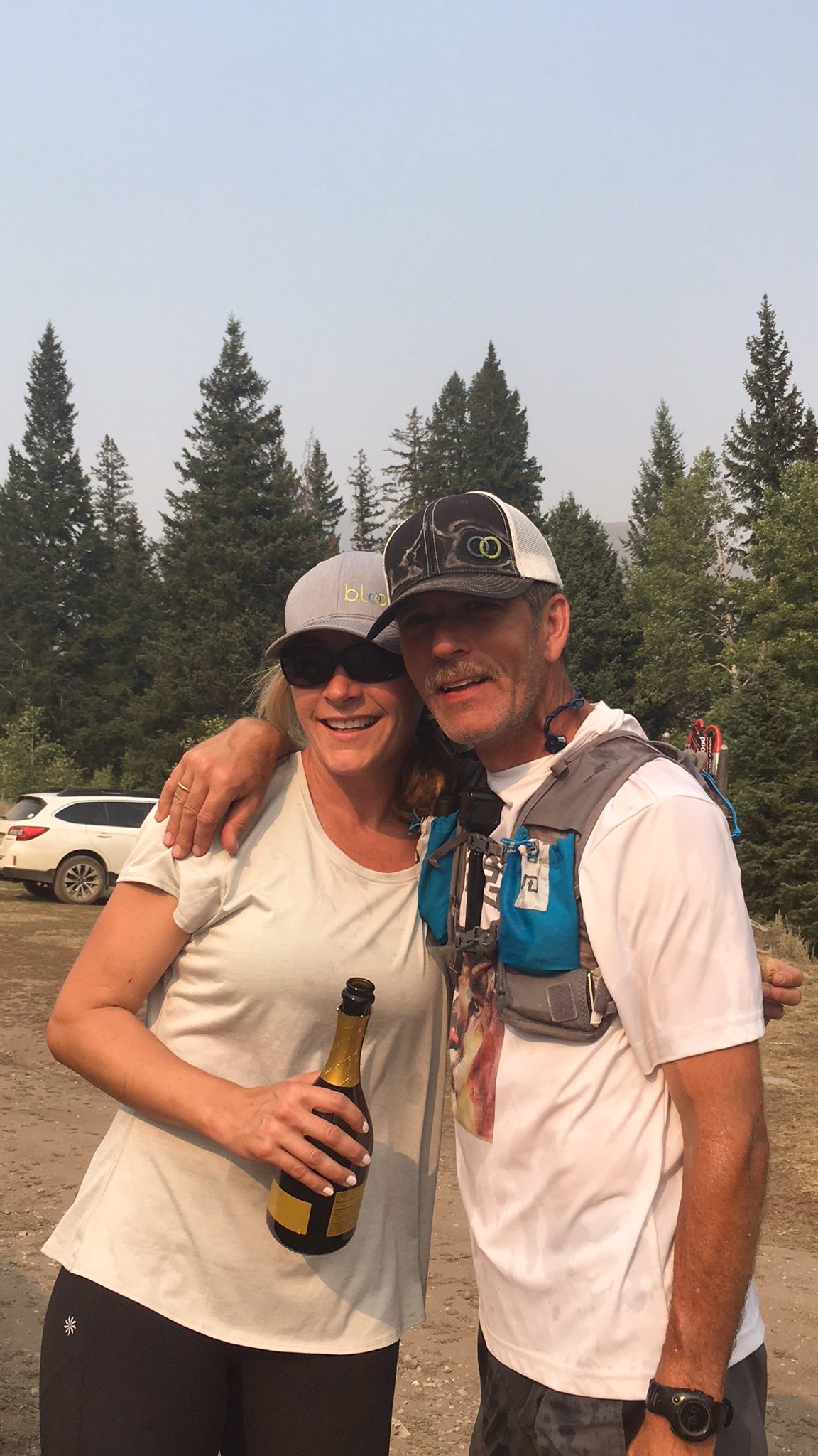
Kelly dropped off the mountain heading for the trailhead at an easy pace. He recalls: “I started my descent off Hyndman. I did stop once to clean my shoes out and ‘soak it all in.’ I even slowed a few times to film, but my running pace was strong and I really didn’t try to hold back.” Nearing the trailhead, he let out a few yells and was promptly answered back. Then it was over. “I was greeted by my daughters, wife and dogs. I had to make sure to touch the trailhead sign. They had decorated the trailer with signs and flags. Michelle sprayed me with champagne. They all made it very special.” He arrived at the trailhead at 4:35PM.
No Man Walks Alone . . .
Journey and ordeal over, Kelly now traveled through an emotional reconciliation with the last two years. He asked himself many questions. “What now? Was it worth it? What could I have done differently? What did I accomplish? What do I do now?” The value of his effort was not immediately apparent according to Kelly. “Now I’ve had a few more weeks to think about my accomplishment, I feel all the time, effort, money, and physical pain, added value to my life. I always thought the end result would be the ‘worth it,’ but the reasoning has changed.”
Having completed the task, I found that the three days of suffering and completing a difficult task was not nearly as important as my completion of the entire task and the involvement of family and friends. It was the whole journey that really makes me proud.” Kelly continues: “The unfamiliarity of the route beforehand, the people I have met in the process, conversations, exploration, overcoming uncertainty coupled with the overwhelming support from my wife and family made me recognize that no man walks alone even when he is struggling solo up a difficult rock face.”
[A shorter version of this article was published in the Idaho Statesman.]
Statistics
· Day One: 32.1 miles; 6,522 feet of elevation gain.
· Day Two: 42 miles; 20,640 feet of elevation gain.
· Day Three: 44.9 miles; 6,603 feet of elevation gain.
Kelly, Michelle and champagne—it’s party time?
Equipment and Supplies
Day One:
Diamond Peak trailhead to Bridget Creek
· Pack: Osprey Duro 15 pack. Fuel: 3.5 liters of water, jerky and gels.
· Clothes: Black Diamond gloves, Dry Max overcalf hiking socks, La Sportiva Ultra Raptor shoes, Gaiters–Wool First Lite.
· Poles: Black Diamond Carbon Mountain poles.
Desert run from Badger Creek to Dry Creek:
· Pack: Ultimate direction Anton Krupicka pack.
· Clothes: Changed shoes and socks. [to what?]
· Fuel: sandwich, chips and a Coke at first rest stop. Changed shoes and socks. gels and trail mix. Chicken and rice soup at second rest stop (vomited shortly thereafter). Coke (note ensure when done for the day) and mashed potatoes.
Day Two: Dry Creek to Borah trailhead.
· Pack and Misc. Gear: Osprey pack, two headlamps, emergency kit with lighter, first aid supply, and bivy sack, Aqua Mira water filter and a knife.
· Clothes: Wool gaiters. Outdoor Research rain jacket, wool T-shirt, wool long sleeve shirt, down puffy, Black Diamond gloves.
· Fuel: Eggs, cheese, and banana with coffee for breakfast. 4 L of water, Nuun electrolyte, Perpetuem drink by Hammer Nutrition. Two wraps with cheese and salami in flour tortilla, 30 gels, tuna fish, jerky, trail mix, couple candy bars.
Day Three: Trail Creek Road to Hyndman Peak to the Hyndman Creek trailhead.
· Pack: Ultimate direction Anton Krupicka pack.
· Poles: Black Diamond Carbon mountain poles.
· Clothes: Dry Max trail crew socks, Outdoor Research rain jacket, La Sportiva Ultra Raptor shoes
· Fuel: Several gels, eggs, and cheese at first rest stop, chicken sandwich, jerky. Coke at finish and ribeye steak and potatoes for dinner a couple hours later, with a beer.
Editor’s Note: The following report by Wes Collins documents his remarkable Lost River Range traverse. His effort no doubt included a number of first ascents. His achievement is one for the ages. All the photos are by Wes.
Last Winter, I traded several emails with Bob Boyles and Frank Florence who both planned on making the trip with me. We decided to hammer it out in a leisurely 4-day trip in late Spring while we could still melt snow for water. However, life kept interfering with our 3 different schedules while Spring came and went as did the snow and the end of our plans. Reluctantly, we decided to put it off for another year but when September rolled around, I made a snap decision to drop everything and solo the traverse. Prior to this time, I had stashed water along the route and only had to iron things out with my own schedule. On a Saturday (3 days later), I was on my way up Mount Borah after leaving a rig parked at the base of Lost River Mountain. The trailhead parking/camping lot was overflowing and there were cars parked on the road all the way past the outhouse. A few hundred yards up the trail I ran into 3 climbers from Idaho (Tracy, Nate and Nashina) and I chatted with them all the way up. The newly-finished trail makes the approach much nicer.
The first hiccup in the trip happened when we got to Chicken-Out saddle, I was climbing down the last little rock knob when my only Nalgene bottle popped out of my pack pocket and took a long, LONG tumble out of sight down the South Side of the col. I immediately thought I’m not going down there to look for that. I had a one liter disposable water bottle that I could make due and I was in a hurry to start the trip beyond Mount Borah.
I stashed my heavy pack on the South Side of Chicken-Out Saddle and, with the load off my back, I practically floated to the summit where a large crowd was lounging in the sun. My adopted crew must have felt bad for me sans pack and plied me with food and drink. Cody Feuz even chipped in. I only stayed on the summit for a few minutes. I always enjoy the company of other mountain people and knew I’d be solo for days but I was anxious to be on my way. Too anxious perhaps. Fifteen minutes after leaving the summit and nearly to the big saddle, I tripped over my own feet and face-planted in a rare patch of soft gravel. My only fall, thankfully.
When I got back to Chicken-Out Saddle, I hopped off the South Col without giving it a second thought. I knew I needed that damn Nalgene bottle but, more than that, I was not going to leave trash on the mountain. I found it WAY down the chute. It had tumbled at least 150 yards but was miraculously intact. I made it back to my pack just in time to see Tracy, Nate and Nashina cruise over Chicken-Out Saddle on their way down.
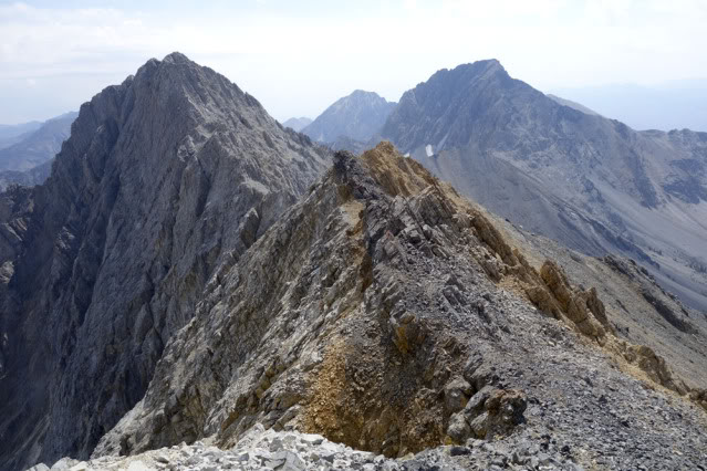
The ridge to Sacajawea from near Chicken-Out Saddle. Mount Idaho is on the right and White Cap Peak is in the middle.
The trip over to Sacajawea was uneventful but fun. There are a few alternatives to get to the top but they all involve Class 4 scrambling. My favorite is to stick to the ridge. The rock quality is great and the exposure is awesome.
A closer look at the Class 4 sections of the ridge.
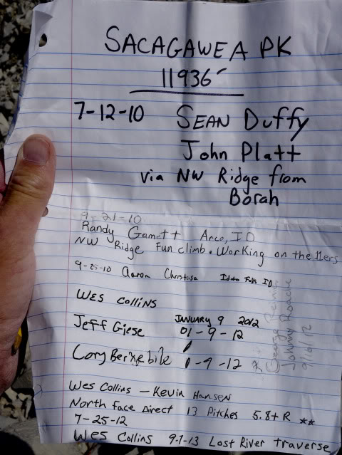
This was one of the few registers I opened in 4 days. I shouldn’t be mystified by this summit’s lack of visitors even though its right next-door to Mount Borah. There are other mountains to climb. Bigger mountains in different states. I should be more mystified by my own lack of imagination. What can I say. This range has an addictive nature and it still seems vast to me.
Sacajawea Register
This descent to the Mount Idaho saddle looks like a straightforward scree-ski but sections of slab rock lie just under the surface, making this a slow and dreary slog. I had been down this side twice before and both times had been lured to the more stable-looking rocks on the ridge, but they are quite rotten and even slower going. This time, I just put my head down and followed the chute.
The descent off the South Side of Sacajawea.The descent route goes all the way down to the level of the big saddle and then crosses over. This chute is begging for a ski descent, probably a first ski descent from the mountain. Spring is coming!
I visited Merriam Lake several times in May through July and, on one of those trips, I stashed 3 gallons of water collected from snow melt just above the upper lake and then packed them up to the ridge. With plenty of water and a great view, camp below Mount Idaho was pretty comfortable.
Camp below Mount Idaho. Sun setting off the North Shoulder at 11,308 feet.
In the morning, I stayed in my sleeping bag until the sun warmed things up a bit and then headed up the ridge toward the summit of Mount Idaho. Several years ago, my first trip to the top of this mountain was up the North Face and I climbed/rappelled down the North Ridge so I knew what to expect. To avoid those steep sections, I climbed out onto the Northwest Side. There are several sections of Class 4 climbing and some Class 5 but the rock was pretty nice. With good route finding, most of that steeper stuff could be avoided especially if you stayed closer to a broken gully system near the North Ridge.
The North Ridge of Mount Idaho as viewed from camp.Looking back to Mount Borah from the summit of Mount Idaho.
The ridge from Idaho to the summit Peak 11967 was all new ground to me. I’d looked at it several times in the past and, although there are a few jagged sections, it looked passable. I tried to stay close to the ridgeline and mounted several Class 4-5 sections, but all of that could be traded for Class 3 on the West Side of the crest.
Looking at the North Summit of Peak 11967 from the saddle below Mount Idaho.Some of the nasty ridgeline to Peak 11967.More ridge pinnacles with Mount Idaho in the background.Looking back to Mount Idaho and Mount Borah from the North Summit of Peak 11967.White Cap Peak as viewed from the North Summit of Peak 11967.
I burned up a good part of the day in the pinnacles and didn’t cross the South Summit of Peak 11967 until about 2:00PM. To save time, I avoided the worst parts of the ridge to White Cap Peak by staying on the West Side.
Looking back at the South Summit of Peak 11967 from the saddle below White Cap Peak.
Some of the ridge sections were unavoidable without a down-climb out onto the West Side. The East Side of the crest was generally too steep throughout this trip. There were a few mandatory Class 4 sections but I was able to avoid anything steeper.
Looking toward the summit of White Cap Peak.From the top of White Cap Peak looking back at the South and North Summits of Peak 11967.White Cap Peak to Leatherman Peak.
I filled 3 gallons of water earlier from a spring above the Elkhorn trailhead and stashed them at Leatherman Pass. I put a few drops of bleach in two of the jugs and planned on using the other jug for cooking and coffee. The unpurified jug had a different lid so I wasn’t worried about accidentally drinking out of it. By the time I got to the summit of White Cap Peak, I was dehydrated. I hustled down to the stash and immediately took a good long pull off the first jug I came to. I only realized my mistake after I’d drunk at least a quart of the unpurified spring water. I wasn’t too worried though. It smelled OK and tasted fine.
I cooked a double-sized Mountain House meal and decided that I had time to get over the top of Leatherman Peak and into the saddle below Bad Rock Peak. By the time I hit the summit, I was feeling a little off my game. I told myself that it was just altitude combined with letting myself get a little dehydrated, but I was thinking I may have screwed up. Two years earlier, I’d seen mountain sheep drinking from the origins of that spring a few hundred yards above my collection point. There wasn’t anything I could do about it. If I got sick, I’d have to go down no matter which side of the peak I was on.
It was getting late and having been down the South Side of Leatherman Peak twice before, I knew the next several hundred yards would be tricky and slow. The trick is to avoid getting cliffed out and having to climb back up for a re-do. Usually this involves ignoring the obvious somewhat easier path half way down and sticking to a few rotten Class 4 cliff bands to your left. In my case, I used a rope and made 2 key rappels on the ridge proper.
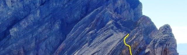
Looking back at Leatherman Peak from the Bad Rock Peak saddle. Yellow (hikers route), red (my route), green (rappels).
Bad Rock camp was pretty comfortable and, like the first night, there was very little wind. I found a nice wide sheep bed to sleep on. In the morning, I woke up to a heavy layer of frost on my bag but it was another bluebird day. My stomach was still off but I definitely had not caught a bug like giardia. I forced a couple granola bars down and headed off, knowing this would be the toughest stretch.
Bad Rock Peak as viewed from the Leatherman Saddle. I have climbed this ridge twice and I knew that although it looks tough, its only Class 3. I made quick work of it.
I looked for a register on the summit of Bad Rock Peak but it’s gone missing. I have descended the South Face several years earlier and its every bit as difficult as the descent on Leatherman Peak. The same rule applies: stay on the ridge or face a long climb back up to the crest. I sat on the summit looking at the ridge beyond for a long time. I knew that it had been done in the past and that put me at ease. I REALLY wanted the summit of Mount Church from the ridge. I’ve heard rumors of it being climbed and was eager to follow.
Thirteen years ago, I traversed from Leatherman Peak to Mount Church by dropping off Bad Rock Peak and climbing Mount Church via its North Face which is an easier/faster alternative. On that trip, I studied the ridge to the summit and decided that it was impossible. However, when I got to the summit I read in the register that a solo mountaineer a few weeks ahead of me had done just that. I was bitterly disappointed in not giving it a chance and vowed to return and finish it.
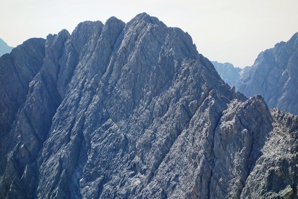
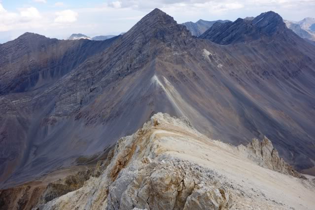
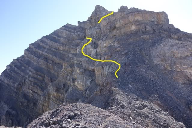
Mount Church as viewed from Bad Rock Peak and the second half of the ridge. The long, jagged slab sections and two rotten-looking towers make this the most wild part of the traverse.The first half of the ridge.
I cliffed out twice while trying to get to the start of the ridge and both times involved a pretty long climb back up to start over. Once on the ridge, the big slab towers I was worried about along the first two-thirds of the traverse proved nothing more than easy Class 3 and I made good time by traversing on their Northeast slabs. The last two (and biggest) were much worse. I skipped the first one by cutting around its Northeast Side but the last one would have none of that and it turned out to be the sketchiest bit of the whole trip.
I planned on climbing right into the col between the towers but the closer I got, the more I realized it was a dead end. From the col, the ridge was blocked by a steep 80-foot buttress. To top it off, the rock quality was terrible. Instead of going all the way to the col, I managed to make my way up a line of weakness just below the crest. But there was a sequence of easy, but exposed, Class 5 steps and holds that could have (should have) blown out. By the time I got back to easier ground, I was pretty rattled. An easier solution would have been to traverse 30 feet lower and past the buttress.
My route up Rotten Tower #2. The possible lower traverse is partly shown at the bottom of the photo.
Back on the ridge, I continued right up to the face and found a place to choke down a handful of cookies. I studied possible lines but was absolutely unable to find anything suitable to start up. I knew if I could make it past the first cliff band, I’d have a good shot at the upper mountain. But that first 30-40 feet of rotten nastiness over a fatal fall zone really needed a belay. I worked my way back and forth across the ridge, hoping to find the key but it just did not materialize.
On one foray, I continued well out onto the West Side of the crest thinking there might be something, but finally admitted defeat. I may have been too demoralized by clawing my way up the rotten tower and felt I’d pushed my luck far enough for this trip. But as I write this, I still believe I made the right choice. At any rate, it was a huge letdown. I traversed the entire West Face looking for a break in the cliffs but, for the most part, they just got bigger and steeper. This long side hill took an enormous amount of time and, in the end, I was close enough to the Church/Donaldson tarn (located on the standard route at 8,600 feet) that I dropped down and tanked up at the greenish pond.
I finished off the water in my trusty Nalgene bottle and filled it along with the gallon jug I had stashed in my pack with boiled water. It was then that I found a split in the bottom of the now-useless jug and realized things were going to get tougher. I climbed back to the crest, dumped everything but the stove, Nalgene bottle and cooker out of my pack and cruised to the top of Mount Church. Earlier, while on top of Bad Rock Peak, I spotted a small snow patch near the summit of Mount Church and I was able to refill again there. I made it to the summit of Donaldson Peak in mid-afternoon.
Donaldson Peak to Mount Church.
Although I intended to make another water cache in the saddle between Donaldson Peak and No Regret Peak, I got lazy and never made it happen. I was still on familiar ground and made quick work out of the long ridge to the summit of No Regret Peak. There are several small sections of Class 3 surprises along this segment and, luckily, I remembered to traverse around the one 70-foot drop-off at the start of the final climb up to the top. If you miss this, it’s a substantial down-climb to get back around it.
Donaldson Peak to No Regret Peak. Class 3 and rotten.
From the top of No Regret Peak to the base of Mount Breitenbach, I was on my second and final stretch of unfamiliar ground. I planned on camping on the ridge just below the big 200-foot tower that blocks access to the top from the ridge. I did not make it far before I came to the first mandatory rappel. It was an easy 40-footer but I had to leave a nut and loop of 6MM cord behind. I pulled my rope and continued to the second and (what I thought) last rappel.
It was too long to do as a double-rope rappel, so I wound up leaving my rope as well as a large nut and small cam attached to the anchor. I knew this meant a return trip in the near future to collect gear, but it would have meant a long down-and-up climb to bypass the drop. I continued on and, as luck would have it, bumped into another straight 30-foot drop. I had to do the long back-and-forth after all. In fact, there were several tough spots on the way to Mount Breitenbach and it eventually ate up the rest of the afternoon.
No Regret Peak as viewed from the ridge to Mount Breitenbach.
With less than 200 yards to go, I ran into yet another 50-foot impassable drop. Again, the only way past it would require a long descent and return. I really wanted to sleep on the crest but there was not a suitable place in sight. I shot one last photo of Peak 11280 and headed down. What the hell, I needed water and I knew Jones Creek started pretty high up.
Triple Peak as viewed from the last drop to Mount Breitenbach. Beyond is Bell Mountain and a section of the Lemhi Range.
The descent went pretty slow because I was still looking for a short way around the drop and back to the crest. By the time I hit the first springs, it was pretty dark. I was sick from not drinking enough water and worse from drinking Leatherman water. I stuck my head in the creek and took a good long pull, then filled and drank a Nalgene bottle. To hell with boiling it. I continued downward, looking for a place to bivy and noticed my headlamp needed new batteries.
I pulled my spares out and found they were dead. I returned the dying ones and made the best of them, but it was not long until I was blindly stumbling around in the boulders. Just about the time I was admitting to myself I’d be doing a dreaded sitting-bivy, I found a flat rock on the lip of a 10-foot waterfall and, after moving a few rocks, I had a nice little nest. For dinner, I ate a handful of cookies as my stomach could not do another freeze-dried feast.
Sleeping that close to the creek was music to my dehydrated ears and, despite the rough bivy spot, I slept very well. I had descended a long way down from the crest and, while drifting off to sleep, I started entertaining the thought of bailing out for the truck at first light. My headlamp was dead, my water container was inadequate, and I was feeling pretty ill.
Jones Creek Camp.
In the morning, I laughed at the idea of bailing. I had a good night’s sleep and a handful of almonds with my coffee improved my disposition even more. I hung around camp for a good 3 hours, drinking water and reading the book I brought. Eventually I gathered up my gear (including the useless water jug) and was standing on top of Mount Breitenbach in just over 2 hours.
No Regret Peak as viewed from below the summit of Mount Breitenbach. The cliff bands made this part of the traverse pretty disheartening and, if I had to do it again, I’d drop 600 feet off the West Side of the summit and do the long side-hill traverse all the way over to Mount Breitenbach. The hike around this cliff on the way to the top (A). The first rappel (B). The second rappel (C). The first hike down and back up (D). The Second down and up (E). The last impassable cliff (F).
In my hurry the night before, I forgot to take a photo of Mount Breitenbach from the last cliff but I’d been between the summit and the last cliff several years earlier. There is a 200-foot steep buttress that is bypassed on its West Side by a short but exposed Class 4 wiggle.
The home stretch, Mount Breitenbach to Lost River Mountain.
I was on familiar ground once again. This section is easily the longest stretch of ridge between peaks and, although a good portion of it is easy hiking, there are several sections of Class 3- 4 rottenness. A broken sheep trail covers much of the distance on the West Side of the crest, making things even easier.
The last quarter of the ridge to Lost River Mountain.
The meat of this segment starts just before the final slopes to the summit and staying on or near the ridge can be perplexing. I’d describe it as climbing layer cakes of crap by finding the way up short cliffs and then searching for a way back down on the other side. There are a few places one has to leave the ridge (usually to the West Slopes) and climb around towers and obstacles but its all Class 3-4 unless you want to make it harder. On a previous trip, I’d bypassed this crux by climbing out to the right of the cliffs. This time I decided to explore to the left. It was all pretty rotten but fairly straightforward excluding one 15-foot section of rotten Class 5 over a steep scree-covered ledge. Beyond this tower, its Class 2 all the way to the truck.
The crux section.Looking back at Mount Breitenbach from just below the summit of Lost River Mountain. Mount Borah is visible in the upper left in the distance.
I was in fairly poor shape at this point. My water was long gone and all I was able to eat was the little pack of almonds. I sat on top and forced down some gorp for the descent while thinking about my return to things less significant than watching every step. I wondered how many miles I had covered and then decided it didn’t really matter. The miles covered up there are like dog years–1 seems like 7. A week later, I was back on top of No Regret Peak to retrieve my rope and gear. Three weeks after that, I collected my empty water jugs at Leatherman Pass as well as a golf club I brought down from the top of White Cap Peak. The water bottles below Mount Idaho will have to wait until Spring, I guess.
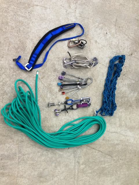
My gear
This was the kit I took and I only used it for rappels. The only place I’d have used it as a self-belay was at the base of Mount Church but I’d have had to set the base anchor pretty far from the climbing. The rope is a 9.1MM I’ve had for years and never used. I cut it in half to save weight. I used the blue gear sling as a swami belt and cut up pieces of the 6MM line for rap anchors.
Author’s Note. This is part trip report and part guide. I’ve left out a good many details in the hopes of preserving some of its mystique but I included reduced size photos of the entire ridge system. Get a hold of me if you want to see a larger version of any of them. (20MB)
Many of us have talked and schemed about doing this traverse and although there’s a lot of information out there, it mostly deals with individual sections. I know some have finished it and many have finished sections of it. If it’s on your wish list, I can tell you that it’s well worth the time and effort.