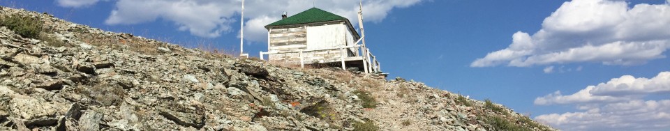
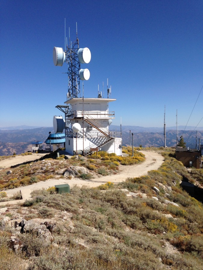
Fire Lookouts are a great way to experience the mountain world. I just discovered a Boise National Forest brochure (linked below) that covers most of the existing fire lookouts on the forest and provides brief access information for each. All of these mountains have pages on this website. Fire lookout sites were chosen because of their commanding views. You will find on a visit to any of these lookouts that the Forest Service chose well. The views are uniformly impressive.
Use the link below to read the entire brochure. Courtesy of USFS.
I would note that I believe the Forest Service has underestimated the difficulties of most of the access roads. I recommend a 4WD or at least a high-clearance vehicle with good all-terrain tires if you are going to visit any of these lookouts.
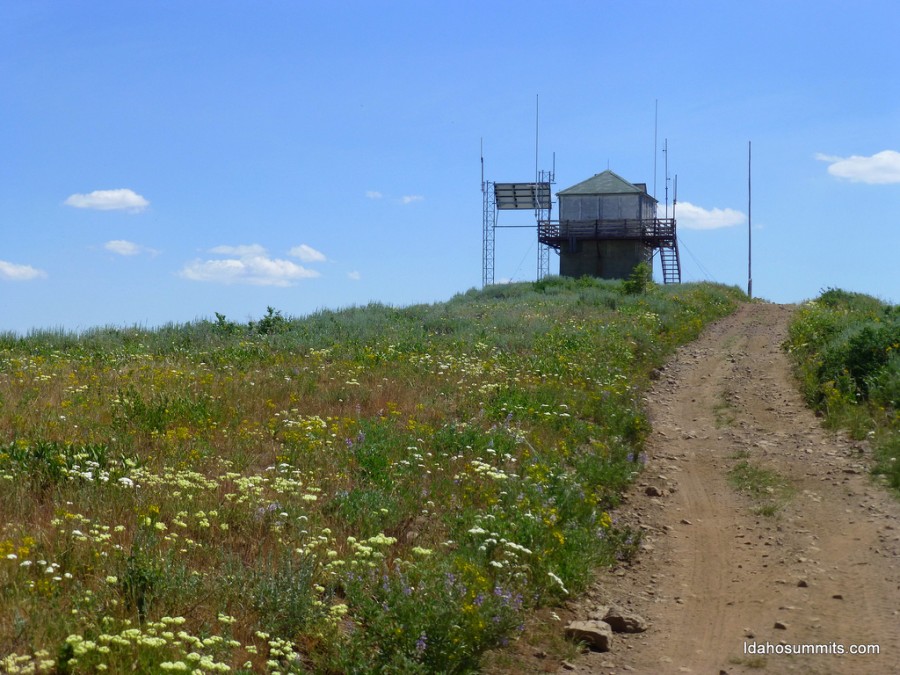
In addition to the manned lookouts, the brochure also lists 5 unmanned lookouts: Bear Valley Mountain, Thorn Creek Butte, Meadow Creek, Rice Peak and Swanholm Peak. Photos and links are found below. The lookout structures are still present on these mountains but they are no longer used. Many other mountains in the Boise National Forest were used as fire lookouts in the past. You can research these and many others at firelookouts.com or Idaho Lookouts.
The brochure also mentions the Deadwood Lookout but gives no directions. Deadwood Lookout is available to rent through recreation.gov. Be forewarned this rental is extremely popular. You will need to reserve many months in advance. Finally, the brochure does not include Shafer Butte (at the center of the Bogus Basin Ski Resort), Hawley Mountain (near Horseshoe Bend) and Pilot Peak (near Idaho City). These lookouts offer great views and are also worth visiting.
The Deadwood Lookout is located due south of the Bog Benchmark. Make sure after you tag the summit to continue on to the lookout for a great view. The lookout is available for overnight rentals.
According to A History of the Salmon National Forest, by 1916 there were two lookouts in the Salmon National Forest, at Blue Nose and Salmon City Peak (later given the name “Baldy“). It was assumed that most of the forest could be seen from these two points. Cathedral Rock, in the Bighorn Crags, was also used at times to see the Middle Fork area, and there wasapparently even a telephone line at one time to Cathedral Rock. [Footnote 7: Personal conversation with Mr. Howard Castle who remembers being told about this phone line. The author seriously doubts, however, that the line was ever extended to the top of the mountain, though it may well have existed at the base of Cathedral Rock. Cathedral Rock is an extremely sheer crag-type mountain not to be climbed except by professionals, which no doubt affords a great view of the Middle Fork area and which would have been left blind by just the use of Baldy and Blue Nose.]
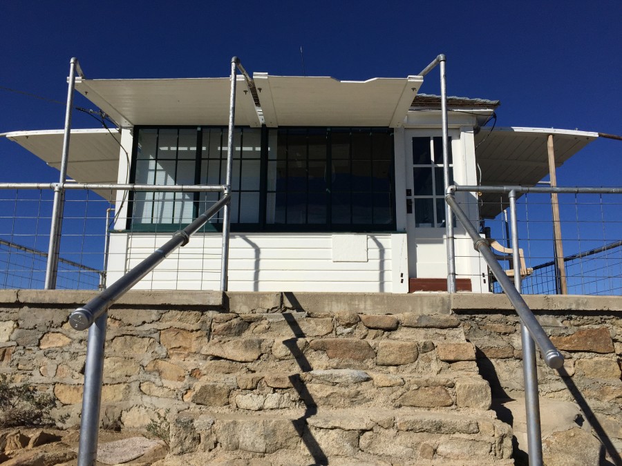
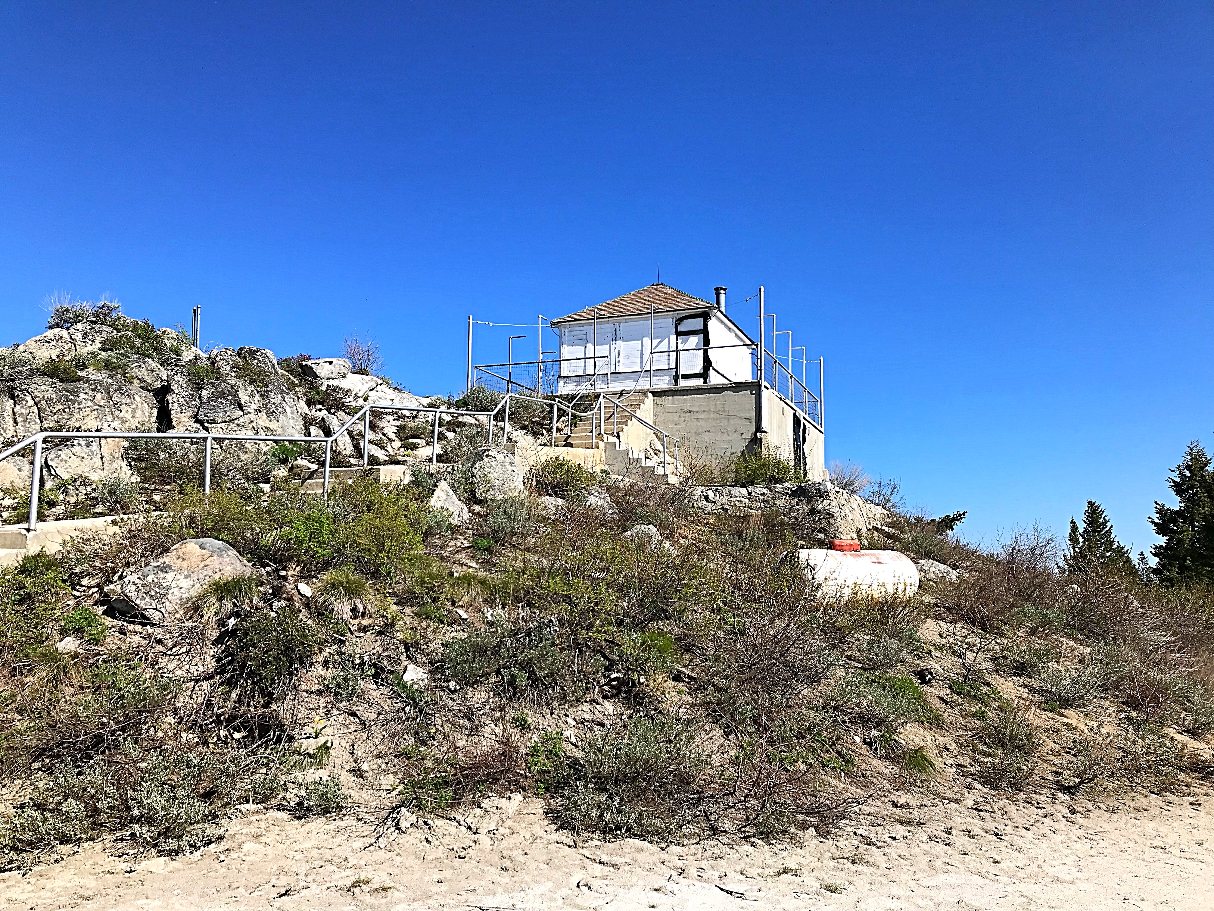
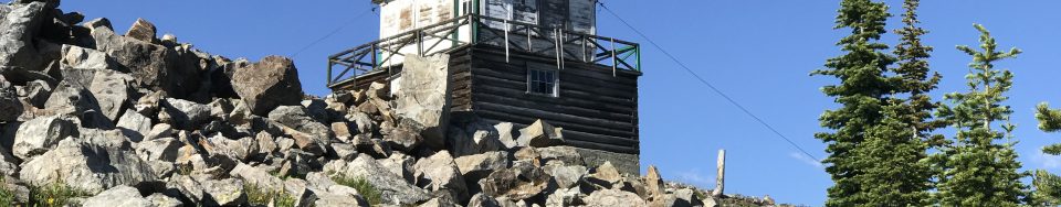
The Blue Nose Lookout is unlocked and is in need of some serious repair work.
At this point, there were few lookout buildings as we know them today. As late as 1924, lookout structures had been built only on Long Tom, Baldy, Taylor, Stein, and Blackbird Mountain. Most of the lookout “houses” built at that time were extremely small—most 9‘ x 9’—and in 1924, only Blackbird Mountain had the more typical 14′ x 14′ structure oftoday’s lookouts.
Rather than live in lookout buildings, most lookouts were camped near mountain peaks during the critical fire period. Many of those lookouts were also “smokechasers,” that is after finding a fire, the lookouts would take off to put it out. This was particularly the use before telephone lines were installed. Lookouts were thus placed in many locations in the forest, often varying from year to year. Since no visibility maps (those indicating the area seen from a lookout) were then available, lookout stationing was not planned in a very organized manner.
It was decided about this time that some lookouts should be considered “primary” and manned for the entire fire season at all times; “secondary”, which would be manned only for a month in the worst part of the fire season ; and “tertiary” or third line lookouts, manned only in bad fire years. In 1923, the Salmon National Forest’s primary lookouts were Taylor Mountain, Blackbird, Blue Nose, and Long Tom. Secondary lookouts were Middle Fork Peak, Two Point, and Granite Peak. Additional smokechasers were stationed at various paces in the forest, including Lake Mountain, Sagebrush, Haystack, and Sheepeater Point. Lookout selection was not made with a lot of information and choices varied from year to year.
In 1926, the first visibility maps were made of many peaks of the forest. Henry Shank, in an effort to better select the primary and secondary lookouts, tried to plot the area visible from each lookout station. The 1926 map indicates Lake Mountain, Stein, Haystack, Sheepeater, Two Point Peak, and Sagebrush as primary lookouts. I assume that Taylor Mountain and Blue Nose were also still in use, as they appear on later maps.
By 1929, 19 points in the forest had either a lookout or a dual/smokechaser. The year 1929 was one ofthe worst fire years in the recorded history of the Salmon NationalForest, particularly with the Wilson Creek Fire.In order to avoid large conflagrations of the size of the Wilson Creek Fire, the early detection system needed additional improvement. This determination to improve detection, coupled with the surfeit of workers made available by the Great Depression, enabled the Forest to initiate a massive lookout construction program. By 1932, 23 lookout points were in operation in the Salmon National Forest, with selection and construction contemplated for 7 more. Smokechasers were also stationed at the Indianola, Hughes Creek, and Yellowjacket Guard Stations.
1935 appears to have marked the time when lookouts reached their peak. Thirty-four lookouts then stood as sentinels over the forest. Buildings had been set up on nearly all of the sites, even though many weren’t primary lookouts. All seemed to be hooked up to telephones.
Just when the lookouts began their decline is not clear, but it is known that by the early 1940s some were being abandoned—particularly early ones like Duck Creek Point and Taylor Mountain. Perhaps this was partly due to the war—there weren’t enough men around to staff all of the lookouts. This is when women began to serve as lookouts. Money was short and it was recognized that there was much visibility duplication in the lookouts.
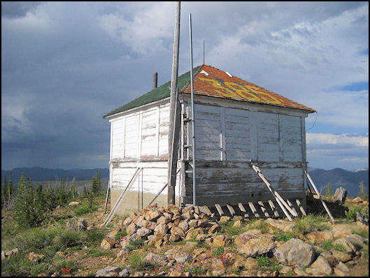
The remains of the Taylor Mountain Lookout.
Even without the war, the decline of the lookout system was inevitable. As early as the 1920s, Region I (Missoula, Montana) had been experimenting with the airplane as a fire detection tool. If anything, the war probably delayed the demise of the lookout system, as airplanes, pilots, and the like were needed more in the war that they were in experimenting with forest fire detection.
After World War II and the Korean conflict, aerial detection began to change the scene. Smokechasers became smokejumpers—at least in the more remote areas—and airplane “watchdogs” replaced many lookouts. Most lookouts faded out gradually one or two at a time until in 1982 there were only 6 of the original number remaining: Long Tom, Stormy Peak, Sagebrush, Stein Mountain, Middle Fork Peak and Sheephorn. Butts Point was not manned in the 1982 season, but the North Fork Ranger District has not given it up, as it is still considered to be of primary importance. Fire management personnel have indicated that it is unlikely that any of the others will be used again.
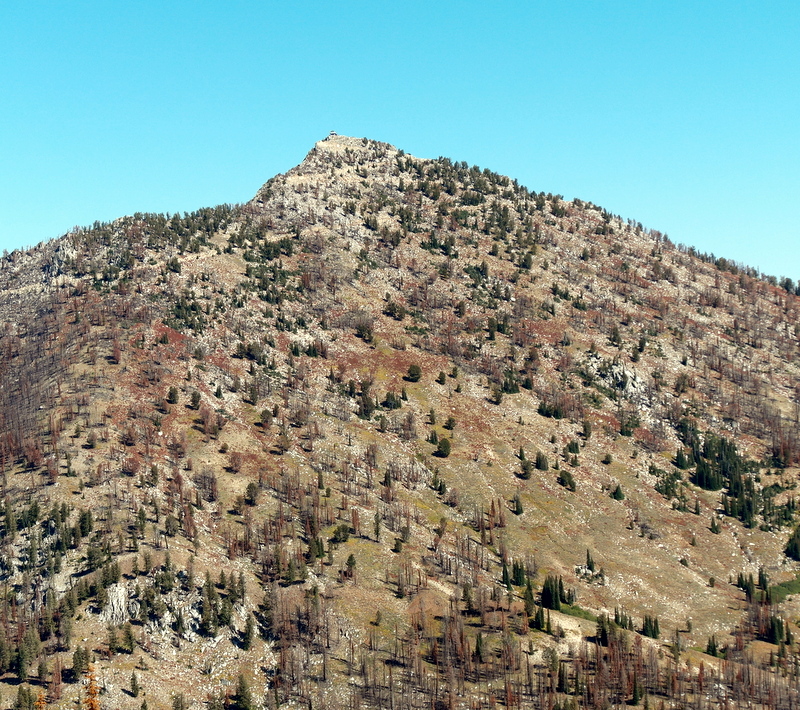
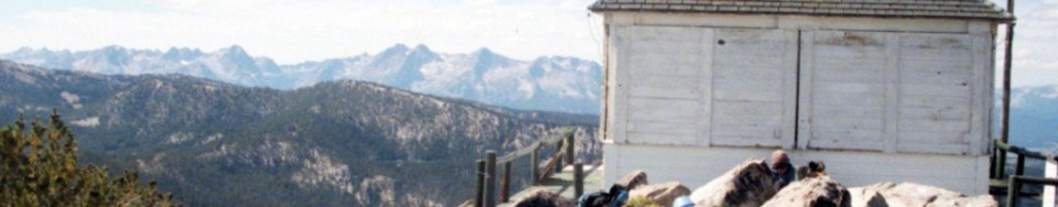
Middle Fork Peak as viewed from Peak 9101.
An interesting trend in the site selection of lookouts was the preference to use the highest peaks in the Forest. Pre-1930 lookouts included Taylor Mountain, Blackbird, Lake Mountain, Cottonwood Butte, Duck Creek Point, Two Point Peak and Middle Fork Peak—all over 9,000 feet. Post-1930 lookouts included Granite Mountain, Jureano, Sheephorn, Hot Springs and Butts Point. Nearly all of the post-1930 lookouts are under 8,500 feet and most are less than 8,000 feet.
This change in trend was probably because the high lookouts may cover great distances, yet they are often too high for visibility of the high-hazard country of lower elevations right under them. Indeed, most of the high lookouts have no view of large or important drainage bottoms. The Forest is hampered by the problem of its extreme verticality. Canyons are generally narrow, steep and very deep. This has made it difficult to use the “highest peaks” as lookouts as is done by manyother Forests.
In the early 1930s, forests were required to have 80 percentlookout coverage of the Forest’s high fire-hazard acreage. The only way to see much in the rugged Salmon River country was to “come down” in elevation. Thus, later lookouts like Granite Mountain and Sheephorn don’t have the horizontal viewing distance that some of the older lookouts do, like Blue Nose and Taylor Mountain. They do, though, affordexcellent views of specialized high-hazard drainages.
Other problems encountered by the high peaks were: the great distances to water which lookouts had to hike to daily; great distances to “climb down” to a fire; the problem that high lookouts were often “fogged in” in the morning (one of the best times to find fires); and rugged and costly to packers supplying the high lookouts.
Today’s lookouts have been selected by the Forest Service through a long process of elimination. They have excellent views of high-hazard drainages and nearly all report fires every year.
By the 1930s, the Forest Service had a goal to “put a firewatch on every mountaintop.” Idaho ended up with 989 fire lookout structures, more than any other state in the Pacific Northwest. Of Southern Idaho’s 128 lookouts, 36 were above 9,000 feet. Red Wings (10,910 feet) was the highest. Twin Peaks (10,340 feet) is the highest fire station in America today. By the 1960s, many of the old lookouts were destroyed in the name of progress but, fortunately, a representative sampling remain today at least until the elements ultimately win.
Everything you’d ever want to know about lookouts is contained in the book “Fire Lookouts of the Northwest” by Ray Kresek. You can reach Ray through his Historic Lookouts Project in Spokane, Washington. In doing his research, Ray has climbed over 1,000 mountains. He knows what he’s talking about. As mountain users, sooner rather than later, we have an encounter with lightning. In his book, Ray describes one of those terrible nights in a shack on a summit, something like this:
As the lightning approached, the firewatcher would pull the “go to hell rope” to disconnect all appliances. The copper wire grounding system would begin to hum and glow with dancing Saint Elmo Fire. At this time, as your hair began standing on end, you’d hop on a glass-legged insulated stool. For the grand finale, the blinding white light would cause anything metal to sizzle. The cabin reeked of foul ozone. After several minutes your sight and senses return….and leave you something not to forget in a lifetime.
Left to right from top: WILDHORSE PEAK (9,546 feet): White Knob Mountains. This fire lookout is preserved as a national historic monument. TWIN PEAKS (10,340 feet): Idaho’s highest outhouse provides a contemplative view to 10,442-foot White Mountain, high point of the Salmon River Mountains SLEEPING DEER (9,881 feet): In the heart of the Frank Church Wilderness. Built in 1935. Still active. SAL MOUNTAIN (9,593 feet): Lemhi Range. This 10’x10′ lookout was built in 1926. The USGS triangulation signal is from 1945. These are the first Idaho mountains to be seen and described by a white man. Cresting Lemhi Pass on August 12, 1805, Meriwether Lewis records: “I discovered immense ranges of high mountains still to the west of us with their tops partially covered with snow.” BLUE NOSE (8,677 feet): ID/MT border. An oddity: this lookout was split down the middle by 2 States, Counties, National Forest Ranger Districts and Regions. The lower floor accommodated livestock. The brass benchmark in the foreground was set by USGS’ T. M. Bannon in 1912. MOUNT GREYLOCK (9,857 feet): Left to the elements. By Rick Baugher (April 24, 2007)